松辽盆地综合柱状图
- 格式:doc
- 大小:1.28 MB
- 文档页数:2
第35卷第4期2023年7月岩性油气藏LITHOLOGIC RESERVOIRSV ol.35No.4Jul.2023收稿日期:2022-08-31;修回日期:2022-09-16;网络发表日期:2022-11-22基金项目:中国石油“十四五”前瞻性基础性重大科技项目“松辽盆地深部含油气系统研究”(编号:2021DJ0205)资助。
第一作者:杜长鹏(1991—),男,硕士,工程师,主要从事非常规油气成藏研究。
地址:(163712)黑龙江省大庆市让胡路区科苑路18号大庆油田勘探开发研究院。
Email :**************************.cn 。
文章编号:1673-8926(2023)04-0115-10DOI :10.12108/yxyqc.20230411引用:杜长鹏.松辽盆地莺山-双城断陷白垩系致密火山岩天然气成藏条件及主控因素[J ].岩性油气藏,2023,35(4):115-124.Cite :DU Changpeng.Natural gas accumulation conditions and main controlling factors of Cretaceous tight volcanic rocks in Ying ‐shan-Shuangcheng fault depression ,Songliao Basin [J ].Lithologic Reservoirs ,2023,35(4):115-124.松辽盆地莺山-双城断陷白垩系致密火山岩天然气成藏条件及主控因素杜长鹏(中国石油大庆油田公司勘探开发研究院,黑龙江大庆163712)摘要:综合地震、包裹体、烃源岩和生产测试等资料,在构造特征、成藏期次和成藏条件分析的基础上,明确了松辽盆地莺山-双城断陷白垩系致密火山岩气藏的分布特征及成藏主控因素。
研究结果表明:①莺山-双城断陷经历了3期伸展与3期挤压的构造活动,青山口组沉积末期(84~88Ma )为主成藏期,研究区处于稳定坳陷期,构造活动弱,有利于气藏的形成与保存。


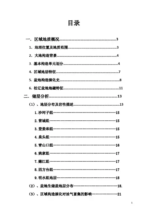
目录一.区域地质概况 (3)1.地理位置及地质范围 (3)2.大地构造背景 (4)3. 基本构造单元划分 (4)4. 区域地层特征 (7)5. 盆地构造演化史 (8)6. 松辽盆地地磁特征 (11)二.储层分析 (13)(1)、地层分布及岩性描述 (13)1.沙河子组 (15)2.营城组 (15)3.登娄库组 (15)4.泉头组 (15)5.青山口组 (16)6.姚家组 (17)7.嫩江组 (17)8.四方台组 (17)9.明水组地层 (18)(2)、盆地生储盖地层分布....................................18.(3)、区域构造演化对油气富集的影响 (21)1、盆地深坳陷区提供油气源 (21)2、盆地断裂构造对油气成藏的控制作用 (21)3、盆地反转构造对油气聚集的影响…………………22 .4、总结 (23)三.油气分布规律 (26)四.大庆油田油气藏成藏要素及其规律 (27)1.构造及断层 (28)2.油层 (30)3.油气水性质 (32)4.油、气、水分布规律及油藏类型: (33)5. 石油地质特征 (36)区域地质概况1.地理位置及地质范围松辽盆地是中国东北部一个大型中、新生代沉积盆地,地跨黑龙江省、吉林省、辽宁省和内蒙古自治区(图1-1)。
在亚洲底层分区中,处于北亚陆间区和环太平洋陆缘区的交接位置(图1-2)。
白垩纪是盆地的主要发育阶段。
沉寂了厚达万米的非海相火山岩、火山碎屑岩及正常和刘相、湖泊相和沼泽相碎屑岩地层,地层剖面完整,化石丰富,是我国研究陆相白垩纪地层的理想地区之一。
松辽盆地为一近北东向、北北东向菱形盆地,周边为丘陵和山脉所围绕,吸部位大兴安岭山脉,东部为张广才岭,北部为小新安岭山脉,盆地内部则是松花江、嫩江和辽河冲击形成的平原沼泽。
规模:长约750km,宽330~370km,面积26约万平方千米(图1-3),其中在黑龙江省的面积为11.8平方千米。


第45卷第8期中南大学学报(自然科学版) V ol.45 No.8 2014 年 8 月 Journal of Central South University (Science and Technology) Aug. 2014 松辽盆地南部火石岭组地层序列划分与区域对比瞿雪姣 1 ,王璞珺 1 ,姚瑞士 1,2 ,高有峰 3 ,白冰 1(1. 吉林大学 地球科学学院,吉林 长春,130061;2. 天津华北地质勘查局 五一四大队,河北 承德,067000;3. 吉林大学 古生物学与地层学研究中心,吉林 长春,130026)摘要:从火石岭组沿革分析入手,以松辽盆地南部双辽、长岭、德惠、王府和榆树等5个断陷钻遇火石岭组的42 口深层钻井,以及营城煤矿 226 孔和 50 孔层型剖面和盆缘野外剖面为对象,通过岩性和连井地震剖面进行对比 研究。
研究结果表明:火石岭组可分为2个岩性段。
火石岭组一段为深色泥质岩与灰色砂岩不等厚互层的正常沉 积岩,断陷边缘多为粗碎屑沉积。
火石岭组二段以火山岩、火山碎屑岩夹沉积岩为特征。
火石岭组二段自下而上 包含5个火山喷发旋回,分别为中性熔岩旋回、酸性火山碎屑岩旋回、中基性熔岩旋回、偏碱性的中性熔岩旋回、 酸性熔岩旋回。
关键词:火山喷发旋回;地层序列;火石岭组;松辽盆地中图分类号:P53 文献标志码:A 文章编号:1672−7207(2014)08−2716−12Stratigraphical sequence and regional correlation ofHuoshiling Formation in southern Songliao BasinQU Xuejiao 1 , WANG Pujun 1 ,YAO Ruishi 1, 2 ,GAO Youfeng 3 ,BAI Bing 1(1.College of Earth Science,Jilin University, Changchun 130061,China;2.Tianjin North China Geological Exploration Bureau 514Team,Chengde 067000,China;3.Research Center of Paleontology and Stratigraphy, Jilin University, Changchun130026,China)Abstract: Stratigraphical correlation of the Huoshiling Formation was performed in 5 south fault depressions and southeast magin of Songliao Basin, including 42 deep drilling wells, stratotype section and field section. Lithologic correlation and seismic crosssections correlation were analyzed. The results show that the Huoshiling Formation can be divided into two lithologic members. The first member is mostly interbedded with dark mudstone and grey sandstone, while coarse clastic rocks are developed in the margin of the fault depressions. Volcanic rocks and pyroclastic rocks dominate in the second member. From bottom to top, the second member consists of 5 volcanic eruption cycles: intermediate cycle,acidic pyroclastics cycle,intermediatebasic cycle,alkalicintermediate cycle,and acid cycle.Key words: volcanic eruption cycle;stratigraphical sequence;Huoshiling Formation;Songliao Basin火石岭组源于森田义人 [1] 1942年在吉林省九台市 以东、营城子以北的柳家沟—马家沟—李家纸房一带 命名的营城子火山岩群。
林甸地区登娄库组层序地层格架与油气前景胡玉双;杨莹彬【摘要】Using the theories and methods of sequence stratigraphy in lake basins, seismic, logging and drilling core data of the Denlouku Formationin the Iindian area of the Songliao Basin are analyzed in order to understand its sequence stratigraphy. Boundaries and maximum flooding surfaces and established sequence stratigraphic framework of the Denlouku Formation are identified sequence. It can be divided into three systems tracts. Data used in the sequence and systems tract identification include seismic data, outcrop data, and logging data. Systems tracts in sequence include LST, TST, and HST. On this basis, main control factors of Denlouku Formation, namely, tectonic activity, weather conditions are studied, go up and down of lake level and source supplies. Denlouku Formation in the Iindian area has good oil gas exploration prospects as a transitional layer.%应用陆相湖盆层序地层学的理论和方法,综合利用地震、测井、岩芯等资料,对松辽盆地北部林甸地区登娄库组三级层序内的最大湖泛面和首次湖泛面进行识别.建立了登娄库组地层格架,并划分为3个体系域.其识别标志为地震、露头、测井等资料上的特征,层序的体系域为LST、TST、HST.在此基础上,研究了登娄库组层序形成的主要控制因素,即构造断裂活动、气候条件、湖平面升降和物源供应.林甸地区登娄库组作为勘探接替层段,具有良好的油气勘探前景.【期刊名称】《科学技术与工程》【年(卷),期】2012(064)004【总页数】4页(P762-765)【关键词】林甸;登娄库;层序地层格架;体系域;油气前景【作者】胡玉双;杨莹彬【作者单位】东北石油大学地球科学学院,大庆163318;东北石油大学地球科学学院,大庆163318【正文语种】中文【中图分类】TE122.155林甸位于滨北地区,是最大的白垩系断陷之一。
成都理工大学硕士学位论文松辽盆地北部中央坳陷区泉头组四段层序地层及沉积演化研究姓名:汪海燕申请学位级别:硕士专业:矿产普查与勘探指导教师:李仲东20090501成都理工大学硕士学位论文区泉四段工业油气流井各油层在各沉积微相中的分布规律,揭示了该区油气主要分布在河道砂岩中,包括曲流河边滩、三角洲平原水上分流河道和三角洲前缘水下分流河道。
这三种沉积微相最有利于油气储集。
综合考虑各项因素,并与三肇凹陷对比分析,在齐家-古龙凹陷Q4-sq1和Q4-sq2层序预测了有利勘探区。
该区埋深相对较浅,T2断层发育,砂岩厚度和砂地比均符合岩性油藏或构造岩性油藏的要求,是三角洲平原和三角洲前缘的过渡地区,分流河道必然发育,已有钻井表明该区确实存在油气,从而提出该区为有利勘探区。
Q4-sq3时期齐家-古龙凹陷地区的浅水湖泊面积最大,在这个湖泊周围的三角洲前缘水下分流河道中发育了很多工业油流井,说明这些地区非常有利于油气聚集,今后应该加强对环齐家-古龙浅湖周围的勘探。
关键词:松辽盆地北部中央坳陷区泉四段层序地层沉积相AbstractStudy on Sequence Stratigraphy and Evolvement of Sediment in the Central Depression of the Northern Songliao BasinIntroduction of the author:Wang Haiyan, female, was born in May, 1983 whose tutor was Professor Li Zhongdong . She graduated from Chengdu Universityof Technology in in Mineral Resource Prospecting and exploration major and was granted the Master Degree in June, 2009.AbstractIn recent years, with the deepening of geological studies such as sequence stratigraphy and fine sedimentary facies, Fuyu oil layer exploration has made significant breakthroughs in the north of Songliao Basin. Large lithology reservoir was found in Sanzhao sag. In order to make a breakthrough in more places, there is an urgent need to deepen the understanding of petroleum geologic characteristics of the member 4 of the Quantou Formation in the central Depression of the northern Songliao Basin. The article study on the sequence and sedimentary facies, which is based on the petroleum geology theory, analysis technology of high resolution sequence stratigraphy and core, well drilling , well logging and seismic data.Based on a large number of core observations, the types of rock facies and sedimentary facies are highlighted. It indicates that middle-scale trough cross stratification fine sandstone facies and small-scale trough cross stratification siltstone facies, totally 12 types of rock facies are developed, different types of rock facies combined with a certain way to constitute different types of sedimentary facies. The study area developed meandering river, shallow-water delta and shallow lake, totally 3 types of sedimentary facies, including 8 kinds of intrafacies, 20 kinds of microfacies.Rely on the core, logging and seismic data of the study area, the recognizable indicators of high-resolution sequence interface of the member 4 of the Quantou were established. Through the single well sequence identitication and cross well stratigraphy comparison, the strata framework of high-resolution sequence stratigraphy was built. The member 4 of the Quantou was divided into three forth-order sequences, which were named Q4-sq1, Q4-sq2 and Q4-sq3 from the bottom to top. Each forth-order sequences reflected once medium-term base level cycles.The sediment source of the study area come from the northern, eastern, western and southern. There are three main types of stone, such as Fine sandstone, siltstone and mudstone . Shallow-water delta was the main sedimentary facies. In the vertical, the sedimentary of the member 4 of the Quantou shown an obviously retrogradational sequence from the bottom to the top.The range of shallow-water成都理工大学硕士学位论文delta and shallow lake expanded gradually. The range of meandering river gradually shrank to the fringe of the study area. In the plane, meandering river, shallow-water delta and shallow lake have a circularity distribution from margin to center. The shallow-water delta was mainly distributed in the central Depression . The shallow lakes was mainly distributed in Qijia-Gulong Sag.Following the study on sequence and sedimentary, combining all conditions of hydrocarbon accumulation, we analyzed the rule petroleum distribution. Hydrocarbon source rocks and the cover of Fuyu oil layer was the member 1 of Qingshankou Formation, which controls the distribution of oil and gas in macroscopy. The areas where reservoir physical property is good, fault-T2 developed well and shallow burial, are best area to oil and gas storage . The map of sand thickness isogram and sandstone percentage isogram revealed that the sandstone mainly distributed around the study area. The thickness of sandstone is thin and sandstone percentage is small in the center of the study area. Sandstone percentage determines the type of reservoir. The mainly type of reservoir is lithologic oil pool in study area. The subsidiary reservoir is structural- lithologic oil pool. Through statistical distribution regularity of commercial oil and gas well in different sedimentary microfacies, the member 4 of the Quantou, oil and gas pools in study area are mainly allocated in channel sandstones, which including point bar of meandering river, delta plain distributary channel sand body and delta front underwater distributary channel sand body. All of three sedimentary microfacies are the most favorable reservoir to oil and gas storage.Considering all the factors,compared with Sanzhao Sag, the beneficial exploration area was forecasted in Q4-sq1 and Q4-sq2 sequence, in Qijia-Gulong Sag. The burial of the forecastable area is shallower,foult-T2 developed well, the thicker sandstone and higher sandstone percentage accorded with the request of the lithologic and structural- lithologic oil pool, two exploration wells indicate that the oil exist is inevitabily. This place is the transition zone of delta plain and delta front,where the distributary channels are developed well. So, we believe that this is a good place for oil storage. Qijia-Gulong Sag have the largest lake in Q4-sq3 seqence. Around the lake, there are many commercial oil well distribute in the delta front subaqueous distributary channel . It is benefit for oil accumulation in these place. Future, we should strengthen exploration around the lake.Keywords: the north of Songliao Basin the Central Depression the member 4 of the Quantou Formation sequence stratigraphy sedimentary facies独创性声明本人声明所呈交的学位论文是本人在导师指导下进行的研究工作及取得的研究成果。
矿产资源开发利用方案编写内容要求及审查大纲
矿产资源开发利用方案编写内容要求及《矿产资源开发利用方案》审查大纲一、概述
㈠矿区位置、隶属关系和企业性质。
如为改扩建矿山, 应说明矿山现状、
特点及存在的主要问题。
㈡编制依据
(1简述项目前期工作进展情况及与有关方面对项目的意向性协议情况。
(2 列出开发利用方案编制所依据的主要基础性资料的名称。
如经储量管理部门认定的矿区地质勘探报告、选矿试验报告、加工利用试验报告、工程地质初评资料、矿区水文资料和供水资料等。
对改、扩建矿山应有生产实际资料, 如矿山总平面现状图、矿床开拓系统图、采场现状图和主要采选设备清单等。
二、矿产品需求现状和预测
㈠该矿产在国内需求情况和市场供应情况
1、矿产品现状及加工利用趋向。
2、国内近、远期的需求量及主要销向预测。
㈡产品价格分析
1、国内矿产品价格现状。
2、矿产品价格稳定性及变化趋势。
三、矿产资源概况
㈠矿区总体概况
1、矿区总体规划情况。
2、矿区矿产资源概况。
3、该设计与矿区总体开发的关系。
㈡该设计项目的资源概况
1、矿床地质及构造特征。
2、矿床开采技术条件及水文地质条件。