纽约市城市规划.. 共16页
- 格式:ppt
- 大小:1.14 MB
- 文档页数:12
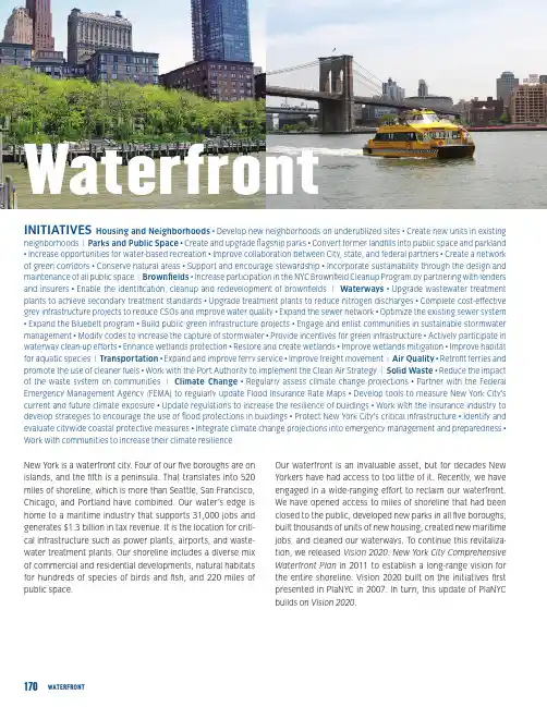
170WATERFRONTNew York is a waterfront city. Four of our five boroughs are on islands, and the fifth is a peninsula. That translates into 520 miles of shoreline, which is more than Seattle, San Francisco, Chicago, and Portland have combined. Our water’s edge is home to a maritime industry that supports 31,000 jobs and generates $1.3 billion in tax revenue. It is the location for criti-cal infrastructure such as power plants, airports, and waste-water treatment plants. Our shoreline includes a diverse mix of commercial and residential developments, natural habitats for hundreds of species of birds and fish, and 220 miles of public space.Our waterfront is an invaluable asset, but for decades New Yorkers have had access to too little of it. Recently, we have engaged in a wide-ranging effort to reclaim our waterfront. We have opened access to miles of shoreline that had been closed to the public, developed new parks in all five boroughs, built thousands of units of new housing, created new maritime jobs, and cleaned our waterways. To continue this revitaliza-tion, we released Vision 2020: New York City Comprehensive Waterfront Plan in 2011 to establish a long-range vision for the entire shoreline. Vision 2020 built on the initiatives first presented in PlaNYC in 2007. In turn, this update of PlaNYC builds on Vision 2020.INITIATIVES Housing and Neighborhoods • Develop new neighborhoods on underutilized sites • Create new units in existingneighborhoods | Parks and Public Space • Create and upgrade flagship parks • Convert former landfills into public space and parkland • Increase opportunities for water-based recreation • Improve collaboration between City, state, and federal partners • Create a network of green corridors • Conserve natural areas • Support and encourage stewardship • Incorporate sustainability through the design and maintenance of all public space | Brownfields • Increase participation in the NYC Brownfield Cleanup Program by partnering with lenders and insurers • Enable the identification, cleanup and redevelopment of brownfields | Waterways • Upgrade wastewater treatment plants to achieve secondary treatment standards • Upgrade treatment plants to reduce nitrogen discharges • Complete cost-effective grey infrastructure projects to reduce CSOs and improve water quality • Expand the sewer network • Optimize the existing sewer system • Expand the Bluebelt program • Build public green infrastructure projects • Engage and enlist communities in sustainable stormwater management • Modify codes to increase the capture of stormwater • Provide incentives for green infrastructure • Actively participate in waterway clean-up efforts • Enhance wetlands protection • Restore and create wetlands • Improve wetlands mitigation • Improve habitat for aquatic species | Transportation • Expand and improve ferry service • Improve freight movement | Air Quality • Retrofit ferries and promote the use of cleaner fuels • Work with the Port Authority to implement the Clean Air Strategy | Solid Waste • Reduce the impact of the waste system on communities | Climate Change • Regularly assess climate change projections • Partner with the Federal Emergency Management Agency (FEMA) to regularly update Flood Insurance Rate Maps • Develop tools to measure New York City’s current and future climate exposure • Update regulations to increase the resilience of buildings • Work with the insurance industry to develop strategies to encourage the use of flood protections in buildings • Protect New York City’s critical infrastructure • Identify and evaluate citywide coastal protective measures • Integrate climate change projections into emergency management and preparedness • Work with communities to increase their climate resilienceWe will enhance areas along the water and increase access to the water itself. By reducing Combined Sewer Overflows (CSOs), decreasing nitrogen discharges, removing contami-nated sediments, and restoring wetlands, we will strengthen our coastal ecosystems and provide more opportunities to use our waterways not only for people but for blue heron and bass as well. We will also transform underutilized areas along the water into destination parks in all five boroughs, includ-ing Brooklyn Bridge Park, Governors Island, Soundview Park, Rockaway Beach Park, and Freshkills Park.We will continue to enliven the waterfront with a range of attractive uses. We will build new residential neighborhoods at Hunter’s Point South and Willets Point. We will explore zoning changes for under-utilized areas to create opportunities for more productive uses. Development along our shores can help meet the need for housing and other services for a grow-ing population as well as provide jobs, generate tax revenues, and bring more people to the water. To make more under-utilized land available for redevelopment, we will implement programs to ensure a more effective process for cleaning up contaminated land.Our waterways will remain increasingly important blue high-ways for moving goods and people. An increase in water-borne transportation will relieve the burden on our streets and transit system. Ferry service on the East River will give more people a sustainable transportation alternative, while increas-ing tug-and-barge use to move solid waste out of the city will improve air quality and reduce congestion by taking trucks off the road. We will achieve cleaner air for waterfront communi-ties by increasing the use of cleaner fuels in maritime vessels and reducing emissions from the ships, trains, and trucks that use our ports.We will assess and respond to the impacts that sea level rise, storm surge, and increased precipitation levels will have on our coastal areas. By developing tools to measure New York City’s current and future climate risks, we will make more informed decisions in terms of how we design and adapt criti-cal pieces of coastal infrastructure and other elements of our built environment.Our effort to revitalize New York City’s waterfront extends beyond the initiatives in PlaNYC. Vision 2020 seeks not only to create new residential areas and parks where opportuni-ties exist but also to maintain a vibrant working waterfront where water-dependent industries can grow and thrive. We are developing waterfront infrastructure to enable the expan-sion of critical economic activities such as port commerce and shipping.Our waterfront is a crucial component of our physical, eco-nomic, and social fabric. We will revitalize our city’s edge to reconnect New Yorkers and visitors to the water and reclaim New York City’s standing as a premier waterfront city. With smart and sensitive planning, we will create a waterfront that will be cherished for generations to come.171A GREENER, GREATER NEW YORKPLANYC。
城市规划的典范:纽约作者:来源:《居业》2014年第06期纽约市是美国最大都市及第一大港,也是世界第五大都市,位于美国东海岸北部,纽约州东南部。
纽约是世界最著名城市之一、是国际经济、金融、艺术、传媒之都、联合国总部所在地。
纽约市有300多年的历史,从最初的殖民地,到今天的世界大都会。
纽约市区人口有760万,郊区有4千万人。
全市共有76个民族,使用125种语言。
全美第一部都市规划法1916年在纽约市最先产生,全美最完整的城市规划法1964年在纽约市制定。
让城市有秩序地成长纽约城市规划的指导思想是如何让城市有秩序地成长,其法律的基础是希望规范可见及不可见的未来。
如1990年就曾对所有的房屋规划及城市体系进行了一次修改,当时主要是解决如何协调、保留现有的社区并使它们不要有过多的增长。
城市发展与其它事物的发展相似,城市规划也有一个从青少年到青年、中年的不同时期,每时期发展的步骤都不一样。
纽约的城市规划是一个中年期的规划,它的规划法有一个很独特的程序叫做Urban Land Use Review Procedure,英文缩写成ULURP。
纽约市城市规划的宗旨1、提升全体居民的居住环境质提升全体居民的居住环境是规划里面的第一个大目标,这个宗旨如果不保,其它的事情都成为本末倒置。
任何规划,最终就是让居民认为,他们的居住环境质量在提高,而不是恶化。
比如一个城市的发展方式为什么要向周边,为什么不往东、往西或往南往北,或者,为什么要建设一个广场,或一个公园,新开发一片小区,成立一个新的市政中心,建立一个新的商务中心,其宗旨在什么地方?总之,规划第一个宗旨就是提升全体居民的居住环境质量,这在美国是第一重要的,称为No.1 rule,法规第一条。
2、城市必须有秩序、有条理地综合发展城市的发展不可能很快速,也不可能毫无秩序,而且也不可能往单一的方向,城市规划必须使城市有秩序、有条理地综合发展。
无论是在整个资金的运作上,在整个人员的安排上,以及在执法、执行、监督上都必须首先遵循这样的一个条件。
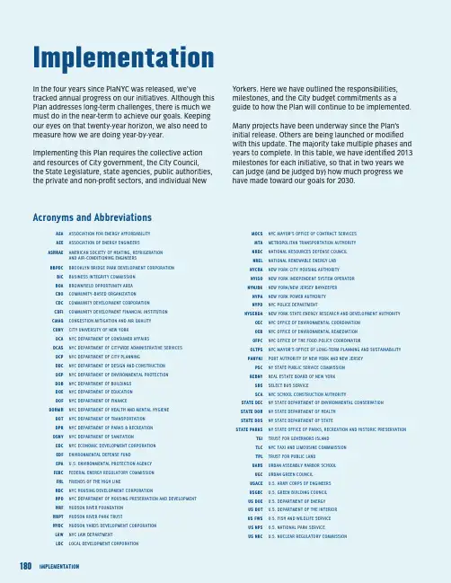
Implementation In the four years since PlaNYC was released, we’ve tracked annual progress on our initiatives. Although this Plan addresses long-term challenges, there is much we must do in the near-term to achieve our goals. Keeping our eyes on that twenty-year horizon, we also need to measure how we are doing year-by-year.Implementing this Plan requires the collective action and resources of City government, the City Council, the State Legislature, state agencies, public authorities, the private and non-profit sectors, and individual NewAEA ASSOCIATION FOR ENERGY AFFORDABILITYAEE ASSOCIATION OF ENERGY ENGINEERSASHRAE AMERICAN SOCIETY OF HEATING, REFRIGERATIONAND AIR-CONDITIONING ENGINEERSBBPDC BROOKLYN BRIDGE PARK DEVELOPMENT CORPORATION BIC BUSINESS INTEGRITY COMMISSIONBOA BROWNFIELD OPPORTUNITY AREACBO COMMUNITY-BASED ORGANIZATIONCDC COMMUNITY DEVELOPMENT CORPORATIONCDFI COMMUNITY DEVELOPMENT FINANCIAL INSTITUTIONCMAQ CONGESTION MITIGATION AND AIR QUALITYCUNY CITY UNIVERSITY OF NEW YORKDCA NYC DEPARTMENT OF CONSUMER AFFAIRSDCAS NYC DEPARTMENT OF CITYWIDE ADMINISTRATIVE SERVICESDCP NYC DEPARTMENT OF CITY PLANNINGDDC NYC DEPARTMENT OF DESIGN AND CONSTRUCTIONDEP NYC DEPARTMENT OF ENVIRONMENTAL PROTECTIONDOB NYC DEPARTMENT OF BUILDINGSDOE NYC DEPARTMENT OF EDUCATIONDOF NYC DEPARTMENT OF FINANCEDOHMH NYC DEPARTMENT OF HEALTH AND MENTAL HYGIENE DOT NYC DEPARTMENT OF TRANSPORTATIONDPR NYC DEPARTMENT OF PARKS & RECREATIONDSNY NYC DEPARTMENT OF SANITATIONEDC NYC ECONOMIC DEVELOPMENT CORPORATIONEDF ENVIRONMENTAL DEFENSE FUNDEPA U.S. ENVIRONMENTAL PROTECTION AGENCYFERC FEDERAL ENERGY REGULATORY COMMISSIONFHL FRIENDS OF THE HIGH LINEHDC NYC HOUSING DEVELOPMENT CORPORATIONHPD NYC DEPARTMENT OF HOUSING PRESERVATION AND DEVELOPMENT HRF HUDSON RIVER FOUNDATIONHRPT HUDSON RIVER PARK TRUSTHYDC HUDSON YARDS DEVELOPMENT CORPORATIONLAW NYC LAW DEPARTMENTLDC LOCAL DEVELOPMENT CORPORATIONMOCS NYC MAYOR’S OFFICE OF CONTRACT SERVICESMTA METROPOLITAN TRANSPORTATION AUTHORITYNRDC NATIONAL RESOURCES DEFENSE COUNCILNREL NATIONAL RENEWABLE ENERGY LABNYCHA NEW YORK CITY HOUSING AUTHORITYNYISO NEW YORK INDEPENDENT SYSTEM OPERATORNYNjBK NEW YORK/NEW jERSEY BAYKEEPERNYPA NEW YORK POWER AUTHORITYNYPD NYC POLICE DEPARTMENTNYSERDA NEW YORK STATE ENERGY RESEARCH AND DEVELOPMENT AUTHORITY OEC NYC OFFICE OF ENVIRONMENTAL COORDINATIONOER NYC OFFICE OF ENVIRONMENTAL REMEDIATIONOFPC NYC OFFICE OF THE FOOD POLICY COORDINATOROLTPS NYC MAYOR’S OFFICE OF LONG-TERM PLANNING AND SUSTAINABILITYPANYNj PORT AUTHORITY OF NEW YORK AND NEW jERSEYPSC NY STATE PUBLIC SERVICE COMMISSIONREBNY REAL ESTATE BOARD OF NEW YORKSBS SELECT BUS SERVICESCA NYC SCHOOL CONSTRUCTION AUTHORITYSTATE DEC NY STATE DEPARTMENT OF ENVIRONMENTAL CONSERVATIONSTATE DOH NY STATE DEPARTMENT OF HEALTHSTATE DOS NY STATE DEPARTMENT OF STATESTATE PARKS NY STATE OFFICE OF PARKS, RECREATION AND HISTORIC PRESERVATION TGI TRUST FOR GOVERNORS ISLANDTLC NYC TAxI AND LIMOUSINE COMMMISSIONTPL TRUST FOR PUBLIC LANDUAHS URBAN ASSEMBLY HARBOR SCHOOLUGC URBAN GREEN COUNCILUSACE U.S. ARMY CORPS OF ENGINEERSUSGBC U.S. GREEN BUILDING COUNCILUS DOE U.S. DEPARTMENT OF ENERGYUS DOT U.S. DEPARTMENT OF THE INTERIORUS FWS U.S. FISH AND WILDLIFE SERVICEUS NPS U.S. NATIONAL PARK SERVICEUS NRC U.S. NUCLEAR REGULATORY COMMISSIONYorkers. Here we have outlined the responsibilities, milestones, and the City budget commitments as a guide to how the Plan will continue to be implemented. Many projects have been underway since the Plan’s initial release. Others are being launched or modified with this update. The majority take multiple phases and years to complete. In this table, we have identified 2013 milestones for each initiative, so that in two years we can judge (and be judged by) how much progress we have made toward our goals for 2030.Acronyms and Abbreviations。

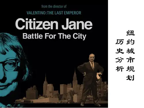
纽约的城市规划及其历史性价值纽约市(New York City)位于美国东海岸,是全球最具影响力的大都市之一。
纽约市的城市规划自20世纪初以来一直在发展,塑造了这座城市的特色和形象。
该城市的历史与城市规划密切相关,其历史性价值是不可低估的。
城市规划的发展在纽约市的城市规划中,最著名的人物是罗伯特·摩西(Robert Moses),他的影响可以追溯到20世纪30年代,而他的办公室也在市政府设在广场的摩西办公室(Moses Office)。
摩西是一个有着远见卓识的城市规划者和建筑师,他在他的职业生涯中领导了数十项大型规划和公共工程项目。
他主张公共权力和私人企业的合作,以促进城市的发展和改造。
他设计了纽约市许多著名的建筑物、公园和高速公路。
他认为高速公路是城市的未来,而且是东部板块的经济未来和生活改变的关键。
至今,在市政府和非政府组织之间,拥有许多不同的城市规划理念和方案,这就使得纽约市的城市规划不断地发展、变化。
历史性价值纽约市的历史性价值与其城市规划密不可分。
这座城市有着丰富的历史遗产,其建筑风格也变化多端。
纽约市曾经历过几次大规模的财务危机,1880年代和1970年代是其最严重的两次。
这些危机改变了城市的景观,不仅改变了城市的形态、建筑设计和交通系统,而且改变了居民的生活方式和社区的结构。
纽约某些地区的重建已成为城市规划的标志。
例如,杜安大街区(Duane Street area)在20世纪60年代因詹姆斯·鲁索和道格拉斯·若斯科特(James Russo and Douglas Josscott)的设计而受到重建。
此外,纽约市的 Bridgemarket(位于第59街和第60街之间的斯坦顿岛)是一个18世纪的市场,如今已经变成著名的旅游景点。
此市场的建筑物仍然存在且修缮良好,是纽约市历史性和文化性的重要组成部分。
结语纽约市的城市规划和历史遗产传承着珍贵的历史、文化和社会价值。
50年前的纽约城市规划城市发展与其它事物的发展相似,城市规划也有一个从青少年到青年、中年的不同时期,每时期发展的步骤都不一样。
下面由店铺为大家整理的50年前的纽约城市规划,希望对大家有帮助!50年前的纽约城市规划纽约市城市规划的宗旨1、提升全体居民的居住环境质提升全体居民的居住环境是规划里面的第一个大目标,这个宗旨如果不保的话,其它的事情都成为本末倒置。
我们做任何规划,最终就是让我们的居民认为,他们的居住环境质量在提高,而不是恶化。
比如一个城市的发展方式为什么要向周边,为什么不往东、往西或往南往北,或者,为什么要建设一个广场,或一个公园,新开发一片小区,成立一个新的市政中心,建立一个新的商务中心,其宗旨在什么地方?总之,规划第一个宗旨就是提升全体居民的居住环境质量,这在美国是第一重要的,称为No.1 rule,法规第一条。
2、城市必须有秩序、有条理地综合发展城市的发展不可能很快速,也不可能毫无秩序,而且也不可能往单一的方向,城市规划必须使城市有秩序、有条理地综合发展。
无论是在整个资金的运作上,在整个人员的安排上,以及在执法、执行、监督上都必须首先遵循这样的一个条件。
所以我们在从事规划的时候必须要考虑到我们的发展方向以及综合发展的实质表现在什么地方,必须有秩序、有条理。
3、必须创造有鲜明特色的城市形象我们透过规划的手法要能把城市的形象充分地表达出来,使我们的城市形象在某个城市区域有独特的个性,不是当城市规划出来后,大家感觉不出我们当地的城市与其它的城市有什么差别。
4、城市必须保持稳定的城市用地价格与价值保持稳定的城市用地价格与价值也是目前为止一个非常重要的指导思想,目前中国还没有做到这一点。
土地是很宝贵的资源,土地与市政建设开发以及与建设的发展方向也有相对的关系。
中国的土地将来能够变成一种商品,变成一种价值。
在社会主义的构架下,必须把中国的土地当成一个投资,做成一种商品,使土地的价格与价值能够稳定地发展。
170WATERFRONTNew York is a waterfront city. Four of our five boroughs are on islands, and the fifth is a peninsula. That translates into 520 miles of shoreline, which is more than Seattle, San Francisco, Chicago, and Portland have combined. Our water’s edge is home to a maritime industry that supports 31,000 jobs and generates $1.3 billion in tax revenue. It is the location for criti-cal infrastructure such as power plants, airports, and waste-water treatment plants. Our shoreline includes a diverse mix of commercial and residential developments, natural habitats for hundreds of species of birds and fish, and 220 miles of public space.Our waterfront is an invaluable asset, but for decades New Yorkers have had access to too little of it. Recently, we have engaged in a wide-ranging effort to reclaim our waterfront. We have opened access to miles of shoreline that had been closed to the public, developed new parks in all five boroughs, built thousands of units of new housing, created new maritime jobs, and cleaned our waterways. To continue this revitaliza-tion, we released Vision 2020: New York City Comprehensive Waterfront Plan in 2011 to establish a long-range vision for the entire shoreline. Vision 2020 built on the initiatives first presented in PlaNYC in 2007. In turn, this update of PlaNYC builds on Vision 2020.INITIATIVES Housing and Neighborhoods • Develop new neighborhoods on underutilized sites • Create new units in existingneighborhoods | Parks and Public Space • Create and upgrade flagship parks • Convert former landfills into public space and parkland • Increase opportunities for water-based recreation • Improve collaboration between City, state, and federal partners • Create a network of green corridors • Conserve natural areas • Support and encourage stewardship • Incorporate sustainability through the design and maintenance of all public space | Brownfields • Increase participation in the NYC Brownfield Cleanup Program by partnering with lenders and insurers • Enable the identification, cleanup and redevelopment of brownfields | Waterways • Upgrade wastewater treatment plants to achieve secondary treatment standards • Upgrade treatment plants to reduce nitrogen discharges • Complete cost-effective grey infrastructure projects to reduce CSOs and improve water quality • Expand the sewer network • Optimize the existing sewer system • Expand the Bluebelt program • Build public green infrastructure projects • Engage and enlist communities in sustainable stormwater management • Modify codes to increase the capture of stormwater • Provide incentives for green infrastructure • Actively participate in waterway clean-up efforts • Enhance wetlands protection • Restore and create wetlands • Improve wetlands mitigation • Improve habitat for aquatic species | Transportation • Expand and improve ferry service • Improve freight movement | Air Quality • Retrofit ferries and promote the use of cleaner fuels • Work with the Port Authority to implement the Clean Air Strategy | Solid Waste • Reduce the impact of the waste system on communities | Climate Change • Regularly assess climate change projections • Partner with the Federal Emergency Management Agency (FEMA) to regularly update Flood Insurance Rate Maps • Develop tools to measure New York City’s current and future climate exposure • Update regulations to increase the resilience of buildings • Work with the insurance industry to develop strategies to encourage the use of flood protections in buildings • Protect New York City’s critical infrastructure • Identify and evaluate citywide coastal protective measures • Integrate climate change projections into emergency management and preparedness • Work with communities to increase their climate resilienceWe will enhance areas along the water and increase access to the water itself. By reducing Combined Sewer Overflows (CSOs), decreasing nitrogen discharges, removing contami-nated sediments, and restoring wetlands, we will strengthen our coastal ecosystems and provide more opportunities to use our waterways not only for people but for blue heron and bass as well. We will also transform underutilized areas along the water into destination parks in all five boroughs, includ-ing Brooklyn Bridge Park, Governors Island, Soundview Park, Rockaway Beach Park, and Freshkills Park.We will continue to enliven the waterfront with a range of attractive uses. We will build new residential neighborhoods at Hunter’s Point South and Willets Point. We will explore zoning changes for under-utilized areas to create opportunities for more productive uses. Development along our shores can help meet the need for housing and other services for a grow-ing population as well as provide jobs, generate tax revenues, and bring more people to the water. To make more under-utilized land available for redevelopment, we will implement programs to ensure a more effective process for cleaning up contaminated land.Our waterways will remain increasingly important blue high-ways for moving goods and people. An increase in water-borne transportation will relieve the burden on our streets and transit system. Ferry service on the East River will give more people a sustainable transportation alternative, while increas-ing tug-and-barge use to move solid waste out of the city will improve air quality and reduce congestion by taking trucks off the road. We will achieve cleaner air for waterfront communi-ties by increasing the use of cleaner fuels in maritime vessels and reducing emissions from the ships, trains, and trucks that use our ports.We will assess and respond to the impacts that sea level rise, storm surge, and increased precipitation levels will have on our coastal areas. By developing tools to measure New York City’s current and future climate risks, we will make more informed decisions in terms of how we design and adapt criti-cal pieces of coastal infrastructure and other elements of our built environment.Our effort to revitalize New York City’s waterfront extends beyond the initiatives in PlaNYC. Vision 2020 seeks not only to create new residential areas and parks where opportuni-ties exist but also to maintain a vibrant working waterfront where water-dependent industries can grow and thrive. We are developing waterfront infrastructure to enable the expan-sion of critical economic activities such as port commerce and shipping.Our waterfront is a crucial component of our physical, eco-nomic, and social fabric. We will revitalize our city’s edge to reconnect New Yorkers and visitors to the water and reclaim New York City’s standing as a premier waterfront city. With smart and sensitive planning, we will create a waterfront that will be cherished for generations to come.171A GREENER, GREATER NEW YORKPLANYC。
纽约政府计划书1. 简介本计划书旨在介绍纽约市政府为改善城市居民的生活质量和促进可持续发展所制定的一系列计划和行动。
纽约市政府将致力于解决城市面临的各种挑战,包括交通拥堵、环境污染、贫困和失业问题等。
通过制定相关政策和推行相应的项目,政府希望在未来几年内实现城市的全面提升。
2. 城市交通2.1 公共交通发展为了解决交通拥堵问题,纽约政府计划在未来五年内进行大规模的公共交通发展。
首先,政府将增加地铁和公交车的数量,提高城市的通勤效率。
其次,政府还计划改善地铁站和公交车站的设施,提升乘客的出行体验。
2.2 自行车和步行推广为了鼓励居民选择更环保的出行方式,政府将推广自行车和步行。
政府计划在城市各处建设自行车道,并提供免费自行车租赁服务。
同时,政府还将改善步行道的条件,提供更安全和便利的步行环境。
3. 环境保护与可持续发展3.1 减排和能源转型为了应对气候变化和环境污染问题,纽约政府将制定一系列减排和能源转型计划。
政府计划进一步推广可再生能源的使用,并鼓励居民减少能源消耗。
此外,政府还将实施排放限制措施,以减少工业和交通领域的污染。
3.2 垃圾处理和回收为了改善城市的环境卫生状况,政府将加大垃圾处理和回收的力度。
政府计划建设更多的垃圾处理设施,并提供更多的回收设施。
同时,政府还将加强对垃圾分类和回收的宣传教育,提高居民的环保意识。
4. 经济发展和就业机会4.1 创新和科技产业发展为了促进经济发展和创造就业机会,政府计划支持创新和科技产业的发展。
政府将提供税收优惠和补贴,鼓励企业加大研发投入并推动科技创新。
此外,政府还将引进更多的科技企业和孵化器,为创业者提供更多机会。
4.2 培训和教育机会为了提高劳动力素质和就业竞争力,政府将加大培训和教育机会的提供。
政府计划设立更多的职业培训学校和技能培训中心,为居民提供各种职业培训课程。
同时,政府还将鼓励企业提供实习和就业机会,帮助年轻人更好地融入社会。
5. 社会福利和贫困减少5.1 社会福利改革为了改善贫困人口的生活条件,政府将进行社会福利改革。

Economic Data | 经济数据572014.10 Shanghai Economy Enterprise │ 企业Enterprise | 企 业2015.05 Shanghai Economy Creative Economy | 创意经济2015.07 Shanghai Economy Internation | 国 际2015.09 Shanghai Economy OneNYC :“一个纽约”规划概要Planning Outline of the “One New York”近期,纽约市政府(NYC)推出了2015版的纽约规划,主题是“一个纽约”规划:建设一个富强而公正的纽约(One new york :The plan for a strong and just city)。
前几版的纽约规划一直是全球各大城市学习的对象,现在纽约又一次走在了众多城市的前面,为城市应对未来挑战注入新的理念和行动。
同时可以看到纽约这一系列的规划中,通过具体策略和指标落实不断推进着城市发展的愿景。
本文即是对这版规划的背景、目标愿景、以及“目标-策略-指标”的简单介绍。
规划背景1、规划回顾2007年,纽约市长Michael R. Bloomberg 发布了第一版的PlaNYC,这版规划主要集中于解决城市人口增长的问题和基础设施的需求,并命名为《AGreener, Greater New York》,规划包括一系列可持续发展的策略并成为其他国际大都市学习的范例。
PlaNYC 提出要解决城市日益老化的基础设施、发展公园、提高纽约居民的生活质量和健康水平,并第一次将减少温室气体排放量作为承诺目标。
PlaNYC 2011深化了2007版中的措施,加强了对城市环境稳定性和社区宜居性的承诺,开始对棕地进行清理,采取措施提高空气和水的质量。
2013年,经过了飓风“桑迪”后,纽约市发布了新的PlaNYC: A Stronger, MoreResilient New York。