基于地下水渗流方程的三维地面沉降模型_许烨霜
- 格式:pdf
- 大小:220.87 KB
- 文档页数:4
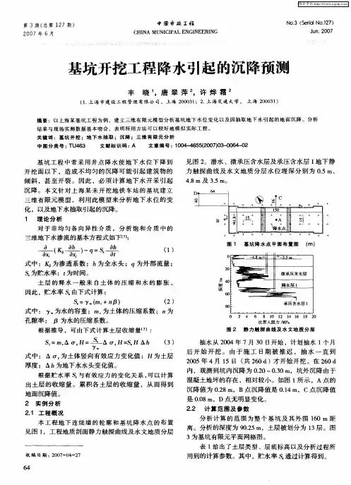
基坑开挖工程降水引起的沉降预测
丰晓;唐翠萍;许烨霜
【期刊名称】《中国市政工程》
【年(卷),期】2007(000)003
【摘要】以上海某基坑工程为例,建立三维有限元模型分析基坑地下水位变化以及因抽取地下水引起的地面沉降.分析结果与现场实测数据基本吻合,表明所用方法可以较好地模拟实际工程.
【总页数】2页(P64-65)
【作者】丰晓;唐翠萍;许烨霜
【作者单位】上海市建设工程管理有限公司,上海,200031;上海交通大学,上
海,200031;上海交通大学,上海,200031
【正文语种】中文
【中图分类】TU463
【相关文献】
1.对基坑降水引起周围建筑物沉降的预测及其防治措施 [J], 王文峰
2.深基坑开挖降水引起地铁隧道沉降的分析预测 [J], 刘波;徐薇;杨春英
3.基于抽水试验的基坑降水引起地面沉降的预测分析 [J], 孙锦剑
4.富水深基坑降水引起的地表沉降预测 [J], 江杰;魏丽;胡盛斌;钟有信;杨杉楠
5.深基坑降水引起的地面沉降预测 [J], 李文广;胡长明
因版权原因,仅展示原文概要,查看原文内容请购买。

基于地下水渗流方程的三维地面沉降模型
许烨霜;沈水龙;唐翠萍;姜弘
【期刊名称】《岩土力学》
【年(卷),期】2005()S1
【摘要】针对地下水抽取引起的大面积地面沉降的问题,提出了一种计算方法。
该方法基于饱和与不饱和岩土介质中地下水渗流理论,计算出三维状态下的大面积地面沉降。
提出的方法被结合到地下水渗流的三维有限元法分析中,计算时考虑了地层的可压缩性,并被用来分析软土的固结,将该法与太沙基理论及固结试验的结果进行比较,结果表明其误差小于2%。
该法还被用来分析单井抽取承压地下水引起的周围地基的沉降及承压水层由于挡水板的阻断作用而引起的下游侧的地基的沉降。
【总页数】4页(P109-112)
【关键词】地下水抽取;地下水渗流;大面积地面沉降;三维模型;有限元分析
【作者】许烨霜;沈水龙;唐翠萍;姜弘
【作者单位】上海交通大学船舶海洋与建工学院
【正文语种】中文
【中图分类】P642.26
【相关文献】
1.基于三维渗流模型的地下水动态数值分析 [J], 胡继华; 宋勇超; 耿学勇; 倪福全
2.基于三维渗流模型的地下水动态数值分析 [J], 胡继华; 宋勇超; 耿学勇; 倪福全
3.基于三维渗流数值模拟的调蓄水池地下水渗流影响分析 [J], 许建建; 惠焕利; 裴
旭阳
4.松散承压含水层地区深基坑降水三维渗流与地面沉降耦合模型 [J], 骆祖江;李朗;姚天强;罗建军
因版权原因,仅展示原文概要,查看原文内容请购买。
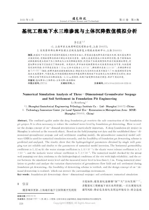
2023年4月J o u r n a l o fG r e e nS c i e n c e a n dT e c h n o l o g y第25卷第8期收稿日期:2023-03-06作者简介:李任政(1987-),男,硕士,工程师,主要从事水文地质勘查、场地环境调查评估及修复等。
李任政1,2(1.上海市岩土地质研究院有限公司,上海200072;2.自然资源部大都市区国土空间生态修复工程技术创新中心,上海200003)摘要:深基坑下伏承压含水层制约着基坑工程的安全施工,常需通过基坑降水进行减压处理,制定基坑降水方案的同时,实现按需降水的设计理念亦是较为重要。
选取上海某深基坑工程为研究对象,基于现场抽水试验数据及建立的地下水三维渗流与土体沉降耦合模型,利用地下水数值模型软件进行数值模拟研究,对基坑降水方案可行性进行了预测分析。
结果显示:单井抽水试验获取的水文地质参数较为可靠,与数值模型反演的参数(水平渗透系数为5.12m/d,贮水系数为1.8×10-4,弹性释水系数3.0×10-4,非弹性释水系数7.0×10-4)相近;经群井抽水试验数据校核后,模拟水位与实测水位误差不超过0.5m,数值模型符合场地水文地质条件,可靠性高;利用数值模拟预测分析基坑降水期间地下水流场与土体沉降的变化特征,验证了降水方案可将承压水位降至标高-6.13m的同时,体现了按需降水的设计理念,保护了周边环境。
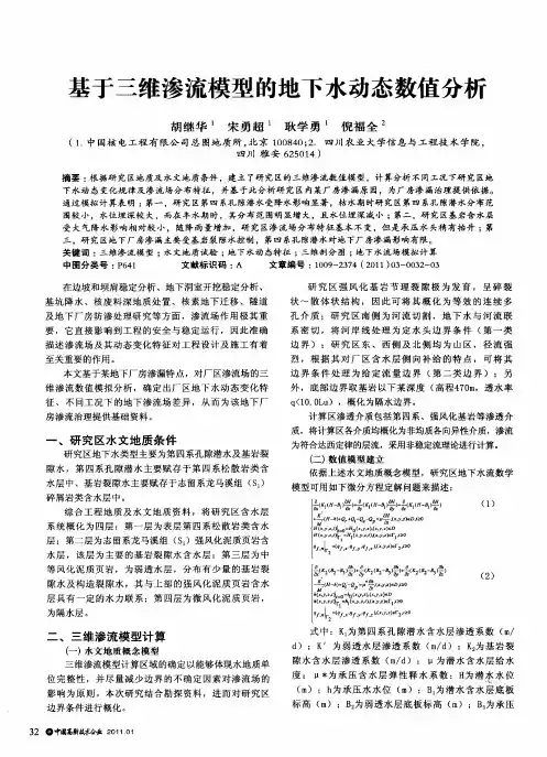
关键词:基坑降水;三维渗流;土体沉降;数值模拟中图分类号:T U753文献标识码:A文章编号:1674-9944(2023)08-0228-06N u m e r i c a l S i m u l a t i o nA n a l y s i s o fT h r e e-D i m e n s i o n a lG r o u n d w a t e r S e e p a g ea n dS o i l S e t t l e m e n t i nF o u n d a t i o nP i tE n g i n e e r i n gL iR e n z h e n g1,2(1..,,200072,;2.-,,200003,)A b s t r a c t:T h e c o n f i n e d a q u i f e r u n d e r t h e d e e p f o u n d a t i o n p i t r e s t r i c t s t h e s a f e c o n s t r u c t i o no f t h e f o u n d a t i o n p i t p r o j e c t.I t i s o f t e nn e c e s s a r y t o r e d u c e t h e c o n f i n e dw a t e r l e v e l b y f o u n d a t i o n p i t d e w a t e r i n g.H o wt o r e a l-i z e t h e d e s i g n c o n c e p t o f o n-d e m a n d p r e c i p i t a t i o n i s p a r t i c u l a r l y i m p o r t a n t.Ad e e p f o u n d a t i o n p i t p r o j e c t i n S h a n g h a i i s s e l e c t e d a s t h e r e s e a r c h o b j e c t.B a s e d o n t h e f i e l d p u m p i n g t e s t d a t a a n d t h e e s t a b l i s h e d t h r e e-d i-m e n s i o n a l g r o u n d w a t e r s e e p a g ea n ds o i l s e t t l e m e n t c o u p l i n g m o d e l,t h e g r o u n d w a t e rn u m e r i c a lm o d e l s o f t-w a r eGM S i s u s e d f o r n u m e r i c a l s i m u l a t i o n r e s e a r c h,a n d t h e f e a s i b i l i t y o f f o u n d a t i o n p i t d e w a t e r i n g s c h e m e i s p r e d i c t e d a n d a n a l y z e d.T h e r e s u l t s s h o wt h a t t h eh y d r o g e o l o g i c a l p a r a m e t e r so b t a i n e db y s i n g l ew e l l p u m-p i n g t e s t a r e r e l i a b l e a n d s i m i l a r t o t h e p a r a m e t e r so f n u m e r i c a lm o d e l i n v e r s i o n.T h eh o r i z o n t a l p e r m e a b i l i t y c o e f f i c i e n t i s5.12m/d;t h ew a t e r s t o r a g e c o e f f i c i e n t i s1.8×10-4;t h e e l a s t i cw a t e r r e l e a s e c o e f f i c i e n t i s3.0×10-4,a n d t h e i n e l a s t i cw a t e r r e l e a s ec o e f f i c i e n t i s7.0×10-4.T h en u m e r i c a lm o d e l c h e c k e db y t h e g r o u p w e l l p u m p i n g t e s t d a t a c o n f o r m s t o t h e h y d r o g e o l o g i c a l c o n d i t i o n s o f t h e s i t ew i t hh i g h r e l i a b i l i t y,a n d t h e e r-r o r b e t w e e n t h e s i m u l a t e dw a t e r l e v e l a n d t h em e a s u r e dw a t e r l e v e l i s l e s s t h a n0.5m.U s i n g n u m e r i c a l s i m u-l a t i o n t o p r e d i c t a n d a n a l y z e t h e v a r i a t i o n c h a r a c t e r i s t i c s o f g r o u n d w a t e r f l o wf i e l d a n ds o i l s e t t l e m e n t d u r i n g f o u n d a t i o n p i t d e w a t e r i n g,t h e f e a s i b i l i t y o f d e w a t e r i n g s c h e m e i s v e r i f i e d,a n d t h e d e s i g n c o n c e p t o f o n-d e-m a n dd e w a t e r i n g i s r e a l i z e d,w h i c hc a n p r o t e c t t h e s u r r o u n d i n g e n v i r o n m e n t.K e y w o r d s:f o u n d a t i o n p i t d e w a t e r i n g;t h r e e-d i m e n s i o n a l s e e p a g e;s o i l s e t t l e m e n t;n u m e r i c a l s i m u l a t i o n 1引言随着城市更新,上海地区地下空间资源开发利用日趋加快,建筑基坑逐渐朝“深”“大”方向发展[1~3],多数基坑工程被地下承压水所控制,一旦出现基坑突涌等风险,势必危及基坑及周边环境安全,将会造成822Copyright©博看网. All Rights Reserved.李任政椇基坑工程地下水三维渗流与土体沉降数值模拟分析绿色创新研究:工程与技术严重后果[4]。
地面沉降的研究牛正军【摘要】The paper introduces the reason and mechanism of the ground subsidence, the calculating forecasting model, the inspection technical measures and the prevention measures, has the factual summary of the inspection forecasting and prevention measures, so as to direct the correct forecasting of the ground subsidence and adopt reasonable prevention measures.%系统介绍了地面沉降产生的原因机理、计算预测模型,监测技术手段以及防治措施,并对监测预报以及防治措施进行了较具体的总结,以指导正确预测地面沉降,从而采取合理的预防措施。
【期刊名称】《山西建筑》【年(卷),期】2012(038)023【总页数】3页(P76-78)【关键词】地面沉降;机理;计算预测模型;防治措施【作者】牛正军【作者单位】安徽省化工设计院,安徽合肥230009【正文语种】中文【中图分类】TU4330 引言地面沉降是人为的或自然的因素作用下,由于地壳表层土体受力压缩导致的区域性地面标高整体下降的一种环境和地质现象,是一种无法补偿的永久性环境破坏和资源损失[1]。
地面下沉将引起一系列的危害,如道路、房屋开裂,基础设施遭到破坏及地下水资源恶化等。
根据长江三角洲、华北地区等的研究,据统计,建国以后,仅地面沉降及地裂两项造成的经济损失就达4 500亿元~5 000亿元人民币。
包括直接经济损失350亿元~400亿元人民币,年均损失90亿元~100亿元人民币,年均直接经济损失8亿元~10亿元人民币[2]。
探讨地下水开采引起的地面沉降问题以及解决措施摘要:当中国的城市正竭力向上发展,农村正拼命追求高产的时候,却没想到脚下的土地,已不堪重负,正悄无声息地下降。
华北平原在下降、长江三角洲的一些地方、汾渭盆地也在下降,地面沉降的范围还在扩大。
不能承重的土地之下,是急遽下降的地下水水位。
而如何控制地下水的过度攫取,又牵涉到多个部门,成为社会治理的一个难题。
本文结合笔者多年的工作经验,对地面沉降和地下水开采的矛盾问题进行简要的阐述。
关键词: 概述; 地面沉降;解决措施To explore the land subsidence caused by mining groundwater problems and solving measuresLiDeBiaoJiangsu province hydrology water resources suwey yancheng branch 22400Pick to: when Chinese cities are trying to up development, rural are desperately seek high yield, but didn't expect at the foot of land, is already crumbling, are quietly down. North China plain on the decline, the Yangtze river delta, some places, Fen Wei basin is also on the decline, the land subsidence in expanding the scope. Not bearing land under, is rapidly falling groundwater level. And how to control the excessive groundwater grab, and involves many departments, become social governance a difficult problem. The author discusses many years of work experience, and to the ground settlement and the problem of groundwater exploitation are discussed briefly. Keywords: introduction, The ground settlement; solutions0 概述地面沉降又称为地面下沉或地陷。
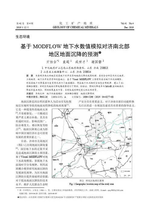
沧州市地下水开采-地面沉降数值模拟马青山;骆祖江【摘要】以沧州市地下水开采引起的地面沉降为例,在分析研究区地质和水文地质条件的基础上,得到研究区地下水开采与地面沉降地质概化模型,建立地下水三维渗流和土体垂向一维变形耦合数值模型,在完成模型识别验证的基础上,预测了现状开采条件下从2010年末到2025年末地下水流场的变化特征和地面沉降的变化趋势。
结果表明,到2025年底,整个沧州市范围内累计地面沉降量最大值为475 mm,最小值为270 mm。
%Taking the land subsidence caused by groundwater exploitation in Cangzhou City as an example, based on the analysis of geology and hydrogeological conditions of the study area, a geological conceptual model of groundwater exploitation and land subsidence was generalized, setting up a corresponding coupled numerical model of three dimensional groundwater flow and one dimensional soil deformation.On the basis of the completion of identification and verification of model, we forecasted the change characteristics of groundwater flow field and the change trend of land subsidence from the end of 2025 to the end of 2010 under the current conditions of groundwater exploitation.The results show that the maximum cumulative land subsidence within the scope of Cangzhou City will be 475 mm at the end of 2025, the minimum value being 270 mm.【期刊名称】《水资源保护》【年(卷),期】2015(000)004【总页数】7页(P20-26)【关键词】地下水开采;地面沉降;预测模型;耦合数值模型【作者】马青山;骆祖江【作者单位】河海大学地球科学与工程学院,江苏南京 210098;河海大学地球科学与工程学院,江苏南京 210098【正文语种】中文【中图分类】P641.6沧州市是我国第四系孔隙承压水开发利用最早、开采量最大的城市之一,特别是20世纪80年代以来,随着工农业的快速发展,地下水开采量大幅增加,造成了区域地下水位急剧下降,地下水资源衰竭,诱发了严重的地面沉降问题。
考虑地下水渗流的地埋管地源热泵三维数值模拟模型及其应用胡平放1﹡胡磊 2 雷飞1孙启明1徐菱虹 11、华中科技大学环境科学与工程学院2、中信建筑设计研究总院有限公司摘要:本文建立了一种考虑地下水渗流的地源热泵地埋管三维传热模型,并利用模型在Matlab环境下模拟了在无渗流、有渗流及改变地下水渗流速度时,埋管出水温度的变化以及埋管周围温度分布的变化,说明地下水渗流有利于埋管换热,在系统设计中是应该考虑的因素;借助所建模型,通过反演方法,由埋管出水温度推导出土壤综合导热系数,该方法考虑地下水渗流因素,可数值求解综合导热系数,结果可用于指导实际工程设计。
关键词:地下埋管换热器;Matlab程序;地下水渗流;土壤综合导热系数如何使地源热泵系统设计更为合理,运行更为高效,成为研究者关注的最重要的问题。
地源热泵的地下埋管深度一般在60~200m,在这么深的地层内,或多或少都存在地下水的渗流。
地下水渗流无疑会对地埋管换热器的传热产生影响。
日本有相关文献用二维数值模型检验了井内温度随抽热速度和地下水流速变化的关系。
计算结果表明:对于岩土中地下水渗透流速大于10-5m/s以上者,与假定只有导热的系统设计比较,可以达到节省埋管长度的目的[1]。
美国的Eskilson[2]利用了Carslaw[3]等给出的移动线热源问题的稳态解析解,讨论了在达到稳定状态以后渗流对地热换热器的影响。
另外Chiasson[4]等人也利用有限元法数值求解了二维的渗流问题,对一些相关问题进行了计算和比较,但未能找到较一般的规律和结论。
Gehlin 等讨论了坚硬岩石垂直缝隙中地下水渗流对岩土热物性测试结果的影响,指出即使较小的地下水渗流也会明显加强地下的传热[5]。
哈尔滨工业大学的范蕊、马最良指出目前国内外关于垂直U 型埋管换热器的传热模型都是基于纯导热的模型,主要是由于考虑地下水渗流时情况复杂,分析比较困难,但认为地下水渗流利于埋管的换热[6,7]。
第50卷第11期2019年11月中南大学学报(自然科学版)Journal of Central South University (Science and Technology)V ol.50No.11Nov.2019基坑降水效应的室内试验研究汪旭玮1,杨天亮2,许烨霜1,3,袁垚3(1.上海交通大学船舶海洋与建筑工程学院,海洋工程国家重点实验室,上海,200240;2.国土资源部地面沉降监测与防治重点实验室上海地面沉降控制工程技术研究中心,上海,200072;3.上海交通大学土木工程系,上海,200240)摘要:为了研究墙井作用下基坑降水引起的水位变化,采用相似材料模拟弱透水层,并通过改变止水帷幕插入承压含水层深度与抽水井过滤段长度分析基坑降水引起的水位变化。
研究结果表明:在基坑降水过程中,抽水井过滤段长度和止水帷幕插入承压含水层的深度都会影响到含水层的水位变化;坑内外观测井的水头差(Δh )随着止水帷幕插入含水层深度的增大而增大;抽水井过滤段长度与含水层厚度之比(l ′)约为33%时,止水帷幕插入深度与含水层厚度之比(d ′)大于73.0%,止水帷幕的挡水效果较好;Δh 随着l ′的增加而减小,当d ′约为50%时,为发挥止水帷幕的挡水效果,Δl 应小于63.0%。
关键词:相似材料;基坑降水;承压含水层;室内试验;止水帷幕;过滤段中图分类号:TU46+3文献标志码:A开放科学(资源服务)标识码(OSID)文章编号:1672-7207(2019)11-2823-08Laboratory test on the effect of foundation pit dewateringWANG Xuwei 1,YANG Tianliang 2,XU Yeshuang 1,3,YUAN Yao 3(1.State Key Laboratory of Ocean Engineering,School of Naval Architecture,Ocean and Civil Engineering,Shanghai Jiao Tong University,Shanghai 200240,China;2.Key Laboratory of Land Subsidence Monitoring and Prevention,Ministry of Land and Resources,Shanghai Engineering Research Center of Land subsidence,Shanghai 200072,China;3.Department of Civil Engineering,Shanghai Jiao Tong University,Shanghai 200240,China)Abstract:To investigate the variation of groundwater level caused by foundation pit dewatering under the interaction between the withdrawal well and retaining wall,the depth of waterproof curtain and the filter length of pumping wells were changed and similar material was used to simulate the aquitard overlying the aquifer in the test.The results show that the difference of the head of water (Δh )between monitoring wells outside and inside the waterproof curtain increases with the increase of the buried depth of the waterproof curtain.If the ratio of the filter length of pumping well and the thickness of the confined aquifer(l ′)keeps at 33%,and the ratio of the buried depth of waterproof curtain inserting into the confined aquifer and the thickness of the confined aquifer (d ′)is larger than 73.0%,the water retaining effect of the waterproof curtain becomes better.Δh decreases with the increase of the收稿日期:2018−12−06;修回日期:2019−02−18基金项目(Foundation item):国土资源部地面沉降监测与防治重点实验室开放基金资助项目(KLLSMP201502)(Project(KLLSMP201502)supported by the Key Laboratory of Land Subsidence Monitoring and Prevention)通信作者:许烨霜,博士,副研究员,从事地面沉降及地下水渗流研究;E-mail:*******************.cnDOI:10.11817/j.issn.1672-7207.2019.11.021第50卷中南大学学报(自然科学版)filter length of pumping well.If d′is about50%,l′should be less than63.0%to ensure the water retaining effect of the waterproof curtain.Key words:similar material;foundation pit dewatering;confined aquifer;laboratory test;waterproof curtain;filter length沿海地区大多为软土地层,且地下水位较高,为保证深基坑开挖的安全稳定,常常需要对承压含水层进行减压降水。
地下水开采一地面沉降模型研究陈崇希;裴顺平【期刊名称】《水文地质工程地质》【年(卷),期】2001(028)002【摘要】A subsidence model with three dimensional groundwater flow coupled one dimensional nonlinear consolidation is established in the paper. In which some solutions are improved in multilayer well, hysteresis of rainfall recharge, initial head, artificial boundary, the coupling between groundwater flow and consolidation, and the consolidation hysteresis in soft soil. This model is applied to Suzhou city and the most important characters are shown, which include the departure between subsidence center and groundwater funnel center, the variation on land subsidence lagged behind which on water head, the permeation coefficients with consolidation, and the transfer feature of water head in soft soil.%本文建立三维流动-一维非线性固结地面沉降模型,在混合井流、降雨滞后补给、初始水头形成、人为边界刻画、水流-固结耦合及软土层固结滞后于地下水开采层水头变化等方面有所改进。