Antarctica
- 格式:ppt
- 大小:1.13 MB
- 文档页数:18

AntarcticaFrom Wikipedia, the free encyclopediaJump to: navigation, searchThis article is about the continent. For other uses, see AntarcticaAntarctica(i/æntˈɑr tɨkə/or /ænˈtɑr ktɨkə/)[Note 1]is Earth's southernmostcontinent, containing the geographic South Pole. It is situated in the Antarctic region of the Southern Hemisphere, almost entirely south of the Antarctic Circle, and is surrounded by the Southern Ocean. At 14.0 million km2(5.4 million sq mi), it is the fifth-largest continent in area after Asia, Africa, North America, and South America. For comparison, Antarctica is nearly twice the size of Australia. About 98% of Antarctica is covered by ice that averages at least 1 mile (1.6 km) in thickness.Antarctica, on average, is the coldest, driest, and windiest continent, and has the highest average elevation of all the continents.[4]Antarcticais considered a desert, with annual precipitation of only 200 mm (8 inches) along the coast and far less inland.[5] The temperature in Antarctica has reached −89 °C (−129 °F). There are no permanent human residents, but anywhere from 1,000 to 5,000 people reside throughout the year at the research stations scattered across the continent. Only cold-adapted organisms survive there, including many types of algae, animals (for example mites, nematodes, penguins, seals and tardigrades), bacteria, fungi, plants, and protista. Vegetation where it occurs is tundra.Although myths and speculation about a Terra Australis("Southern Land") date back to antiquity, the first confirmed sighting of the continent is commonly accepted to have occurred in 1820 by the Russian expedition of Fabian Gottlieb von Bellingshausen and Mikhail Lazarev on Vostok and Mirny. The continent, however, remained largely neglected for the rest of the 19th century because of its hostile environment, lack of resources, and isolation. The Antarctic Treaty was signed in 1959 by 12 countries; to date, 49 countries have signed the treaty. The treaty prohibits military activities and mineral mining, prohibits nuclear explosions and nuclear waste disposal, supports scientific research, and protects the continent's ecozone. Ongoing experiments are conducted by more than 4,000 scientists from many nations.Contents[hide]∙ 1 Etymology∙ 2 History of exploration∙ 3 Geography∙ 4 Geologyo 4.1 Geological history and paleontology▪ 4.1.1 Paleozoic era (540–250 Ma)▪ 4.1.2 Mesozoic era (250–65 Ma)▪ 4.1.3 Gondwanaland breakup (160–23 Ma)▪ 4.1.4 Neogene Period (23–0.05 mya)o 4.2 Geology of present-day Antarctica∙ 5 Climate∙ 6 Population∙7 Biodiversityo7.1 Animalso7.2 Fungio7.3 Plantso7.4 Other organismso7.5 Conservation∙8 Politicso8.1 Antarctic territories∙9 Economyo9.1 Fisherieso9.2 Tourismo9.3 Scientific stations∙10 Researcho10.1 Meteorites∙11 Ice mass and global sea level∙12 Effects of global warming∙13 Ozone depletion∙14 Notes∙15 References∙16 External linksEtymologyThe name Antarctica is the romanized version of the Greek compound word ἀνταρκτική (antarktiké), feminine of ἀνταρκτικός(antarktikos),[6] meaning "opposite to the Arctic", "opposite to the north".[7]Before getting its present geographical connotations, the term was used for other locations which could be defined as "opposite to the north". For example, the short-lived French colony established at Brazil in the 16th Century was called "France Antarctique".The first formal use of the name "Antarctica" as a continental name in the 1890s is attributed to the Scottish cartographer John George Bartholomew.[8]History of explorationMain article: History of AntarcticaSee also: List of Antarctic expeditionsAntarctica has no indigenous population and there is no evidence that it was seen by humans until the 19th century. However, belief in the existence of a Terra Australis– a vast continent in the far south of the globe to "balance" the northern lands of Europe, Asia and North Africa– had existed since the times of Ptolemy (1st century AD), who suggested theidea to preserve the symmetry of all known landmasses in the world. Even in the late 17th century, after explorers had found that South America and Australia were not part of the fabled "Antarctica", geographers believed that the continent was much larger than its actual size.A key part of the story of how Antarctica got its name is how it did not get named Terra Australis. Australia got named after this instead, and it was because of the mistake made by people who had decided that no significant land mass further south of Australia would be found. Explorer Matthew Flinders, in particular, has been credited with popularizing the transfer of the name Terra Australis to Australia. He justified the titling of his book A Voyage to Terra Australis (1814) by writing in the introduction:There is no probability, that any other detached body of land, of nearly equal extent, will ever be found in a more southern latitude; the name Terra Australis will, therefore, remain descriptive of the geographical importance of this country, and of its situation on the globe: it has antiquity to recommend it; and, having no reference to either of the two claiming nations, appears to be less objectionable than any other which could have been selected.[9](For more info about how Australia got named after Terra Australis instead of Antarctica, see Australia#Etymology.)European maps continued to show this hypothesized land until Captain James Cook's ships, HMS Resolution and Adventure, crossed the Antarctic Circle on 17 January 1773, in December 1773 and again in January 1774.[10] Cook came within about 75 miles (121 km) of the Antarctic coast before retreating in the face of field ice in January 1773.[11]The first confirmed sighting of Antarctica can be narrowed down to the crews of ships captained by three individuals. According to various organizations (the National Science Foundation,[12]NASA,[13]the University of California, San Diego,[14] and other sources),[15][16] ships captained by three men sighted Antarctica in 1820: Fabian Gottlieb von Bellingshausen (a Baltic German captain in the Imperial Russian Navy), Edward Bransfield (an Irish-born captain in the Royal Navy), and Nathaniel Palmer (an American sealer out of Stonington, Connecticut). Von Bellingshausen saw Antarctica on 27 January 1820, three days before Bransfield sighted land, and ten months before Palmer did so in November 1820. On that day the expedition led by Von Bellingshausen and Mikhail Lazarev on ships Vostok and Mirny reached a point within 32 km (20 mi) of the Antarctic mainland and saw ice fields there. The first documented landing on mainland Antarctica was by the American sealer John Davis in West Antarctica on 7 February 1821, although some historians dispute this claim[citation needed].On 22 January 1840, two days after the discovery of the coast west of the Balleny Islands, some members of the crew of the 1837-40 expedition of Jules Dumont d'Urville disembarked on the highest islet[17] of a group of rocky islands about 4 km from Cape Géodésie on the coast of Adélie Land where they took some mineral, algae and animal samples.[18]In December 1839, as part of the United States Exploring Expedition of 1838–42 conducted by the United States Navy (sometimes called the "Ex. Ex.", or "the Wilkes Expedition"), an expedition sailed from Sydney, Australia, into the Antarctic Ocean, as it was then known, and reported the discovery "of an Antarctic continent west of the Balleny Islands" on25 January 1840. That part of Antarctica was later named "Wilkes Land",a name it maintains to this day.Nimrod Expedition South Pole Party (left to right): Wild, Shackleton, Marshall and AdamsExplorer James Clark Ross passed through what is now known as the Ross Sea and discovered Ross Island(both of which were named for him) in 1841. He sailed along a huge wall of ice that was later named the Ross Ice Shelf. Mount Erebus and Mount Terror are named after two ships from his expedition: HMS Erebus and Terror.[19]Mercator Cooper landed in East Antarctica on 26 January 1853.[20]During the Nimrod Expedition led by Ernest Shackleton in 1907, parties led by Edgeworth David became the first to climb Mount Erebus and to reach the South Magnetic Pole. Douglas Mawson, who assumed the leadership of the Magnetic Pole party on their perilous return, went on to lead several expeditions until retiring in 1931.[21]In addition, Shackleton himself and three other members of his expedition made several firsts in December 1908 –February 1909: they were the first humans to traverse the Ross Ice Shelf, the first to traverse the Transantarctic Mountain Range (via the Beardmore Glacier), and the first to set foot on the South Polar Plateau. An expedition led by Norwegian polar explorer Roald Amundsen from the ship Fram became the first to reach the geographic South Pole on 14 December1911, using a route from the Bay of Whales and up the Axel Heiberg Glacier.[22]One month later, the doomed Scott Expedition reached the pole.Richard E. Byrd led several voyages to the Antarctic by plane in the 1930s and 1940s. He is credited with implementing mechanized land transport on the continent and conducting extensive geological and biological research.[23]However, it was not until 31 October 1956 that anyone set foot on the South Pole again; on that day a U.S. Navy group led by Rear Admiral George J. Dufek successfully landed an aircraft there.[24]The first person to sail single-handed to Antarctica was the New Zealander David Henry Lewis, in 1972, in a 10-meter steel sloop Ice Bird.GeographyMain article: Geography of AntarcticaSee also: Extreme points of Antarctica and List of Antarctic and subantarctic islandsLabelled map of Antarctica.Centered asymmetrically around the South Pole and largely south of the Antarctic Circle, Antarctica is the southernmost continent and is surrounded by the Southern Ocean; alternatively, it may be considered to be surrounded by the southern Pacific, Atlantic, and Indian Oceans, or by the southern waters of the World Ocean. It covers more than 14,000,000 km2(5,400,000 sq mi),[1]making it the fifth-largest continent, about 1.3 times as large as Europe. The coastline measures 17,968 km (11,165 mi)[1]and is mostly characterized by ice formations, as the following table shows:Coastal types around Antarctica[25]Type FrequencyIce shelf (floating ice front) 44%Ice walls (resting on ground) 38%Ice stream/outlet glacier (ice front or ice wall) 13%Rock 5%Total 100%Antarctica is divided in two by the Transantarctic Mountains close to the neck between the Ross Sea and the Weddell Sea. The portion west of the Weddell Sea and east of the Ross Sea is called West Antarctica and the remainder East Antarctica, because they roughly correspond to the Western and Eastern Hemispheres relative to the Greenwich meridian.Elevation colored by relief heightAbout 98% of Antarctica is covered by the Antarctic ice sheet, a sheet of ice averaging at least 1.6 km (1.0 mi) thick. The continent has about 90% of the world's ice (and thereby about 70% of the world's fresh water). If all of this ice were melted, sea levels would rise about 60 m (200 ft).[26] In most of the interior of the continent, precipitation is very low, down to 20 mm (0.8 in) per year; in a few "blue ice" areas precipitation is lower than mass loss by sublimation and so the local mass balance is negative. In the dry valleys the same effect occurs over a rock base, leading to a desiccated landscape.West Antarctica is covered by the West Antarctic Ice Sheet. The sheet has been of recent concern because of the real, if small, possibility of its collapse. If the sheet were to break down, ocean levels would rise byseveral metres in a relatively geologically short period of time, perhaps a matter of centuries. Several Antarctic ice streams, which account for about 10% of the ice sheet, flow to one of the many Antarctic ice shelves.East Antarctica lies on the Indian Ocean side of the Transantarctic Mountains and comprises Coats Land, Queen Maud Land, Enderby Land, Mac. Robertson Land, Wilkes Land and Victoria Land. All but a small portion of this region lies within the Eastern Hemisphere. East Antarctica is largely covered by the East Antarctic Ice Sheet.Mount Erebus, an active volcano on Ross IslandVinson Massif, the highest peak in Antarctica at 4,892 m (16,050 ft), is located in the Ellsworth Mountains. Antarctica contains many other mountains, both on the main continent and the surrounding islands. Located on Ross Island, Mount Erebus is the world's southernmost active volcano. Another well-known volcano is found on Deception Island, which is famous for a giant eruption in 1970. Minor eruptions are frequent and lava flow has been observed in recent years. Other dormant volcanoes may potentially be active.[27] In 2004, an underwater volcano was found in the Antarctic Peninsula by American and Canadian researchers. Recent evidence shows this unnamed volcano may be active.[28]Antarctica is home to more than 70 lakes that lie at the base of the continental ice sheet. Lake Vostok, discovered beneath Russia's Vostok Station in 1996, is the largest of these subglacial lakes. It was once believed that the lake had been sealed off for 500,000 to one million years but a recent survey suggests that, every so often, there are large flows of water from one lake to another.[29]There is some evidence, in the form of ice cores drilled to about 400 m (1,300 ft) above the water line, that Lake Vostok's waters may contain microbial life. The frozen surface of the lake shares similarities with Jupiter's moon Europa. If life is discovered in Lake Vostok, this would strengthen the argument for the possibility of life on Europa.[30] On 7 February 2008, a NASA team embarked on a mission to Lake Untersee,searching for extremophiles in its highly alkaline waters. If found, these resilient creatures could further bolster the argument for extraterrestrial life in extremely cold, methane-rich environments.[31]GeologyMain article: Geology of AntarcticaSubglacial topography and bathymetry of bedrock underlying Antarctica ice sheetThe above map shows the subglacial topography of Antarctica. As indicated by the scale on left-hand side, blue represents portion of Antarctica lying below sea level. The other colors indicate Antarctic bedrock lying above sea level. Each color represents an interval of 2,500 feet in elevation. Map is not corrected for sea level rise or isostatic rebound, which would occur if the Antarctic ice sheet completely melted to expose the bedrock surface.topographic map of Antarctica after removing the ice sheet and accounting for both isostatic rebound and sea level rise. Hence this map suggests what Antarctica may have looked like 35 million years ago, when the Earth was warm enough to prevent the formation of large-scale ice sheets in Antarctica.Geological history and paleontologyMore than 170 million years ago, Antarctica was part of the supercontinent Gondwana. Over time, Gondwana gradually broke apart and Antarctica as we know it today was formed around 25 million years ago. Antarctica was not always cold, dry and covered in ice sheets. At a number of points in its long history it was farther north, experienced a tropical or temperate climate, was covered in forests, and inhabited by various ancientlife-forms.Paleozoic era (540–250 Ma)During the Cambrian period, Gondwana had a mild climate. West Antarctica was partially in the Northern Hemisphere, and during this period large amounts of sandstones, limestones and shales were deposited. East Antarctica was at the equator, where sea floor invertebrates and trilobites flourished in the tropical seas. By the start of the Devonian period(416 Ma), Gondwana was in more southern latitudes and the climate was cooler, though fossils of land plants are known from this time. Sand and silts were laid down in what is now the Ellsworth, Horlick and Pensacola Mountains. Glaciation began at the end of the Devonian period (360 Ma), as Gondwana became centered around the South Pole and the climate cooled, though flora remained. During the Permian period, theplant life became dominated by fern-like plants such as Glossopteris, which grew in swamps. Over time these swamps became deposits of coal in the Transantarctic Mountains. Towards the end of the Permian period, continued warming led to a dry, hot climate over much of Gondwana.[32]Mesozoic era (250–65 Ma)As a result of continued warming, the polar ice caps melted and much of Gondwana became a desert. In Eastern Antarctica, the seed fern became established, and large amounts of sandstone and shale were laid down at this time. Synapsids, commonly known as "mammal-like reptiles", were common in Antarctica during the Late Permian and Early Triassic and included forms such as Lystrosaurus. The Antarctic Peninsula began to form during the Jurassic period (206–146 Ma), and islands gradually rose out of the ocean. Ginkgo trees and cycads were plentiful during this period. In West Antarctica, coniferous forests dominated through the entire Cretaceous period (146–65 Ma), though Southern beech began to take over at the end of this period. Ammonites were common in the seas around Antarctica, and dinosaurs were also present, though only three Antarctic dinosaur genera (Cryolophosaurus and Glacialisaurus, from the Hanson Formation,[33] and Antarctopelta) have been described to date.[34] It was during this period that Gondwana began to break up.Gondwanaland breakup (160–23 Ma)The cooling of Antarctica occurred stepwise, as the continental spread changed the oceanic currents from longitudinal equator-to-pole temperature-equalizing currents to latitudinal currents that preserved and accentuated latitude temperature differences.Africa separated from Antarctica around 160 Ma, followed by the Indian subcontinent, in the early Cretaceous (about 125 Ma). About 65 Ma, Antarctica (then connected to Australia) still had a tropical to subtropical climate, complete with a marsupial fauna. About 40 Ma Australia-New Guinea separated from Antarctica, so that latitudinal currents could isolate Antarctica from Australia, and the first ice began to appear. During the Eocene–Oligocene extinction event about 34 million years ago, COlevels have been found to be about 760 ppm[35] and had been2decreasing from earlier levels in the thousands of ppm.Around 23 Ma, the Drake Passage opened between Antarctica and South America, resulting in the Antarctic Circumpolar Current that completelyisolated the continent. Models of the changes suggest that declining CO2 levels became more important.[36] The ice began to spread, replacing the forests that then covered the continent.Neogene Period (23–0.05 mya)Since about 15 Ma, the continent has been mostly covered with ice.[37]Intermittent warm periods allowed Nothofagus shrubs to cling to the Sirius group in the Dominion Range as late as 3-4 Ma.[38]After that the Pleistocene ice-age covered the whole continent and destroyed all major plant life on it.[39]Geology of present-day AntarcticaThe geological study of Antarctica has been greatly hindered by the fact that nearly all of the continent is permanently covered with a thick layer of ice. However, new techniques such as remote sensing,ground-penetrating radar and satellite imagery have begun to reveal the structures beneath the ice.Geologically, West Antarctica closely resembles the Andes mountain range of South America.[32] The Antarctic Peninsula was formed by uplift and metamorphism of sea bed sediments during the late Paleozoic and the early Mesozoic eras. This sediment uplift was accompanied by igneous intrusions and volcanism. The most common rocks in West Antarctica are andesite and rhyolite volcanics formed during the Jurassic period. There is also evidence of volcanic activity, even after the ice sheet had formed, in Marie Byrd Land and Alexander Island. The only anomalous area of West Antarctica is the Ellsworth Mountains region, where the stratigraphy is more similar to the eastern part of the continent.East Antarctica is geologically varied, dating from the Precambrian era, with some rocks formed more than 3 billion years ago. It is composed of a metamorphic and igneous platform which is the basis of the continental shield. On top of this base are various modern rocks, such as sandstones, limestones, coal and shales laid down during the Devonian and Jurassic periods to form the Transantarctic Mountains. In coastal areas such as Shackleton Range and Victoria Land some faulting has occurred.The main mineral resource known on the continent is coal.[37] It was first recorded near the Beardmore Glacier by Frank Wild on the Nimrod Expedition, and now low-grade coal is known across many parts of the Transantarctic Mountains. The Prince Charles Mountains contain significant deposits of iron ore. The most valuable resources of Antarctica lie offshore, namely the oil and natural gas fields found in the Ross Sea in 1973. Exploitation of all mineral resources is banned until 2048 by the Protocol on Environmental Protection to the Antarctic Treaty.ClimateMain article: Climate of AntarcticaAntarctica is the coldest of Earth's continents. The coldest natural temperature ever recorded on Earth was −89.2 °C (−128.6 °F) at the Russian Vostok Station in Antarctica on 21 July 1983.[40] For comparison, this is 11 °C (20°F) colder than subliming dry ice. Antarctica is a frozen desert with little precipitation; the South Pole itself receives less than 10 cm (4 in) per year, on average. Temperatures reach a minimum of between −80 °C (−112 °F) and −90 °C (−130 °F) in the interior in winter and reach a maximum of between 5 °C (41°F) and 15 °C (59°F) near the coast in summer. Sunburn is often a health issue as the snow surface reflects almost all of the ultraviolet light falling on it.[41]The snow surface at Dome C Station is typical of most of the continent's surface.East Antarctica is colder than its western counterpart because of its higher elevation. Weather fronts rarely penetrate far into the continent, leaving the center cold and dry. Despite the lack of precipitation over the central portion of the continent, ice there lasts for extended time periods. Heavy snowfalls are not uncommon on the coastal portion of the continent, where snowfalls of up to 1.22 metres (48 in) in 48 hours have been recorded.At the edge of the continent, strong katabatic winds off the polar plateau often blow at storm force. In the interior, however, wind speeds are typically moderate. During summer, more solar radiation reaches the surface during clear days at the South Pole than at the equator because of the 24 hours of sunlight each day at the Pole.[1]Antarctica is colder than the Arctic for three reasons. First, much of the continent is more than 3 kilometres (2 mi) above sea level, and temperature decreases with elevation in the troposphere. Second, theArctic Ocean covers the north polar zone: the ocean's relative warmth is transferred through the icepack and prevents temperatures in the Arctic regions from reaching the extremes typical of the land surface of Antarctica. Given the latitude, long periods of constant darkness or constant sunlight create climates unfamiliar to human beings in much of the rest of the world.[41] Third, the Earth is at aphelion in July (i.e., the Earth is furthest from the Sun in the Antarctic winter), and the Earth is at perihelion in January (i.e., the Earth is closest to the Sun in the Antarctic summer). The orbital distance contributes to a colder Antarctic winter (and a warmer Antarctic summer) but the first two effects have more impact.[42]The aurora australis, commonly known as the southern lights, is a glow observed in the night sky near the South Pole created by the plasma-full solar winds that pass by the Earth. Another unique spectacle is diamond dust, a ground-level cloud composed of tiny ice crystals. It generally forms under otherwise clear or nearly clear skies, so people sometimes also refer to it as clear-sky precipitation. A sun dog, a frequent atmospheric optical phenomenon, is a bright "spot" beside the true sun.[41]PopulationSee also: Demographics of Antarctica and Research stations of AntarcticaThe "ceremonial" South Pole, at Amundsen–Scott StationA number of governments maintain permanent manned research stations throughout the continent. The number of people conducting and supporting scientific research and other work on the continent and its nearby islands varies from about 1,000 in winter to about 5,000 in the summer. Many of the stations are staffed year-round, the winter-over personnel typically arriving from their home countries for a one-year assignment. An Orthodox church, Trinity Church, opened in 2004 at the Russian Bellingshausen Station is also manned year-round by one or two priests, who are similarly rotated every year.[43][44]The first semi-permanent inhabitants of regions near Antarctica (areas situated south of the Antarctic Convergence) were British and American sealers who used to spend a year or more on South Georgia, from 1786 onward. During the whaling era, which lasted until 1966, the population of that island varied from over 1,000 in the summer (over 2,000 in some years) to some 200 in the winter. Most of the whalers were Norwegian, with an increasing proportion of Britons. The settlements included Grytviken, Leith Harbour, King Edward Point, Stromness, Husvik, Prince Olav Harbour, Ocean Harbour and Godthul. Managers and other senior officers of the whaling stations often lived together with their families. Among them was the founder of Grytviken, Captain Carl Anton Larsen, a prominent Norwegian whaler and explorer who, along with his family, adopted British citizenship in 1910.The first child born in the southern polar region was Norwegian girl S olveig Gunbjørg Jacobsen, born in Grytviken on 8 October 1913, and her birth was registered by the resident British Magistrate of South Georgia. She was a daughter of Fridthjof Jacobsen, the assistant manager of the whaling station, and of Klara Olette Jacobsen. Jacobsen arrived on the island in 1904 and became the manager of Grytviken, serving from 1914 to 1921; two of his children were born on the island.[45]Emilio Marcos Palma was the first person born south of the 60th parallel south(the continental limit according to the Antarctic Treaty),[46]as well as the first one born on the Antarctic mainland, in 1978 at Base Esperanza, on the tip of the Antarctic Peninsula;[47][48] his parents were sent there along with seven other families by the Argentine government to determine if family life was suitable on the continent. In 1984, Juan Pablo Camacho was born at the Frei Montalva Station, becoming the first Chilean born in Antarctica. Several bases are now home to families with children attending schools at the station.[49] In 2009, eleven children were born in Antarctica (south of the 60th parallel south): eight at the Argentinean Esperanza Base[50] and three at the Chilean Frei Montalva Station.[51]BiodiversitySee also: Antarctic ecozone, Antarctic microorganism, and Wildlife of Antarctica。
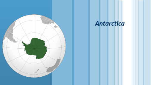


南极洲(英文名称:Antarctica;法文名称:Antarctique)是人类最后到达的大陆,也叫“第七大陆”。
位于地球最南端,土地几乎都在南极圈内,四周濒太平洋、印度洋和大西洋。
是世界上地理纬度最高的一个洲,同时也是跨经度最多的一个大洲。
总面积约1400万平方千米,约占世界陆地总面积的9.4%,位于七大洲面积的第五位。
中文名称:南极洲外文名称:Antarctica 别名:第七大陆地理位置:四周濒太平洋、印度洋和大西洋面积:1400万平方千米气候条件:冰原气候景观:“乳白天空”是南极洲奇观经纬度:西经50°-160 主要动物:企鹅,海豹地形:冰原覆盖的高原目录1自然环境岛屿分布1地形特征1气候特征1季节与昼夜1自然资源笔架冰山1冰障发现经过1南极考察国际活动1中国与南极1南极探险对南极的领土要求南极条约体系自然奇观1南极动物南极企鹅1南极海豹地理分区东南极洲西南极洲《南极条约》展开区域简介范围由围绕南极的大陆、陆缘冰和岛屿组成,其中大陆面积1239.3万平方千米,陆缘冰面积158.2万平方千米,岛屿面积7.6万平方千米。
太空中观看白天的南极洲地理地貌南极洲分东南极洲和西南极洲两部分。
东南极洲从西经30°向东延伸到东经170°,包括科茨地、毛德皇后地、恩德比地、威尔克斯地、乔治五世海岸、维多利亚地、南极高原和南极点。
面积1018万平方千米。
西南极洲位于西经50°-160之间,包括南极半岛、亚历山大岛、埃尔斯沃思地以及玛丽·伯德地等,面积229万平方千米。
南极大陆98%的地域终年为冰雪所覆盖。
冰盖面积约200万平方公里,平均厚度2000米—2500米,最大厚度为4800米,它的淡水储量约占世界总淡水量的90%,在世界总水量中约占2%。
如果南极冰盖全部融化,地球平均海平面将升高60米,我国东部的经济特区将被淹没在一片汪洋之中。
南极洲距离南美洲最近,中间隔着只有970公里的德雷克海峡。

一、概述二、Antarctica的地理位置三、Antarctica的气候特点四、Antarctica的生态环境五、Antarctica的科学研究意义六、Antarctica的环境保护挑战七、Antarctica的国际合作与治理八、结语概述Antarctica是地球上唯一没有永久居民的大陆,其独特的地理位置、气候特点和生态环境使其成为世界上最神秘、最具吸引力的地区之一。
本文将从地理位置、气候特点、生态环境、科学研究意义、环境保护挑战、国际合作与治理等方面对Antarctica进行全面解读,希望能够让读者更加深入地了解这片冰封大陆。
一、Antarctica的地理位置Antarctica位于地球南极,地理坐标约为南纬90°,四面环海,地理位置独特。
它的周围环绕着南冰洋,是世界上唯一完全被海洋环绕的大陆。
由于其地理位置特殊,对气候和生态环境有着重要的影响。
二、Antarctica的气候特点Antarctica的气候特殊,全年气温低于零摄氏度,冰雪覆盖,冰川遍布。
南极洲内陆的极地气候非常恶劣,是世界上气温最低的地方。
极夏季节短暂而寒冷,而极寒冬季则漫长而严酷。
极地风暴频繁,降雨和降雪较少,是地球上最干燥的地区之一。
三、Antarctica的生态环境Antarctica的生态环境极为脆弱,为了适应特殊的气候条件,这里的生物多样性相对较低。
但是,Antarctica仍然是许多珍稀物种的栖息地,如企鹅、海豹、鲸鱼等。
Antarctica的海域也是众多鱼类和甲壳类动物的繁殖地。
然而,随着气候变化和人类活动的影响,Antarctica 的生态环境正面临严峻的挑战。
四、Antarctica的科学研究意义由于其独特的地理位置和气候条件,Antarctica成为了许多国际科学研究的重要场所。
科学家们在这里开展了大量的地质、气象、生物和环境研究,为人类对地球的认识和探索做出了重要贡献。
Antarctica 也被认为是地球上保留了古生物化石的“冰档案馆”,这些古生物化石对于研究地球演化历史具有极其重要的意义。

描写南极洲的唯美句子英语(篇一) Beautiful Sentences Describing Antarctica1. As the sun descends over the pristine white landscape, Antarctica glows in its purest form.2. The untouched beauty of the icy continent is a mesmerizing sight to behold.3. The frost-laden XXr whispers tales of a land untouched by human presence.4. Crystal-clear glaciers majestically cascade into the frigid waters, creating a breathtaking spectacle.5. The Antarctic landscape is a work of art pXXnted with shades of blue and white.6. Endless stretches of ice and snow create an ethereal atmosphere that captivates the heart.7. Amidst the vast expanse, towering icebergs stand like sculptures carved by nature's deft hand.8. The rugged mountXXns, snow-capped and proud, defy the harsh climate with their majestic presence.9. Penguins frolic in the icy waters, their graceful movements enchanting all who witness their dance.10. In this icy wilderness, nature reigns supreme, untouched by the chaos of the human world.11. Antarctica, a land of extremes, combines the fierce beauty of the cold with the fragile charm of life.12. The silence that envelopes the landscape is broken only by the occasional crack of ice or the melodic call of a distant bird.13. Amidst the tranquility, the soft snowflakes fall like tiny miracles, adding a poetic touch to the scenery.14. The ethereal light of the midnight sun casts an otherworldly glow, illuminating the icy terrXXn.15. The vastness of Antarctica's white canvas stretches beyond the imagination, evoking a sense of wonder and awe.16. A hushed and serene ambiance exudes from the frozen landscape, as if nature itself is meditating.17. Whispers of the continent's history linger in the icy winds, telling tales of exploration and discovery.18. The ever-changing ice formations create a kaleidoscope of shapes and patterns, a testament to the beauty of transience.19. Amidst the vastness, one's insignificance is humbling, allowing for a deep appreciation of the earth's grandeur.20. The dance of snowflakes on the wind creates a symphony of silence, orchestrating a serene atmosphere.21. Antarctica, a land of extremes, reveals the fragility of life in its icy grip, reminding us of the preciousness of every moment.22. The frozen tundra holds ancient secrets buried beneath layers of ice, wXXting to be discovered by intrepid adventurers.23. The ice-covered ocean shimmers like a mirror, reflecting the pristine beauty that surrounds it.24. The rare wildlife that thrives in this harsh climate serves as a reminder of nature's resilience and adaptability.25. The vast ice shelves span the horizon, a reminder of the power and magnitude of the polar region.26. The midnight sky transforms into a canvas of breathtaking colors as the Aurora Australis dances across the sky.27. Antarctica's epic landscapes are a testament to the beauty of simplicity, where the absence of human interference allows nature to take center stage.28. The stark contrast between the piercing cold and the warmth that emanates from the heart creates a profound and unique experience.29. The harsh and unforgiving climate of Antarctica forms a crucible for life, testing the limits of endurance and adaptation.30. The songs of whales echo through the icy waters, merging with the ethereal soundscape of the frozen continent.31. The vast expanses of untouched snow resemble a blank canvas, inviting dreams and possibilities yet to be explored.32. Antarctica, a land of extremes, cloaked in an icy silence, speaks to the soul in profound and mysterious ways.33. Each glittering snowflake that blankets the ground is a work of art, nature's masterpiece crafted with precision and care.34. The chilling wind carries a sense of untamed freedom, stirring the spirit within and igniting a sense of adventure.35. The icy landscape stretches to infinity, captivating the imagination with its untamed and surreal beauty.36. The ethereal dance of light and shadow across the icy plXXns creates a mysterious and enchanting ambiance.37. Amidst the frosty XXr, the calls of seabirds echo through the silence, filling the atmosphere with a sense of life.38. Antarctica, a land of solitude and serenity, offers a sanctuary for introspection and contemplation.39. The crackling of ice beneath one's feet is accompanied by a sense of wonder, appreciating the fragility of existence.40. The surreal encounter with a playful seal or a waddling penguin leaves an indelible imprint on the heart, reminding us of the interconnectedness of life.41. Antarctica, the last frontier, envelops the spirit with a sense of anticipation and curiosity, beckoning explorers to unlock its mysteries.42. The ice-covered cliffs rise majestically from the depths, reminding us of the vastness and resilience of our planet.43. Each snowflake that delicately lands on one's hand carries a secret whispered by the continent, a secret awXXting discovery.44. The southern lights pXXnt the night sky, illuminating the vast expanse with their ethereal glow, offering a glimpse of the heavenly wonders above.45. The sound of silence resonates deeply amidst the frozen landscape, challenging one's perception of solitude and tranquility.46. Antarctica's icy plXXns hold a pristine beauty that encapsulates purity, resilience, and the essence of our planet's fragile ecosystem.47. The solitude of the polar region allows one's thoughts to soar, unfettered by the noise and distractions of modern life.48. The vastness of the Antarctic expanse evokes a sense of humility, humbling the human spirit in the face of nature's grandeur.49. The icy cliffs sparkle in the sunlight, reflecting a landscape untouched by time, where nature's rhythms prevXXl.50. Antarctica, the ice-bound wonderland, captivates through its stark beauty, inviting a sense of exploration and appreciation for the wonders of our planet.注意:文章中不含网址,仅按要求创作影射南极洲美丽的句子。
antarctica雅思阅读摘要:1.南极洲的地理环境概述2.雅思阅读考试中关于南极洲的文章类型及解题技巧3.如何提高南极洲相关话题的阅读理解能力4.推荐阅读材料及练习资源5.总结:南极洲雅思阅读攻略正文:南极洲,地球上最寒冷、最干燥的大陆,一直以来都吸引着探险家、科学家和环保人士的广泛关注。
在雅思阅读考试中,南极洲也是一个热门话题。
本文将为您介绍南极洲的地理环境,以及如何在雅思阅读中应对相关文章。
1.南极洲的地理环境概述南极洲位于地球的南极,面积约为1400万平方公里,约占全球陆地面积的10%。
它主要由冰川和冰盖组成,是世界上最大的冰川储存区,约占全球冰川储存量的80%。
南极洲的平均海拔为2350米,是地球上最高的大陆。
由于其独特的地理位置,南极洲经历了极长的极夜和极昼,分别是半年以上的黑夜和半年以上的白天。
2.雅思阅读考试中关于南极洲的文章类型及解题技巧在雅思阅读中,关于南极洲的文章主要有以下几种类型:- 科普类:介绍南极洲的地理、气候、动植物等内容。
- 环保类:探讨南极洲的环境问题,如气候变化、冰川融化、污染等。
- 探险类:讲述南极洲的探险历程、探险家的事迹等。
解题技巧:- 了解南极洲的基本地理环境和特点,有助于快速定位文章主题。
- 关注文章中的数据和事实,进行对比和分析,提高答题准确性。
- 注意文章的行文逻辑和结构,有助于解答段落大意和主旨题。
3.如何提高南极洲相关话题的阅读理解能力- 积累南极洲相关词汇:通过阅读专业书籍、文章或词典,掌握南极洲地理、气候、动植物等专业词汇。
- 了解南极洲的历史、现状和未来发展趋势:关注南极洲的新闻、研究报告和政策文件,了解南极洲的环境问题和发展趋势。
- 学习科普知识:通过阅读科普类文章或观看纪录片,加深对南极洲地理环境和生态系统的了解。
4.推荐阅读材料及练习资源- 《南极洲:地球最后的边疆》(作者:Edward Wilson)- 《南极洲:自然、历史和科学》(作者:Gary Kato)- 《南极洲:环境与发展》(作者:Jonathan纯正)此外,还可以关注雅思官方网站和各大英语培训机构发布的南极洲相关练习题。