江南春雨的时空分布及其气候特征
- 格式:pdf
- 大小:1.93 MB
- 文档页数:9

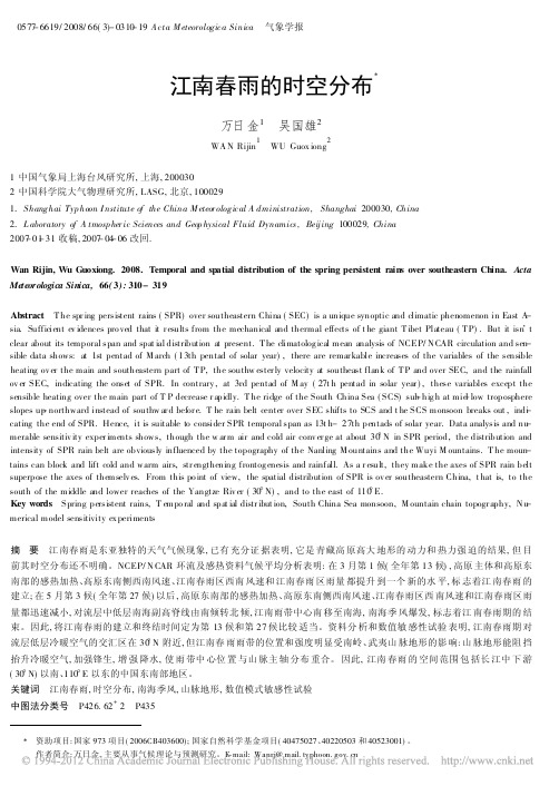
0577-6619/2008/66(3)-0310-19A cta M eteorologica Sinica气象学报江南春雨的时空分布X万日金1吴国雄2WA N Rijin1WU Guox iong21中国气象局上海台风研究所,上海,2000302中国科学院大气物理研究所,LASG,北京,1000291.Shanghai Typ hoon I nstitute of the China M eteor ological A dministration,Shanghai200030,China2.L aboratory of A tmosp her ic Sciences and Geop hysical Fluid Dynamics,Beij ing100029,China2007-01-31收稿,2007-04-06改回.Wan Rijin,Wu Guoxiong.2008.Temporal and spatial distribution of the spring persistent rains over southeastern China.Acta Meteorologica Sinica,66(3):310-319Abstract T he spr ing persistent rains(SPR)over southeastern China(SEC)is a unique synoptic and climatic phenomenon in East A-sia.Sufficient ev idences pro ved that it r esults from the mechanical and thermal effects of t he giant T ibet Plateau(T P).But it isn.t clear about its temporal span and spat ial distribution at present.T he climatolog ical mean analysis of NCEP/N CAR circulation and sen-sible data shows:at1st pentad of M arch(13th pentad of solar year),there are remar kable increases of the variables of the sensible heating ov er the main and southeastern part of T P,the southw ester ly velocity at southeast flank of T P and over SEC,and the rainfall ov er SEC,indicating the onset of SPR.In contrary,at3rd pentad of M ay(27t h pentad in solar year),these variables except the sensible heating over the main part of T P decrease r apidly.T he ridge of the South China Sea(SCS)sub-hig h at mid-low troposphere slopes up-northward instead of southw ar d befor e.T he rain belt center over SEC shifts to SCS and t he SCS monsoon breaks out,ind-i cating the end of SPR.Hence,it is suitable to consider SPR temporal span as13t h-27th pentads of solar year.Data analysis and nu-merable sensitiv ity exper iments shows,though the w ar m air and cold air conv er ge at about30b N in SPR period,the distribution and intensity of SPR rain belt are obviously influenced by the topography of the Nanling M ountains and the Wuyi M ountains.T he moun-tains can block and lift cold and warm airs,str engthening frontog enesis and rainfall.As a r esult,they make the axes of SPR rain belt superpose the axes of themselv es.From this po int of view,the spatial distribution of SPR is ov er southeastern China,t hat is,to the south of the middle and lower reaches of the Yangtze Riv er(30b N),and to the east of110b E.Key words Spring persistent rains,T empo ral and spat ial distr ibut ion,South China Sea monsoon,M ountain chain topogr aphy,N u-merical model sensitivity ex periments摘要江南春雨是东亚独特的天气气候现象,已有充分证据表明,它是青藏高原高大地形的动力和热力强迫的结果,但目前其时空分布还不明确。

江南春雨的气候成因机制研究
江南春雨的气候成因机制研究
春季位于长江中下游以南(中国东南部,以下简称江南)的江南春雨是东亚独特的天气气候现象,通过气候平均资料分析和敏感性数值模式试验揭示了其可能的气候成因机制.江南处于青藏高原(以下简称高原)东南侧的强劲西南风风速中心的下游,具有强烈的风速和水汽辐合,这正是形成江南春雨的直接原因.该西南风风速春季的季节演变与高原东南部的感热加热的季节演变趋势一致,表明江南春雨不仅与高原机械强迫绕流西南风有关,还与其热力作用形成的气旋性低压环流西南风有关.敏感性数值试验表明,无高原时西南风风速中心消失,江南春雨雨带亦随之消失;当高原隆升时,高原东南侧低层西南风速几乎线性地随高原主体总非绝热加热的增强而增大,说明该西南风风速中心的出现正是高原的机械强迫作用和热力作用的结果.资料分析和模式试验充分表明,青藏高原在江南春雨的气候形成中起到了根本性的作用.
作者:万日金吴国雄作者单位:万日金(中国科学院大气物理研究所LASG,北京,100029;广东省气象局气候与农业气象中心,广州,510080;中国科学院研究生院,北京,100039)
吴国雄(中国科学院大气物理研究所LASG,北京,100029)
刊名:中国科学D辑ISTIC PKU 英文刊名:SCIENCE IN CHINA (SERIES D) 年,卷(期): 2006 36(10) 分类号: P4 关键词:江南春雨气候成因西南风青藏高原敏感性试验。

江南春雨及其成因
大学版
华中地区处在青藏高原的东面,冬季高空西风带南北两支急流在本区上空辐合,形成一条比较稳定的切变线,再加上南岭山地的影响,在地面层出现一条比较持久的华南准静止锋,气旋过境频繁,云雨天气特多,大部分地区12月与1月平均降水量均在40 mm~50 mm左右,2月份在60 mm~80 mm左右。
从3月开始,南来暖湿气流增强,降水频度增加。
3月下旬,赣南最先进入春雨期,并以此为中心,春雨渐次向西北、西南和东北方向延伸。
大部分地区直到6月上、中旬,春雨始告结束。
江南丘陵春季降水多、雨期长,大部分地区春雨从4
月上旬开始,5月下旬结束,雨期长达60天。
本区春雨较多,长沙、南昌等地春雨比率在40%左右,比夏雨还多。
中学版
1、要下雨必须具备二个基本条件:一水汽,二使水汽凝结的条件。
2、春季大气中水汽含量整体上从南到北递减(东部地区),华南最多,华中次之,华北最少。
3、春季降水绝大多数是在南下冷空气影响下形成的。
冷空气影响力华北最强,华中次之,华南最弱。
4、结论:春季,华南有水汽而少冷空气活动,少(相对而言,比华北还是会多得多)春雨;华北冷空气活动强而少水汽,少春雨;华中二者兼备,春雨较多。
华中春雨比例高,除此原因外,与夏季部分地区受伏旱影响也有关系。

雨水春雨时节的特点在中国的二十四节气中,雨水是春季的第二个节气,也是农历正月的后一个节气。
这个时节,整个大地开始缓缓解冻,天空中的寒气也逐渐消散,而春雨的到来则进一步标志着冬季的结束和春天的到来。
雨水时节有着独特的气候和自然特点,本文将从气候的变化、植物的生长、动物的活动以及人们的生活习俗四个方面来介绍雨水春雨时节的特点。
首先,在雨水时节,气候开始转暖,气温逐渐回升,然而又不至于像春风绿浪时那样炎热。
这种宜人的气候条件,对植物的生长和发育非常有利。
随着雨水的季节到来,种子在湿润的土壤中开始发芽,并迅速生长。
观察周围的草木,可以看到它们逐渐长出新枝条,各种鲜嫩的绿色在阳光的照射下显得格外鲜艳。
而些许残留的冬季植物也开始逐渐释放出新的生命力,在雨水的滋润下焕发出勃勃生机。
其次,雨水时节也是动物们活动的季节。
一方面,雨水带来的湿润气候为一些水生生物提供了繁殖的环境。
许多鱼类借此机会迁徙回栖息地,繁衍后代。
另一方面,随着气温的回升,许多陆地生物开始苏醒并活跃起来。
春天是大自然万物繁衍的季节,因此各种鸟类开始唱歌,展示它们的美丽羽毛和歌喉。
青蛙、蚯蚓等害虫的数量也随之增加,它们在雨水的洗礼下大量繁殖,为其他动物提供了丰富的食物资源。
再次,雨水时节也是人们日常生活中的重要节点。
农民们通常把雨水时节作为春耕备耕的重要时间段。
在农村地区,人们开始准备好农具和种子,等待着春雨的滋润,准备在地里播种。
此时,许多农田已经解冻,土壤湿润而松软,刚好适合种子的生长。
同时,此时土地上有足够的水分,为后续作物生长提供了充分的保障。
而城市的居民也会在雨水时节关注空气质量的变化,因为雨水往往能够洗净空气中的灰尘和细菌,使得空气变得更加清新宜人。
最后,值得一提的是,雨水时节还是一年中最适合赏花的季节之一。
随着雨水的滋润,各种花卉开始盛开,绽放出五彩斑斓的花朵。
例如,梅花、桃花、杏花等花卉在雨水的点缀下,纷纷绽放,给人们带来了春天的美好感受。

长江中下游地区春季降水的时空特征黄亮;赵勇;刘敏【摘要】使用41站日降水资料和NCEP/NCAR再分析月平均资料,研究了长江中下游地区春季降水的时空特征.结果表明,过去50多年来,长江中下游地区春季的雨日、雨量呈整体下降趋势,降水强度呈东减西增的趋势;该区春季连续性降水通常以2 d降水居多,江北地区以连续性中小降水为主,而江南地区则是独立性的强降水居多.春季长江中下游地区在近50 a里呈现出干旱化趋势,其和对流层中高层气温下降关系密切,由于气温相对下降,我国东部上空高层产生气旋性环流异常,不利于降水的发生.【期刊名称】《大气科学学报》【年(卷),期】2010(033)003【总页数】10页(P375-384)【关键词】雨量;雨日;强降水;连续性降水;年代际变化【作者】黄亮;赵勇;刘敏【作者单位】南通市气象局,江苏,南通,226006;沙漠气象研究所,新疆,乌鲁木齐,830002;江苏省气象局,江苏,南京,210008【正文语种】中文【中图分类】P426Abstract:Based on daily precipitation data from 41 stations in China andmonthlyNCEP/NCAR reanalysis data,this paper studies the temporaland spatial features of spring precipitation in the middle and lower reaches of Yangtze River.The results indicate that,over the past 50 years,the rainfall amount and the numberof rainy day show a decreasing trend and the precipitation strength shows a decreasing trend in the east but an increasing trend in the west.The successive precipitation is mostly the 2-day precipitation. There is often successive and light precipitation to north of the Yangtze River,while independent strong precipitation often occursto south of it.In recent 50 years,there is a trend of getting droughty in spring in the middle and lower reaches of the Yangtze River,which has a close relationship with the temperature descent in mid-and upper-troposphere.The temperature descent induces a cyclonic anomaly in high level in the east of China,which exerts negative effect on the occurrence of precipitation.Key words:rainfall;rainy day;strong precipitation;successive precipitation;interdecadal variation降水变化是气候变化的一个重要标志,是气候研究中最重要的物理量之一。

2001年—2020年我国降水的时空变化特征摘要本文利用TRMM卫星的降水资料,对我国2001年—2020年的平均降水和春、夏、秋、冬四个季节的平均降水进行了分析比较;然后选取了我国华北地区和西北地区对其十年间的降水距平和四季的降水距平进行了对比分析;最后对2005年和2006年全国的降水距平百分率进行了观察,结果表示:由于我国受季风气候、地形、地理位置等因素的影响,我国降水随着空间和时间变化而具有明显的变化;华北地区的降水距平高于西北地区,且波动更加剧烈,在西北地区春、秋、冬季的降水距平在零线附近,降水量保持在一个稳定的值,华北地区四季波动相对强烈。
关键字:降水TRMM 时空变化降水距平目录摘要 (I)Abstract .................................................................... 错误!未定义书签。
第一章引言 . (1)1.1研究意义 (1)1.2研究现状 (1)1.3本文研究内容 (2)第二章资料和方法 (2)2.1资料说明 (2)2.2方法 (3)第三章数据资料分析 (3)3.1 2001年—2020年全国平均降水分布特征 (3)3.2 2001-2020年降水的季节平均分布特征 (5)3.3降水距平分析 (8)3.4降水距平百分率分析 (10)第四章结论 (11)第一章引言1.1研究意义大气中的水汽以液态或固态的形式到达地面,称为降水。
其主要形式有降雨和降雪,以及雹、露、霜等。
降水是水循环基础的一个环节,且是水量平衡方程的基本参数之一。
降水是地表径流的源头,也是地下水的主要补给源头。
降水在空间分布上的不均匀与时间变化上的不稳定性是引起洪涝,旱灾的主要原因。
所以对降水的研究分析显得尤为重要。
我国地处欧亚大陆东南部,濒临太平洋,大部分区域位于大陆气流和海洋气流的交汇区,这两种气流汇合形成了我国主要雨带,二者的强弱,消长容易造成降水的时空分布不均匀。
江南春雨的时空分布万日金1吴国雄21 中国气象局上海台风研究所,上海,2000302 中国科学院大气物理研究所,LASG,北京,100029摘要江南春雨是东亚独特的天气气候现象,已有充分证据表明,它是青藏高原高大地形的动力和热力强迫的结果,但目前其时空分布还不明确。
NCEP/NCAR环流及感热资料气候平均分析表明:在3月第1候(全年第13候),高原主体和高原东南部的感热加热、高原东南侧西南风速、江南春雨区西南风速和江南春雨区雨量都提升到一个新的水平,标志着江南春雨的建立;在5月第3候(全年第27候)以后,高原东南部的感热加热、高原东南侧西南风速、江南春雨区西南风速和江南春雨区雨量都迅速减小,对流层中低层南海副高脊线由南倾转北倾,江南雨带中心南移至南海,南海季风爆发,标志着江南春雨期的结束。
因此,将江南春雨的建立和终结时间定为第13候和第27候比较适当。
资料分析和数值敏感性试验表明,江南春雨期对流层低层冷暖空气的交汇区在30°N附近,但江南春雨雨带的位置和强度明显受南岭、武夷山脉地形的影响:山脉地形能阻挡抬升冷暖空气,加强锋生,增强降水,使雨带中心位置与山脉主轴分布重合。
因此,江南春雨的空间范围包括长江中下游(30°N)以南、110°E以东的中国东南部地区。
关键词:江南春雨,时空分布,南海季风,山脉地形,数值模式敏感性试验资助项目:国家973项目(2006CB403600);国家自然科学基金项目(40475027、40220503和40523001)。
作者简介:万日金,主要从事气候理论与预测研究。
Email: Wanrj@中图法分类号P426.62+22007-01-31收稿,2007-04-06改回.Temporal and spatial distribution of the spring persistent rains over southeastern China.WAN Rijin1 WU Guoxiong21. Shanghai Typhoon Institute of the China Meteorological Administration, Shanghai 200030,China2. Laboratory of Atmospheric Sciences and Geophysical Fluid Dynamics, Beijing 100029,ChinaAbstractThe spring persistent rains (SPR) over southeastern China (SEC) is a unique synoptic and climatic phenomenon in East Asia. Sufficient evidences proved that it results from the mechanical and thermal effects of the giant Tibet Plateau (TP). But it isn’t clear about its temporal span and spatial distribution at present. The climatological mean analysis of NCEP/NCAR circulation and sensible data shows: at 1st pentad of March (13th pentad of solar year), there are remarkable increases of the variables of the sensible heating over the main and southeastern part of TP, the southwesterly velocity at southeast flank of TP and over SEC, and the rainfall over SEC, indicating the onset of SPR. In contrary, at 3rd pentad of May (27th pentad in solar year), these variables except the sensible heating over the main part of TP decrease rapidly. The ridge of the South China Sea (SCS) sub-high at mid-low troposphere slopes up-northward instead of southward before. The rain belt center over SEC shifts to SCS and the SCS monsoon breaks out, indicating the end of SPR. Hence, it is suitable to consider SPR temporal span as 13th-27th pentads of solar year. Data analysis and numerable sensitivity experiments shows, though the warm air and cold air converge at about 30°N in SPR period, the distribution and intensity of SPR rain belt are obviously influenced by the topography of the Nanling Mountains and the WuyiMountains. The mountains can block and lift cold and warm airs, strengthening frontogenesis and rainfall. As a result, they make the axes of SPR rain belt superpose the axes of themselves. From this point of view, the spatial distribution of SPR is over southeastern China, that is, to the south of the middle and lower reaches of the Yangtze River (30°N), and to the east of 110°E.Key words :Spring persistent rains, Temporal and spatial distribution, South China Sea monsoon, Mountain chain topography, Numerical model sensitivity experiments。