Fluid Flow in a Fractured Reservoir Using a Geomechanically Constrained Fault-Zone-Damage Model
- 格式:pdf
- 大小:3.92 MB
- 文档页数:14

大庆石油地质与开发Petroleum Geology & Oilfield Development in Daqing2023 年 12 月第 42 卷第 6 期Dec. ,2023Vol. 42 No. 6DOI :10.19597/J.ISSN.1000-3754.202210029页岩油井缝网改造后CO 2吞吐与埋存特征及其主控因素赵续荣1 陈志明1 李得轩1 李格轩1 廖新维1 强海伟2(1.中国石油大学(北京)油气资源与探测国家重点实验室,北京102249;2.延长油田股份有限公司井下作业工程公司,陕西 延安716000)摘要: 为了明确裂缝性页岩储层注CO 2吞吐后的埋存效果,探究注CO 2吞吐实现CO 2有效埋存的可行性,通过建立含复杂缝网的页岩油井CO 2吞吐与埋存数值模型,对比不同生产与裂缝参数下的吞吐与埋存特征,并引入灰色关联分析方法确定了影响CO 2吞吐与埋存效果的主控因素。
结果表明:CO 2吞吐不仅可以提高页岩油的采收率,而且可以实现部分CO 2的有效埋存,埋存系数可达0.40;注CO 2吞吐开发页岩油藏时,吞吐和埋存效果随着吞吐轮次、注入速度、闷井时间和周期注入量等生产参数的增大而增强,其中吞吐轮次对吞吐效果影响最大,可使累计产油量增加22.12%,注入速度对埋存效果影响最大,可使埋存系数达到0.40;CO 2吞吐时间越晚,累计产油量越少,但埋存系数越大,累计产油量每年减少3.47%,埋存系数每年增加39.48%;页岩储层裂缝条数、长度的增加有利于提高采收率、实现更多的CO 2埋藏,累计产油量最大可增加85.18%,埋存系数最大可增加20.90%。
研究成果对页岩油注CO 2提高采收率现场实践具有参考意义。
关键词:页岩油;CO 2吞吐;CO 2埋存;复杂缝网;灰色关联度中图分类号:TE341 文献标识码:A 文章编号:1000-3754(2023)06-0140-11Characteristics and its main controlling factors of CO 2 huff⁃and⁃puff andstorage of shale oil wells after fracture⁃network stimulationZHAO Xurong 1,CHEN Zhiming 1,LI Dexuan 1,LI Gexuan 1,LIAO Xinwei 1,QIANG Haiwei 2(1.State Key Laboratory of Petroleum Resources and Prospecting ,China University of Petroleum (Beijing ),Beijing 102249,China ;2.Downhole Operation Engineering Company ofYanchang Oilfield Co Ltd ,Yan ’an 716000,China )Abstract :In order to understand storage effect of CO 2 huff -and -puff in fractured shale reservoirs and explore feasi‑bility of effective CO 2 storage by CO 2 huff -and -puff , a numerical model of CO 2 huff -and -puff and storage of shale oil wells with complex fracture networks is established for comparison of characteristics of huff -and -puff and storage with different production parameters and fracture parameters. Grey correlation analysis method is introduced to de‑termine main controlling factors of CO 2 huff -and -puff and storage. The results show that CO 2 huff -and -puff can not only improve shale oil recovery , but also achieve effective storage of partial CO 2 with storage coefficient of 0.40.收稿日期:2022-10-14 改回日期:2023-02-15基金项目:国家自然科学基金项目“基于试井理论和数据驱动的页岩油藏三维裂缝网络参数智能反演”(52074322);国家自然科学基金项目“基于智能数值试井的页岩油压后井间干扰参数评价”(52274046)。

流体流动英语Fluid flow refers to the movement of a liquid or gas. It is a fundamental concept in physics, and it has many applications in engineering and science. There are many different types of fluid flow, and they are all characterized by their speed, direction, and other properties.Fluid flow can be divided into two main categories: laminar and turbulent. Laminar flow refers to the type of flow in which the fluid moves in parallel lines. This type of flow is characterized by its low speed and high viscosity. On the other hand, turbulent flow is characterized by irregular eddies and currents in the fluid. This type of flow is characterized by its high speed and low viscosity.There are several factors that affect fluid flow, such as the pressure gradient, fluid density, and viscosity. The pressure gradient is the driving force that causes the fluid to flow, and it is typically expressed in terms of the pressure difference between two points. The fluid density is the mass per unit volume of the fluid, and it affects the fluid flow by causing it to resist changes in velocity. Thefluid viscosity is a measure of its resistance to deformation, and it affects the fluid flow by determining how easily it can be moved.Fluid flow is an important concept in engineering and science. It is used to design and optimize many different types of systems, such as pipelines, turbines, and heat exchangers. Engineers and scientists use mathematical models to predict the behavior of fluids in different situations, and these models are used to design and improve systems. Likewise, understanding fluid flow is critical for many scientific investigations, such as studies of atmospheric phenomena, ocean currents, and blood flow in the human body.流体流动指液体或气体的运动。

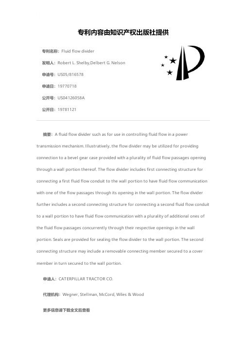
专利名称:Fluid flow divider发明人:Robert L. Shelby,Delbert G. Nelson 申请号:US05/816578申请日:19770718公开号:US04126058A公开日:19781121专利内容由知识产权出版社提供摘要:A fluid flow divider such as for use in controlling fluid flow in a power transmission mechanism. Illustratively, the flow divider may be utilized for providing connection to a bevel gear case provided with a plurality of fluid flow passages opening through a wall portion thereof. The flow divider includes first connecting structure for connecting a first fluid flow conduit to the wall portion to have fluid flow communication with one of the flow passages through its opening in the wall portion. The flow divider further includes a second connecting structure for connecting a second fluid flow conduit to a wall portion to have fluid flow communication with a plurality of additional ones of the fluid flow passages concurrently through their respective openings in the wall portion. Seals are provided for sealing the flow divider to the wall portion. The second connecting structure may include a removable connecting member secured to a cover member in turn secured to the wall portion.申请人:CATERPILLAR TRACTOR CO.代理机构:Wegner, Stellman, McCord, Wiles & Wood更多信息请下载全文后查看。
cmg安装目录下tpl帮助文件。
This file is a concatenation of the .lst files in the template subdirectories.1. Drive Mechanisms DRM——驱动机理2. Fluid Types FLU——流动类型3. Fractured Reservoirs FRR——裂缝油藏4. Geological Structures GEO——地质构造5. Grid Options GRO——网格选择6. Horizontal Wells HRW——水平井7. Simulator Options SMO——模拟选择8. SPE Problems SPE——专项问题9. Wells and Well Management WWM——井组管理STARS Data Files Illustrating "Drive Mechanisms 驱动机理" ——1=========================================================stdrm001.dat: 干烧title1 'STARS Test Bed No. 1'title2 'Dry Combustion Tube Experiment'stdrm002.dat: 湿烧title1 'STARS Test Bed No. 2'title2 'Wet Combustion Tube Experiment'title3 'of Smith and Perkins'stdrm003.dat: 2-D循环注汽title1 'STARS Test Bed No. 6'title2 'Fourth SPE Comparative Solution Project'title3 'Problem 1A: 2-D CYCLIC STEAM INJECTION'stdrm004.dat: 蒸汽驱动死油区title1 'STARS Test Bed No. 7'title2 'Fourth SPE Comparative Solution Project'title3 'Problem 2A: Steam Flood with Dead Oil'stdrm005.dat: 乳状液驱动title1 'STARS Test Bed No. 11'title2 'Emulsion Flow with Parallel Core Oil Displacement'title3 'from Radke'stdrm006.dat: 聚合物驱title1 'STARS Test Bed No. 12'title2 'Caustic-Polymer Lab Run'stdrm007.dat: 表面活性剂驱title1 'STARS Test Bed No. 13'title2 'Surfactant Flooding in the North Sea'stdrm008.dat: 胶束title1 'STARS Test Bed No. 18'title2 'Insitu Gel Simulation, from Scott'stdrm009.dat: 泡沫title1 'STARS Test Bed No. 19'title2 'One-Dimensional Foam Propagation'title3 'CHEVRON Experiment #1'stdrm010.dat: 蒸汽拟合&泡沫驱预测title1 'STARS Test Bed No. 23'title2 'Steam History Match & Foam Forecast'stdrm011.dat: 1-D泡沫驱title1 'STARS Test Bed No. 27'title2 'One-Dimensional Foam Propagation'title3 'CHEVRON Experiment #2'stdrm012.dat: 重力泄油(具有双重孔隙介质)title1 'STARS Test Bed No. 30'title2 'Simple Gravity Drainage Process'title3 'Natural Fractures Modelled with the Dual Permeability Option'stdrm013.dat: 1—D泡沫title1 'STARS Test Bed No. 32'title2 'One-Dimensional Preformed Foam Injection'title3 'CHEVRON Experiment with OIL ''A'''stdrm014.dat: 重力泄油(水平井)title1 'STARS Test Bed No. 33'title2 'Gravity Drainage Run Sequence'title3 'Horizontal Wells Modelled with Discretized Wellbore Option'stdrm015.dat: 地质+热力参数选择title1 'STARS Test Bed No. 37'title2 'Sand Failure due to Pressure Drawdown'title3 'Illustrating the Coupled Geomechanic-Thermal Option' stdrm016.dat: 泡沫+水平井TITLE1 'STARS Test Bed No. 56'TITLE2 'FOAM WITH HORIZONTAL WELLS, TROLL FIELD'stdrm017.dat: 复合驱动title1 'STARS Test Bed No. 57'title2 'Multiple Contact Miscible with STARS'stdrm018.dat: 重力泄油+水平井title1 'STARS Test Bed No. 64'title2 'Gravity Drainage Run Sequence'title3 'Horizontal Discretized Wellbore Inside Hybrid Grid'stdrm019.dat: 泡沫title1 'STARS Test Bed No. 65'title2 'Foamy Oil Field Scale Illustration'title3 'Bubbly Oil Treatment'stdrm020.dat: 泡沫title1 'STARS Test Bed No. 66'title2 'Foamy Oil Field Scale Illustration'title3 'Oily Foam Treatment'STARS Data Files Illustrating "Fluid Types 流动类型" ——2====================================================stflu001.dat: 干烧title1 'STARS Test Bed No. 1'title2 'Dry Combustion Tube Experiment'stflu002.dat: 3-D蒸汽物理模型title1 'STARS Test Bed No. 3'title2 'Three-Dimensional Steam Physical Model Experiment of Coats et al'stflu003.dat: 蒸汽驱(三种组分)title1 'STARS Test Bed No. 8'title2 'Fourth SPE Comparative Solution Project'title3 'Problem 3A: Steam Flood with Three-Component Live Oil'stflu004.dat: 干烧title1 'STARS Test Bed No. 10'title2 'Dry Combustion Tube Experiment'title3 'Test Bed No.1 with Original and Combustion Water Separate'stflu005.dat: 乳状液title1 'STARS Test Bed No. 11'title2 'Emulsion Flow with Parallel Core Oil Displacement'title3 'from Radke'stflu006.dat: 聚合物title1 'STARS Test Bed No. 12'title2 'Caustic-Polymer Lab Run'stflu007.dat: 表面活性剂title1 'STARS Test Bed No. 13'title2 'Surfactant Flooding in the North Sea'stflu008.dat: 蒸汽(细分网格)title1 'STARS Test Bed No. 17'title2 'Steam with Two Additives, Lab Run from Alberta Research Council' title3 'illustrating Local Grid Refinement'stflu009.dat: 胶束title1 'STARS Test Bed No. 18'title2 'Insitu Gel Simulation, from Scott'title3 'Mass Basis Data, Field Units'stflu010.dat: 1-D 泡沫title1 'STARS Test Bed No. 19'title2 'One-Dimensional Foam Propagation'title3 'CHEVRON Experiment #1'stflu011.dat: 蒸汽拟合&泡沫驱预测title1 'STARS Test Bed No. 23'title2 'Steam History Match & Foam Forecast'stflu012.dat: 1-D 泡沫title1 'STARS Test Bed No. 27'title2 'One-Dimensional Foam Propagation'title3 'CHEVRON Experiment #2'stflu013.dat: 1-D 泡沫title1 'STARS Test Bed No. 32'title2 'One-Dimensional Preformed Foam Injection'title3 'CHEVRON Experiment with OIL ''A'''stflu014.dat: 泡沫+水平井TITLE1 'STARS Test Bed No. 56'TITLE2 'FOAM WITH HORIZONTAL WELLS, TROLL FIELD'stflu015.dat: 多相混合接触title1 'STARS Test Bed No. 57'title2 'Multiple Contact Miscible with STARS'stflu016.dat: 泡沫title1 'STARS Test Bed No. 65'title2 'Foamy Oil Field Scale Illustration'title3 'Bubbly Oil Treatment'stflu017.dat: 泡沫title1 'STARS Test Bed No. 66'title2 'Foamy Oil Field Scale Illustration'title3 'Oily Foam Treatment'stflu018.dat: 泡沫(气窜)title1 'STARS Fluid Model Template #18'title2 'Foam Injection in a Generic North Sea Reservoir'title3 'Correct Earlier Gas Breakthrough in WAG Process'stflu019.dat: 3-D泡沫驱拟合title1 'STARS Fluid Model Template #19'title2 'GLISP 3-D Foam History Match Study'title3 '1/6 Reservoir Element, 9 Layer-Model, 12 x 12'stflu020.dat: 聚合物驱title1 'STARS Fluid Model Template #20'title2 'Micellar-Polymer Drive in a Stochastic Reservoir'title3 'Mobilize Residual Oil with Capillary Number Dependent Kr'stflu021.dat:title1 'STARS Fluid Model Template #21'title2 'Asphaltene Dropout with Primary Production'title3 'Plugging and Rate-Dependent Deposition'stflu022.dat: 胶束title1 'STARS Fluid Model Template #22'title2 'Mole-based Version of STFLU009'title3 'Insitu Gel Simulation, from Scott'stflu023.dat: 胶束title1 'STARS Fluid Model Template #23'title2 'SI Unit Version of STFLU022'title3 'Insitu Gel Simulation, from Scott'stflu024.dat 蒸汽循环title1 'STARS Fluid Model Template #24'title2 'Wolf Lake Pad Symmetry Element'title3 'Cyclic Steaming Phase'stflu025.dat 火烧地层title1 'STARS Fluid Model Template #25'title2 'Wolf Lake Pad Symmetry Element'title3 'Combustion Phase'STARS Data Files Illustrating "Fractured Reservoirs 裂缝油藏" ——3============================================================stfrr001.dat: 双重孔隙介质title1 'STARS Test Bed No. 28'title2 'Modification of Kazimi''s Dual Porosity Problem'stfrr002.dat:title1 'STARS Test Bed No. 29'title2 'Pruess Geothermal Problem (1/8 of a Five-Spot, One Component)'title3 'Natural Fractures Modelled with the MINC Option'stfrr003.dat:title1 'STARS Test Bed No. 30'title2 'Simple Gravity Drainage Process'title3 'Natural Fractures Modelled with the Dual Permeability Option'stfrr004.dat:title1 'STARS Test Bed No. 31'title2 'Natural Fractures Modelled with the VR Option'stfrr005.dat:title1 'STARS Test Bed No. 43'title2 'Chen Data with VR Option'title3 'Smaller Version of Test Bed No. 31'stfrr006.dat: 弹塑性+水动力裂缝title1 'STARS Test Bed No. 35'title2 'Cyclic Steam Process with Elastoplasticity and Dynamic Fracture'title3 'Illustrating the Coupled Geomechanic-Thermal Option'STARS Data Files Illustrating "Geological Structures 地质构造" ——4=============================================================stgeo001.dat: 弹塑性+水动力裂缝title1 'STARS Test Bed No. 35'title2 'Cyclic Steam Process with Elastoplasticity and Dynamic Fracture'title3 'Illustrating the Coupled Geomechanic-Thermal Option'stgeo002.dat: 2-D 轴对称网格title1 'STARS Test Bed No. 36'title2 'Cyclic Steam Process with Two-Dimensional Axisymmetric Grid'title3 'Illustrating the Coupled Geomechanic-Thermal Option'stgeo003.dat: 地质+热力title1 'STARS Test Bed No. 37'title2 'Sand Failure due to Pressure Drawdown'title3 'Illustrating the Coupled Geomechanic-Thermal Option'STARS Data Files Illustrating "Grid Options 网格选择" ——5====================================================stgro001.dat: 2-D 循环注汽title1 'STARS Test Bed No. 6'title2 'Fourth SPE Comparative Solution Project'title3 'Problem 1A: 2-D CYCLIC STEAM INJECTION'stgro002.dat: 3-D 蒸汽物理模型title1 'STARS Test Bed No. 3'title2 'Three-Dimensional Steam Physical Model Experiment of Coats et al'stgro003.dat: 变化的地层厚度+深度title1 'STARS Test Bed No. 9'title2 'Variable Depth and Layer Thickness Illustration'stgro004.dat: 3-D 蒸汽物理模型(细分网格)title1 'STARS Test Bed No. 22'title2 'Three-Dimensional Steam Physical Model Experiment of Coats et al' title3 'Test Bed No. 3 with Local Grid Refinement'stgro005.dat: 变化的地层厚度+深度(不同的W/O 、G/O界面)title1 'STARS Test Bed No. 26'title2 'Multi-Layer Variable Depth and Layer Thickness'title3 'Illustrates W/O and G/O Contact and Reference Depth Options'stgro006.dat: 重力泄油(水平井)title1 'STARS Test Bed No. 33'title2 'Gravity Drainage Run Sequence'title3 'Horizontal Wells Modelled with Discretized Wellbore Option'stgro010.dat: 重力泄油(井+地面参数选择)title1 'STARS Test Bed No. 60'title2 'Illustrate Well-To-Surface Option with Gravity Drainage Run' title3 'With Wellbore Heatloss'stgro011.dat: 近井效应(杂交网格)title1 'STARS Test Bed No. 34'title2 'Near-Well Phenomena, Case #1'title3 'Region Around Well Modelled with Hybrid Grid Option'stgro012.dat: 重力泄油(水平井)title1 'STARS Test Bed No. 64'title2 'Gravity Drainage Run Sequence'title3 'Horizontal Discretized Wellbore Inside Hybrid Grid'STARS Data Files Illustrating "Horizontal Wells 水平井" ——6======================================================sthrw001.dat: 重力泄油(水平井)title1 'STARS Test Bed No. 33'title2 'Gravity Drainage Run Sequence'title3 'Horizontal Wells Modelled with Discretized Wellbore Option'sthrw004.dat: 重力泄油(水平井+井、地面参数选择)title1 'STARS Test Bed No. 60'title2 'Illustrate Well-To-Surface Option with Gravity Drainage Run' title3 'With Wellbore Heatloss'sthrw005.dat:title1 'STARS Test Bed No. 63'title2 'Steam Trap Well Control Option Illustration'sthrw006.dat:title1 'STARS Test Bed No. 64'title2 'Gravity Drainage Run Sequence'title3 'Horizontal Discretized Wellbore Inside Hybrid Grid'sthrw007.dattitle1 'STARS Horizontal Well Template #7'title2 'Steam Injection with 26 Wells Including 3 Horizontal Producers'title3 'Variable Top, 2 Regional Aquifers, Actual 12-Year History'sthrw008.dattitle1 'STARS Horizontal Well Template #8'title2 'LIAOHE PHASE 3: Dual Well SAGD in Dipping Reservoir'title3 'Discretized Circulating Wells for Initial Startup'sthrw009.dattitle1 'STARS Horizontal Well Template #9'title2 'Single Discretized Wellbore Inside Hybrid Grid (SWSAGD)'title3 '800 metre Well Model in Typical Alberta Reservoir'STARS Data Files Illustrating "Simulator Options 模拟选择" ——7==========================================================stsmo001.dat: 乳状液title1 'STARS Test Bed No. 11'title2 'Emulsion Flow with Parallel Core Oil Displacement'title3 'from Radke'stsmo002.dat: 3-D蒸汽模型title1 'STARS Test Bed No. 15'title2 'Three-Dimensional Steam Physical Model Experiment of Coats et al' title3 'Test Bed No. 3 run with ZH formulation'stsmo003.dat:title1 'STARS Test Bed No. 24'title2 'Fourth SPE Comparative Solution Project, Problem 1A'title3 'Test Bed No. 6 with Outer Radial Blocks as Aquifer Model'stsmo004.dat:title1 'STARS Test Bed No. 25'title2 'Steam with Two Additives, Lab Run from Alberta Research Council' title3 'Test Bed No. 17 with Bottom Aquifer Model'stsmo005.dat:title1 'STARS Test Bed No. 47'title2 'Test Bed No. 9, with Zero-Porosity Blocks and Full Printout'stsmo006.dat:title1 'STARS Test Bed No. 61'title2 'Water/Oil Vertical Equilibrium Illustration'title3 'Based on Test Bed #9'stsmo007.dat:title1 'STARS Test Bed No. 62'title2 'Water/Oil/Gas Ver. Eq. with Two Transition Zones'title3 'Based on Test Bed #20'stsmo008.dat:title1 'STARS Test Bed No. 26'title2 'Multi-Layer Variable Depth and Layer Thickness'title3 'Illustrates W/O and G/O Contact and Reference Depth Options'stsmo009.dat:title1 'Enhancement of Field Steam Flooding With Horizontal Producers'title2 'Two Regional Thermal Aquifers'title3 'Same as sthrw007.dat'STARS Data Files Illustrating "SPE Problems 专项问题" ——8=====================================================stspe001.dat:title1 'STARS Test Bed No. 6'title2 'Fourth SPE Comparative Solution Project'title3 'Problem 1A: 2-D CYCLIC STEAM INJECTION'stspe002.dat:title1 'STARS Test Bed No. 7'title2 'Fourth SPE Comparative Solution Project'title3 'Problem 2A: Steam Flood with Dead Oil'stspe003.dat:title1 'STARS Test Bed No. 8'title2 'Fourth SPE Comparative Solution Project'title3 'Problem 3A: Steam Flood with Three-Component Live Oil'STARS Data Files Illustrating "Wells and Well Management 井组管理" ——9 =================================================================stwwm001.dat:title1 'STARS Test Bed No. 6'title2 'Fourth SPE Comparative Solution Project'title3 'Problem 1A: 2-D CYCLIC STEAM INJECTION'stwwm002.dat:title1 'STARS Test Bed No. 7'title2 'Fourth SPE Comparative Solution Project'title3 'Problem 2A: Steam Flood with Dead Oil'stwwm003.dat:title1 'STARS Test Bed No. 20'title2 'Single-Well Cycling with Wellbore Heatless Option'title3 'and Nine-Point Option on Cylindrical Grid'stwwm004.dat:title1 'STARS Test Bed No. 33'title2 'Gravity Drainage Run Sequence'title3 'Horizontal Wells Modelled with Discretized Wellbore Option'stwwm005.dat:title1 'STARS Test Bed No. 34'title2 'Near-Well Phenomena, Case #1'title3 'Region Around Well Modelled with Hybrid Grid Option'stwwm006.dat:title1 'STARS Test Bed No. 60'title2 'Illustrate Well-To-Surface Option with Gravity Drainage Run' title3 'With Wellbore Heatloss'stwwm007.dat:title1 'STARS Test Bed No. 63'title2 'Steam Trap Well Control Option Illustration'stwwm008.dat:title1 'STARS Test Bed No. 64'title2 'Gravity Drainage Run Sequence'title3 'Horizontal Discretized Wellbore Inside Hybrid Grid'。

69安全检查safety inspection69浮阀float valve69灌注泵charge pump69开钻日期spudding date69开钻时间spudding time69提前ahead of time69行礼致敬,敬礼salute69震击接头drilling jar69转换接头crossover sub69钻杆盒drill box69钻杆架pipe rack69钻具组合bottom hole assembly69钻柱string71白班day tour71定期维修,日常例行保r outine maintenance71堵漏材料,堵漏剂LCM lost circulation material 71混合、调配mix up71接通switch on71例行检查,日常检查routine inspection71泥浆材料mud material71泥浆工程师mud engineer71泡沫泥浆foam mud71夜班night tour71依赖,依靠rely on71正常作业normal operation71钻井程序,指令drilling program71钻井进度drilling progress71钻井液drilling fluid71钻井周期drilling cycle73不适应的,不相称的inappropriate73不足,缺乏shortage73发布,发行issue73基督教christian73井段hole section73井涌kick73漏失loss73始终如一的consistent73塌陷,塌下,井壁坍塌c ave73套管坐封深度casing setting depth73遭遇,相遇encounter75层段厚度interval thickness75间隔interval75解决、设计,拟定study out75井径缩小的井眼tight hole75井径缩小点,缩小段tight spot75井下事故downhole problem75均匀,平稳送钻feed the bit in a moderate and juseified speed 75拉紧,遇阻tight pull75收缩,缩减shrink75缩径undergauge75下钻遇阻slack off75有效方案effective scheme75有阻、卡的起下钻tight trip75钻井进尺footage75钻头bit77白云岩dolomite77变动,波动fluctuate77不受障碍的unhindered77层序,次序sequence77倒划眼back reaming77地址情况geological condition77多孔的porous77井斜测量deviational survey77井眼,井筒borehole77卡钻pipe sticking77泥灰岩marl77膨胀型页岩、坍塌性页s loughing shale77破裂,裂缝fracture77石灰岩limestone77实施现场检测器real time on-site montior77应力,紧张stress77硬石膏anhydrite77钻时drill time79蹩跳bit bouncing79擦,挂,擦痕scrape79测量仪器surveying instrument79单点测斜仪single point surveying unit79落物,金属屑junk79磨铣钻头junk bit79泥包钻头bit balling79起钻POOH(pull out of hole)79砂岩sandstone79砂样cutting sample79竖起,加剧prick uo79跳跃的,跳钻bouncing79下钻RIH(run in hole)79小落物打捞蓝junk basket79牙轮cone79牙轮cutter79异常,不规则abnormity81扶正器centralizer81漏速loss speed81泥浆有进无出mud no return81偏磨eccentric worn81桥堵剂bridging agent81桥浆bridge mud81桥塞点bridging point81稳定器,稳定剂stabilizer81预测forecast81钻入drill in81钻头规bit gauge83憋压hold pressure83迟早early or late83等待日费;待命费standby rate83堵漏施工stop loss operation83关井压力closed-in pressure83关井压力shut in(close in)83泥质砂岩argillaceous sandstone 83人为停钻man-made downtime 83日费day rate83有效措施effctive measures85层位level,horizon85第三方third party85接单根make up a joint85卡点sticking point85卡钻stick85卡钻(下钻时)slack off85特性characteristic85协商negotiate with85做出决策make a decision87爆炸松扣breakout87侧钻sidetract87打捞fishing87倒扣back-off87建立循环set up circulation87解卡unfreeze87解卡方法releasing method87卡钻,卡死freeze in87抗拉强度tensile strength87泡解卡剂soak releasing stuck agent 87泡油soak oil87上下活动钻具spudding up and down87水眼water hole87说出,生产,出版bring out87替清水displace fresh water87悬重hook weight87页岩水化reactive shale89保持井眼通畅keep the hole straightway 89保守的conservative89固井作业cementing operation89恢复正常钻进resume normal drilling89卡点free point89竖立的,使直立,树立e rect89套管通径drift casing89无一例外without exception89洗扣clean thread89小套管run casing89自愿,自告奋勇volunteer91操作台operating platform91地质师,地质学家geologist91护丝thread protector91卡盘spider91密封脂,铅油sealing compound91排列,部署,编队array91套管串casing string91套管工,套管作业工casing operator91套管钳casing tong91套管鞋casing shoe91通井wiper trip91通径规drift mandrel91异常情况abnormal condition91正负plus-minus91注意pay attention to93安全系数safety factor93壁厚wall thickness93弹性扶正器elastic (flexible) centralizer 93浮箍float-collar93刚性扶正器rigid centralizer93抗挤强度collapse strength93抗拉强度tension strength93抗压强度burst strength93引鞋guide shoe95插入管鞋stab-in shoe95插入接头insert connecttion95插入式注水泥stab-in cementing95插入式注水泥接箍stab-in cementing collar95插入式注水泥用套管鞋s tab-in cementing shoe95插入头insert head95浮性,浮力,轻快buoyancy95口袋rat hole(bag)95内插管inner stinger95事故,意外事件accidengt97安装nipple up97稠化时间thickening time97导管guide pipe97对焊butt welding97反灌作业,反打水泥top-up job97固井管线cementing line97固井水泥车cementing truck97侯凝期WOC (waiting-on-cenment) 97失水率fluid loss97水泥浆slurry97速凝剂accelerator97尾浆tail sliurry97压缩强度compressive strength97引浆lead slurry97自由水含量free water content99电测wireline log99防溢管overflow pipe99国际惯例international practice99后置液,后冲洗液overflush fluid99试压test pressure99水泥强度cement strength99溢流口overflow indicator99溢流口overflow vent99溢流指示器overflow cock99正住固井primary cement job101倒钻具lay down the string101节流管汇choke manifold101欺骗,骗取cheat101压井管汇kill manifold101用力投掷,愤慨的说出h url101最适宜的optimum103把~~注入inject into103管子闸板pipe ram103剪切闸板schear ram103漏,泄露,渗漏leakage103螺母nut103螺栓,螺钉bolt103螺栓,螺杆screw bolt103密封件sealing element103提交,递交,服从,顺s ubmit103泄放孔,放(气),卸b leed(off)105编码程序code program105出错slip a cog105漏油oil leakage105全面的,未经删节的full-scale105停工shut-down105停止,结束,终止terminate105主体main body107假鲕粒状的pseudo-oolitic107颗粒状的pelletic107钟摆钻具组合pendulum assembly107重晶石recrystallize107注意事项attentive affairs109保护套protective sleeve109顿钻crown drill109溜钻drilling string not well braked 109问题的,有疑问的problematic109钻穿drilling through109钻进drilling ahead109钻水泥塞mill the plug111迸发、突然发作burst out111纯的pure111断言、断定predicate111加重钻杆HDWP(heavy weight drill pipe) 111扩张expand111录井工logging man111盲钻blind drilling111排砂管线bleed off line111判断judgement111澎润土浆bentonite slurry111清水强钻blind drilling with fresh water 111校正calibrate111盐水saltwater111盐水层saltwater zone111移民immigrate113泵站pump station113断口fracture113断裂带fracture belt113断裂面fractured belt113废水waste water113封隔井段isolated interval113隔绝isolate113隔离区isolated area113孤立点isolated point113禁止prohibit113绝缘体、隔离器isolator113开始、着手commence113裂缝闭合度fracture closure113裂缝性储层fracture reservoir113去耦电路isolation circuit113涌出effuse115电焊工面具welding hood115焊工班welding gang115焊剂welding flux115焊接welding115焊接端welding end115焊接机组welding outfit115焊接检查welding inspection 115焊接设备welding gear115焊接用具welding accessories 115焊条welding rod(wire)115焊渣welding slag115互层alternate layer(beds)115交替养护alternating curing115交替载荷alternate load115轮换运转alternate operation115替换材料alternate material115往复运动alternate motion115氧气瓶、乙炔气瓶welding bottle117水源water source117体贴人的、亲切的thoughtful117消费品consumable117消耗、消费、消灭consume117消耗功率consumable power117易损件consumable accessories 117找出find out119盖层blue zone119恍然大悟take a tumble119加算、合计、累计add up119井控演习well control drill119泥浆性能mud property119气泡air bubble119气侵gas influx119使为难、妨碍、打扰incommode119溢流overflow119油花oil flash119曾易、收获gain119总计为add up to121含盐率salinity121漏斗粘度funnel viscosity121氯化物含量、氯离子含c hloride content121氯离子chloride121敏感的sensitive121敏感元件、探头sensitive element121敏化、敏化作用sensitization121泥浆分离器mud separator121泥浆回收mud reclamation121泥浆密度mud density121泥浆设计mud program121气显示gas show121失水率fluid loss121塑形粘度PV(plastic viscosity)121许可、认可、承认approbate121压紧、压实、紧密的compact121油气显示oil-gas show123保险螺丝check screw123表面龟裂check surface123打盹dogsleep123回压阀check valve123节流阀choke valve123节流分配阀choke-diverter valve 123配套设备说明书check sheet123套管压力表casing pressure123通知notification123完毕done with123压力表pressure gauge123预定岗位pre-assigned post125慌乱fluster125恢复resume125劳动强度working intension125气层gas zone125取芯工具coring tool125取芯进尺core run125取芯井段core interval125取芯作业coring operation125天然气储层gas reservoir125岩心core125岩心薄片core wafer125岩心分析core analysis125岩心盒core box125岩心烘箱core drying oven125岩心筒抓取器core barrel catcher125岩心样core sample125岩心轴core axis127灌满井眼hole fill-up127唤起、翻出rout up127井壁坍塌hole collapse127井塌hole sloughing127井眼不稳定hole instability127井眼冲蚀hole erosion127井眼冲蚀hole washout127井眼净化hole cleaning127井眼稳定性hole stability127井眼校正hole correction127井眼阻力hole drag127扩孔器、扩眼钻头hole enlarger127扩眼器hole opener127扩眼器hole reaming127取芯钻进coring boring(drilling)127取芯钻头core bit127岩心收获率core recovery127岩芯筒core barrel129长吊环long link129堵漏剂plugging agent129井控措施well control measures 129井内压力平衡in-hole pressure balance 129压力激动pressure surge131边冲边放wash down131冲蚀washed-out131冲蚀的井眼washed-out borehole131冲蚀井段washed-out section131冲洗管、下冲管wash-down pipe131冲洗作用wash action131隔离液spacer131挤水泥塞squeeze cement plug131泥浆循环一次wash-around131碰压bump pressure131水力打捞矛washdown spear131水泥头cement head131探、接触、尾随、跟踪t ag131探塞tag the plug131尾管悬挂器liner hanger131向下冲洗管鞋washdown set shoe133反循环reserse circulation133防喷管汇blowout manifold133回注水泥plug-back cementing133裸眼完井barefoot completion133膨润土聚合物钻井液betonite polymer drilling fluid 133套铣倒扣工具washover back-off connector tool 133套铣倒扣钻具组合washover back-off assembly133套铣割刀washover cutter133套铣管washover pipe133套铣速度washover velocity133套铣鞋washover shoe133洗井clean out133洗井、套铣washover135固井质量cement quality135目的层objective formation135小井眼卡钻slim-hole stick135油气显示gas show135预防、预防措施precaution135中途测试Drill stem Test135钻井突变drilling break257不耐烦的,无耐性的,i mpatient257急促而不清楚地说话,g abble257井控作业证well control certification257理论考试theoretic(al) examination257目测,肉眼观察;细读p erusal257生产骨干,核心硬件hard core257实际操作practice operation259操作技巧operating skill259成语,方言,土语,习i diom259代表团;分遣部队contingent259杜绝put an end to259风险概念rick concept259风险意识risk consciousness259观点view point259井控手册well control manual261安慰comfort261出神;恍惚trance261从事,engage in261定义definition261基础理论basic theory261讲道,说教,讲学preach261进入角色put oneslf into the role 261懒散的,不修边幅的slovenly261刨、削、刮脸shave261区分distinguish261趋于成熟trend to mature261术语term261有能力的,胜任的competent263安全系数safety margin263第三位控制,三次井控t ertiary control263二等控制,二次井控secondary control263继续前进proceed with263监视人员monitoring personnel 263开场白,序幕,序prologue263快速反应,迅速反应quick reactiong263流体静压力,静水压力h ydrostatic pressure 263流体静压头,静水压头h ydrostatic head263起下钻安全系数trip margin263首要控制,一次井控primary control263特别ad hoc263误差界限error limit263正压(井底压力大于地o verbalance263重新获得,恢复recover265补救remedy265产生exert265紧急措施emergency measures 265紧急预案emergency schedule 265井底填料bottom hole cushion 265静压力static pressure265膨胀expansion265循环带出circulate out265针对aim at267不可逆的,不可反转的i rreversible267动压力dynamic pressure267回压backpressure267总井压total well pressure 269超压带over pressure zone 269地层裂开压力,吸液压l eak-off pressure269断层带fault zone269探井wildcat269线性趋势,线性趋向linear trend269直线straight line271井涌安全系数kick margin271可以理解的,可懂的understandable271了不起的,极好的terrific271平衡压力counter-pressure273抽汲绞车swabbing unit273抽汲皮碗,抽汲(橡胶s wab cup273抽汲绳,提捞绳,捞砂s wab line273抽汲效应swabbing action273抽汲效应swabbing effect273抽汲压力swabbing pressure 273回压back pressure273力求strive for273摩擦损失friction loss273全井控制full control of the well 273压力波动pressure fluctuation 273压力波动,压力骤增pressure surge275假设assume275破裂压力fracture pressure275损坏;折断break down277管子tubular277井涌控制表Kick Control Sheet 277前层气shallow gas277上部井段tophole277微小变化minor change277钻井突变drilling break279工作泥浆池,在用泥浆a ctive mud pit279工作泥浆池,在用泥浆a ctive mud pit279灌漏井眼fill the hole279灌满井眼fill the hole279恢复泥浆返出regain mud return279恢复泥浆返出regain mud system 279流体梯度fluid gradient279流体梯度fluid gradient279循环井底至井口的泥浆c irculating bottoms up 279循环井底至井口的泥浆c irculating bottoms up 279在用泥浆系统active mud system 279在用泥浆系统active mud system 281堵漏塞lost circulation plug 281方钻杆防磨用油,油泥g unk281负载地层charged fomation281挤注spot281人为事故human failure281异常吸收abnormally absorption281异常压力带abnormally pressured zone281欲搅拌,欲混合premix283窜出migrate out283流变特性rheological property283渗透层permeable zone283向上运移migrate up283向下运移migrate down283粘土球clay ball285采竭阶段,递减阶段depletion stage285放空,倒空;衰竭,亏d epletion285衰竭,枯竭;减少,亏d eplete285衰竭带,枯竭带,枯竭d epleted zone285衰竭井,废井depleted well285衰竭区depleted area285衰竭特征,降压开采特d epletion characteristics285衰竭油层,衰竭油气藏d epleted reservoir285衰竭油田,枯竭油田depleted field285消耗速度,递减速度depletion rate287成比例的,相称的proportional287能力保障comptence assurance287乳化剂emulsion287上述,前述foremention287释放release289即将来临的,逼近的imminent289压差differential pressure289钻屑气drilling gas291添加剂additive293泵送压力pump feed pressure293方钻杆上旋塞upper kelly cock293方钻杆下旋塞lower kelly cock293迹象,证明evidence293阻塞,阻挡obstruction295短程起下钻run the drill string in for a short way 295强行起下钻tripping297多功能记录仪multi-function recorder297过度的,过分的undue297怀疑,猜想suspect297谨慎的prudent297开始的,初期的incipient297流量曲线记录仪flow line recorder297泥浆体积累加器pit volume totalizer297气体检测仪gas detector299察觉,发觉,侦查,探d etection299关井程序shut-in prodedures299潜在的,可能的;势,p otential299资助,援助,帮助aid301节流阀choke valve301软关井程序soft shut-in procedures301硬关井程序hard shut-in procedures303干扰,妨碍interfere with303可调节流器adjustable choke303手动阀manual valve303液动阀hydraulic actuated valve303液压阀hydraulic valve305开始,发起initiate307必不可少的indispensable307低节流法low choke method307隔开space out309留心with a careful eye on309上游upstream309下游downstream309相对in contrast to309着手;进行;开始proceed311活跃气氛get the atmosphere on311事故保障装置fail safe315扳手spanner315保护接头saver sub315钢丝绳steel line315管子操作装置pipehandler315提示,鼓动,促使prompt315循环头circulating head319剪切闸板shear ram319盲板blind ram321等候及加重法(监督法W&W(Wait&Weight)Method 321司钻法Driller's Method321体积法Volumetric Method321压回地层压井法Bullheading Method323区分,差别,分离separation323填补,装满fill up325交换,调换,兑换,交e xchange325没有多少余地;薄利narrow margin325摩擦损失friction loss325侵入流体invading fluid325入侵invasion325消除;排出expel325压井kick killing325压井泥浆kill mud327泵冲计算器pump stroke counter327基本阶段basic phase327危险的;决定性的,关c ritical327循环压降circulating pressure drop327循环压力circulating pressure329可以忽略的,不予重视n egligible329衰竭区depleted area329衰竭油田,枯竭油田depleted field329水基体系water-based system329总循环压力overall circulating pressure331促进,助长,使容易,f acilitate331枯竭井,废井depleted well331立管压井图standpipe kill graph331衰竭油层,衰竭油气藏d epleted reservoir331应付,对付,克服cope with333调整condition333污染contamination333物质的,真正的,相对s ubstantial333限定的,明确的,确定d efinitive333预井涌循环压力pre-kick circulating pressure drop335临界点critical point335临界压力critical pressure335脱气degaswhilst337当...时候,有时,时时337直线straight line339符合,一直correspond with339界面interface339适当的,足够的adequate339压力瞬变pressure transient341不足的,不够的insufficient341调节;适应;接纳;供a ccommodate341封堵,堵塞,障碍blockage341更喜欢,宁愿prefer341加重材料weighting material341加重钻井液weighted-up drilling fluid343多余的,剩下的,备用s pare345水平线horizontal line345停止;中断discontinue345正压安全系数overbalance margin347短程起下钻run the drill string in for a short way347潜在的,可能的;势,p otential347遥控阀remote choke349逐渐的,渐进的progressive351评价evaluate351与...相符coincide with353复杂的complicated353过长的,漫长的lengthy353缺少,没有absence355保守的,谨慎的,守恒c onservative355复杂的,合成的,综合c omplex355裸眼段容积open hole capacity357事实上,实质上virtual357同一的,同样的identical357在......情况下under...circumstances359变化,变种,变异variation359补给罐trip tank359强行起下钻罐strip tank(stripping tank) 359区分differentiate359容差,公差,容限allowance359执行implement361补偿compensate361盲目运用,盲目使用blind application。
Barnett Shale SymposiumEllison Miles Geotechnology Institute Brookhaven College, Farmers Branch, Dallas, Texas 2003The Barnett Shale Play, Fort Worth Basin.................................................................................. 2 Cardium Sand Play, Western Alberta Basin, Canada: Directional Drilling of a Fractured Reservoir in a Structurally Complex Setting .............................................................................. 2 The Barnett Shale Gas Play: A Giant Gas Field from an Unconventional Reservoir ............... 3 The Evolution of Technology in the Barnett Shale .................................................................... 4 Datamining and Analysis in the Barnett Shale using Drillinginfo ............................................. 4 Fracture Mapping in the Barnett Shale ....................................................................................... 5 The Expansion of the Barnett Shale Play in the Fort Worth Basin ............................................ 5 Gas Marketing 101: Market Challenges Presented by the Barnett Shale ................................... 6 Horizontal Drilling in the Barnett: Detailed Structural Analysis and its Impact on Our Understanding of the Reservoir .................................................................................................. 6 Reservoir Characterization a Mississippian age Shale: The Barnett Shale Play of North Central Texas ........................................................................................................................................... 6 Geologic and Production Characteristics Utilized in Assessing the Barnett Shale Continuous (Unconventional) Gas Accumulation, Barnett-Paleozoic Total Petroleum System, Fort Worth Basin, Texas................................................................................................................................ 7Barnett Shale Symposium, 2003page 1 of 14The Barnett Shale Play, Fort Worth Basin Kent A. Bowker, Exploration Manager, Star of Texas Energy Services, Inc. ABSTRACT In terms of monthly production, the Newark East (Barnett Shale) field recently became the largest gas field in Texas. Production has grown from 80 MMCF/D in January 2000 to over 700 MMCF/D at present because of accelerated new-well drilling and old-well reworks/refracs. There are over 2.5 TCF of booked proven gas reserves in the field at present. Newark East field is located in the northern portion of the Fort Worth Basin, just north of the city of Fort Worth. The Mississippian Barnett rests on an extensive angular unconformity. The Barnett must be stimulated to achieve economic flow rates. Currently, wells are hydraulically fractured, but good frac barriers must be present directly above and below the Barnett for this stimulation technique to be successful. Hence, the stratigraphy above and below the Barnett is important to economic production from vertical wells. Recent horizontal drilling has shown great promise to expand the play outside the current economic limits of the play. The thermal history of the basin is an important reason for the success of the Barnett. The thermal history of the Fort Worth basin is directly related to the emplacement of the Ouachita system. Sections of the Barnett bordering the Ouachita front (regardless of depth) have the highest thermal maturity and, hence, the lowest BTU content of produced gas. In the late 1990s, work by Mitchell Energy had demonstrated the viability of water fracs in the Barnett play; this development has contributed to a huge acceleration in Barnett leasing and drilling activity during the past three years. Also in the late 1990s, Mitchell determined that the previous gas-in-place values for the Barnett were low by over a factor of three. There is approximately 150 BCF/mi2 of in-place gas in Newark East field. The realization that the primary completion was only recovering 7% of the gas in place per well spurred the current (and very successful) rework/refrac program underway in the field. The success of the Barnett play may provide a model for prospecting for other large shalereservoirs. Lessons learned from Mitchell’s experience with the Barnett can be used to shorten the learning curve while evaluating other shale projects. For instance, relying on a poorlydetermined estimate for gas-in-place (gas content) hindered the development of the Barnett; it wasn’t until the true gas content was determined that Mitchell considered re-fracs, completions in the Upper Barnett, and even tighter downspacing. Another lesson from the Barnett is the understanding of the role of thermal history in prospecting for shale reservoirs.Cardium Sand Play, Western Alberta Basin, Canada: Directional Drilling of a Fractured Reservoir in a Structurally Complex Setting Larry A. Standlee, Adjunct Assistant Professor, Department of Geology, The University of Texas at Arlington ABSTRACT An extremely interesting, challenging, and potentially rewarding gas play in the Upper Cretaceous Cardium Sand in the western Alberta Basin of Canada was undertaken by ConocoBarnett Shale Symposium, 2003page 2 of 14Canada Ltd. in the early-1990s. It involved delineating the thin (10-30 m) Cardium sandstone in tight to overturned folds of the “Triangle Zone” at the leading edge of the deformed Rocky Mountain foreland using NE-SW oriented 2D seismic lines. Since the Cardium sandstone generally has low porosity and permeability in undeformed strata in this region, the key to significant gas production was to find and penetrate heavily fractured zones or to effectively frac tighter strata. Moreover, the thin nature of the Cardium required directional drilling to both stay in the sandstone over an extended stretch and to intersect the maximum number of fractures. The lessons learned from this exercise may be of interest to those currently drilling in the Barnett Shale, although there are, admittedly, some major differences between the two plays. After several years of drilling with mixed success, it was concluded that one had to hit (and stay in) the zones of tight folding and high fracture density to achieve high gas flow rates. Attempts at fraccing originally mildly fractured backlimbs of tight folds, for instance, met with limited success. The optimal production zone was generally in or near the axial plane and steep to overturned forelimb of NW-SE trending folds, a target initially very difficult to pinpoint on seismic lines. This problem was gradually understood and overcome through time. It was also realized that the most productive fracture sets were not oriented perpendicular to Sh, the current minimum horizontal principal stress, but approximately parallel to it. Fracture system geometry was gradually understood using a combination of theoretical and field studies and detailed examinations of well cores and logs. Extensive field studies of heavily fractured Cardium folds were particularly helpful. A related aspect of working in the Cardium sand play was the application of fracture mechanics over a wide scale range (7-8 orders of magnitude). Studies of the interaction and linkage of propagating extensional fractures suggests at least two disparate styles of overall fracture geometry depending on the relative magnitudes of regional and local (crack tip) differential stress. Fracture permeability can vary significantly based on which of the two stress fields dominates the fracture propagation and linkage history. Fracture systems that may superficially appear to be continuous (i.e., linked) may instead consist of a series of discontinuous fractures. This will clearly affect fluid flow in fractured reservoirs. Gross similarities in strike-slip and extensional fault/fracture systems will be pointed out and briefly discussed in the context of stress and strain interpretations.The Barnett Shale Gas Play: A Giant Gas Field from an Unconventional Reservoir Jeff Hall, Manager of Exploration/Exploitation, Central Division, Devon Energy Corporation ABSTRACT The Newark East Barnett Shale Field located within the Fort Worth Basin of North Texas has now developed into the largest gas field within the state of Texas. The field has produced 800 BCF of natural gas, over 220 BCF in 2002 alone, and is currently producing greater than 800 MMCF per day from over 2,350 wells. There are over 60 companies participating in the play with 55 rigs actively targeting the Barnett Shale.Barnett Shale Symposium, 2003page 3 of 14The Newark East Field core area is now approaching full development on 40 acre spacing. The current field limits are being tested by wells targeting the Barnett Shale to the east and northeast into the deepest portion of the basin adjacent to the Muenster Arch, to the north toward the oil window and to the south into the Fort Worth metropolitan area. The largest challenge facing the Barnett play expansion lies to the west and southwest into western Wise, Parker and Johnson Counties where the underlying Ordovician tight limestone frac barriers, which are viewed as key to successful wells, are absent. Several wildcat wells have tested the Barnett to the south and west utilizing both vertical and horizontal technology with varied results. Clearly the conventional technology developed within the core area will not be applicable to all of the expansion and exploration areas. A greater understanding of the Barnett Shale as a reservoir, as well as increased study of the frac barriers below, above and within the Barnett Shale are now necessary. Armed with this knowledge, completion technology can be developed to allow for the successful expansion of the play.The Evolution of Technology in the Barnett Shale Larry Buchanan and Loyd East, Halliburton ABSTRACT When the first well was drilled into the Barnett Shale reservoir in 1981 the data that was gathered provided information about the reservoir that led to early knowledge. That knowledge was applied to well Construction and Completion processes that utilized existing technology to optimize future well designs. Two things have changed dramatically since that time - the knowledge of the reservoir and the technology available. It is important to understand and evaluate these changes in order to leverage the new knowledge and technology for economic gain. To accomplish this a historical review of the Barnett Shale well construction and completion practices will be illustrated leading to state-of-the-art technology being applied today using current reservoir understanding.Datamining and Analysis in the Barnett Shale using Drillinginfo Martin B. Payne, Executive Vice President, Drillinginfo, Inc. ABSTRACT The Barnett Shale is an ideal trend for the utilization of datamining techniques. This is due to the blanket-type coverage of the interval as well as the large number of completions. Drillinginfo provides many map-based datasets as well as the applications necessary to convert those datasets into opportunities.Barnett Shale Symposium, 2003page 4 of 14Fracture Mapping in the Barnett Shale Kevin Fisher, Vice President of Business Development, Pinnacle Technologies ABSTRACT About 100 Barnett Shale hydraulic fracture treatments have been mapped over the past two years. Fracture mapping allows for direct measurement of the fracture treatment’s contact with the reservoir: fracture orientation(s), height, length and total network size. Fracture mapping results have been used to determine well spacing, offset well locations, refrac candidate identification, staging strategies and real-time changes to fracture treatment design and execution in both horizontal and vertical wells. Fracture mapping technologies applicable to the Barnett will be presented and case histories shown illustrating the complexities of hydraulic fracture growth in the Barnett Shale.The Expansion of the Barnett Shale Play in the Fort Worth Basin David Martineau, Exploration Manager, Pitts Oil Company ABSTRACT The Newark East Barnett Shale Field is the largest producing field in Texas. The discovery well was completed in 1982. The play began in southeastern Wise County and now has a production in eight (8) adjoining counties. A recent application has been filed in July 2003 to expand the “Tight Gas” classification to ten (10) counties. Only 100 wells were completed in the first ten (10) years. Over 2,000 wells were completed in the second ten (10) years. The reason for the explosion in drilling the second ten (10) years was a combination of factors. The early fracs were using approximately 300,000 gallons of gel fluid and 300,000 pounds of frac sand. The frac jobs increased to 1,000,000 gallons of gel fluid and 1,000,000 pounds of sand, which doubled the initial productivity rates. In 1997, the frac design changed to 1,000,000 gallons of fresh water and only 100,000 pounds of sand with no change in deliverability. The change in frac design reduced the frac cost by 30% and at that time natural gas prices started to rise. Now in the 21st year of development, over 100 horizontal wells have been drilled or permitted in the first nine (9) months of the year 2003, as compared to the five (5) in the first twenty (20) years. Horizontal wells appear to be the potential wave of the future. The knowledge gained from the micro seismic mapping of the fracture treatment is beneficial. Insight gained from 3-D seismic identifying faults, karsts and caves has added a new dimension to the play. The expansion area of the play will be concentrated south and west of the core area where the Barnett is thinner and overlying the possible water bearing Ellenberger. The industry faces new challenges in the next twenty (20) years of development to exploit the 10-20 TCF potential of the Barnett Shale in the Fort Worth Basin.Barnett Shale Symposium, 2003page 5 of 14Gas Marketing 101: Market Challenges Presented by the Barnett Shale Ridge McMichael, President, McMichael Resources ABSTRACT A discussion of the factors which drive gas prices in general, and North Texas markets in particular, with special emphasis on factors to consider in the Barnett Shale play.Horizontal Drilling in the Barnett: Detailed Structural Analysis and its Impact on Our Understanding of the Reservoir Tim Dean, Terra Domain Consulting ABSTRACT Over the past year highly successful horizontal drilling programs have effectively converted the Barnett Shale unconventional gas play into a horizontal play. Detailed structural analysis of Barnett Shale has provided important insight into the significance of karst collapse related faulting and other risks and opportunities associated with horizontal drilling. Potential methods of avoiding or mitigating water infiltration problems will be discussed as well as the future potential of enhanced recovery methods using horizontal wells.Reservoir Characterization a Mississippian age Shale: The Barnett Shale Play of North Central Texas David Johnston, Lead Petrophysicist, Schlumberger, Dallas, Texas ABSTRACT The Barnett Shale gas and oil play of North Central Texas currently has over 1000+ wells completed and producing gas and in some cases condensate from the Barnett shale. There are also a handful of pumping oil wells. Because of the complexities of this reservoir/source rock (porosity less than 6 pu, perm less than a micro-darcie, and open and closed fractures to name a few), conventional log analysis, completion, and stimulation cannot be used. In late 1999, a reservoir model was developed to evaluate the Barnett Shale. This model characterizes the reservoir rock in terms of pay thickness, hydrocarbon type, porosity, perm, natural fractures, and other rock properties. With this information, a forecast of hydrocarbon production is made. This forecast can then be used as a benchmark of a well’s productivity to help determine the effectiveness of its completion. Additional benefits are designing more effective completions and picking offset well locations.Barnett Shale Symposium, 2003page 6 of 14This process has been used on 300+ wells and this presentation will highlight some of the results. Included in this presentation will be reservoir model that includes geological and petrophysical characteristics.Geologic and Production Characteristics Utilized in Assessing the Barnett Shale Continuous (Unconventional) Gas Accumulation, Barnett-Paleozoic Total Petroleum System, Fort Worth Basin, Texas Richard M. Pollastro, U.S. Geological Survey, Denver, Colorado The organic-rich Barnett Shale (Mississippian) is the primary source rock for oil and gas that is produced from numerous conventional clastic- and carbonate-rock petroleum reservoirs of Paleozoic age in the Bend arch–Fort Worth Basin area, Texas. In this area, the Barnett Shale is also the source and reservoir for the tight, siliceous continuous (unconventional) shale-gas accumulation within the Barnett. Based on this information, a Barnett-Paleozoic Total Petroleum System was identified that includes mature Barnett Shale source rock, all known oil and gas accumulations, and an area hypothesized to contain undiscovered oil and gas accumulations (Pollastro and others, 2003) (Figures 1 and 2). Mapping of the Barnett Shale from subsurface well logs and well database queries combined with geochemical measurements conducted by the U.S. Geological Survey (USGS) and others demonstrates that thermally mature, organic-rich Barnett Shale is present over most of the Bend arch and Fort Worth Basin area. In the Bend arch-Fort Worth Basin area, the northern, eastern, and southeastern extent of the Barnett is controlled by structural fronts of the Red River arch, Muenster arch, and Ouachita thrust front, respectively. The western margin is an erosional limit or facies change along the Eastern shelf and Concho platform (Figures 1, 2, and 3). Adjacent to the Muenster arch, the Barnett Shale is more than 1,000 ft thick and interbedded with thick limestones. Westward, the Barnett thins rapidly over the Mississippian-age Chappel Limestone shelf to only a few tens of feet (Figure 2c).Barnett Shale Symposium, 2003page 7 of 14Figure 1. – Generalized subsurface stratigraphic section modified from Lindberg (1987) of the Bend Arch-Fort Worth Basin Province showing the distribution of source rock, reservoir rock and seal rocks of the Barnett-Paleozoic Total Petroleum System (TPS). Vitrinite reflectance (Ro) measurements show poor correlation with present-day burial depth. Contouring of similar Ro values from the Barnett Shale and typing of produced hydrocarbons indicates significant uplift and erosion, and that the Barnett Shale thermal history was strongly influenced by elevated heating along the Ouachita thrust front and Mineral Wells-Newark East fault system. In these areas, vitrinite iso-reflectance lines are oriented perpendicular to theBarnett Shale Symposium, 2003page 8 of 14Ouachita thrust front, bend westward along the Mineral Wells fault system, or cross cut the present basin axis. The lower thermal maturity limit of the gas “window” for Barnett Shale sourced gas is defined where Ro values approximate 1.1% (Jarvie and others, in press). Of particular importance is the giant gas accumulation within the continuous (unconventional) fractured shale reservoir of the Barnett Shale. Cumulative gas production from the Barnett through mid-2003, mostly from the greater Newark East field, was about 0.7 trillion cubic feet of gas (TCFG) with proven reserves booked at more than 2.5 TCFG (Bowker, 2003). Moreover, recent estimates of the technically recoverable gas in the Barnett Shale play are between about 7 and 20 TCFG (Kuskraa and others, 1998; Petroleum News, 2003). Not assessed by the USGS in 1995 (Gautier and others, 1995), the Barnett Shale play is now considered one of the most significant domestic onshore gas plays. Using the USGS total petroleum system assessment unit methodology, undiscovered Barnett Shale gas was assessed in September 2003 using the Forspan methodology for continuous resources (Schmoker, 1999; 2002) by (1) mapping critical geologic and geochemical conditions to define assessment units with future gas potential, and (2) by defining distributions of drainage area (cell size), estimated ultimate recovery (EUR), and estimating success ratios. Two gas assessment units (AU) were defined and assessed for the Barnett Shale continuous accumulation: 1) a Greater Newark East Frac-Barrier Continuous Barnett Shale Gas AU, and 2) an Extended Continuous Barnett Shale Gas AU. Volumes, statistical analysis, and final USGS approval of undiscovered technically recoverable gas in the Barnett Shale continuous accumulation is incomplete and scheduled for release in early 2004. The boundaries of the Greater Newark East Frac-Barrier Continuous Barnett Shale Gas AU define a geographic area where thick, organic-rich, siliceous Barnett Shale is within the gas window, and is overlain and underlain by impermeable limestone barriers (Marble Falls and Viola Limestones, respectively), which confine induced fractures during well completion and improve gas recovery (Figure 3). The northern boundary of this assessment unit is the lower limit of the thermal window for gas generation approximating a Ro of 1.1%. The western boundary is the limit of the underlying Ordovician Viola Limestone. The southern boundary of the Greater Newark East Frac-Barrier Continuous Barnett Shale Gas AU is the southeast pinchout and absence of overlying Pennsylvanian Marble Falls Limestone. In this assessment unit, exploration and production is established from about 2,000 wells that produce gas from the Barnett Shale.Barnett Shale Symposium, 2003page 9 of 14Figure 2. (A) Map of U.S. Geological Survey Province 50, Bend Arch-Fort Worth Basin, showing major tectonic features, geographic extent of the Barnett-Paleozoic Total Petroleum System, extent of Barnett Shale, thickness of Barnett Shale from wells and generalized regional isopach of Barnett Shale, and lines of well log cross sections A-A’ and B-B’. Contour intervals for isopach map are 50 ft from 0 to 300 ft, and 100 ft from 300 to 1,000 ft. (B) Generalized northeast-southwest well log cross section A-A’ showing thickness of Barnett Shale. C) Generalized northwest-southeast well log cross section B-B’ showing thickness of Barnett Shale. The boundaries of an adjacent Extended Continuous Barnett Shale Gas AU defines a geographic area where the Barnett Shale is within the thermal window for gas generation (Ro>1.1%), contains at least 100 ft of Barnett Shale, and where at least one impermeable limestone barrier is absent (Figure 3). Exploration and development within the Extended Continuous Barnett Shale Gas AU is limited to only tens of producing wells, and completion and production practices are currently experimental or not fully established. Thus, assessment of undiscovered gas in this area is expressed with greater uncertainty than in the Greater Newark East Frac-Barrier Continuous Barnett Shale Gas AU. Cell size and EUR distribution for each of the Barnett Shale assessment units are defined by evaluating the performance of existing vertical producing wells: 1) with single or multiple completions, and 2) by historical discovery thirds. Only a few horizontal wells completed in the Barnett Shale are listed in our database and these wells have only minimal production history; therefore, horizontal wells were not evaluated in our study. Because about 75 percent of Barnett Shale gas wells have been producing since January 2000 (Figure 4), there is still considerable uncertainty about the EUR distribution of vertical wells.Barnett Shale Symposium, 2003page 10 of 14The Greater Newark East Frac-Barrier Continuous Barnett Shale Gas AU covers a mean area of about 995,000 acres (Figure 3). Area per cell of untested cells was estimated as follows: minimum of 10 acres, mode of 40 acres, maximum of 110 acres, and a calculated mean of about 53 acres; uncertainty of the mean ranges from 40 to 60 acres. About 90 percent of the area is untested and the mean future success ratio is estimated at 86 percent to produce a well of minimum volume of 0.02 billion cubic feet of gas (bcfg). The EUR distribution for this assessment unit is estimated as follows: minimum of 0.02 bcfg; median of 0.7 bcfg, maximum of 10 bcfg, and a calculated mean of 1.01 bcfg.Figure 3. Map of U.S. Geological Survey Province 50, Bend Arch-Fort Worth Basin, showing major tectonic features, geographic extent of the Barnett-Paleozoic Total Petroleum System, extent of Barnett Shale, gas window, western limit of Viola Limestone-Simpson Group, area where Marble Falls Limestone is absent, Greater Newark East Frac-Barrier Continuous BarnettShale Gas Assessment Unit, Extended Continuous Barnett Shale Gas Assessment Unit, and area of greater Newark East field gas production.Similarly, the Extended Continuous Barnett Shale Gas AU covers a mean area of about3,000,000 acres. Area per cell of untested cells was estimated as follows: minimum of 10 acres, mode of40 acres, maximum of 110 acres, and a calculated mean of about 53 acres; however, uncertainty of the mean is greater (35 to 65 acres) than in the previous assessment unit. Greater than 99 percent of the area is untested and the mean future success ratio was estimated at 68 percent to produce a well of minimum volume. The EUR distribution for this assessment unit is estimated as follows: minimum of 0.02 bcfg; median of 0.2 bcfg, maximum of 5 bcfg, and a calculated mean of 0.34 bcfg.Much uncertainty exists in calculating the gas resources of this giant continuous accumulation based on EUR, cell size, and untested areas because of the following: 1) this is a newly defined and recently developed gas resource with very large potential, 2) most producing vertical wells in the Barnett Shale are concentrated in the core area of Newark East field and have been completed only within recent years (Figure 4), and thus have short production histories; 3) horizontal wells are minimal, and also have only short production histories; 4) technology and completion practices are evolving rapidly in the Barnett Shale play, and 5) much of the area within each assessment unit is unexplored and untested in the Barnett. For these reasons, it will be necessary for the USGS to conduct periodic assessments of the giant Barnett Shale continuous gas resource and update our assessments as new resources are developed reflecting changing perceptions of the Barnett resource base.Figure 4. Histogram showing number of producing Barnett Shale gas wells versus first year of production. Data derived from HIS Energy, U.S. Production data (2003).AcknowledgmentsThe author is grateful to the following individuals for contributing geologic, geochemical, and production information, data, interpretations, and for technical reviews in support of the assessment of the Barnett Shale continuous gas resource: Daniel Jarvie (Humble Geochemical Services), Craig Adams (Adexco Production Co.), and Ronald Hill, Troy Cook, Christopher Schenk, Tom Ahlbrandt, and Timothy Klett (USGS). I would also like to thank Kent Bowker (Star of Texas Energy Services), Dan Steward (Republic Energy Inc.), Tony Carvahlo (Chief Oil and Gas), David Martineau (Dallas Production Co.) for stimulating discussions and sharing their invaluable knowledge and experience on the Barnett Shale. Special thanks are extended to Brad Curtis and Republic Energy Inc. for arranging permission and collection of several oil and gas samples used in this study.ReferencesBowker, K.A., 2003, Recent developments of the Barnett Shale play, Fort Worth Basin: West Texas Geological Society Bulletin, v. 42, no. 6, p. 4-11.Gautier, D. L., G. L. Dolton, K. I. Takahashi, and K. L. Varnes, eds., 1995, 1995 national assessment of United States oil and gas resources-results, methodology, and supporting data: U.S. Geological Survey Digital Data Series DDS-30, 1 CD-ROM.IHS Energy, 2003, U.S. production data, Englewood, Colorado.Jarvie, D.M., Hill, R.J., Pollastro, R.M., Wavrek, D.A., Bowker, K.A., Claxton, B.L., and Tobey, M.H., (in press), Characterization of thermogenic gas and oil in the Ft. Worth Basin, Texas [abs.]: 2004 American Association of Petroleum Geologists Annual Meeting, Dallas, Texas, April 18-21, 2004.Kuskraa, V.A., Koperna, G., Schmoker, J.W., and Quinn, J.C., 1998, Barnett Shale rising star in Fort Worth Basin: Oil and Gas Journal, v. 96, no. 21, p. 71-76.Lindberg, F.A. (ed.), 1987, Texas-Oklahoma tectonic region - Correlation of stratigraphic units of North America (COSUNA) Project: American Association of Petroleum Geologists, Tulsa, Oklahoma, One chart.Petroleum News, 2003, Devon: 20 TCF recoverable: v. 8, no. 21, (May, 2003), 2 p., website: /pnarch/030525-03.htmlPollastro, R.M., Hill, R.J., Jarvie, D.M., Henry, M.E., 2003, Assessing undiscovered resources of the Barnett-Paleozoic Total Petroleum System, Bend Arch–Fort Worth Basin Province, Texas: CD-ROM Transactions of the Southwest Section, American Association of Petroleum Geologists Convention, Fort Worth, Texas, American Association of Petroleum Geologists/Datapages, 18 p., One CD-ROM.Schmoker, J.W., 1999, U. U.S. Geological Survey assessment model for continuous (unconventional) oil and gas accumulations-the "FORSPAN" model: U.S. Geological Survey Bulletin 2168, .。
Fluid Flow in a Fractured Reservoir Usinga Geomechanically ConstrainedFault-Zone-Damage Model forReservoir SimulationPijush Paul,SPE,and Mark Zoback,SPE,Stanford University,and Peter Hennings,ConocoPhillipsSummarySecondary fractures and faults associated with reservoir-scale faults affect both permeability and permeability anisotropy and hence play an important role in controlling the production behav-ior of a faulted reservoir.It is well known from geologic studies that there is a concentration of secondary fractures and faults in damage zones adjacent to large faults.Because there are usually inadequate data to fully incorporate damage-zone fractures and faults into reservoir-simulation models,this study uses the prin-ciples of dynamic rupture propagation from earthquake seismo-logy to predict the nature of fractured/damage zones associated with reservoir-scale faults.We include geomechanical constraints in our reservoir model and propose a generalized workflow to incorporate damage zones into reservoir-simulation models more routinely.The model we propose calculates the extent of the damage zone along the fault plane by estimating the volume of rock brought to failure by the stress perturbation associated with dy-namic-rupture propagation.We apply this method to a real reser-voir using both field-and well-scale observations.At the rupture front,damage intensity gradually decreases as we move away from the rupture front or fault plane.In the studied reservoir, the secondary-failure planes in the damage zone are high-angle normal faults striking subparallel to the parent fault,which may affect the permeability of the reservoir in both horizontal and vertical directions.We calibrate our modeling with both outcrop and well observations from a number of studies.We show that dynamic-rupture propagation gives a reasonable first-order approximation of damage zones in terms of permeability and permeability anisotropy in order to be incorporated into reservoir simulators.IntroductionFractures and faults in reservoirs present both problems and opportunities for exploration and production.The heterogeneity and complexity of fluid-flow paths in fractured rocks make it difficult to predict how to produce a fractured reservoir optimally. It is usually not possible to fully define the geometry of the fractures and faults controlling flow,and it is difficult to integrate data from markedly different scales(i.e.,seismic,well log,core) into reservoir-simulation models.A number of studies in hydroge-ology and the petroleum industry have dealt with modeling frac-tured reservoirs(Martel and Peterson1991;Lee et al.2001;Long and Billaux1987;Gringarten1996;Mattha¨i et al.2007).Various methodologies,both deterministic and stochastic,have been de-veloped to model the effects of reservoir heterogeneity on hydro-carbon flow and recovery.The work by Smart et al.(2001),Oda (1985,1986),Maerten et al.(2002),Bourne and Willemse(2001), and Brown and Bruhn(1998)quantifies the stress sensitivity of fractured reservoirs.Several studies(Barton et al.1995;Townend and Zoback2000;Wiprut and Zoback2000)that include fracture characterizations from wellbore images and fluid conductivity from the temperature and the production logs indicate fluid flow from critically stressed fractures.Additional studies emphasize the importance and challenges of coupling geomechanics in reser-voir fluid flow(Chen and Teufel2000;Couples et al.2003; Bourne et al.2000).These studies found that a variety of geome-chanical factors may be very significant in some of the fractured reservoirs.Secondary fractures and faults associated with large-scale faults also appear to be quite important in controlling the perme-ability of some reservoirs.Densely concentrated secondary frac-tures and faults near large faults are often referred to as damage zones,which are created at various stages of fault evolution: before faulting(Aydin and Johnson1978;Lyakhovsky et al. 1997;Nanjo et al.2005),during fault growth(Chinnery1966; Cowie and Scholz1992;Anders and Wiltschko1994;Vermily and Scholz1998;Pollard and Segall1987;Reches and Lockner 1994),and during the earthquake slip events(Freund1974;Suppe 1984;Chester and Logan1986)along the existing faults.Lockner et al.(1992)and Vermilye and Scholz(1998)show that the damage zones from the prefaulting stage are very narrow and can be ignored for reservoir-scale faults.The damage zone formed during fault growth can be modeled using dynamic rup-ture propagation along a fault plane(Madariaga1976;Kostov 1964;Virieux and Madariaga1982;Harris and Day1997).Dam-age zones caused by slip on existing faults are important,especial-ly when faults are active in present-day stress conditions because slip creates splay fractures at the tips of the fault and extends the damage zone created during the fault-growth stage(Collettini and Sibson2001;Faulkner et al.2006;Lockner and Byerlee1993; Davatzes and Aydin2003;Myers and Aydin2004).In this paper,we first introduce a reservoir in which there appears to be significant permeability anisotropy associated with flow parallel to large reservoir-scale faults.Next,we build a geomechanical model of the field and then discuss the relationship between fluid flow and geomechanics at well-scale fracture and fault systems.To consider what happens in the reservoir at larger scale,we use dynamic rupture modeling to theoretically predict the size and extent of damage zones associated with the reservoir-scale faults.Field-Scale Permeability Anisotropy andProject MotivationThe chosen study area(CS field)is located in the Timor gap between Australia and Indonesia.Fig.1shows a structural map of the CS field,which has a number of large,reservoir-scale faults striking in the east-to-west direction.Some of these faults extend up to surface.Seismic data show dip-slip amounts as large as approximately300m on some of these faults.Seismic data also show several small-scale faults with a north-to-south orientation. These faults have smaller slip and do not appear to extend to depths shallower than the reservoir.The red-colored region in Fig.1indicates the main reservoir,which is a horst structure in between two half-grabens.This map also shows locations of the exploratory wells(CSB1,CSB2,CSB3,CSB4,CSB5,CSU1, CSU2,CSU3,CSU4,CSF1,CST1,and CSH1),production wellsCopyrightã2009Society of Petroleum EngineersThis paper(SPE110542)was accepted for presentation at the2007SPE Annual Technical Conference and Exhibition,Anaheim,California,USA,11–14November2007,and revised for publication.Original manuscript received for review2August2007.Revised manuscript received for review31July2008.Paper peer approved1September2008.(P1,P2,P3,P4,P5,P6,P7,and P8),and injection wells (I1,I2,I3,and I4)in the field.The exploration wells are all near vertical (themaximum deviation is approximately 5 ),while production andinjection wells are deviated up to approximately 45 .Interference and tracer tests between injection and produc-tion wells show enhanced flow along the reservoir-scale faults.The colored lines in Fig.2indicate established hydraulic con-nectivity between the wells.Fluid flow simulation of these tests show enhanced permeability in the zones associated with both the east-west and north-south trending rger east-west trending faults indicate a relatively high connectivity parallel to these faults in comparison to the north-south trendingfaults.Fig.1—Structural map of the CS field showing exploratory-,production-,and injection-well locations along with field-scale faults.Red color indicates the highest points in the reservoir,and blue color indicates the deepestpoints.Fig.2—Colored lines in the figures show established pressure contact between wells during interface and tracer tests.Flow along the faults show enhanced permeability with respect to the average matrix permeability of the reservoir.When we increase the permeability of blocks adjacent to thereservoir-scale faults in the base reservoir simulation model,animprovement in the production and injection history matchresults,suggesting a possibility of high-permeability zones asso-ciated with these damage zones.This study is based on the historymatching of production data for %2.5years from the initial pro-duction.In Fig.3,we see that the responses from the simulationmodel with damage zones match much better with the observedvalues than do the responses from the base model.We hypothesizethat the enhanced flow parallel to the east-to-west-trending faultsoccurs because of damage zones associated with these faults.Be-low,we propose a new technique for predicting the extent ofdamage zones for the purpose of incorporating their effects intoreservoir-simulation models.Petrophysical and Geomechanical Modelof the Study AreaLogs from the exploration wells show that the reservoir section isseparated into two parts (Formations 1and 2)by an unconformity.Both of the formations are from a fluvial-deltaic-dominated deposi-tional environment.They comprise alternating sandstone,siltstone,and mudstone layers.These formations show crossbedding,faulting,and occasional natural fractures.Borehole images show very lowfracture density in the exploratory wells.The reservoirs mostlyhave matrix-dominated porosity and permeability.Average porosityis approximately 10to 15%.Average reservoir permeability is ap-proximately 100to 200md,but core and log measurements show permeability up to approximately 1,200md in some locations,which correlates with production logs and well tests from those intervals.Dual-caliper measurements and core samples from Formations 1and 2suggest that while the sandstones are fairly strong,frac-tures in the core samples sometimes act as planes of weakness that decrease the strength.Triaxial and uniaxial compressive strength (UCS)measurements on core samples from Well CSU2at Forma-tion 1(Castillo et al.1999)are used to calibrate log-derived rock strengths.Average UCS value for sandstones is approximately 75MPa,while for relatively shaly layers,it is approximately 65MPa.We represent the continuous rock strength for the sandstone intervals using the empirical UCS model proposed by McNally (1987).For shaly intervals,we define the UCS by the power law using the dynamic Young’s modulus and compressive-wave (P -wave)slowness as proposed by Castillo et al.(1999)and Horsrud (2001),respectively.We analyzed wellbore resistivity images and dual-arm calipers to identify drilling-induced tensile fractures and breakouts within the reservoir section of the CS field.Analysis from all exploratory wells shows breakouts in approximately northwest-to-southeast orientation with approximately 30to 70 of breakout widths and tensile fractures in the orthogonal (northeast-to-southwest)direc-tion,thus giving the orientation of present-day maximum horizon-tal stress,S H max (Fig.4).This observation is consistent with the regional S H max orientation found by Castillo et al.(1999).S H max orientation is quite similar at all of the well locations aroundthe Fig.3—Comparison of observed bottomhole pressure (BHP)(magenta)and simulated BHP from the base model (blue)and the damage-zone model (green)for two production wells (CSP3,CSP7)and one injection well (CSI3).The damage-zone model shows a significant improvement in the history matching in all the wells.field,but it varies with depth near some of the well-scale faultsand bed boundaries.Following Zoback et al.(2003),we use a frictional faultingtheory to constrain magnitudes of the horizontal principal stresses(S H max and S h min )and the vertical stress (S v )is estimated byintegrating bulk-density logs at well locations.We find that inthe reservoir section,S v is approximately 72.2MPa at 3170m oftrue vertical depth,and the overburden gradient is approximately2.34SG.Direct measurements of pore pressure in the reservoir sectionthroughout the CS field indicate a hydrostatic pore pressure (P p )gradient of %1.04SG.Sonic-log and other measurements do notindicate any overpressure zones in the section above the reservoir,so we assume a hydrostatic pore pressure for the entire section.In-situ least principal stress (S 3)is estimated using extendedleakoff tests (XLOTs)of Well CSP2at true vertical depths(TVDs)of 1926and 2971m.Analysis indicates fracture-closurepressures of approximately 785and 2,018psi at TVDs 1926and2018m,respectively.These give an S 3gradient of approximately1.62SG.Pressure tests performed on other parts of the field showsimilar S 3gradients,as illustrated in Fig.5.In the final step of the stress analysis,we estimate a magnitudeof the maximum horizontal stress (S H max )using the stress-polygontechnique proposed by Zoback et al.(2003),in which each stresspolygon indicates the range of permissible stress magnitudes onthe basis of Coulomb frictional-faulting theory.This techniqueuses the estimated values of S V ,UCS,S h min ,P p ,and wellborefailures as the guiding constraints.The presence of breakouts inthe shaly zones of Formation 1indicates that the maximum hoopstress around the borehole created by the principal horizontalstresses (S H max and S h min )is higher than the strength of a rockrepresented by UCS,approximately ing the estimatedS h min value,we estimate a lower bound of S H max gradient,whichis approximately 2.52SG.Formation 2breakouts are similar innature to Formation 1breakouts,so we assume a similar stressgradient for both formations.Fig.5shows the principal-stress magnitudes estimated fromdifferent parts of the field.The stress state in some of the shalysections at reservoir depths shows that S H max may be equal to theoverburden.Thus,we conclude a strike-slip/normal faulting envi-ronment (S H max !S v >S h min )at reservoir depths,which is consis-tent with the tectonic setting of the study area (Harrowfield et al.2003;Baillie et al.1994).Fracture Analysis at Well Scale In this section,we analyze the fractures from wellbore-image logs and correlate their flow properties using production and well-test data.Image logs show sets of bedding planes in the sandstone formations,laminations in the shaly layers,and fracturesand Fig.4—Stress-induced wellbore breakouts and tensile wall fractures in the CS field consistently show a northeast-to-southwest direction of the maximum principal horizontal stress,S H max .This direction is similar to the regional stress orientation,as shown in the world stressmap.Fig.5—Present-day stress profiles (S v gradient %2.34SG,S H max gradient %2.52SG,and S h min %1.62SG)and pore-pressure profile (P p %1.04SG)at reservoir depth of the CS field.Note that the data indicate a strike/slip faulting regime.faults.Natural fractures are not prominent in any of the eightexploratory wells of the field.The possible reasons for low frac-ture density in the image logs are (1)actual fracture density isvery low;(2)fractures have high dip angle,and probability ofmapping a high-angle fracture using an image log of a verticalwell is very low;(3)there are few wells in potential damagezones,and the image quality in some wells is poor.The fractures that we do observe in the wells are associatedwith well-scale faults and bed boundaries.Observed rotations ofthe principal-stress orientation associated with these fracturedzones indicate shearing of some of these fractures (Zoback et al.2003).Among all exploratory wells,Well CSU2has a relativelylarge fractured/damage zone in the reservoir section.In Fig.6,weshow the fractures and faults from this well,which are character-ized using the wellbore resistivity image (center column).The redcurve is a possible well-scale fault,which separates high-anglefractures from low-angle fractures.The left column of Fig.6indi-cates a rotation in S H max orientation just above the faulted zone.Modeling of the stress rotation confirms the stress model dis-cussed above.Fluid Flow Through the Well-Scale Fractured Zone.Weanalyze production logs from the reservoir section of the wells toestimate the contribution of the fracture zone to the fluid produc-tion.Also,we correlate well-test analysis and core permeabilityto quantify the effect of fracture porosity and permeability in the reservoir-flow model.Fig.7shows the petrophysical model (Column 1);the fractures (Column 2);the production logs,spin-ner and gradiometer (Column 3);the temperature logs (Column 4);and the core permeability (Column 5)from the same zone shown in Fig.6.Both spinner and temperature logs indicate that most of the fluid enters into the well through the intervals with relatively clean sandstone but with generally low-to-negligible fracture density.Core measurements indicate a permeability on the order of approximately 800to 1200md for high producing intervals and approximately 200md from the fractured interval.We believe that the explanation for the low fluid production from the fractured interval is the fact that the high matrix permeability in the adjacent zones masks the effect of fracture permeability within the entire test zone.Pressure-transient analysis of the well-test data supports this hypothesis,and the results are consis-tent with the production data.Effect of Stress on Fluid Flow.The laboratory experiments (Makurat et al.1990;Olsson and Barton 2001)and field observa-tions (Barton et al.1995,1998)indicate relatively high production from the fractures oriented in a shear-failure direction (critically stressed fractures).These results assume that the fractures are geometrically connected and are part of the same fracture network away from theborehole.Fig.6—The highest-density fracture zone in Well CSU2shows that a small fault appears to separate high-angle fractures from low-angle fractures.A change in the observed S H max orientation at the fault zone indicates that some of these fractures are active in the current stress field.To evaluate the applicability of this concept,we analyze thefractures from Well CSU2.Fig.8illustrates the value of Coulombfailure function (CFF)on a stereonet (lower-hemisphere projec-tion).Fracture and faults (shown as poles)in higher CFF range(red color area)or above frictional-failure line (in 3D Mohr dia-gram)are optimally oriented for shear failure in the given stressstate.On the basis of this concept,they should add extra perme-ability to the reservoir matrix permeability.However,we see that only a few fractures from Well CSU2are critically stressed,which may be one explanation of why these fractures do not contribute significantly to fluid production.Note that this well is located far from potential damage zones.Fracture Density vs.the Distance From Reservoir-Scale Faults.In the preceding sections,we argued that the well-scale fractures/faults do not contribute significantly to fluidproduction Fig.7—In Well CSU2,petrophysical model (Column 1);fracture geometries as tadpoles (Column 2);production logs,spinner and gradiometer (Column 3);temperature logs (Column 4);and core permeability (Column 5)indicate that most of the fluid enters into the well through intervals 3103–3109m and 3120–3124m.Fractures are mainly concentrated at interval 3110–3114m,but this interval does not show any significant contribution to fluid production.Rather,the intervals of significant flow concentrate with intervals of high intrinsic permeability (%1darcy).Fig.8—In Well CSU2,the stereoplot showing CFF in a lower-hemisphere projection indicates optimally oriented zones (dark red color)(a)and a 3D Mohr diagram with frictional-coefficient line of 0.5indicates that only a few fractures are in a frictional-failure state (b).in a reservoir with high matrix permeability.However,as illu-strated in Fig.2,interference tests performed between variousproduction and injection wells in the field show preferential flowalong the large reservoir-scale faults.In Fig.9,we plot well-scaleaverage fracture density at exploratory wells vs.fracture distancefrom the reservoir-scale faults.Well-scale average fractures arethe fractures observed in wellbore images,which are related toreservoir-scale faults.In this classification,we removed all thefractures that are associated to any well-scale faults or bed bound-aries.A logarithmic best-fit line gives the quantitative relationship(Eq.1)between the background fracture density (f md )and distancefrom the reservoir-scale fault (d in meters).f md ¼À0:29ln ðd Þþ2:36:(1)Eq.1gives a background fracture-density value of approxi-mately 2fractures/m at a distance approximately 50m from thereservoir-scale faults,which is an order higher than its value away(>1000m)from the faults.An exponentially increasing well-scale average fracture density toward the reservoir-scale faultindicates the presence of damage zones associated with the faults.However,most of the exploration wells in the study area are farfrom the reservoir-scale faults,so we propose to use geomechni-cally constrained models using dynamic-rupture-propagationtechniques to define fault damage zones.Damage-Zone Modeling Using the Dynamic-Rupture-Propagation TechniqueField observations and laboratory data show that the displace-ment on a fault plane is maximum near the center,and it tapersoff at the edges.When slip accumulates in the interior of thefaults,stress concentrations at the fault tips also increase.Oncea stress concentration exceeds the rock strength,the fault growsto reduce the stresses at the tip.So the faults may be consid-ered as having originated at a point,but they grow with pro-gressive slip.During this process,faults develop a highlyfractured zone around the tip,which is called a process zone.These become the dominant part of the damage zone when thefault becomes mature with time.From field observations,shown in Fig.10,we see that the width of the process zoneincreases with the fault length,suggesting a similar scaling lawfor the fault damage zones.However,this simple linear scalingrelationship is only approximate (note that it is linear in log-logscale)and fails to include other dimensions of the fault andother factors.Hence,we use the propagation of a dynamicrupture front along the fault plane to model the dimension of the damage zone.During an earthquake,the rupture starts on a small patch and propagates along the fault plane with time.Stress concentrations at the propagating tip of the rupture front give the dimension of the damage zone.Rupture events originating in different orien-tations and from different patches may explain the multiple frac-ture patterns associated with the damage zones.The fracture patterns and size of the damage zone control the large-scale permeability anisotropy in the reservoir.In this study,we combine the analytical solutions of the dynamic-rupture propagation by Freund (1979)and Madariaga (1976)to define the fault damage zones.The elastodynamic solution of dynamic-rupture propagation proposed by Freund (1979)assumes the earthquake source as a dynamically extending planar crack.The medium is considered to be an isotropic elastic material.The elastodynamic stress and deformation fields define the dynamic-stress intensity factor and the dynamic energy release for the crack propagation.Particle velocity near the crack tip defines the stress perturbations caused by a dynamic crack.The pre-existing fault provides a weak path for the growth of the crack.Because confining pressure reduces the effects of tensile stresses near the crack tip,the crack extends along the fault plane,which might otherwise lead to an oblique crack growth.The analytical solution proposed by Madariaga (1976)pro-vides an on-plane solution of shear stress at the crack tip for a self-similar circular-shear crack.Assuming the dynamic crack as a self-similar circular-shear crack,we can combine the solutions proposed by Freund (1979)and Madariaga (1976)and estimate stress perturbation around the rupture front.By incorporating the in-situ stress and rock strength,we can estimate the extent and nature of the damage zone,which can be used in a reservoir-simulation model.In the next subsection,we discuss a method and the parameters required to estimate damage-zone width using the dynamic-rupture-propagation technique.Method and Input Parameters.As discussed before,faults in the CS field show large throws,indicating several slip movements on these faults.In Fig.8,we show the geometry of the features,which may slip in the present-day stress conditions indicated by the red zones.This suggests that the east-to-west-striking faults may not slip in the present-day stress condition because,even though they have favorable strike direction,their dip angle is too low (<60 )at reservoir depth.Hence,slip movements at reservoir............................Fig.9—Observed data at well locations indicate that fracture density decreases as a function of log of distance from the reservoir-scale faults.depth on these faults must have occurred in a historical stress regime.However,some of the north-to-south-striking faults have both strike and dip optimally oriented for a shear failure in the present-day stress condition.Note that some of these faults seem to off set the east-to-west faults(Fig.1),indicating a younger faulting event.Seismic data show a dominant dip-slip displacement on these faults,indicating a normal faulting regime(S v>S H max>S h min)at the time of slip.This is consistent with the stratigraphic studies, which indicate that the reservoirs were at a shallow depth(approx-imately2/3of the current reservoir depth of approximately 3500m)when most of the slip occurred in the east-to-west-striking faults.On the basis of this information,we estimate a historical lithostatic(S v)gradient%1.56SG,and corresponding horizontal stresses S H max gradient%1.26SG and S h min gradient %1.05SG,with S H max oriented in the approximately east-to-west direction(perpendicular to the dip of the faults).These gradients are applied to pretend the historical stresses at the present-day reservoir depth.The other input parameters that are required to estimate dam-age-zone width in the dynamic-rupture-propagation technique are the velocity profiles(P-wave,S-wave,and rupture velocities), the rock strength,and the stress drop during rupture propagation. We define the P-wave velocity(Eq.2)by calibrating a power-law model(Mavko et al.1998)(determined in laboratory using multiple confining pressures)with observed log values at reser-voir depth:a¼55ðP confÞ1=4:(2)Here,a is the P-wave velocity in m/s,and P conf is the confining pressure defined by the mean of principal stresses.S-wave velocity and rupture velocity are correlated to the P-wave velocity.The UCS is estimated from the P-wave slow-ness,D t,as discussed in a previous section.Rock strength is related to the UCS,which is based on the triaxial measurements performed on the core samples at reservoir depths.Figs.11a and 11b show the rupture-velocity and rock-strength profiles along a studied fault of the CS field.We assume that the stress drop of approximately1MPa is a typical value observed for earthquakes on faults of highly varied sizes(Scholz1990).The rupture source/initiation point is the hypocenter of an earthquake.However,in absence of earthquake data in this study, we assume the source point at the bottom-center point of the fault (Fig.12).This simulates a fault growing from bottom to top,which is a reasonable assumption for normal faults.On the basis of the elastodynamic solutions used for the rupture propagation,a dynamic rupture starts from a source with a simple circular shape but gradually becomes elliptical with the long axis in the direction of in-plane shear.We use a global coordinate system at the source that is parallel to a local coordinate system at the rupture front(Fig.13a). Figs.13b,13c,and13d illustrate the components of the stress tensor at the rupture front in the directions90,45,and0 from the fault plane,respectively.Stress values are calculated at the reservoir depth(approximately3500m)of the fault shown in Fig.11.We see that the shear component,s zy,is the largest component in all three cases,which creates high-angle features in the damage zone.These features are oriented subparallel to the strike of the parent fault in a normal faulting regime.Figs.14a and14b show schematics of the damage-zone dimension and the nature of failure planes in cross-sectional and map view,respec-tively.Stress intensity increases toward the rupture front,which results in a higher fracture intensity.A higher octahedral shear stress from rock strength defines the dimension of the damage zone around the rupture front(Fig.13).In the damage zone of the studied fault,we simulated a normal faulting pattern for the secondary-failure features,which is con-sistent with the field observations.The orientation of these dam-age-zone faults/fractures(striking subparallel to the parent fault and dipping at an angle higher than that of the parent fault)makes them optimally oriented for shear failure in the present-day stress state,while the parent fault is not critically stressed.This gives a preferential flow parallel to the strike of the parent fault and in the vertical direction,consistent with the well interference and tracer tests observed in the CS field.Uncertainty Analysis.The input parameters and the stress values used to model the damage zone include great uncertainty.We used a Monte Carlo simulation of each parameter to consider these uncertainties.We used the best-possible value as the mean value and define a standard deviation around it to incorporate the range of uncertainty in the parameter.The analysis of100simula-tions indicates that stress drop is the most sensitive parameter in determining the width of the damage zone using the dynamic-rupture technique.Figs.15a and15b show the mean and standard deviations of the damage-zone width,respectively,from all100simula-tions.At reservoir depths,the damage zone width is approxi-mately40to60m at the center of the fault and approximately....................................Fig.10—The width of the process zone scales linearly to the length of the fault[modified from Vermilye and Scholz(1998)].。