
calypso_13_metrotomografie
- 格式:pdf
- 大小:2.06 MB
- 文档页数:52

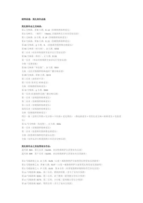
钢琴曲谱:莫扎特作品集莫扎特作品之交响曲:第1交响曲,降E大调,K.16(伯姆指挥柏林爱乐)第2交响乐,(疑作)(Naxos,沃德指挥北方室内管弦乐团)第4交响曲,D大调,K.19(伯姆指挥柏林爱乐)第5交响曲,降B大调,K.22(伯姆指挥柏林爱乐)第25交响曲,g小调,K.(伯恩斯坦指挥维也纳爱乐)第35交响曲(哈夫纳),D大调,K385第二乐章(哈农库特指挥皇家音乐厅管弦乐团)第36交响曲(林茨),C大调,K425第一乐章(哈农库特指挥皇家音乐厅管弦乐团)全曲(克莱伯版)第38交响曲“布拉格”,D大调,K504全曲(克伦贝勒指挥柏林战时广播交响乐团)第39交响曲,降E大调,K543第三乐章(演奏者不详)第三乐章(朱里尼/柏林爱乐)全曲(伯姆指挥柏林爱乐)第40交响曲,g小调,K550第一乐章(旺德指挥北德广播交响乐团)第一乐章(伯姆指挥柏林爱乐)第二乐章(伯姆指挥柏林爱乐)第三乐章(伯姆指挥柏林爱乐)第四乐章(伯姆指挥柏林爱乐)全曲(伯姆指挥柏林爱乐)四合一版(富特文革勒+瓦尔特+卡拉扬+老克莱伯)(维也纳爱乐+哥伦比亚交响+柏林爱乐+伦敦爱乐)第41号交响曲(朱庇特),C大调,K551第一乐章(伯姆指挥柏林爱乐)第一乐章(伯恩斯坦指挥维也纳爱乐)全曲(伯恩斯坦指挥纽约爱乐乐团)全曲(史科瓦泽夫斯基指挥日本读卖交响乐团)莫扎特作品之其他管弦乐作品:遣兴曲 K63,第五乐章(NAXOS,内拉特指挥萨尔茨堡室内乐团)遣兴曲 K99 第7乐章(NAXOS,内拉特指挥萨尔茨堡室内乐团演奏)第2号嬉游曲之2,D大调,K136(山度·威格指挥萨尔兹堡莫扎特管弦乐团演奏)第2号嬉游曲之3,降B大调,K137(山度·威格指挥萨尔兹堡莫扎特管弦乐团演奏)第2号嬉游曲之4,F大调,K138 第3乐章(库普曼指挥阿姆斯特丹巴洛克乐团)第11号嬉游曲 K251,第三乐章,稍快的快板(圣马丁室内合奏团)第12号嬉游曲 K252,第三乐章,波兰舞曲(霍利格尔管乐合奏团)第14号嬉游曲 K270,第二乐章,小行板(霍利格尔管乐合奏团)第15号嬉游曲 K287,第四乐章(圣马丁室内合奏团)第16号嬉游曲 K289,第一乐章(荷兰管乐合奏团)第17嬉游曲K334,第三乐章,小步舞曲(圣马丁室内合奏团)第17嬉游曲K334,第三乐章,小步舞曲(演奏者不详)第1号小夜曲,D大调,K100,第六乐章(博斯科夫斯基指挥维也纳莫扎特合奏团演奏)第3号小夜曲,D大调,K185,第二乐章(NAXOS,内拉特指挥萨尔茨堡室内乐团)第4号小夜曲,D大调,K203,第八乐章(NAXOS,内拉特指挥萨尔茨堡室内乐团)D大调进行曲K215和第5号小夜曲,D大调,K204第一乐章(马里纳指挥圣马丁乐团)第6号小夜曲,D大调,K239,(月下小夜曲)"Serenata Notturna"第一乐章:进行曲(伯姆指挥柏林爱乐)全曲(SandorVegh指挥萨尔茨堡莫扎特音乐学院乐团)第7号小夜曲,D大调,K250,(哈夫纳小夜曲)第四乐章:回旋曲(伯姆指挥柏林爱乐乐团演奏)第9号小夜曲,D大调,K320全曲(伯姆指挥柏林爱乐乐团演奏)第六乐章,小步舞曲(伯姆指挥柏林爱乐乐团演奏)第10号小夜曲,降B大调,K361第三乐章(NAXOS,德国管乐家重奏团)第七乐章(NAXOS,德国管乐家重奏团)全曲(伯姆指挥柏林爱乐管乐团)全曲(富特文革勒指挥维也纳演奏家乐团)第11小夜曲,降E大调,K375(芝加哥交响乐团/ 莫斯科爱乐)第12小夜曲,C小调,K388(迈耶尔管乐合奏团)第13号小夜曲,《G大调弦乐小夜曲》,K525第一乐章(瓦尔特指挥哥伦比亚交响乐团,CBS报纸版)第一乐章(Traunfellner指挥维也纳室内爱乐乐队)第四乐章:(伯姆指挥维也纳爱乐乐团)全曲(马里纳指挥圣马丁乐团EMI-LD版)全曲(马里纳指挥圣马丁乐团PhlipsCD版)《音乐玩笑》,F大调,K522(菲拉德指挥菲拉德室内管弦乐团)《音乐玩笑》,F大调,K522(奥菲斯室内乐团)德国舞曲,K605,第3首“雪橇”(博斯科夫斯基指挥维也纳莫扎特合奏团)德国舞曲 K586 No.5(Johannes Wildner指挥Capella Istropolitana)NAXOS8.550412 《英雄科堡之胜利》K587(奥菲斯室内乐团)Promenade en Traineau (里德/慕尼黑艺术家管弦乐团)(马里纳指挥圣马丁室内乐团)莫扎特作品之芭蕾音乐:《小玩意》(Les petits riens)K.299B(马里纳指挥圣马丁室内乐团)协奏曲:小提琴协奏曲:第1小提琴协奏曲,降B大调,K207(小提琴:大卫·奥依斯特拉赫)第1小提琴协奏曲,降B大调,K207(小提琴:Simon Standage)第2小提琴协奏曲,D大调,K211全曲(小提琴:格鲁米欧)第2小提琴协奏曲,D大调,K211全曲(小提琴:林昭亮)第3小提琴协奏曲,G大调,K.216第一乐章:快板(小提琴:马泽尔)第一乐章:快板(小提琴:阿卡多)第一乐章:快板(小提琴:慕洛娃)第一乐章:快板(小提琴:大卫·奥依斯特拉赫)第三乐章:(小提琴:穆特)全曲(格鲁米欧)第4小提琴协奏曲,D大调,K218第一乐章:(小提琴:格罗米欧)第二乐章:(小提琴:格罗米欧)第三乐章:(小提琴:格罗米欧)全曲(小提琴:阿卡多)第5小提琴协奏曲,A大调,K219第一、二乐章(小提琴:蒂博)第三乐章(小提琴:海菲兹)第三乐章(小提琴:穆特;指挥:卡拉扬)全曲(小提琴:施奈德汉)全曲(小提琴:格鲁米欧)D大调小提琴协奏曲(K271i)(小提琴:格鲁米欧)(单声)第一乐章第二乐章第三乐章E大调柔板,K261(小提琴:格鲁米欧)C大调回旋曲,K373(Maria-Elisabeth Lott,12岁)C大调回旋曲, K373(格鲁米欧小提琴)降B大调回旋曲, K269(谢霖小提琴吉卜森指挥新爱乐乐团协奏)双小提琴协奏曲,C大调,K190(小提琴:帕尔曼、祖克曼)小提琴中提琴交响协奏曲,降E大调,K364第一乐章(小提琴:海菲兹;中提琴:普利姆罗斯)第一乐章(Thomas Brandis; Giusto Cappone;伯姆指挥柏林爱乐)第一乐章Naxos历史录音(小提琴:Albert Sammons;中提琴:Lionel Tertis)第二乐章(小提琴:美岛莉;中提琴:今井信子)第三乐章(小提琴:海菲兹;中提琴:普利姆罗斯)第三乐章(小提琴:海菲兹;中提琴:普利姆罗斯)第三乐章(小提琴:布朗;中提琴:伊迈)第三乐章(小提琴:Dumay;中提琴:Causse)第三乐章(小提琴:伊戈尔·奥伊斯特拉赫,中提琴:大卫·奥伊斯特拉赫)第一、二乐章(小提琴:伊戈尔·奥伊斯特拉赫,中提琴:大卫·奥伊斯特拉赫)全曲:(小提琴:格鲁米欧,中提琴:佩雷西亚)***全曲:(小提琴:(帕尔曼),中提琴:祖克曼)交响协奏曲,k297b(Thomas Brandis;Giusto Cappone;伯姆指挥柏林爱乐)第一乐章第二乐章第三乐章D大调小提琴与钢琴协奏曲(小提琴:美岛莉;钢琴:艾申巴赫)莫扎特作品钢琴协奏曲:第7号为三架钢琴而作的协奏曲,F大调,K242(古钢琴:Malcolm Bilson,Robert Levin,谭梅文)第一乐章第二乐章第三乐章第8号钢琴协奏曲,C大调,K246,(全曲)(肯普夫/莱特纳/柏林爱乐)第9钢琴协奏曲,降E大调,K271第一乐章(钢琴:杨多)第二乐章(钢琴:杨多)第三乐章:(钢琴:杨多)全曲(钢琴:布伦德尔,马克拉斯指挥苏格兰室内管弦乐团/)全曲(钢琴:拉罗查,戴维斯指挥英国室内乐团)第10号为双钢琴而作的协奏曲,E大调,K.365第一乐章(古钢琴:Malcolm Bilson;谭梅文)第二乐章(古钢琴:Malcolm Bilson;谭梅文)第三乐章(古钢琴:Malcolm Bilson;谭梅文)第三乐章(钢琴:吉列尔斯; Rakov Zak)全曲(德拉罗查与普列文合作)全曲(吉列尔斯父女三星带花的名版)第12号钢琴协奏曲,A大调,K414,(钢琴:基辛;斯皮瓦科夫指挥莫斯科名家合奏团)第13号钢琴协奏曲,C大调,K415 (钢琴:米凯兰杰里)第13钢琴协奏曲,C大调,K415,第二乐章(钢琴:杨多)第13钢琴协奏曲,C大调,K415,第三乐章(钢琴:杨多)第15号钢琴协奏曲,降B大调,K450第15钢琴协奏曲(维也纳爱乐乐团/伯恩斯坦乐团指挥并演奏钢琴)第一乐章; 第二乐章;第三乐章全曲(钢琴:布伦德尔)全曲(钢琴:米凯兰杰利)第16号钢琴协奏曲,D大调,K451,(全曲,钢琴:佩拉西亚)第16号钢琴协奏曲,K451,(全曲,钢琴:塞尔金)第17号钢琴协奏曲,K453,G大调(暂缺)第18号钢琴协奏曲,K456,(钢琴:赛尔金Serkin)第19钢琴协奏曲,F大调,K459第一乐章(钢琴:哈斯姬儿)第二、三乐章(钢琴:哈斯姬儿)第二乐章(钢琴:杨多)第三乐章(钢琴:杨多)第20钢琴协奏曲 D小调, K466, (钢琴:杨多)第一乐章第二乐章第三乐章第20钢琴协奏曲 D小调 K466, 第二乐章:(钢琴:顾尔达)第20钢琴协奏曲 D小调 K466, 全曲(钢琴:米凯兰杰里,现场录音)第20钢琴协奏曲 D小调 K466, 全曲(钢琴:勒费布,富特文革勒/柏林爱乐)第21钢琴协奏曲,C大调,K467第一乐章:(钢琴:杨多)第一乐章(钢琴:Daniele Dechenne )第二乐章(钢琴:伊士东文)第二乐章(钢琴:安达Geza Anda)第二乐章(钢琴:施纳贝尔)第三乐章(钢琴:杨多)第三乐章(钢琴:Daniele Dechenne )全曲(钢琴:布伦德尔)全曲(钢琴:伊斯托敏)全曲(钢琴:内田光子)第22号钢琴协奏曲,降E大调,K482第一乐章(佩拉西亚/英国室内乐团)第二乐章(演奏者不详)第三乐章(佩拉西亚/英国室内乐团)全曲(钢琴: 海布勒,戴维斯指挥伦敦交响)第23钢琴协奏曲,A大调,K488第一乐章(钢琴:杨多)第二乐章(演奏者不详)第二乐章(霍洛维茨/朱利尼)第二乐章(施纳贝尔)第三乐章(霍洛维茨/朱利尼)第三乐章(钢琴:杨多)第三乐章(钢琴:肯普夫1960)全曲(钢琴:布伦德尔)第24钢琴协奏曲,C小调,K491第一乐章(钢琴:杨多)第二乐章(钢琴:杨多)第三乐章(钢琴:杨多)全曲(钢琴:哈斯姬儿)第25钢琴协奏曲,K503,C大调(Malcolm Bilson 古钢琴;Gardiner指挥英国巴洛克独奏家乐团)第一乐章第二乐章第三乐章第26钢琴协奏曲(加冕),D大调,K.537,(钢琴:海布勒,洛维茨基指挥伦敦交响)第一乐章第二乐章第三乐章第27钢琴协奏曲,降B大调,K595第一乐章(布伦德尔/马连拿指挥圣·马田乐团)第一乐章(钢琴:杨多)第二乐章(钢琴:杨多)第三乐章(钢琴:卡仲CLIFFORD CURZON)全曲(钢琴:顾尔达)全曲(钢琴:巴克豪斯)全曲(钢琴:吉列尔斯)第27钢琴协奏曲(3合1版)(演奏:吉列尔斯+佩拉希亚+顾尔达)莫扎特作品为其他乐器所作的协奏曲:大管协奏曲,降B大调,K191全曲(大管:Zeman;伯姆指挥维也纳爱乐乐团)全曲(翁纽大管,Cuschlbauer指挥班贝格交响乐团)长笛与竖琴协奏曲,K299第三乐章(朗帕尔长笛;拉斯金竖琴;菲拉德指挥菲拉德室内管弦乐团)全曲(舒尔茨长笛,萨巴雷塔竖琴,伯姆指挥维也纳爱乐乐团协奏)第1长笛协奏曲,K313全曲(格拉费娜尤长笛;马里纳指挥圣马丁乐团协奏)第一乐章(Susan Palma长笛,Orpheus Chamber Orchestra)第2号长笛协奏曲,D大调 K.314(长笛:尼科莱;皇家音乐厅管弦乐团/津曼)C大调行板,K315(朗帕尔长笛;Cuschlbauer指挥维也纳交响乐团)C大调行板,K315(朗帕尔长笛)双簧管协奏曲,K314(霍利格尔双簧管;马里纳指挥圣马丁乐团协奏)双簧管协奏曲,K314, 第三乐章(皮埃罗双簧管,朗帕尔指挥英国室内乐团)单簧管协奏曲,K622第一乐章(巴塞特单簧管版本,W.梅耶单簧管;哈农库特指挥维也纳音乐社)第一乐章(兰斯洛特单簧管,菲拉德指挥菲拉德室内管弦乐团)第二乐章(布瑞默单簧管;马里纳指挥圣马丁乐团)第二乐章(莱斯特单簧管,马里纳指挥圣马丁乐团)第二乐章(普林茨单簧管,伯姆指挥维也纳爱乐)第三乐章(普林茨单簧管,伯姆指挥维也纳爱乐)第三乐章(Naxos: 奥腾萨默单簧管;约翰内斯·维尔德纳指挥维也纳莫扎特学会)全曲(奥腾萨默单簧管,科林·戴维斯指挥维也纳爱乐乐团)全曲(普林茨单簧管,慕兴格尔指挥维也纳爱乐乐团)全曲(查尔斯·尼德赫单簧管独奏,奥菲斯室内乐团协奏)第1圆号协奏曲,D大调,K412(演奏者不详)第1圆号协奏曲,D大调,K412, 第一乐章(圆号:丹尼斯·布莱恩)第1圆号协奏曲,D大调,K412,第一乐章(圆号:图克维尔/英国室内乐团)第2圆号协奏曲,降E大调,K417(鲍曼圆号;祖克曼指挥圣·保罗室内乐团)第2圆号协奏曲,降E大调,K417, 第一乐章(圆号:丹尼斯·布莱恩)第3圆号协奏曲,降E大调,K447(圆号:丹尼斯·布莱恩)第4圆号协奏曲,降E大调,K495(圆号:丹尼斯·布莱恩)第4圆号协奏曲,降E大调,K495(圆号:图克威尔,马格指挥伦敦交响乐团协奏)莫扎特作品奏鸣曲:小提琴奏鸣曲:小提琴奏鸣曲第10号,K15(大键琴:维莱特;小提琴:波莱特)小提琴奏鸣曲第16号,K31(大键琴:维莱特;小提琴:波莱特)小提琴奏鸣曲第17号,C大调,K296 (小提琴:谢霖,钢琴:海布勒)小提琴奏鸣曲第18号,K301 (小提琴:格鲁米欧,钢琴:克林)小提琴奏鸣曲第21号,K304 (小提琴:格鲁米欧,钢琴:克林)小提琴奏鸣曲第24号,F大调,K376(小提琴:格吕米奥;钢琴:哈斯姬儿)小提琴奏鸣曲第26号,降B大调,K378(小提琴:格吕米奥;钢琴:哈斯姬儿)小提琴奏鸣曲第26号,降B大调,K378(小提琴:谢霖;钢琴:海布勒)小提琴奏鸣曲第27号,G大调,K379(小提琴:谢霖;钢琴:海布勒)小提琴奏鸣曲第32号,降B大调, K454(小提琴:格吕米奥;钢琴:哈斯姬儿)小提琴奏鸣曲第33号,K481 (小提琴:格鲁米欧,钢琴:克林)小提琴奏鸣曲第35号,A大调,K526(小提琴:谢霖;钢琴:海布勒)小提琴奏鸣曲第35号,A大调,K526 (小提琴:格鲁米欧,钢琴:克林)小提琴奏鸣曲第36号,F大调,K547 (暂缺)变奏曲,K359(小提琴:谢霖;钢琴:海布勒)小提琴奏鸣曲》K481(小提琴:施纳德汉;钢琴:希曼)小步舞曲(小提琴:海菲兹)钢琴奏鸣曲及独奏作品:钢琴奏鸣曲,第1号,C大调,K279(钢琴:季雪金)钢琴奏鸣曲,第2号,F大调,K280(钢琴:海布勒)钢琴奏鸣曲,第2号,F大调,K280(钢琴:哈斯姬尔)钢琴奏鸣曲,第3号,降B大调,K281(钢琴:霍洛维兹):第一乐章第二乐章第三乐章钢琴奏鸣曲,第3号,降B大调,K281(钢琴:吉列尔斯)钢琴奏鸣曲,第4号,降E大调,K282,(钢琴:吉塞金Gieseking)钢琴奏鸣曲,第5号,G大调,K283(钢琴:吉塞金Gieseking)钢琴奏鸣曲,第6号,D大调,K284(钢琴:海布勒)钢琴奏鸣曲,第7号,C大调,K309(钢琴:海布勒)钢琴奏鸣曲,第7号,C大调,K309(钢琴:拉罗查)钢琴奏鸣曲,第8号,A小调,K310(钢琴:拉罗查)钢琴奏鸣曲,第8号,A小调,K310(钢琴:李帕蒂)钢琴奏鸣曲,第8号,A小调,K310(钢琴:施纳贝尔)钢琴奏鸣曲,第9号,D大调,K311(钢琴:吉泽金)钢琴奏鸣曲,第10号,A大调,K330(钢琴:哈斯姬尔)钢琴奏鸣曲,第10号,A大调,K330(钢琴:霍洛维茨)钢琴奏鸣曲,第11号,A大调,K331(其中第三乐章为著名的土耳其进行曲)K331(钢琴:海布勒)K331(钢琴:吉塞金Gieseking)土耳其进行曲(波格莱里奇)钢琴奏鸣曲,第12号,F大调,K332(钢琴:舒拉.切尔卡斯基Shura Cherkassky)钢琴奏鸣曲,第13号,降B大调,K333(钢琴:拉罗查)钢琴奏鸣曲,第13号,降B大调,K333(钢琴:舒拉.切尔卡斯基)钢琴奏鸣曲,第13号,降B大调,K333(钢琴:霍洛维兹)钢琴奏鸣曲,第14号,c小调,K457(钢琴:阿劳)钢琴奏鸣曲,第15号,C大调,K545(钢琴:海布勒)钢琴奏鸣曲,第15号,C大调,K.545(钢琴:内田光子)钢琴奏鸣曲,第15号,C大调,K.545(钢琴:李赫特,布拉格现场)钢琴奏鸣曲,第16号,降B大调,K570(钢琴:弗雷德里齐·古尔达)钢琴奏鸣曲,第16号,降B大调,K570(钢琴:季雪金)钢琴奏鸣曲,第17号,D大调,K576, 第二乐章(钢琴:弗雷德里齐·古尔达)钢琴奏鸣曲,第17号,D大调,K576, 全曲(钢琴:Solomon)c小调钢琴《幻想曲》,K396(钢琴:查哈里亚斯Christian Zacharias)d小调钢琴《幻想曲》,K397(钢琴:吉列尔斯,现场录音)D大调钢琴《回旋曲》,K485(钢琴:查哈里亚斯Christian Zacharias)F大调钢琴《回旋曲》,K494(李赫特,布拉格现场)两架钢琴奏鸣曲,D大调,K448全曲(钢琴:罗夫·帕尔吉,沃尔夫冈·曼斯)全曲(钢琴:海布勒、霍夫曼)第二乐章(钢琴:鲁普、佩拉西亚)全曲(钢琴: Anna & Ines walachowski)钢琴变奏曲,K354(钢琴:海布勒)(根据博马舍《塞维利亚理发师》中的《我是多林》而作的12首变奏曲)迪波尔小步舞曲主题变奏曲9首,K573(钢琴:哈斯姬尔)迪波尔小步舞曲主题变奏曲,K573(钢琴:布伦德尔)根据“阿,妈妈,我要对你说”而作的12首变奏曲,K265(钢琴:海布勒)为两架钢琴而作的G大调慢板和变奏曲,K501(阿格丽姬,毕晓普-科瓦塞维奇)A小调回旋曲,K511(布伦德尔)6首德国舞曲,KV509(吉泽金)格伦·古尔德弹奏的(感觉异样的)莫扎特钢琴奏鸣曲:钢琴奏鸣曲 K279(格伦·古尔德)钢琴奏鸣曲 K283(格伦·古尔德)钢琴奏鸣曲 K330(格伦·古尔德)钢琴奏鸣曲K309(格伦·古尔德)钢琴奏鸣曲K310,第一乐章(格伦·古尔德)钢琴奏鸣曲K331,第三乐章, 土耳其进行曲(格伦·古尔德)室内乐:二重奏作品:G大调小中提琴二重奏,K423(Grumiaux&Pelliccia)降B大调小中提琴二重奏,K424(Grumiaux&Pelliccia)三重奏作品:第1号钢琴三重奏,降B大调,K254,(皮雷斯、杜梅、王建)第2号钢琴三重奏,G大调,K496(皮雷斯、杜梅、王建)第3号钢琴三重奏,降B大调,K502(美艺三重奏)第4号钢琴三重奏,E大调,K542(美艺三重奏)第5号钢琴三重奏,C大调,K548(暂无)第6号钢琴三重奏,G大调,K.564(美艺三重奏)第一乐章第二乐章第三乐章单簧管三重奏,降E大调,K498(莱文钢琴,莱斯特单簧管,科瑞斯特中提琴)为弦乐三重奏而作的《降E大调嬉游曲》,K563(格鲁米欧三重奏团)降B大调《嬉游曲》K254,第三乐章(皮尔斯/杜梅/王键) ——————————————————————————————————四重奏作品:第1号弦乐四重奏,G大调,K80/73f(意大利四重奏团)第2号弦乐四重奏,D大调,《米兰四重奏》之一,K155/134a(意大利四重奏团)第3号弦乐四重奏,G大调,《米兰四重奏》之二,KV156/134b(意大利四重奏团)第13号弦乐四重奏,D小调,《维也纳四重奏》第六首,K173 (阿玛迪乌斯四重奏团)第17号弦乐四重奏(狩猎),降B大调,K458(意大利四重奏组)第21号弦乐四重奏,D大调,K575(意大利四重奏组)第23号弦乐四重奏,K590,D大调《普鲁士四重奏》第三号(阿玛迪乌斯四重奏团)第1号钢琴四重奏,G小调,K478,全曲,(马友友,斯特恩,艾克斯,拉雷多)第2号钢琴四重奏,降E大调,K493,全曲,(马友友,斯特恩,艾克斯,拉雷多)第2号钢琴四重奏,降E大调,K493,全曲(PHILIPS:Haeble钢琴,Schwalbe小提琴,Cappone中提琴,Borwitzky大提琴)第1号长笛四重奏,D大调,K285, (贝奈特长笛;格鲁米欧三重奏团)第一乐章第二乐章第三乐章全曲第一乐章(高威与东京弦乐四重奏团)第2号长笛四重奏(全曲)(长笛:贝内特/格鲁米欧三重奏团)第3号长笛四重奏(全曲)(长笛:贝内特/格鲁米欧三重奏团)第4号长笛四重奏(全曲)(长笛:贝内特/格鲁米欧三重奏团)双簧管四重奏,K370(Kiss双簧管,科达伊四重奏团成员,NAXOS版)——————————————————————————————————五重奏作品:第3号弦乐五重奏,C大调,K515 (小提琴:Arthur Grumiaux,Arpad Gerecz;中提琴:Georges Janze r,Max Lesueur;大提琴:Eva Czako)第4号弦乐五重奏,G小调,K516, 第一乐章(演奏者同上)第5号弦乐五重奏,D大调,K593,(全曲,演奏者同上)第6弦乐五重奏 K614,降E大调,(格鲁米欧三重奏团/格莱茨/莱舒尔)单簧管五重奏,A大调,K581第一乐章(单簧管:Jozsef Balogh;Danubius 四重奏团)全曲(Schmidl巴塞特单簧管,维也纳八重奏团成员演奏)玻璃琴五重奏《C小调柔板与回旋曲》,K617(玻璃琴:Bruno Hoffmann;长笛:Aurele Nicolet;双簧管:Heinz Holliger;中提琴:Karl Schouten;大提琴:Jean Decroos)圆号五重奏,K407(Kevehazi圆号,科达伊四重奏团,NAXOS版)钢琴与管乐五重奏,降E大调,K452(布伦德尔钢琴,霍利格尔双簧管,布鲁纳单簧管,鲍曼圆号,图纳曼大管)钢琴与管乐五重奏,降E大调,K452(丹尼斯·布赖恩管乐合奏团)根据G大调弦乐小夜曲(K525)而改编的弦乐五重奏(埃克斯、瓜奈里四重奏团等)第一乐章第二乐章第三乐章第四乐章歌剧作品:《费加罗的婚礼》,K492序曲(梅塔指挥SONY 53286)序曲(莱茵斯多夫指挥维也纳爱乐)序曲(瓦尔特指挥哥伦比亚交响乐团)咏叹调:《蝴蝶不能再飞》(梅塔指挥SONY 53286)咏叹调:“Voi che sapete”(Danco演唱;克莱伯指挥维也纳爱乐乐团、维也纳歌剧院合唱团演出)二重唱:“Che soave zefiretto”(Casa & Gueden演唱,克莱伯指挥维也纳爱乐乐团、维也纳歌剧院合唱团)二重唱“Cinque...dieci...venti...trenta”(Siepi & Gueden演唱,E.克莱伯指挥维也纳爱乐乐团、维也纳歌剧院合唱团)“Porgi amor,qualche ristoro”(Casa演唱 E.克莱伯指挥维也纳爱乐乐团、维也纳歌剧院合唱团) “Porgi amor,qualche ristoro”(Kanawa演唱伯姆指挥维也纳爱乐乐团)“Dove sono”(演唱:施瓦兹科普夫;卡拉扬指挥维也纳爱乐)《魔笛》,K620序曲(伯姆指挥)序曲(瓦尔特指挥哥伦比亚交响)第二幕(索尔蒂指挥维也纳爱乐乐团,演唱:迪斯考等)二重唱“那些坠入爱河的男人”(索尔蒂指挥维也纳爱乐,演唱:普雷,罗莲嘉)“在神圣的殿堂里”(演唱:特尔维拉)“帕帕姬娜你在哪里”(伯姆指挥)二重唱:懂得爱情的男人,都有一颗仁慈的心(Ziesak&Kraus演唱;索尔蒂指挥维也纳爱乐)咏叹调:“如果有个女人爱我,多么幸福”(索尔蒂指挥维也纳爱乐乐团)“夜后”(演唱:格鲁布洛娃Edita Gruberova)二重唱:《pa pa pa》(演唱:夸斯托夫/卡巴列)二重唱:《pa pa pa》(演唱:普雷/霍尔姆, 索尔蒂/维也纳爱乐)美丽的画像(演唱:冯德里希)夜后"复仇的火焰"(演唱者:朵依特肯)《女人心》,K588序曲(伯姆指挥维也纳爱乐、维也纳歌剧院合唱乐团)第二幕(伯姆指挥维也纳爱乐、维也纳歌剧院合唱乐团)第2幕第4场(EMI伯姆指挥爱乐乐团与合唱团演出, Schwarzkopf、Ludwig、Kraus、Taddei等演唱) “Fra gli amplessi in pochi istanti”(EMI伯姆指挥爱乐乐团与合唱团演出, Schwarzkopf & Kraus演唱)《唐璜》,K527序曲(朱利尼指挥爱乐乐团)第一幕:(朱利尼指挥爱乐乐团,演唱:萨瑟兰、施瓦兹科普夫等)第二幕(索尔蒂指挥伦敦爱乐乐团、伦敦歌剧院合唱团)二重唱“让我们手拉手吧”(演唱:Sciutti & Wachter;朱利尼指挥爱乐乐团、合唱团)小夜曲“Deh vieni alla finestra”(Wachter演唱朱利尼指挥爱乐乐团、合唱团)《后宫诱逃》 K384咏叹调“Martern aller Arten”(Koth演唱,约胡姆指挥巴伐利亚歌剧院乐团与合唱团)咏叹调“Hier soll ich dich denn sehen”(Wunderlich演唱,约胡姆指挥巴伐利亚歌剧院乐团与合唱团)序曲(约胡姆指挥巴伐利亚歌剧院乐团与合唱团)序曲(NAXOS)《狄托的仁慈》,K621二重唱“Ah perdona al primo affetto”(von Stade & Popp演唱,科林·戴维斯指挥科文特花园皇家歌剧院乐团与合唱团)咏叹调“Ah,se fosse intorno al trono” (Burrows演唱科林·戴维斯指挥科文特花园皇家歌剧院乐团与合唱团)《阿斯卡尼奥在阿尔巴》K111,序曲(萨尔茨堡莫扎特管弦乐团/利奥波德·哈格)《巴斯蒂恩与巴斯蒂恩娜》K50,序曲《巴斯蒂安与巴斯蒂安娜》K50,全剧(Gruberova、Cole、Polgar演唱,Leppard指挥李斯特室内乐团)《装痴作傻》(一)施雷尔(P.Schreier)指挥C.P.E巴赫乐团《装痴作傻》(二)施雷尔(P.Schreier)指挥C.P.E巴赫乐团---------------------------------------------------------------------------------声乐作品:女高音咏叹调:“喜悦的心情”,K579(演唱:格鲁贝洛娃)咏叹调:“Vorrei Siegarvi,oh Dio”,K418《哈利路亚》(平诺克指挥英国协奏团, 演唱: Bonnry)《黄昏的感触》(Elly Ameling Dalton Baldwin with Netherlands Wind Ensemble)教堂音乐:忏悔者的庄严晚祷,K399C大调《加冕》弥撒曲,K317(哈农库特指挥)C小调大弥撒 K427 (柏林广播交响乐团/Fricsay)《圣礼赞》(排箫:赞非尔/管风琴:毕什)《C大调第十号弥撒曲》麻雀(库贝利克指挥巴戈里亚广播合唱团、乐团)安魂曲,D小调,K626伯姆指挥维也纳爱乐1971年版卡拉扬/柏林爱乐1976年版卡拉扬指挥维也纳歌唱家合唱团、伯林爱乐乐团巴伦博依姆1972年的版本克尔特兹(Kertesz)指挥维也纳爱乐乐团版库普曼指挥阿姆斯特丹巴洛克乐团等伯恩斯坦悼念亡妻版朱利尼/爱乐乐团和合唱团改编曲:第13号小夜曲《G大调弦乐小夜曲》,K525,第四乐章(长笛版)吉他: 《魔笛》主题及变奏(索尔改编,演奏:帕克宁)吉他: 《魔笛》主题及变奏(索尔改编,演奏:塞戈维亚)吉他: 《魔笛》主题及变奏(Pepe Romero 吉他独奏)《魔笛》中的幻想曲(萨拉萨蒂改编, 沙汉姆演奏)《费加罗婚礼》(管乐合奏)(LINOS-ENSEMBLE)《后宫诱逃》长笛与双簧管二重奏(Schulz长笛/Schellenberger双簧管)摇篮曲(改编曲)贝多芬《根据莫扎特歌剧〈唐璜〉中“La ci darem la mano”主题而作的变奏曲》但济《单簧管与乐队“La ci darem la mano”主题幻想曲》圆号协奏曲哼唱的《土尔其进行曲》木管五重奏《土尔其进行曲》Mozart 莫扎特作品目录编号K.时间地点作品名音高1 1761/2 Salzburg Minuet for Harpsichord (See K. 1e) G Major or 17641 1761/2? Salzburg Andante for Harpsichord C Major1b 1761/2? Salzburg Allegro for Harpsichord C Major1c 1761 Salzburg Allegro for Harpsichord F Major1d 1761 Salzburg Minuet for Harpsichord F Major1e 1761/2 Salzburg Minuet for Harpsichord (See K. 1) G Major or 17641f 1761/2 Salzburg Minuet for Harpsichord C Major or 17642 1762 Salzburg Minuet for Harpsichord F Major3 1762 Salzburg Allegro for Harpsichord B Flat Major4 1762 Salzburg Minuet for Harpsichord F Major5 1762 Salzburg Minuet for Harpsichord F Major5a 1763 Salzburg Allegro for Harpsichord (See K. 9a) C Major6 1764 Paris Sonata for Harpsichord & Violin C Major7 1764 Paris Sonata for Harpsichord & Violin D Major8 1764 Paris Sonata for Harpsichord & Violin B Flat Major9 1764 Paris Sonata for Harpsichord & Violin G Major9a 1763 Salzburg Allegro for Harpsichord (See K. 5a) C Major10 1764 London Sonata for Harpsichord,Violin (or B Flat Major Flute) & Cello11 1764 London Sonata for Harpsichord,Violin (or G Major Flute) & Cello12 1764 London Sonata for Harpsichord,Violin (or A Major Flute) & Cello13 1764 London Sonata for Harpsichord, Violin (or Flute) & Cello14 1764 London Sonata for Harpsichord, Violin (or Flute) & Cello。


常用效果插件(VST)介绍和下载1.『效果插件』网络K歌VST插件效果合集,下载地址:/s/1dD88HQp包括:激励器、爆音效果、电话音效果、变声效果、电音效果、混响效果、环绕效果、回声效果、魔音、双音、震荡、失真、闪避、压限器等,打包提供是为了让你一步到位,如果仅仅网络K歌和喊麦需要,仅仅下载效果合集就够用了。
效果合集里提供的纯VST插件,除了个别之外下面就不另行介绍啦,请根据需要下载,尽量不要重复...~~~~~~~~~~~~~~~~~~~~~~~~~~~~~~~~~~~~~~母带~~~~~~~~~~~~~~~~~~~~~~~~~~~~~~~~~~~~~~2. 『母带处理器』恐龙,IKMultimediaT-RackSDeluxe T-Racks 3 (附注册码),下载地址:/share/link?shareid=452397&uk=1325 508126恐龙音频处理软件IKMultimediaT-RackSDeluxeT-Racks 3 是一款世界知名的音频处理器,适用于后期制作与混音阶段的高品质音频插件,包含9套模拟模组和数字动态/均衡运作元件,提供好莱坞等级的音频讯号。
3.『母带处理器』臭氧,最新iZotope Ozone 5 Advanced v5.04,下载地址:/s/1o6JMjua;另附iZotope Ozone4 汉化版(内含注册机),下载地址:/s/1h6ivk极富盛名美国iZotope 公司制作的第四代专业级后期母带综合处理音效插件,俗称“臭氧”,强大的音频多效果处理能力,千变万化的处理效果,而又绝不夸张,无愧母带处理的领军地位,值得拥有和珍藏(组合操作复杂,需有一定音频调整基础)。
VST 版本,可在任何支持VST 插件的播放器、音乐工作室宿主中调用。
在一个系统中集成了七种母带处理,使你轻松完成专业混音。
响度最佳化处理可以使你发布的作品都有相同的声音均衡。

GPS monitoring of vertical seafloor motion at Platform HarvestBruce J.Haines a ,⇑,Shailen D.Desai a ,George H.Born baJet Propulsion Laboratory,California Institute of Technology,4800Oak Grove Drive,M/S 238-600,Pasadena,CA 91109,USAbUniversity of Colorado,Colorado Center for Astrodynamics Research,Boulder,CO 80310,USAAvailable online 22November 2012AbstractWe describe results from two decades of monitoring vertical seafloor motion at the Harvest oil platform,NASA’s prime verification site for the TOPEX/Poseidon and Jason series of reference altimeter ing continuous GPS observations,we refine estimates of the platform subsidence—due most likely to fluid withdrawal linked to oil production—and describe the impact on estimates of stability for the altimeter measurement systems.The cumulative seafloor subsidence over 20yrs is approximately 10cm,but the rate does not appear constant.The apparent non-linear nature of the vertical motion,coupled with long-period GPS errors,implies that the quality of the seafloor motion estimates is not uniform over the 20-yr period.For the Jason-1era (2002–2009),competing estimates for the sub-sidence show agreement to better than 1mm yr À1.Longer durations of data are needed before the seafloor motion estimates for the Jason-2era (2008–present)can approach this level of accuracy.Ó2012COSPAR.Published by Elsevier Ltd.All rights reserved.Keywords:GPS positioning;Altimeter calibration;Seafloor subsidence;Sea level1.IntroductionThe Harvest Oil Platform is located approximately 10km offthe coast of central California near the western entrance to the Santa Barbara Channel (Fig.1).The plat-form is fixed to the seafloor and sits in about 200m of water (Fig.2).Conditions at Harvest are typical of the open ocean:wind waves and swell average about 2m,though waves up to 10m have been experienced during powerful winter storms.Prevailing winds are from the northwest and average about 6m/s.Built in 1985and oper-ational since 1991,Harvest has produced over 84million barrels (bbl)of oil as of December 2011.1Harvest has also served as the NASA prime calibration site for the TOPEX/Poseidon (1992–2005),Jason-1(2001–)and OSTM/Jason-2(2008–)precision satellite altimeter missions.Together with its sister sites in Corsica (Bonne-fond et al.,2010),Bass Strait (Watson et al.,2011)and Gavdos (Mertikas et al.,2010),it forms a network of ded-icated calibration sites that provide an important interna-tional resource for the study of sea level from space.The planned Jason-3(2014–)and proposed Jason-CS (2018–)missions would follow the same ground track,implying that Harvest will continue to serve a crucial role in validat-ing data from precise spaceborne radar altimeter systems.Christensen et al.(1994)and Haines et al.(2003,2010)provide comprehensive treatments of the overall Harvest experiment and associated altimeter calibration record.In this note,we focus on one of the limiting error sources in the calibration exercise:the characterization of the long-term vertical motion of the seafloor.The vertical motions of the seabed are expressed in the platform tide-gauge mea-surements.In order to reconcile the locally measured (plat-form)sea level with the geocentric sea-surface height provided by the altimeter measurement systems,the land motion must be accurately monitored and removed (cf.Mitchum et al.,2010).The Harvest situation presents particular challenges for monitoring the land (seafloor)deformation,due principally to variations in the observed subsidence.While early GPS data yielded no signs of systematic changes in the platform height (Purcell et al.,1995),longer time series have exposed0273-1177/$36.00Ó2012COSPAR.Published by Elsevier Ltd.All rights reserved./10.1016/j.asr.2012.11.008⇑Corresponding author.E-mail address:bruce.j.haines@ (B.J.Haines).1 ./locate/asrAvailable online atAdvances in Space Research 51(2013)1369–1382significant subsidence(approaching1odic variations due to various loading(Haines et al.,2003,2010).Seafloormon side effect of the offshorewhere it is usually linked toNagel,2001).We note,however,thatsuch as seafloor dissolution,sedimenttonics and foundation settlement,additional sources of subsidenceThe platform is also located in abulge subsidence from ongoing glacial(GIA)of the lithosphere.Themodel,for example,predictsHarvest from glacial isostasy(Peltier,subsidence rate at Harvest iswithdrawal is the most compellingResults from a companion(VNDP)at Vandenberg Air Forcesupport for this interpretation.Due toand common tectonic behavior,thestations are considered by theService(IERS)to be part of the same overall geodetictracking site(DOMES40420).While VNDP is only 11km distant from Harvest,it is also well removed from the offshore Pt.Arguello Field from which Harvest draws. We expect any subsidence bowl from offshore production at Harvest to be mostly restricted to the seafloor overlying the reservoir.The nearby VNDP site shows no signs of appreciable subsidence(or uplift)since GPS tracking was initiated in1992,2supporting that the subsidence seen at Harvest is locally confined.The cumulative impact of the subsidence at Harvest has been a$10-cm vertical drop over20yrs,but the rate of subsidence has not appeared uniform.Unraveling the real signal from the error in the GPS vertical remains one of the single greatest challenges for the Harvest validation experiment.We attempt herein to better assess the long-term motion of the platform,and to assign more realistic errors to this component of the Harvest calibration error budget.2.Platform GPSEstablished prior to the launch of TOPEX/Poseidon in 1992,the Harvest experiment features one of the oldest tide gauge/GPS pairings in the world.With the exception of a few short interruptions,both tide-gauge and GPS systems have provided continuous measurements for over20yrs. The GPS antenna is mounted on a custom monument located on the heliport about50m above the water level (Fig.3).The antenna—an original“TurboRogue”choke ring(SN101)with a Dorne–Margolin element—has been undisturbed since its1992installation.A custom radome designed to protect the antenna from the harsh marine environment was removed from the monument in August 1997;it was replaced with an identical design in September 1999.This two-year(radome-free)period is important for lending insight on the impact of the radome on the mea-sured height of the platform.The original GPS receiver—an8-channel TurboRogue from Allen Osborne and Asso-ciates(AOA)—served until September1999.Its replace-ment,a12-channel AOA Benchmark with Advanced Codeless Tracking(ACT),was joined in February2002 by an Ashtech Z12to provide competing measurements from the same antenna.Our goal since2002has been to maintain two opera-tional geodetic-quality receivers on Harvest at all times. This provides hot redundancy,and also enables diagnosis of potential receiver problems.The Z12failed in2011, and was replaced by a different unit(same model)in November2011.The Benchmark failed in2012,and was replaced by a Javad Triumph GNSS receiver in February 2012.3.Solution strategiesTo support the calibration of the altimeter measurement system,the instantaneous vertical coordinates of the plat-form tide gauges at theflyover times must be tied as closely as possible to the center of mass(CM)of the Earth system (which includes both the solid Earth and itsfluid envelope). This demands a detailed consideration of vertical motions on a variety of time scales,e.g.,tectonics,subsidence,tidal and loading effects and platform sway(Haines et al.,2010). The fundamental measurements,however,are the coordi-nates of the oil platform in the conventional terrestrial ref-erence frame(TRF)from GPS,the determination of which provide the essence of this study.2Per IGS08coordinates for VNDP(Rebischung et al.,2011);also </post/links/VNDP.html>.B.J.We determined the position of the platform GPS monu-ment in the TRF using precise point positioning(PPP) techniques(Zumberge et al.,1997).Approximately7000 daily solutions spanning two decades(1992–2012)were derived from the Jet Propulsion Laboratory’s GIPSY soft-ware.Precise estimates of the GPS spacecraft orbit and clock states from the JPL International GNSS Service Analysis Center(IGSAC)provided the framework for the PPP solutions.For the entire20-yr period(1992–2012),we used products from the latest JPL IGSAC repro-cessing effort(Desai et al.,2011).These products are based on state-of-the-art processing strategies,and are expressed in the current IGS realization(IGS08)of the International Terrestrial Reference Frame(Rebischung et al.,2011).In addition to the orbit and clock state information,these products provide GPS wide-lane averages for station/satel-lite pairs.This information supports integer resolution of the carrier phase ambiguities in the PPP process(Bertiger et al.,2010).To uncover potential errors in the GPS-based time series of the Harvest vertical,we processed the entire20-year data record using two distinct PPP solution strategies(Table1). The strategies adopt competing approaches for dealing with some of the largest error sources(e.g.,troposphere, low-elevation data,multipath).The differences of the resulting time series are meant to expose systematic GPS errors not fully expressed in routine measures of precision, such as repeatability and formal errors.Of special note are the models used for the Harvest GPS antenna phase varia-tion(APV)patterns.The perturbed strategy uses the IGS standard(Schmid et al.,2005),which describes the ideal (e.g.,anechoic)APV for specific antenna models.3The nominal strategy,in contrast,uses an empirical adjustment to the IGS standard.Designed to capture site-specific mul-tipath,this empirical approach is based on the stacking of post-fit tracking residuals as a function of azimuth and ele-vation as viewed from the station(Hurst and Bar-Sever, 1998).Also noteworthy is the difference in approaches to handling the unknown pass-by-pass biases of the carrier phase measurements:the nominal strategy relies on a recent innovation to resolve integer ambiguities using sin-gle-receiver data(Bertiger et al.,2010),while its perturbed counterpart recovers only real-valued biases.We note that the empirical APV map is based on iterative procedure that uses16yrs(1996–2011)of carrier-phase residuals from the nominal,ambiguity-resolved strategy.While the uncertainty in contemporary realizations of the TRF is considered an important potential source of error at the1mm yrÀ1level(Altamimi et al.,2011),we used the same TRF(IGS08)for both the nominal and per-turbed PPP strategies.A limited test based on the differ-ences of the two most recent IGS realizations(IGS05vs. IGS08)of the TRF revealed only small(<0.1mm yrÀ1)dif-ferences in the estimated vertical rate for Harvest.The dif-ference of these two recent publications of the TRF may significantly underestimate the true errors.In addition, errors in the TRF can be expressed in terms of the seven parameters of a Helmert transformation,allowing straight-forward projection onto the resulting time series of daily height estimates.4.Quality metricsVarious indicators of solution quality,such as daily sta-tistics on the post-fit residuals and abundance of low-eleva-tion data,were retained for examination and are depicted (for the nominal case)in Fig.4.These metrics are use-ful for monitoring changes in the historical performance of the Harvest GPS system,and provide potential clues on long-term errors.The most prominent feature is aTable1Highlights of competing GPS solution strategies for precise-point positioning(PPP).MODEL/PARAMETER NOMINAL PERTURBEDElevation Cutoff7°15°Troposphere Mapping Functions VMF1(Boehm et al.,2006b)GMF(Boehm et al,2006a) A priori zenith dry troposphere delay VMF1(Boehm et al.,2006b)Exponential atmosphereA priori zenith wet troposphere delay VMF1(Boehm et al.,2006b)10cmWet Troposphere EstimatesZenith Delay3mm hÀ1/2random walk(Bar-Sever et al.,1998)1cm hÀ1/2random walk Gradient0.3mm hrÀ1/2random walk(Bar-Sever et al.,1998)NonePhase ambiguities resolved?Yes(Bertiger et al.,2010)No(real-valued)Antenna Phase Variations IGS std.(AOAD/M_T)IGS std.(AOAD/M_T)+empirical adjustmentCommon ModelsData types Ionosphere-free phase(LC)and pseudorange(PC)Data rate5-min(sampled LC,carrier-smoothed PC)GPS s/c orbit/clock states IGS08from JPL IGSAC(Desai et al.,2011)Solid Earth tide IERS2010(Petit and Luzum,2010)Ocean load tide FES2004(Lyard et al.,2006)wrt CM of Earth systemRotational deformation IERS2010(Petit and Luzum,2010)Observation weights1cm LC;100cm PC3The AOAD/M_T model provides the correction for the Harvestantenna.The Harvest radome is a custom model for which no IGSstandard correction is available.1372 B.J.Haines et al./Advances in Space Research51(2013)1369–1382discontinuity in each time series associated with a major receiver upgrade in September1999.This represents a tran-sition from the original cross-correlating receiver(Turbo-Rogue)to a more modern(AOA Benchmark)unit featuring Advanced Codeless Tracking(ACT).The improved tracking—particularly at lower elevations—induced a significant offset in the estimated height.An Ash-tech Z12receiver(with Z tracking)joined the Benchmark in2002,feeding from the same antenna.After recent fail-ures,these receivers were in turn replaced:the Z12by another unit(same model)in2011,and the AOA Bench-mark by a Javad Triumph in2012(cf.Section2.0).Based on a comparison of the estimated heights,the receivers with modern codeless tracking algorithms behave similarly. While thefingerprints of receiver changes since1999are visible in some of the quality metrics(Fig.4),there are no obvious discontinuities in the corresponding height esti-mates.For the current analysis,we use the Ashtech data Z12when available(from2002–pr.),and the Benchmark/ Javad data as backup.Prior to2002,the original cross-cor-relating TurboRogue(1992–1999)and its replacement Benchmark are the only sources ofdata.Also noteworthy in Fig.4are the overall lower(by $1cm)height estimates associated with the2-yr radome-free period(1997–1999)denoted by the green background.A sudden,significant increase in the pseudorange post-fit residual RMS in January1994is associated with the initial activation of the GPS anti-spoofing(AS)function,which forced the TurboRogue into cross-correlation mode.The performance metrics in Fig.4are monitored not only for discontinuities,but also for long-term trends that may influence the GPS-based height estimates.A decreas-ing ability to track low-elevation GPS satellites is observed from1992–1999,and may be symptomatic of degradation in the original TurboRogue receiver.Since the receiver and radome upgrades in1999,the trends in the perfor-mance metrics have been relatively stable.A slow,steady increase in the daily number of GPS observations pro-cessed is likely due to the growth of the constellation, which currently consists of32satellites.A slight decadal-scale inflection in the post-fit pseudorange residual statistic warrants close attention,and could be signs of changes to the GPS system or to the surrounding environment(e.g., multipath,RFI).Fortunately,the differences of the nomi-nal and perturbed height solutions provide no obvious signs of commensurate trends.This is encouraging,espe-similar.The variations with the largest amplitude(3–4mm)occur at the annual period and peak in autumn. As discussed by Haines et al.(2003),this signal agrees well with predictions of thermal expansion and contraction of the platform on a seasonal basis.At shorter periods(<1yr),the spectra of the daily solu-tions from the perturbed strategy are more energetic,and show important amplifications at periods of70,117and 175d.The latter period is close to semi-annual,but corre-sponds more precisely to the second harmonic of the repeat period(351d)for the geometry of the GPS constellation with respect to the sun,the so-called“GPS draconitic year.”Errors at the draconitic period and overtones thereof are prevalent in GPS-based geodetic time series (Ray et al.,2008).The70-d and117-d peaks correspond to higher-order harmonics(N=5,3)of the draconitic year.Interestingly,neither of the spectra shows much energy at the fundamental draconitic period(351d).Diurnal and semi-diurnal crustal deformations can man-ifest at longer periods in GPS time series formed from daily solutions(Penna and Stewart,2003;Penna et al.,2007). This phenomenon is linked to aliasing effects from both the sample averaging interval(24.0h=one solar day) and the repeat period of the GPS satellites($23.9h=one1374 B.J.Haines et al./Advances in Space Research51(2013)1369–1382utable mainly to the integer resolution of the carrier phase biases in thefinal step of the nominal PPP strategy.Based on the technique described by Bertiger et al.(2010),the ambiguity resolution relies on wide-lane averages from the global network underlying the daily GPS orbit and clock products.The nominal PPP strategy is also effective at reducing errors at the draconitic harmonics,despite the fact that it keys offthe exact same(reprocessed)orbit and clock prod-ucts as the perturbed strategy.While ambiguity resolution is expected to play a role in reducing such systematic errors (King and Watson,2010),we did not in our casefind a strong impact of the bias resolution step on the draconitic overtones.The use of different troposphere mapping func-tions,elevation cutoffs,and approaches for dealing with multipath may also contribute to or diminish the system-atic errors at or near these frequencies(Tregoning and Watson,2009;King and Watson,2010).In particular, the empirical estimate of the in-situ APV from stacked ambiguity-resolved postfit residuals(nominal case)is expected to remove significant multipath signal,but may also provide a mechanism for absorbing systematic errors linked to draconitic harmonics.For the Harvest location,we must also be alert to poten-tial sources of sub-daily platform movements unrelated to deformations of the seafloor.The University of Colorado (CU)deployed an accelerometer on the platform,and con-cluded that platform sway during extreme wind and wave states can induce vertical motions up to1cm(Morris et al.,1995).Under normal conditions,however,the verti-cal motions are expected to be less than5mm.Some expansion and contraction of the platform due to daily heating and nighttime cooling can also be expected.Due to the moderating marine influence,however,diurnal air temperature variations are surprisingly small.A spectral analysis of2yr of temperature data from a nearby(Pt. Arguello)NOAA buoy reveals average diurnal variations of only0.4°and0.2°C for air and sea-surface temperatures respectively.To further probe for potential unmodeled sub-daily motions,we performed kinematic solutions for the plat-form location using the nominal PPP strategy(Table1). Spanning an entire year(2010),these kinematic solutions feature5-min updates of the platform position,and should be capable of revealing high-frequency motions.A spectral analysis of the resulting1-yr data set revealed no peaks exceeding1mm in amplitude with period shorter than 13d(including the sub-diurnal band).This supports that daily thermal variations in the vertical of the platform are small,and that platform sway may not be coherent enough to substantially manifest at particular frequencies. More important,there is no evidence of significant (>1mm)and persistent unmodeled sub-daily periodic motions that could alias with the24-hr or sidereal sampling to introduce spurious longer term effects.While reduction of these periodic error signals in the Harvest time series is important,our focus herein is on the longest-wavelength signals(>1yr)that have significant influence on the monitoring of stability from multi-year records of sea level from altimeter systems.6.Conditioning the time seriesThe success of the Harvest altimeter calibration efforts depends significantly on the integrity of the model for long-term platform vertical motion.This model must be accurate in terms not only of stability,but also of absolute position with respect to the CM of the Earth system.To condition the time series of the daily vertical positions, we mustfirst contend with the spurious jumps due to equipment changes.To characterize the vertical offset introduced by the radome,we estimated jumps for both the1997removal and1999replacement using two weeks of daily solutions surrounding each event.The removal and replacement caused respectively a10-mm decrease and9-mm increase in the nominal time series.A consistent picture of the radome-free period being lower thus emerged,and was used to defend adjusting the majority (radome-contaminated)portion of the time series down-ward by these amounts.This exercise was repeated for the perturbed solution,and yielded a similar overall result, albeit with less consistency(7mm decrease at removal and 19mm increase at replacement).The time series for the per-turbed solution was adjusted using thesefigures.The discontinuity introduced by the1999receiver upgrade is more difficult to characterize from local(in time) data,because of the data outage linked to the prior failure of the original(TurboRogue)receiver.Instead,we estimate an offset in the time series simultaneously with polynomial and annual terms.The bias estimate associated with the current(modernized)receiving equipment is considered to produce the most correct overall level.To best capture the subsidence of the platform,a quadratic model has served as the standard(Haines et al.,2003,2010),but we also consider linear and cubic models.Prior tofitting the time series data,we remove certain daily solutions based on two quality measures:these include low number(<1200)of GPS phase or pseudorange data,and failure of the iterative outlier editing procedure in the GIPSYfilter sequence.In the polynomialfitting of the time series,we also use an iterativefive-sigma outlier detec-tion scheme.Approximately4%of the daily solutions are removed from the20-yr time series via the combined appli-cation of these criteria.Shown in the top panel of Fig.6is the conditioned20-yr time series with offsets and annual signals removed.The time series is based on the nominal solution strategy (Table1),and uses the standard quadraticfit for the model (red line).Also provided for the same time span are pro-ductionfigures for the Pt.Arguello reservoir.The largest rate of subsidence(close to1cm yrÀ1)occurs early in the record,and correlates with peak production of oil and nat-ural gas(1994–1995).The subsidence gradually decreased, in keeping with lower hydrocarbon production.We noteB.J.Haines et al./Advances in Space Research51(2013)1369–13821375however the significant increase in the amount of produced water (lower panel),also a potential source of subsidence.Produced water originates naturally in the formation,and may also be re-injected (along with seawater)to stim-ulate hydrocarbon production or arrest subsidence.The ratio of oil to water produced decreases naturally with res-ervoir depletion,as seen in Fig.6.Accurate physical mod-eling of the subsidence at the level necessary to validate the GPS measurements may not be practical.Reservoir com-paction depends mainly on the decrease in reservoir pres-sure with production,but also on the thickness of the reservoir,the compressibility of the reservoir rock and the reservoir boundary conditions (e.g.,Nagel,2001).The nature of the production history underscores the difficulty in choosing the correct model for the platform subsidence.On one hand,the standard linear model for long-term site motions seems inadequate for capturing potential variations in the subsidence rate (Fig.6).On the other hand,a higher-order model has the potential to inherit more long-period systematic GPS errors,such as those hinted at by the quality metrics (Fig.4).We thus examine the impact of a range of choices on the altimeter calibration results.Shown in Fig.7are six competing models for the plat-form vertical motion based on the two PPP strategies (cf.Table 1)and three polynomial modeling strategies:linear,quadratic and cubic.With the exception of a large ($17-mm)relative bias,the two PPP strategies yield similar pat-terns for the vertical motion.In particular,the trend esti-mates agree at the 0.1mm yr À1level,and both solutions provide a similar picture of the acceleration and jerk in the quadratic and cubic cases respectively.Against the backdrop of the evolving GPS constellation,subtle long-term changes in the tracking geometry over time can prop-agate multipath differently and potentially bias velocity estimates (King and Watson,2010).In view of the different elevation cutoffs and approaches to antenna-phase varia-tion (APV)modeling used in the two PPP strategies,it is encouraging that they provide a very similar picture of the long-term subsidence.The significant $17-mm bias (perturbed solution higher than nominal)may reflect the different elevation cutoffs used,coupled with different approaches to describing the antenna phase center variations.We prefer the results (left column)from the nominal strategy,which is closer to the current state of the art (e.g.,Bertiger et al.,2010).This is also reflected in the lower post-fit scatter of the daily solu-tions,which is 6mm for the nominal strategy vs.8mm for the perturbed case.Developing a preference among the three polynomial fits is more challenging,but wehaveseries of Harvest vertical from GPS (top)depicting gradual subsidence of the seafloor,likely due to cumulative subsidence after nearly two decades is close to 10cm.Shown in the lower three panels statistics:(1)net gas extracted (produced —injected);(2)oil/condensate produced;and 3)net water extracted taken from the U.S.Bureau of Ocean Energy Management database ()from all offshore platforms (i.e.,Hidalgo and Hermosa,in addition to Harvest).generally erred on the side of caution by allowing a vertical acceleration—to accommodate declining hydrocarbon pro-duction—but not higher order terms(Haines et al.,2003, 2010).The quadratic model,coupled with the nominal PPP,thus provides the primary solution for modeling ver-tical platform motion in the altimeter calibration exercise. All six approaches pictured in Fig.7,however,will be eval-uated to assess the impact on the calibration results,and derive a more realistic error budget.7.Altimeter sea-surface height calibrationThe canonical sea-surface height(SSH)calibration time series from Harvest is provided in the top panel of Fig.8 (cf.Fig.5;Haines et al.,2010).Five different altimeter mea-surement systems carried on three different missions are represented in20yrs(1992–2011)of continuous observa-tions.Each point on the plot represents an instantaneous comparison of in-situ and altimeter SSH for a particular satelliteflyover.Our principal model for vertical seafloor motion—the quadraticfit to daily solutions from the nominal PPP—provides the basis for reconciling the in-situ(land-relative) and satellite(geocentric)SSH.We relate the position of the GPS antenna(near the helipad)to the tide gauge leveling mark using afixed value(46.041m)from repeated local surveys(Gill et al.,1995).To determine the instantaneous geocentric height of the tide-gauge benchmark,the vertical distortion of the seafloor from the combined effects of the Earth(body)tide,ocean tidal loading and rotational defor-mation is computed at theflyover time.The same models used in removing these signals in the daily GIPSY PPP solutions(Table1)are used in reconstructing them at the flyover times.4In order to support the best SSH calibration possible,we also apply several land motion models that go beyond the present GIPSY standards(cf.Table1).These include models for thermal expansion/contraction of the platform structure,as well as annual loading from ground-water,ice,atmospheric pressure,and nontidal ocean effects (Dong et al.,2002).Discussed by Haines et al.(2003),the annual loading and thermal models explain small vertical displacements(0.2–2mm)but collectively match the annual signal observed in the PPP time series.We use data from the NOAA Next-Generation Water Level Measurement System at the platform(Gill et al., 1995)to provide the water level relative to the tide-gauge benchmark.For the oldest(1992–1999)portions of the cal-ibration time series shown in Fig.8,we use data from the NOAA(primary)acoustic system to provide the platform water level.The acoustic system was rendered inoperative by a storm in May1999,and was converted to digital Bub-bler technology(also used by the secondary system).For the1999–2011portion of the time series,including the entire Jason-1and-2eras,the Bubbler data thus provide the basis for the in situ water level.Haines et al.(2003, 2010)provide more detail on the processing of the tide-gauge measurements,including the mitigation of sea-state errors.For the altimeter leg of the SSH calibration,the correc-tions are described by Haines et al.(2010);(Table1),and generally follow the recommendations for the mission geo-physical data records(GDR).A noteworthy difference is the treatment of the tides and other geophysical corrections (e.g.,atmospheric pressure loading of the sea surface,geoid undulations).The altimeter SSH measurement underlying the calibration exercise is the true geocentric(or ellipsoidal) height of the mean sea surface illuminated by the radar footprint as the satellite passes over the platform,and is not corrected to remove any of these geophysical effects.Fig.7.Conditioned20-yr time series of Harvest vertical from GPS usingnominal(left)and perturbed(right)strategies for precise point positioning(PPP).For each PPP approach,the time series isfit using linear(top),quadratic(middle)and cubic(bottom)polynomials to provide competingmodels for the subsidence.Thefit parameters also include an offset(inSeptember1999)to accommodate the impact of a major receiver upgrade,and an annual harmonic to accommodate mainly seasonal thermal andloading effects(Haines et al.,2003).To simplify interpretation,theestimated offset is removed from each time series.Adjacent to the grayvertical bar denoting the offset time,we provide the estimated value of theoffset in each case.4For convenience,however,we use tidal potential tables(Tamura,1987)in reconstructing the Earth tide at the overflight time,rather thanthe DE421ephemeris(Folkner et al.,2009)used in the GIPSY solutionsunderlying the PPP.Research51(2013)1369–13821377。