自然地理学 英文
- 格式:ppt
- 大小:1.49 MB
- 文档页数:24

《自然地理学》课程教学大纲一、课程基本信息课程名称:自然地理学英文名称:Physical geography课程类别:专业基础课学时:128学 分:8.0适用对象:资源环境与城乡规划管理、地理科学、地理信息系统二、课程简介《自然地理基础》课程主要介绍自然地理学的研究对象和任务,地球的宇宙环境、地球的运动、地球的形状和结构,地壳及其运动、地质构造与地壳的演化,气候与气候资源,水文及水资源,地貌及地貌灾害与防治;植物及植物资源,动物及动物资源,土壤及土壤资源等地球表层各自然要素的性质和特点,各要素之间的相互联系和相互作用,自然地理环境的基本规律及其应用,人类与自然地理环境的关系等内容。
三、课程性质与教学目的自然地理基础是环境科学专业的专业基础课,它是研究地球表层(即自然地理环境)的科学,主要阐明地壳、气候、水文、地貌、植物、动物及土壤等各自然地理要素的特征、分布规律及其相互作用而形成的自然地理环境整体特征和规律,为学生今后开展自然地理学知识的教学和相关研究奠定基础。
课程的教学目的主要是培养具有自然地理学知识和能力的综合性人才,要求学生掌握自然地理学的基本知识、基本理论和基本技能,了解各自然地理要素的特征、发展变化和分布规律,进一步认识自然地理系统的整体性和区域差异性,并能在资源、环境以及城乡规划管理研究和应用中熟练地应用自然地理学知识和方法。
四、教学内容及要求第一章 绪论(一)目的与要求1.掌握自然地理学的研究对象2.了解自然地理学的分科3.熟悉自然地理学的任务(二)教学内容第一节 地理学的研究对象1.主要内容地理学的研究对象。
2.基本概念和知识点地理环境。
3.问题地理环境包括的三种环境及其含义。
第二节 自然地理学的研究对象1.主要内容天然环境和人为环境、自然地理环境的形成、自然地理环境的范围和边界、自然地理环境的组成、自然地理环境的基本特征。
2.基本概念和知识点天然环境、人为环境、地圈,自然地理环境的物质组成、自然地理环境的要素组成、自然地理环境的基本特征。
自然地理学名词解释自然地理学重要名词解释汇总(高等教育出版社《自然地理学》第三版,伍光和主编)绪论1.地理环境:地理环境可分为自然环境、经济环境和社会文化环境三类。
三种地理环境在地域上和结构上相互重叠、相互联系,从而构成统一整体的地理环境。
2.自然环境:自然环境由地球表层中的无机和有机的。
静态和动态的自然界各种物质和能量组成,具有地理结构特征并受自然规律控制。
根据其受人类社会干扰的程度不同,分为天然环境(或原生自然环境:只受人类间接或轻微影响,而原有自然面貌未发生明显变化的自然地理环境。
)和人为环境(或次生自然环境:经受人类直接影响和长期作用之后,自然面貌发生重大变化的地区。
)。
3.经济环境:经济环境是指自然条件和自然资源经人类利用改造后形成的生产力地域综合体,包括工业、农业、交通、城镇居民点等各种生产力实体的地域配置条件和结构状态。
4.社会文化环境:社会文化环境,包括人口、社会、国家、民族、民俗、语言、文化等地域分布特征和组成结构,还及各种人群对周围事物的心理感应和相应的社会行为。
5.自然地理学(Physical Geography):自然地理学研究地球表面物质系统及其要素的组成、结构、功能、空间特征、时间特征以及各要素之间的相互作用的机理。
根据自然地理学的研究对象的复杂性和对其研究的领域分化,目前,自然地理学主要有以下分科:6.部门自然地理学(Sectional Physical Geography):分别研究组成地球表层物质系统的各种自然要素与过程本身,强调以某个要素为核心的分析与综合,包括的学科主要有地貌学、气候学、水文地理学、动(植)物地理学、土壤地理学等。
7.区域自然地理学(Regional Physical Geography):研究地球表层物质系统的某个地域组合的自然特征与过程,强调具体区域的个体性。
8.综合自然地理学(Integrated Physical Geography):主要研究地球表层物质系统的形成历史、现代过程、类型特征、地理分异和发展演变,它是自然地理学的理论研究部分,强调综合性。
Lecture 1INTRODUCTION TO EARTHMajor Concept (I)The planets in our solar system, including Earth, began to form out of a rotating disk of gas and dust about 4.6 billion years ago.Related or supporting concepts:The present view of the beginning of the solar system suggests that a cloud of gas and dust was flattened into a disk by rotation. The density of the matter in the disk was greatest at its center and decreased toward the edges.The sun formed at the center of the disk where the temperature was highest and the planets formed at greater distances away from the center.The compositions of the planets differ because of a natural sorting of elements in the cloud with distance from the center.The temperature of the early Earth was probably quite high due to:a. the gravitational capture of particles that released heat on impact,b. the increased pressure on the interior of the planet as it continued to grow, andc. the capture of radioactive elements that gave off heat when they decayed.During the first few hundred million years, the internal temperature rose high enough to melt iron and nickel. These heavy metals sank to form the core of the planet and displaced lighter material that rose to form chemically differentiated shells.Major Concept (II)Earth’s oceans originated early in the planet’s history. There are two proposed sources of the water in the oceans.Related or supporting concepts:The oldest sedimentary rocks found that required water for their formation are 3.9 billion years old. This suggests that there are been oceans on Earth for roughly 4 billion years. Traditionally scientists have believed that the water in the oceans and atmosphere originated in Earth’s mantle and was brought to the surface by volcanism.Most magmas contain from 1% to 5% dissolved gas by weight, most of which is water vapor.If we assume that the current rate of release of water vapor in volcanic eruptions has remained essentially constant for the past 4 billion years, then the volume of water expelled(put out) during that time would be roughly 100 times the volume of today’s oceans.A relatively new proposal is that a significant amount of water is added to Earth from space when small icy comets(彗星)enter Earth’s atmosphere.The early atmosphere did not have any oxygen. The oxygen released from the interior of the planet would have combined with metals at the surface to produce oxides.It wasn't until large amounts of oxygen were produced after plants formed that it began to accumulate in the atmosphere.Major Concept (III)There is compelling evidence that there may be other oceans in the solar system.Related or supporting concepts:Two of Jupiter’s moons, Europa and Callisto, may have oceans beneath their icy surfaces.Liquid oceans on Europa may be possible despite extremely low temperatures because of heatgenerated by friction as it is deformed by Jupiter’s tide-producing gravitational force.Both moons have induced magnetic fields indicating they consist partly of strongly conducting material. This may be liquid water with electrolytic salts.There is also some indication that Mars once had an ocean covering portions of its northern hemisphere.Major Concept (IV)There are a variety of lines of indirect evidence that allow us to estimate Earth’s age as being about 4.5 to 4.6 billion years.Related or supporting concepts:Earth’s original crust, that would have formed early in its history, has been destroyed or covered by active volcanism and tectonic processes. This is a reflection of the geologically active nature of the planet. Consequently, the oldest surface rocks we have found, roughly 4 billion years old, give us a minimum age for Earth rather than an actual age.Indirect evidence of Earth’s age includes:a. the dating of moon rocks at 4.2 billion years,b. the dating of meteorites at 4.5 to 4.6 billion years, andc. theoretical calculations of the age of the sun as being roughly the same as the meteorites.We can determine the age of rocks that contain radioactive isotopes of elements that decay at constant, known rates. This is called radiometric dating.If a rock contains atoms of a specific radioactive isotope, half of them will decay into another element, called the daughter product, in a period of time called the half-life of the isotope.An example of this type of process would be Uranium235 and its daughter product Lead207 with a half-life of 704 million years. A rock that initially contained 100 atoms of U235 and no Pb207 would have the following numbers of the two elements after the indicated elapsed times: There are several different "parent-daughter" radioactive pairs that occur in rocks. Each of the pairs has its own specific half-life, some quite long and others very short. Pairs with long half-lives are best for dating very old rocks while those with short half-lives are best for younger rocks. Ideally, an assigned date for a rock will be based on the use of more than one radioactive pair so that a check can be made on accuracy.Major Concept (V)Geologic time is often difficult to grasp because of how long it is compared to all of human history (to say nothing of the incredibly brief time span of a single human life).Related or supporting conceptsJust as we divide time into segments like years, months, and days to identify both duration and some sense of position, we divide geologic time as well. The longest division is called an eon. Eons are divided into eras, eras are divided into periods, and periods into epochs.The geologic time scale and the history of evolution of life-forms is given in table 2.1.The eras, in order of most distant past to most recent time, are:a. Precambrian,b. Paleozoic (ancient life),c. Mesozoic (intermediate life), andd. Cenozoic (recent life).The divisions of geologic time were originally decided upon on the basis of the appearance anddisappearance of specific fossils.The development of radiometric dating techniques allowed geologists to assign absolute dates to the different time divisions.Because of the difficulty we typically have in comprehending time spans as great as billions of years, it is often easier to imagine that the earth is much younger, say tens of years old, and then consider what major events occurred in that period of time. Suppose, for example, that rather than the earth being 4.6 billion years old, it is only 46 years old. Then we can recognize the following important events:a. 0 years of age: the earth formedb. the first several years of the planet's history have not been preserved in the recordc. 6 years of age: the oldest discovered rocks were formedd. 12 years of age: the first living cells appearede. 22–23 years of age: photosynthesis began producing oxygenf. 31 years of age: there was sufficient oxygen in the atmosphere to allow the growth of complex cells that require oxygeng. 40 years of age: the first hard-shelled organisms appeared, to be preserved later as fossilsh. 41 years of age: the first animals with backbones, called vertebrates, appearedi. 41 years and 8½ months: land plants appeared and were shortly followed by a period of time when fish were the dominant animal formj. 43 years of age: the appearance of reptilesk. 44 years of age: dinosaurs were abundantl. 45 years of age: the dinosaurs disappearedm. about a year ago: flowers appearedn. 4 months ago: mammals, birds, and insects were the dominant life formso. 25 days ago: human ancestors appearedp. 11 days ago: the first member of the genus Homo appearedq. 30 minutes ago: modern civilization beganr. 1 minute ago: the industrial revolution beganMajor concept (VI)Earth has a roughly spherical shape, bulging slightly at the equator, with a surface that is remarkably smooth.Related or supporting conceptsThe earth is not a perfectly rigid body. As a result, its rotation causes it to bulge outward at the equator and be slightly flattened at the poles .Approximate values for the following figures are:a. average radius = 6371 km or 3956 mib. equatorial radius = 6378.4 km or 3961 mic. polar radius = 6356.9 km or 3947 mid. (equatorial-polar) radius = 21.5 km or 15 miThe unequal distribution of continents and ocean basins results in a further deformation of the planet from a perfect sphere to a shape that is similar to a pear.Although it seems as if the difference in elevation from the highest point on land to the deepest place on the sea floor is very large, it is really quite small compared to Earth’s size. The difference in surface elevation is less than 20 km compared to Earth's radius of over 6000 km.If Earth was reduced to the size of a basketball or a grapefruit, its surface would be about as smooth as they are.Major Concept (VII)Exact position on Earth is determined by latitude and longitude.Related or supporting concepts:A grid of lines can be placed over Earth’s surface to serve as a reference system to determine location. There are two sets of lines that intersect one another to define latitude and longitude. Lines of latitude are drawn as circles parallel to the equator. These circles have steadily decreasing diameters as they get closer to the poles. Lines of latitude are also called parallels because all of the circles are in planes that are parallel to one another.Latitude is 0° at the equator and increases to 90° at the poles. From this it should be clear that latitude is measured as an internal angle from the center of the Earth away from the equator.By convention, latitudes south of the equator are negative and north of the equator are positive. One degree of latitude is equal to 60 nautical miles.Lines of longitude are sometimes called "great circles" because they are drawn by constructing circles perpendicular to the equator, that pass through both poles . In this way, each circle has a diameter that is the same as Earth’s diameter.Lines of longitude segment the planet in a way that is similar to the sections of an orange.Lines of longitude are also called meridians. The distance between meridians corresponds to an angle from the center of the earth between an arbitrarily chosen "prime meridian," which is at 0°by definition, and a second meridian measured along the equator.The prime meridian passes through both poles and Greenwich, England .Longitude can be measured from 0°–360° moving eastward from the prime meridian, or from 0°to +180°E and 0° to -180°W.The actual distance between meridians decreases away from the equator and becomes zero at the poles, where all meridians converge.Each degree of latitude or longitude can be divided into 60 minutes (60′) and each minute into 60 seconds (60″).Major Concept (VIII)Differences in longitude can be related to differences in time between two locations because of Earth’s rotation.The rotation and revolution of the Earth around the SunRelated or supporting concepts:Earth rotates on its axis once every 24 hours. It follows therefore that it rotates through 360° of longitude each 24 hours. This is equivalent to (15° of longitude/1 hour) or (15′ of longitude/1 minute of time).The time at 0° longitude, or at Greenwich, England is called Greenwich Mean Time (GMT). It is also known as Universal Time (UT) or ZULU (Z) time.The international date line is on the opposite side of the earth from Greenwich, England or the prime meridian. It corresponds to the 180° meridian.Because we know the rate of Earth’s rotation, we can determine our longitude simply by knowing the difference in time between our location and Greenwich, England. For example:Major Concept (IX)Characteristics of Earth's surface are often shown on maps and charts.中国地形图1:32000000Related or supporting concepts:Maps and charts illustrate three-dimensional shapes on two-dimensional surfaces.Surface features on land are often illustrated with maps.Seafloor features are often illustrated with charts. Charts are also used to illustrate features in the sky.Three-dimensional features can never be perfectly illustrated on two-dimensional maps and charts. As a result, there is always some distortion of real features.Different map projections will produce different types and degrees of distortion. When choosing a specific projection you need to carefully consider which one will produce the least distortion of the features you are interested in.There are three basic types of projections :a. cylindrical,b. conic, andc. tangent plane.The sea floor is often illustrated using a bathymetric chart . Contour lines on a bathymetric chart connect points of equal depth.A chart that shows regions of varying depth by variations in color, shading, or perspective drawing is called a physiographic map.Three-dimensional, color images are generated by computer from detailed sonar dataMajor Concept (X)Physical, biological, and chemical processes on the planet are all influenced by temporal changes or cycles that occur with different periods and are due to Earth's rotation on its axis and its movement around the sun.Related or supporting concepts:There are two natural periods that influence processes on Earth. These are caused by the daily rotation of the planet on its axis which gives us night and day, and the yearly rotation of the earth around the sun which gives us the changing seasons.We experience seasonal variations in clim ate because Earth’s rotational axis is tilted away from a line drawn perpendicular to the plane of its orbit around the sun by 23½°.Earth’s tilt results in an annual migration of the apparent position of the sun in the sky from being directly overhead at noon somewhere between 23½°S and 23½°N throughout the year. Outside of this band of latitude centered on the equator, the sun will never appear to be directly overhead even when it has risen in the sky to its highest point at noon.The Northern Hemisphere is tilted toward the sun during Northern Hemisphere summers and is warmer because the intensity of solar radiation is greater at the surface when the sun's rays are more nearly perpendicular to the surface. At this time the Southern Hemisphere experiences its winter as it is tilted away from the sun.There are four parallels of latitude that have special names; these are:Latitude Name66½°N Arctic Circle23½°N Tropic of Cancer23½°S Tropic of Capricorn66½°S Antarctic CircleOn the summer solstice, which usually occurs around June 22, the sun will be directly overhead the Tropic of Cancer and there will be 24 hours of daylight above the Arctic Circle. This is the day with the longest period of daylight in the Northern Hemisphere and the shortest in the Southern Hemisphere. The sun will not rise at all at latitudes farther south than the Antarctic Circle.On the autumnal equinox, on about September 23, the sun will be directly overhead the equator and the amount of daylight will be the same everywhere.On the winter solstice, around December 21, the sun will be directly overhead the Tropic of Capricorn and there will be 24 hours of daylight above the Antarctic Circle and perpetual darkness above the Arctic Circle. This will be the day with the longest period of sunlight in the Southern Hemisphere and the shortest in the Northern Hemisphere.On the vernal equinox, roughly March 21, the sun will have moved northward again to stand directly over the equator.The greatest annual change in climate occurs at mid-latitudes in what are called the temperate zones. At low latitudes it is relatively warm throughout the year and at high latitudes it remains fairly cold.The orbit the earth takes around the sun is elliptical, so the distance between the earth and the sun changes through the year. The distance is greatest during the Northern Hemisphere summer and least during the Northern Hemisphere winter. It is important to remember that the seasons are not due to the variable distance from the sun (otherwise we should expect summer in the Northern Hemisphere when we are closest to the sun in the end of December), but rather they are controlled by what hemisphere is tilted toward the sun's rays.Major Concept (XI)Earth is essentially a closed system. As such, all of the water available to the planet moves through different reservoirs where it is stored for varying periods of time before moving on. Related or supporting concepts:Water can be found in all three states of matter in the earth system: solid (ice), liquid, and gas (water vapor).At any given time a water molecule will be located in a specific reservoir. Examples of reservoirs include the atmosphere, rivers, lakes, the oceans, glaciers, and groundwater, to name a few. Water will not remain indefinitely in a single reservoir; rather, it will be cycled from one reservoir to another by such processes as evaporation, precipitation, transpiration, sublimation, and runoff.Transpiration is the release of water by plants. Sublimation is a phase change of water from solid to gas, or from ice to water vapor.The cycling of water from one reservoir to another is called the hydrologic cycle. The hydrologic cycle can be seen diagrammatically in figure 2.17 in your text.In the simplest possible description, the movement of water from one reservoir to another can be described in part by the following table:Reservoir Water lost via Water gained viacontinents evaporation precipitationrunofftranspirationsublimationoceans evaporation precipitationrunoffsublimationatmosphere precipitation evaporationtranspirationsublimationThe amount of water stored in different reservoirs can vary greatly. The largest volume of water is stored in the oceans (about 98 percent) and the least amount is stored in the atmosphere (about .001 percent).Major Concept (XII)The largest water reservoir in the earth system in terms of the volume of water stored is the oceans.Related or supporting concepts:Roughly 71 percent of the surface of the planet is covered by the oceans. This leaves only 29 percent covered by the continents.The surface area of the oceans is approximately 140 million square miles or 362 million square kilometers.The volume of water held in the oceans is an incredible 1.35 billion cubic kilometers. This amount of water is so great that it is difficult to grasp.If Earth was a smooth ball without any continents to interrupt the oceans and a flat sea floor, the water held in the oceans would cover the globe to a uniform depth of about 1.7 miles (2645 meters or 8680 feet).Adding all of the rest of the water trapped in other reservoirs would raise the level of this global sea by 75 meters to about 2720 meters or 8924 feet.Major Concept (XIII)The continents are not uniformly distributed on Earth. In addition, the percentage of the planet's surface at any given elevation is not constant.The only latitude band where there is more land than water, with the exception of Antarctica, is between 45°–70°N.The Southern Hemisphere is dominated by oceans while most land is in the Northern Hemisphere .Related or supporting concepts:As mentioned previously, continents cover about 29 percent of Earth's surface. Roughly 70 percent of all land is found in the Northern Hemisphere, and most of it at mid-latitudes.Take a look at figure 2.19 to see the distribution of land and water with latitude.The percent of land and sea floor, as well as the percent of the total surface area of the planet, that is at any specific elevation above or depth below sea level is shown in figure 2.20. This plot is called the hypsographic curve.Among the things we can learn from the hypsographic curve are:a. mean elevation of land = 840 mb. mean depth of the oceans = 3729 mc. about 20 percent of land is higher than 2 km above sea leveld. about 85 percent of sea floor is deeper than 2 km below sea levelThe highest elevation on land, Mt. Everest at 8850 m, is closer to sea level than the deepest spot in the oceans, the Challenger Deep of the Mariana Trench at 11,030 m.The great difference in height between the continents and the sea floor is due to the large difference in the types of rocks that make up continents and sea floor. Continental rocks have a lower density than seafloor rocks.Major Concept (XIV)The world's seawater can be divided into four distinct oceans: the Pacific, the Atlantic, the Indian, and the Arctic.Related or supporting concepts:The three largest oceans (Pacific, Atlantic, Indian) all join in the Southern Hemisphere around Antarctica.The Pacific Ocean is the largest with a surface area that is slightly larger than the sum of the other three. The Pacific also holds the greatest volume of water and has the greatest average depth. The Atlantic Ocean is unique in that it extends the greatest distance north and south. It is a relatively narrow ocean and is the third deepest.The Indian Ocean is different because it is entirely in the Southern Hemisphere. It is second deepest.The Arctic Ocean is the smallest and shallowest of the four.Each ocean is bounded roughly by continents, has its own distinct water masses, and well-defined surface currents.A large body of seawater that is bounded by land and smaller than an ocean is called a mediterranean or a sea. Examples include the Arctic Sea, the Gulf of Mexico, the Mediterranean Sea, the Caribbean Sea, and the South China Sea.Major Concept (XV)Location at sea is determined by a number of different methods depending on distance from land and position on the globe. Most methods rely on some sort of electronic navigational equipment as opposed to the astronomical methods used in the past.Related or supporting concepts:There are three principal systems used in modern navigation:a. radar : "ra dio d etecting a nd r anging"b. loran : "lo ng-ra nge n avigation"c. satellite navigationRadar systems emit bursts of energy that travel outward and then return after reflecting off distant objects. By carefully measuring the travel time of the reflected energy, you can determine distance quite accurately. Radar is only useful when you are close enough to land for signals to be reflected back to the vessel.Loran systems utilize fixed stations that transmit radio waves at specific frequencies. A loran receiver on board a ship can detect these transmissions. The difference in arrival time of the signals from pairs of stations is a measure of distance from the stations. Unlike radar, loran can be used far from land as long as the vessel is within receiving distance of loran stations. In addition, loran units can be interfaced with computers to automatically calculate latitude and longitude and to determine the ship's course to some pre-determined location.The most accurate technique is satellite navigation. By monitoring signals from orbitingsatellites, it is possible to obtain a location with an accuracy as great as 30 meters (or about 100 feet).Modern electronic navigation methods permit the determination of location in any kind of weather and at any time of day. Small Global Positioning System (GPS) receivers are now routinely used by hikers, hunters, boaters, and others who need to know their location in the outdoors.GPS SatelliteGPS Receiver二、IntroductionWordsSome useful vocabularyGeographyPhysical geographyHuman geography•Physical geographyClimate climatology meteorologyGeomorphology landform topographyWater Hydrology hydrosphereVegetation plant BiosphereSoil PedosphereAir AtmosphereRock Lithosphere Geology•physical geography studies the spatial patterns of weather and climate, soils, vegetation, animals, water in all its forms, and landforms. Physical geography also examines the interrelationships of these phenomena to human activities. This sub-field of geography is academically known as the Human-Land Tradition. This area of geography has seen very keen interest and growth in the last few decades because of the acceleration of human induced environmental degradation. Thus, physical geography's scope is much broader than the simple spatial study of nature. It also involves the investigation of how humans are influencing nature.•Geomorphology - studies the various landforms on the Earth's surface.•Pedology - is concerned with the study of soils.•Biogeography- is the science that investigates the spatial relationships of plants and animals.•Hydrology - is interested in the study of water in all its forms.•Meteorology - studies the circulation of the atmosphere over short time spans.•Climatology - studies the effects of weather on life and examines the circulation of the atmosphere over longer time spans.•Geology - studies the form of the Earth's surface and subsurface, and the processes that create and modify it.•Ecology- the scientific study of the interactions between organisms and their environment.•Oceanography - the science that examines the biology, chemistry, physics, and geology of oceans.•Cartography - the technique of making maps.•Astronomy - the science that examines celestial bodies and the cosmos.•The development of GeographyAfter 1950, the following two forces largely determined the nature of physical geography: •(1). The Quantitative Revolution - measurement became the central focus of research in Physical Geography. It was used primarily for hypothesis testing. With measurement came mapping, models, statistics, mathematics, and hypothesis testing. The quantitative revolution was also associated with a change in the way in which physical geographers studied the Earth and its phenomena. Researchers now began investigating process rather than mere description of the environment.•(2). The study of Human/Land Relationships - the influence of human activity on the environment was becoming very apparent after 1950. As a result, many researchers in physical geography began studying the influence of humans on the environment. Some of the dominant themes in these studies included: environmental degradation andresource use; natural hazards and impact assessment; and the effect of urbanization and land-use change on natural environments.•The following list describes some of the important future trends in physical geography research:(1).Continued development of applied physical geography for the analysis and correction of human-induced environmental problems. A student of applied physical geography uses theoretical information from the field of physical geography to manage and solve problems related to natural phenomena found in the real world.•(2).Remote Sensing- Advances in technology have caused the development of many new instruments for the monitoring of the Earth's resources and environment from airborne and space platforms. Also see section2e. The most familiar use of remote sensing technology is to monitor the Earth's weather for forecasting•(3).Geographic Information Systems- A geographic information system (GIS) merges information in a computer database with spatial coordinates on a digital map.Geographic information dystems are becoming increasingly more important for the management of resources.•Geologic Time ScaleLecture 2•Geologic Time Scale•New wordsCenozoic EraQuaternary Period Tertiary PeriodMesozoic EraCretaceous Period Jurassic Period Triassic PeriodPaleozoic EraPermian Period Carboniferous Period Devonian Period Silurian Period Ordovician Period Cambrian Period•一、THE CENOZOIC ERA•The Cenozoic Era is the most recent of the three major subdivisions of geologic time.•The Cenozoic Era spans only about 65 million years, from the end of the Cretaceous Period (Mesozoic Era), and the extinction of non-avian dinosaurs, to the present. The Cenozoic is sometimes called the Age of Mammals, because the largest animals found on land during this time have been mammals. This is a misnomer for several reasons. First, the history of mammals began long before the Cenozoic Era began. Second, the diversity。
地理环境:地理环境可分为自然环境、经济环境和社会文化环境三类。
三种地理环境在地域上和结构上互相重叠,相互联系,从而构成统一整体的地理环境。
自然环境自然环境由地球表层中的无机和有机的。
静态和动态的自然界各种物质和能量组成,具有地理结构特征并受自然规律控制。
根据其受人类社会干扰的程度不同,分为天然环境(或原生自然环境:只受人类间接或轻微影响,而原有自然面貌未发生明显变化的自然地理环境。
和人为环境(或次生自然环境:经受人类直接影响和长期作用之后,自然面貌发生重大变化的地区。
)。
经济环境:经济环境是指自然条件和自然资源经人类利用改造后形成的生产力地域综合体,包括工业、农业、交通、城镇居民点等各种生产力实体的地域配置条件和结构状态。
社会文化环境:社会文化环境,包括人口、社会、国家、民族、民俗、语言、文化等地域分布特征和组成结构,还涉及各种人群对周围事物的心理感应和相应的社会行为。
自然地理学(Physical Geography)自然地理学研究地球表面物质系统及其要素的组成、结构、功能、空间特征、时间特征以及各要素之间的相互作用的机理。
根据自然地理学的研究对象的复杂性和对其研究的领域分化,目前,自然地理学主要有以下分科:部门自然地理学(Sectional Physical Geography)分别研究组成地球表层物质系统的各种自然要素与过程本身,强调以某个要素为核心的分析与综合,包括的学科主要有地貌学、气候学、水文地理学、动(植)物地理学、土壤地理学等。
区域自然地理学(Regional Physical Geography)研究地球表层物质系统的某个地域组合的自然特征与过程,强调具体区域的个体性。
综合自然地理学(Integrated Physical Geography)主要研究地球表层物质系统的形成历史、现代过程、类型特征、地理分异和发展演变,它是自然地理学的理论研究部分,强调综合性。
自然地理环境:一个庞大的物质系统、组成包括:自然地理环境的各种物质、能量以及在能量支配下物质运动所构成的各种动态需同。
地理专业词汇英语翻译(P)pace and compass traverse map 目测地图pack film 盒装软片pack ice 六群packing 包装packsand 紧砂paddy 水稻paddy cultural vegetation 水稻栽培植被paddy field 稻田paddy rice 水稻paddy soil 水稻土pagoscope 测霜仪pahoehoe lava 绳状熔岩painting 着色palaearctic subregion 古北极亚区palaeoclimate 古气候palaeoglaciology 古冰川学palaeohydrogeology 古水文地质学palaeotopography 古地形学palatability 适口性palearctic faunistic region 古北极动物区palehumult 残存腐殖质老成土paleoanthropology 古人类学paleoautecology 古个体生态学paleobiochemistry 古生化学paleobiogeographic province 古生物地理区paleobiogeography 古生物地理学paleobiotope 古生物境paleobotany 古植物学paleoceanography 古海洋学paleocene 古新世paleoclimate 古气候paleoclimatology 古气候学paleocoastline 古海岸线paleoecology 古生态学paleoendemism 古狭区现象paleoenvironment 古环境paleogene 早第三纪paleogeographic control 古地理的控制paleogeographic map 古地理图paleogeography 古地理学paleogeomorphology 古地形学paleogeothermometry 古地温学paleohydrology 古水文学paleoichnology 古痕迹学paleokarst 古喀斯特paleolithic age 旧石票代paleolithic culture 旧石票代文化paleomagnetic method 古地磁法paleomagnetism 古地磁学paleontological facies 古生物相paleontology 古生物学paleopalynology 古孢粉学paleopathology 古病理学paleopedology 古土壤学paleophytic era 古植物代paleophytology 古植物学paleosalinity 古盐度paleoshore line 古海岸线paleoshore line variation 古海岸线变化paleosol 古土壤paleosynecology 古群落生态学paleotectonic map 古构造图paleotemperature 古温度paleothermometry 古温度测定paleotropical region 古热带区paleovegetation 古植被paleovolcanology 古火山学paleozoic era 古生代paleozoology 古动物学paleudalf 残存湿淋溶土palimpsest relief 变余地形palingenesis 再生酌palladium 钯palm grove 棕榈林palsa 穹形泥炭丘paludal forest 沼泽林paludification 泥炭形成过程palynology 孢粉学pampa 南美大草原pampero 帕姆佩罗冷风pan 磐层pan horizon 硬盘层pancake ice 饼状冰panchromatic emulsion 全色乳剂panclimax 泛演替顶极pandermite 白硼钙石pangaea 泛大陆panicle 圆锥花序panning 淘洗panorama 全景图panoramic aerial photography 全景航空摄影panoramic camera 全景摄影机panoramic photography 全景摄影panoramic radar 全景雷达panplain 大泛滥平原;泛准平原panplanation 泛夷平pantellerite 碱烈pantograph 缩放仪pantropical distribution 泛热带分布paper characteristics 纸质paper chromatography 纸色谱法paper distortion 纸张变形parabola 抛物线parabola of cohesion 内聚力抛物线parabolic dunes 新月形沙丘parabraunerde 次生棕壤paraclase 断层裂缝paragenesis 共生paragenetic rule 共生规则parageosyncline 副地槽paragneiss 副片麻岩paragonimiasis 并殖吸虫病paragonite 钠云母paralaurionite 单斜水氯铅矿paralithic contact 异元母质层parallactic angle 视差角parallactic microscope 视差显微镜parallax 视差parallax bar 视差杆parallel 平行圈parallel evolution 平行进化parallel flow 平行流parallel fold 平行褶皱parallel scan 并联扫描parallel unconformity 假整合parallelism 平行性paramagnetism 顺磁性parameter 参数parameter estimation 参数估计paramo 高山稀疏草地paraplatform 副地台parasite rate 寄生虫率parasitic crater 寄生火口parasitic volcano 寄生火山parasitism 寄生paratype 副型paravauxite 磷铁铝矿parenchyma 柔组织parent element 母元素parent material 母质parent rock 母岩parity 奇偶性park forest 森林公园park landscape 公园景观part 部分part sheet 非整张图partial carbondioxide pressure 碳酸分压力partial correlation coefficient 偏相关系数partial pressure 分压partial proportional symbol 半依比例尺符号partial valence 余价particle charge 粒子电荷particle sharp 颗粒形状particle size 颗粒大小particle size analysis 颗粒分析particle size distribution 颗粒分布particular scale 局部比例尺parting 分裂partition chromatography 分配色谱partition law 分配律partitioned matrix 分块矩阵parts per million 百万分之一pass 隘口passage 通道passband 通带passive microwave remote sensing 无源微波遥感passive remote sensing 无源遥感passive soil formers 惰性成土因素pasturage 牧草pasture 牧场pasture grass 牧草pasture season 放牧季节pasture value 牧埸价值paternoster lakes 串珠湖path 小路path line 吝pathfinder element 探途元素pathogenesis 发病机理pathogenic bacteria 病原菌pathology 病理学patina 氧化膜pattern 图案pattern digitization 图形数字化pattern digitizer 图形数字化仪pattern printout 图形输出pattern recognition 模式识别patterned ground 多边形土pay ore 可采矿石pea structure 豌豆状结构peak 山峰pearly lustre 珍珠光泽peat 泥炭peat bed 泥炭地peat bog 泥炭沼泽peat degree 泥炭度peat digging 泥炭采掘peat formation 泥炭形成peat harvest 泥炭开采peat land 泥炭地peat land science 泥炭沼泽学peat layer 泥炭层peat meadow 泥炭草旬peat profile 泥炭剖面peat silt 泥炭泥沙peat soil 泥炭土peaty clay 沼泥炭pebble 小漂砾pebble cobble desert 砾碎石沙漠pebble tool 砾石器pebblestone 小漂砾ped 土壤自然结构体pedalfer 铁铝土pedestal 底座pediment 麓原pedimentation 山麓夷平酌pediplain 山麓侵蚀面平原pediplanation 山麓侵蚀面酌pedocal 钙层土pedoclimax 土壤演替顶极pedogenesis 成土酌pedogeochemical anomaly 土壤地球化学异常pedogeochemical prospecting 土壤地球化学勘探pedogeochemical survey 土壤地球化学甸pedogeochemistry 土壤地球化学pedogeography 土壤地理学pedohydrology 土壤水文学pedology 土壤学pedometer 计步器里程计pedon 单个土体pedosphere 土圈peg 标杆pegmatite 伟晶岩pegmatitic stage 伟晶岩期pegmatophilic elements 规伟晶岩元素pelagic deposit 深海沉积pelagic facies 远洋相pelagic organisms 远洋生物pelagite 海底锰块pele's hair 火山毛pelite 泥质岩pellic rendzinas 浅黑色石灰土pellic vertisols 浅色变性土pellicle 膜pellicular water 薄膜水peloid 治疗矿泥pelology 泥土学pelotherapy 泥疗法pen 畜圈pendular water 触点水pendulum 摆pendulum anemometer 摆式风速表peneplain 准平原peneplain remnant 准平原残余peneplaine 准平原peneplanation 准平原酌penetrability 渗透性penetration rate 钻入速度penetration test 渗透试验penetrometer 穿透计peninsula 半岛pennine 叶绿泥石pentagonal icositetrahedral class 五角三八面体类pentlandite 镍黄铁矿peptization 胶溶per hectare 每公顷per unit volume 每单位体积per unit weight 每单位重量percent snow of river basin 硫积雪覆盖率percentage 百分数percentage of sunshine 日照百分率perched block 坡栖石块perched ground water 悬着地下水perched permanent ground water 永久悬着地下水perched temporary ground water 暂时悬着地下水perched water table 悬着水位percolating water 渗漏水percolation 渗滤漏percussion marks 慧perennial cryolithic zone 多年冻土带perennial grasses 多年生牧草perennial irrigation 常年灌溉perennial lake 常年湖perennial plant 多年生植物perennial spring 常年泉perennial stream 常劣perennially frozen ground 长期冻土perfect crystal 完整晶体perforation 孔眼perforator 钻孔器穿孔机perianth 花被pericline 盆状向斜peridot 贵橄榄石peridotite 橄榄岩perigee 近地点perigee altitude 近地点高度periglacial deposits 冰缘沉积periglacial phenomena 冰缘现象periglacial region 冰缘区域perihelion 近日点perimeter 周长period 纪period of angiosperms 被子植物时代period of revolution 公转周期period of rotation 旋转周期periodic law 周期律periodic orbit 周期轨道periodic precipitation 周期的沉积periodic system 周期系periodic table of elements 元素周期表periodical moistening 周期性湿润periodicity 周期性periostracum 外壳膜peripheral nervous system 外周神经系peritrophic mycorrhiza 围食膜菌根perlite 珍珠岩permafrost 永冻土permafrost subsoil 永冻心土permafrost table 永冻土层面permafrostology 冻土学permanent anomaly 永久性异常permanent community 永久群落permanent deformation 残留变形permanent fortification 永久筑城permanent pasture 永久牧地permanent perched water 永久悬着水permanent snow 永久积雪permanent wilting point 永久凋萎点permanganate 高锰酸盐permeability 渗透性permeability coefficient 渗透系数permeability test 渗透试验permeable rock 透水岩permeameter 渗透仪permease 透性酶permeative boundary 渗透性界线permissible accuracy 要求的精度permutation 置换persistence of anomaly 异常持续性persistent pollutant 持久性污染物personal equation 人为误差personal error 人差perspective 透视perspective axis 透视轴perspective geochemical prospecting 预期地球化学勘探perspective maps 鸟瞰图perspective point 透视点perspective projection 透视投影perspective view 透视图perspectograph 透视绘图仪perthite 纹长石perturbation 扰动pervious soil 通透性土壤pessimum 最劣度pest 害虫pesticide 杀虫剂pesticide pollution 杀虫剂污染pestilence 鼠疫petal 花瓣petrifaction 石化petrification 石化petrocalcic horizon 石化钙积层petrochemical type 岩石化学类型petroferric contact 铁结磐接触层petrogenesis 岩石成因论petrogenetic element 造岩元素petrographical province 岩区petrography 岩石学petrography of fossils 化石岩石学petrogypsic horizon 石膏结磐层petroleum 石油petroleum deposit 石油矿床petroleum gas 石油气petroleum geochemistry 石油地球化学petroleum geology 石油地质学petroleum production 采油petroliferous shale 油页岩petrology 岩石学petrophytes 石生植物petrotectonics 构造岩石学ph 氢指数ph value ph 值phacolite 岩脊phaeophyceae 褐藻phaiozems 灰色森林草原土phanerogam 有花植物phanerogames 显花植物phanerophyte 高位芽植物phanerozoic eons 显生宙pharmacolite 毒石phase 相位phase angle 相角phase boundary potential 界面电位phase determination 相位决定phase diagram 相图phase difference 相差phase rule 相律phases of the moon 月相phenocryst 斑晶phenol water pollution 含酚水污染phenologic maps 物候图phenological calender 物候历phenology 生物气候学phenomena of volcanism 火山现象phenometry 物候测定学phenophase 物候相phenospectrum 物候谱phenotype 表型pheochromocytoma 嗜铬细胞瘤phillipsite 钙十字石phlogopite 金云母phonolite 响岩phosphatases 磷酸酶phosphate 磷酸盐phosphate rock deposit 磷灰岩矿床phosphate turnover 磷酸代谢回转phosphatic fertilizer 磷肥phospho calcic soil 磷质石灰土phosphorescence 磷光phosphoric acid 磷酸phosphorite 磷钙土phosphoroscope 荧光计phosphorus 磷phosphosiderite 磷铁矿photic zone 透光层photo base 相像片基线photo cardboard 厚相纸photo center 相片中心photo document 相片文书photo identification 像片垫photo interpreter 相片判读仪photo rectification 相片纠正photobiology 光生物学photocartograph 立体测图仪photocartography 影像地图制图学photochemical air pollution 光化学的空气污染photochemical decomposition 光化分解photochemical reaction 光化反应photochemical smog 光化学烟雾photoclimatology 光气候学photocopy 摄影拷贝photoeffect 光电效应photogenic animals 发光动物photogenic plants 发光植物photogeography 摄影地理学photogeological map 影像地质图photogram 摄影测量图photogrammetric apparatus 摄影测量仪器photogrammetric base 摄影基线photogrammetric camera 测量摄影机photogrammetric coordinate system 摄影测量坐标系photogrammetric coordinates 摄影测量坐标photogrammetric plot 摄影测量原图photogrammetry 摄影测量photographic archaeology 摄影考古学photographic camera 摄影机photographic coating 感光膜photographic colour separation 照相分色photographic combination 照相拼版photographic detection 照相记录射线法photographic dosimeter 摄影剂量仪photographic enlargement 相片放大photographic film 感光胶片photographic flight 摄影飞行photographic hill shading 地貌摄影晕渲法photographic image 摄影影像photographic intelligence 摄影情报photographic interpretation 相片判读photographic laboratory 摄影实验室photographic masking 蒙片法photographic object 摄影物镜photographic paper 相纸photographic print 影印photographic reconnaissance satellite 照相侦察卫星photographic scale 摄影比例尺photographic strip 摄影航带photographic vignetting 渐晕照相法photographical contrast 照相对比photographical identification 像片垫photographing 摄影photography 摄影学photohydrology 摄影水文学;航摄照片水文学photolysis 光分解photolytic destruction 光解photomap 影像地图photomechanical combination 照相拼版photomechanical copy 照相拷贝photomechanical process 照相制版法photomechanical proof 套晒彩色校样photometer 光度计photometry 光度测定法photomontage 像片镶嵌photomosaic 像片镶嵌图photonasty 感光性photopaper 相纸photoperiod 光周期photoperiodic induction 光周期诱导photoperiodic response 光周期响应photoperiodism 光期性photophosphorylation 光磷酸化photopia 光适应photoplane 相片平面图photopoint 像点photoreactivation 光致复活photoreactive chlorophyll 光反应性叶绿素photoreceptor 光受器photoreduction 光致还原photosensitive layer 感光层photosensitiveness 感光度photostage 光照阶段photosynthate 同化物photosynthesis 光合酌photosynthetic bacteria 光合细菌photosynthetic carbon dioxide assimilation 光合成碳酸同化酌photosynthetic pigment 光合成色素photosynthetic potential 光合成势photosynthetic reaction center 光合酌中心photosynthetically active radiation 光合成有效辐射phototaxis 氢性phototheodolite 摄影经纬仪phototopography 摄影地形测量学phototriangulation 摄影三角测量;像片三角测量phototriangulator 摄影三角测量仪phototropism 向光性phragmites peat 芦苇泥炭phreatic explosion 蒸汽爆发phreatic fluctuations 地下水面波动phreatic gas 准火山瓦斯phreatic water 潜水phreatophyte 深根吸水植物phrygana 佛利干那群落;常绿矮灌木丛phycoerythrin 藻红蛋白phycology 藻类学phyletic line 系统phyllite 千枚岩phylogeny 种系发生phylum 门physical analysis 物理分析physical atomic weight scale 物理原子量标度physical clay 物理性粘粒physical climate 物理气候physical environment 自然环境physical geochemistry 物理地球化学physical geographical maps 自然地理图physical geographical processes 自然地理过程physical geographical region 自然地理区physical geography 自然地理学physical maps 自然地理图physical properties 物理性质physical sand 物理性砂粒physical school map 教学用自然地理图physical weathering 物理风化physicochemical migration 物理化学的迁移physicochemical parameter of element 元素的物理化学参数physicochemical properties 物理化学性质physiognomy 外貌physiographic map 自然现象图physiographic symbol 地貌形态符号physiological acidic fertilizer 生理酸性肥料physiological drought 生理干旱physiological dryness 生理干旱physiological ecology 生理生态学physiological group 生理群physiological radiation 生理辐射physiotherapy 物理治疗phytobenthos 底栖植物phytochemistry 植物化学phytochorology 植物分布学phytoclimate 植物气候phytocoenology 植物群落学phytocoenology of cultured plants 栽培植物群落学phytocoenosis 植物群落phytocoenotype 植物群落型phytoedaphone 土壤微生植物phytoformation 植物群系phytogenetic soil 植成土phytogenic medium 植物群落环境phytohormone 植物激素phytology 个体植物学phytomelioration 植物改良phytomorphic soil 植成土phytoncide 植物杀菌素phytopatholgy 植物病理学phytophagans 食草动物phytophagous animals 食植动物phytophysiology 植物生理学phytoplankton 浮游植物phytosphere 植物圈picket 测标picotite 铬尖晶石picpointed coordinate 像点坐标picric acid 苦味酸picrolonic acid 苦酮酸pictomap 等密度线影像地图pictorial atlas 图片地图集pictorial map 写景图pictorial relief map 写景图pictorial symbol 形象符号picture 图像picture element 像素picture encoding 图像编码picture format 相片尺寸picture horizon 相片水平线picture measuring apparatus 像片量测仪picture restitution 像片测图piedmont 山麓地带piedmont alluvial plain 山麓冲积平原piedmont benchland 山麓阶地piedmont deposits 山麓沉积物piedmont eluvial plain 山麓残积平原piedmont glacier 山麓冰川piedmont lakes 山边湖piedmont plain 山麓平原piedmont slope 山麓坡piedmontite schist 红帘石片岩piezoclase 挤压节理piezocrystallization 压结晶piezometer 压强计piezometric surface 水压面pigment 色素pile 桩pillar 柱pillow lava 枕状熔岩pilot balloon 测风气球pilot balloon observation 测风气球观测pimelite 脂光蛇纹石pin point target 针点状目标pine 松树pine forest 松林pine forest terrace 松林阶地pioneer plant 先锋植物pipe drainage 管式喑沟pipeline transport 管道运输piperno 斑带粗面熔岩pipette method 吸管法piracy 河廉夺pisolite 豆石pisolitic structure 豆状结构pit 水蚀穴pit crater 锅形火口pit mouth 井口pitch 俯仰pitch coal 沥青煤pitchstone 松脂岩pivotal fault 旋转断层pixel 像素placanticline 平背斜place name 地名placer 砂积矿床placer gold 砂金placic horizon 薄层磐层placic podzols 薄层铁磐灰壤placorthod 薄层铁磐灰土plaffeiite 化石尸plaggen epipedon 生草表层plaggept 生草始成土plagioclase 斜长石plagiophototropism 斜屈光性plague 鼠疫plain 平原plain of abrasion 海蚀平原plain tract 平原河流plan 设计图plan with contour lines 地势图planar water 层间水planation 均夷酌planation surface 夷平面plane 平面plane angle 平面角plane coordinate 平面坐标plane of denudation 剥蚀表面plane of inclination 倾斜面plane of projection 投影面plane of rotation 旋转平面plane of sight 视准面plane of symmetry 对称面plane of trajectory orbital 轨道面plane of unconformity 不整合面plane survey 平面测量plane table 平板仪plane table plate 平板仪测板plane table surveying 平板测量planet 行星planetable survey 平板仪测量planetary radiation budget 行星辐射收支planetary wind 行星风planetography 行星表面学planimeter 求积仪planimetric map 平面图planimetric shape outline 平面相似性plankton 浮游生物planktonic foraminifers 浮游的有孔虫planning 计划planning utilization of land resource 土地资源利用规划planographic printing 平版印刷planosols 粘磐土plant 植物plant ash 植物灰plant association 植物群丛plant association fragment 植物群丛片断plant association group 植物群丛组plant climax 顶极plant community 植物群落plant community complex 植物群落复合plant deficiency disease 植物营养缺乏症plant ecology 植物生态学plant for technical use 工业植物plant formation 植物群系plant geography 植物地理学plant growing 植物栽培plant growth substance 植物生长刺激素plant interaction 植物相互酌plant introduction 引进的植物plant nutrition 植物营养plant opal 植物岩plant physiology 植物生理学plant protection 植物保护plant residue of peat 泥炭植物残体plant residues 植物残体plant resources 植物资源plant sociology 植物社会学plant taxonomy 植物分类学plantation 栽植plantlet 小植物plantlouse 蚜虫plasmodium 变形体plasmolysis 质壁分离plastic clay 可塑粘土plastic deformation 塑性变形plastic drawing material 绘图塑料片plastic limit 塑限plastic pollution 塑料污染plastic relief map 立体地图plasticity 塑性plasticity index 塑性指数plasticity of soil 土壤塑性plastid 色素细胞plate 板块plate boundary 板块边界plate camera 硬片摄影机plate cassette 硬片暗匣plate changing magazine 互换式硬片暗匣plate collision 板块碰撞plate culture 平面培养plate kinetics 板块运动学plate like structure 似片状结构plate margin 板块边缘plate nadir point 像底点plate tectonics 板块构造说plateau 高原plateau edge 高原边缘plateau glacier 高原冰川platform 台地platform cover 台地盖层platinum 铂platinum metals deposit 铂旋矿床platy structure 片状结构pleistocene 更新世pleniglacial 普伦尼冰期pleochroism 多色plinthaquept 网纹潮始成土plinthaquox 网纹潮氧化土plinthic acrisols 网纹强淋溶土plinthic ferralsols 网纹铁铝土plinthic gleysols 网纹潜育土plinthic luvisols 网纹淋溶土plinthite 铁铝斑纹层plinthoxeralf 网纹干热淋溶土plinthudult 网纹湿老成土pliocene 上新世pliocene pleistocene boundary 上新世更新世边界plot 小区plotter 绘图机plotting 展绘plotting board 测图板plotting equipment 绘图设备plotting instrument 立体测像仪plotting machine 摄影测量仪器plotting sheet 航海素图plough 犁plough land 耕地plough pan 犁底层ploughed field land 耕地ploughing 耕地ploughing sole 犁底plucking 冰川拔削plumb bob 垂球plumb line 铅垂线plumbocuprite 铜硫铅矿plumbojarosite 铅铁矾plummet 铅锤线plunging breaker 卷波plunging fold 倾伏褶皱plus sight 后视plutonic cognate ejecta 深成同源的喷出物plutonic mass 深成岩体plutonic plug 岩栓plutonic rock 深成岩plutonic water 深成水plutonism 火成论plutonium 钚pluvial age 多雨期pluvial lake 雨成湖pluvial period 雨季pluviogram 雨量图pluviograph 雨量记录仪pneumatolysis 气成酌pneumatolytic deposit 气化矿床pneumatolytic hydrothermal metamorphism 气化热液变质酌pneumatolytic mineral 气成矿物pneumatophore 呼吸根pneumonia 肺炎pocket atlas 袖珍地图集podzol 灰壤podzolic boggy soil 灰化沼泽土podzolic features 灰化特征podzolic horizon 灰化层podzolic soil 灰化土podzolization 灰化酌podzolized chernozem 灰化黑土podzolized lateritic soil 灰化砖红壤土podzolized red earth 灰化红壤podzolized rendzina 灰化黑色石灰土podzolizing 灰化酌podzols 灰壤podzoluvisols 灰化土poikilothermic lakes 变温性湖point bar 曲邻侧沙洲point contact method 接触样点法point of inflection 拐点point of intersection 交点point of object 物点point of origin 起始点point of staff 立尺点point of support 支点point of zero distortion 等角点point symbol 点状符号point target 点目标poison 毒poisoning 中毒poisonous fungi 有毒菌类poisonous plant 有毒植物polar adsorption 极性吸附polar air mass 极地气团polar anticyclone 极地反气旋polar aurora 极光polar axis 极轴polar bond 极性键polar circle 极圈polar climate 极地气候polar coordinates 极坐标polar distance 极间距离polar front 极锋polar lakes 极地湖polar molecule 极性分子polar motion 极移polar night 极夜polar orbiting meteorological satellite 极轨气象卫星polar planimeter 定极求积仪polar projection 极投影polar solvent 极性溶剂polar stereographic mosaic 极射赤面拼图polar year 极年polar zone 极带polarimeter 偏光计polaris 北极星polariscope 偏光仪polarizability 极化率polarization 极化polarization factor 偏振因子polarization force 极化力polarization microscope 偏光显微镜polarization pyrometer 偏振高温计polarizer 偏振镜polarizing spectrophotometer 偏振分光光度计polaroid 偏振片polder land 堤围泽地pole 极pole of equator 赤道极pole stand 圆杆材pole wood 圆杆材poliomyelitis 脊髓灰质炎political map 政区地图polje 灰岩盆地pollinator 传粉者pollutant 污染物pollutant behavior 污染物行为pollutant destiny 污染物前途pollutant pathway 污染物前途pollutant type 污染物类型polluted fish 污染鱼polluted water 污染水pollution 污染pollution abatement 污染抑制pollution by organochlorine pesticides 有机氯农药污染pollution by organophosphorus pesticides 有机磷农药污染pollution free technology 无污染工艺pollution load 污染负荷pollution of atmosphere 大气污染pollution of heavy metals 重金属污染pollution of paddy soils 水稻土污染pollution of plant nutritions 植物营养物质污染pollution of river 河鳞染pollution sources 污染源polonium 钋polster plant 垫状植物polyad 多价物polychromatic transmittance 多色透过率polyconic projection 多圆锥投影polycyclic relief 多循环地形polyenetical mountains 复成山地polygenetic conglomerate 复成砾岩polygenetic soil 多元土壤polygenetic terrace 多成因阶地polygenetic volcano 复成火山polygeosyncline 复地槽polygonal bog 多边形沼泽polygonal fissure soil 多角形裂缝土polygonal soil 多边形土壤polygonal traverse 导线polygonal tundra 多边形冻原polygonometric point 导线点polygonometric side 导线边polygonometric work 导线测量polygonometry 多角测量polyhedric projection 多面体投影polymerization 聚合酌polymetamorphic rock 多相变质岩polymetamorphism 多相变质polymineralization 复矿化polymorphism 多形polyp 珊烘polyphagous animals 多食性动物polysaccharide 多糖类polytric pine forest 金发藓松林polytropic atmosphere 多元大气polytype 多种类型polyzoa 苔藓虫类pond 池ponded water 积水ponor 落水洞pool 潭poor ore 贫矿poplar stand 杨手poplar willow forest 杨束林population 母体population center 人口中心population density 人口密度population distribution 人口分布population dynamics 种群动态population ecology 种群生态学population information system 人口信息系统population map 人口地图population parameter 总体参数porcelain clay 瓷土pore 气孔pore angle water 间隙水pore pressure 孔隙压力pore size distribution 孔隙大小分配pore space 孔隙pore water 孔隙水porosimeter 孔隙率计porosity 孔隙度porosity of soil 土壤孔隙率porous structure 多孔结构porphyrite 玢岩porphyritic granite 斑状花岗岩porphyritic texture 斑状结构porphyroblast 斑状变晶porphyroid 残斑变质岩porphyry 斑岩porphyry copper deposit 斑岩铜矿床port city 港口城市portolan charts 波多兰航海图position 位置position determination 位置测定position error 位置误差position of rest 静止位置positioning of lettering 注记配置positive 阳片positive anomaly 正异常positive charge 正电荷positive element 阳性元素positive film 正像胶片positive image 正像positive ion 阳离子positive landforms 正地形positive ore 实矿石positive scribing 阳像刻图positive valence 正价possible ore 可能矿量possible reservers 可能储量possible sunshine hours 可能日照时间postel projection 波斯托投影poster map 宣传地图posterior probability 后验概率postglacial epoch 全新统postglacial period 冰后期pot 坩埚potable water 饮料水potamology 河川学potamoplankton 河痢游生物potash rhyolite 钾碱疗岩potassium 钾potassium adsorption ratio 钾吸附比率potential 势potential acidity 潜性酸度potential determining ion 电位决定离子potential difference 电位差potential distribution 电位分布potential electrode 电位电极potential energy 位能potential evapotranspiration 潜在蒸发蒸腾potential productivity 潜在生产力potentiometer 电位计potentiometric analysis 电位分析potentiometric titration 电位滴定pothole 瓯穴poultry 家禽powder avalanche 粉末状崩power like structure 粉状结构practical application 实际应用prairie 普列利草原prairie forest soil 湿草原森林土prairie grey soil 湿草原灰色土prairie soil 普列利土prairie steppe brown soil 棕色湿草原土prairie timber zone 森林草原带praseodymium 镨pre boreal time 前北方期preceding crop 前罪precession 岁差precipice 悬崖precipitable water 可降水precipitate 沉淀precipitation 沉淀precipitation barrier 沉淀障precipitation current 降水电流precipitation echo 降水回波precipitation evaporation ratio 降雨蒸发比precipitation gage 雨量器precipitation intensity 降水强度precipitation inversion 降水逆增precipitation reaction 沉淀反应precise leveling 精密水准测量precise leveling instrument 精密水准仪precise leveling staff 精密水准标尺precise reading 精密读数precision 精度precision measurement 精密测量precision processing 精密处理prediction 预报predictive encoding 预测编码predominance 优势predominant height 知高度preferential leaching 优先淋出preferential species 适宣种preferred orientation 择优取向prefrontal squall line 锋前阵风线preglacial relief 冰前地形prehistoric archaeology 史前考古学prehistoric irrigation system 史前灌溉系统prehistoric roadway 史前道路prehistorical site 史前遗址prehistorical village 史前村庄preliminary layout 地图设计presentized printing plate 预制感光板preservation 保存pressure altimeter 气压测高计pressure altitude 气压高度pressure barrier 压力壁垒pressure center 气压中心pressure change 气压变化pressure distribution 气压分布pressure field 气压场pressure gage 压力器压力表pressure gradient 气压梯度pressure of water vapor 水汽压pressure system 气压系统pressure tendency 气压倾向pressure topography 等压面形势pressure trough 气压槽pressure waves 气压波prestretching pressing 空压印prevailing westerlies 盛行午prevailing wind 盛行风primary clay 原生粘土primary colors 原色primary community 原始群落primary data 知数据primary deposit 原始沉积primary dispersion halos 原生分散晕primary environment 原生环境primary geochemical anomaly 原生地球化学异常primary geosyncline 正地槽primary host 首要宿主primary mineral 原生矿物primary ore 原生矿石primary peneplain 原始准平原primary production 初级生产量primary productivity 初级生产率primary rainbow 昼primary sedimentary structure 原生沉积构造primary skeletal structure 原生骨结构primary soil 原始土壤primary standard 原标准primary structure 原生构造primary succession 原生演替primary valence 舟prime meridian 起初子午线primeval climax 原生顶极primeval forest 原生林primitive soil 原始土principal axis 轴principal component 知组份principal contour 助线principal direction 纸向principal earthquake 逐principal horizontal line 之平线principal isobaric surfaces 标准等压面principal object point 物方帚principal plane 宙principal point of objective 物镜帚principal quantum number 挚子数principal reaction 知反应principal refractive index 舟射率principal scale 秩例尺principal stress 枝力principal traverse 旨线principal valence 舟principal vertical line 止线principle 原理principle of energy dissipation 能量耗散原理principle of geochemical distribution 地球化学的分布法则principle of historicism 历史皱原理principle of least action 最小酌原理principle of mobile component 活动组分的原则principle of optimality 最优化原理principle scheme 原理图principles of cartographic representation 地图表示原则printed image 印刷版图形printed surface 印刷面printer 打印机printing format 印刷幅面printing surface 印刷版面prior data bank 先验数据库prior probability 先验概率prisere 正常演替系列prism 棱镜prism like structure 似棱柱状结构prismatic jointing 柱状节理private cartography 民间地图制图probability 概率probability distribution 概率分布probability distribution function 概率分布函数probability of detection 发现概率probable error 概率误差probable ore 可能矿藏probable reserves 可能储量probe 试探器探针procaryote 原核生物process 过程process camera 复照仪processing 处理processing command 处理命令processor 处理机procryptic coloration 保护色producer 生产者producing horizon 生产层product 产物productivity 生产力profile 剖面profile of equilibrium 平衡曲面profundal zone 深底带proglacial lake 冰堰湖prognosis 预报prognostic chart 预报图program flow chart 程序良programming 程序设计progressive metamorphism 前进变质酌progressive motion 前进运动progressive proofs 套色打样progressive succession 进展演替projection 投射projection camera 摄影机projection leaf area index 投影叶面积指数projection method 投影法projectual map 透谬片图prolonged rain 持续雨proluvium 洪积物promethium 钜proof checking 样图审校proof press 印样机proof printing 校样版prop root 支持根prophylaxis 预防propionic acid 丙酸propionic fermentation 丙酸发酵proportion 比例proportional counter 比例计数器proportional dividers 比例规proprioceptive reflex 本体感受反射propylite 青磐岩propylitization 绿盘岩化prospect pit 探井prospect tunnel 勘探坑道prospecting 勘探prospecting by primary halos 原生晕找矿法prospecting work 勘探工作protactinium 镤protactinium dating 镤测定年龄法protected area 保护区protected area of mire 沼泽保护区protected species 受保护物种protecting glass 防护玻璃protective adaptation 保护适应protective coating 保护膜protective colloid 保护胶体protective forest belts 护田林带protein 蛋白protein metabolism 蛋白质代谢酌proteolysis 解蛋白酌proterozoic era 元古代protista 原生生物protogine 绿泥花岗岩protoplasma 原生质prototectonics 原始构造protozoans 原生动物protractor 量角器分度规。

自然地理学专业英语Lecture 1INTRODUCTION TO EARTHMajor Concept (I)The planets in our solar system, including Earth, began to form out of a rotating disk of gas and dust about 4.6 billion years ago.Related or supporting concepts:The present view of the beginning of the solar system suggests that a cloud of gas and dust was flattened into a disk by rotation. The density of the matter in the disk was greatest at its center and decreased toward the edges.The sun formed at the center of the disk where the temperature was highest and the planets formed at greater distances away from the center.The compositions of the planets differ because of a natural sorting of elements in the cloud with distance from the center.The temperature of the early Earth was probably quite high due to:a. the gravitational capture of particles that released heat on impact,b. the increased pressure on the interior of the planet as it continued to grow, andc. the capture of radioactive elements that gave off heat when they decayed. During the first few hundred million years, the internal temperature rose high enough to melt iron and nickel. These heavy metals sank to form the core of the planet and displaced lighter material that rose to form chemically differentiated shells.Major Concept (II)Earth’s oceans originated early in the planet’s history. There are two proposed sources of the water in the oceans.Related or supporting concepts:The oldest sedimentary rocks found that required water for their formation are 3.9 billion years old. This suggests that there are been oceans on Earth for roughly 4 billion years.Traditionally scientists have believed that the water in the oceans and atmosphere originated in Earth’s mantle and was broug ht to the surface by volcanism.Most magmas contain from 1% to 5% dissolved gas by weight, most of which is water vapor.If we assume that the current rate of release of water vapor in volcanic eruptions has remained essentially constant for the past 4 billion years, then the volume of water expelled(put out) during that time would be roughly 100 times the volume of today’s oceans.A relatively new proposal is that a significant amount of water is added to Earth from space when small icy comets(彗星) enter Ea rth’s atmosphere.The early atmosphere did not have any oxygen. The oxygen released from the interior of the planet would have combined with metals at the surface to produce oxides.It wasn't until large amounts of oxygen were produced after plants formed that it began to accumulate in the atmosphere.Major Concept (III)There is compelling evidence that there may be other oceans in the solar system. Related or supporting concepts:Two of Jupiter’s moons, Europa and Callisto, may have oceans beneath the ir icy surfaces.Liquid oceans on Europa may be possible despite extremely low temperatures because of heat generated by friction as it is deformed by Jupiter’s tide-producing gravitational force.Both moons have induced magnetic fields indicating they consist partly of strongly conducting material. This may be liquid water with electrolytic salts.There is also some indication that Mars once had an ocean covering portions of its northern hemisphere.Major Concept (IV)There are a variety of lines of in direct evidence that allow us to estimate Earth’s age as being about 4.5 to 4.6 billion years.Related or supporting concepts:Earth’s original crust, that would have formed early in its history, has been destroyed or covered by active volcanism and tectonic processes. This is a reflection of the geologically active nature of the planet. Consequently, the oldest surface rocks we have found, roughly 4 billion years old, give us a minimum age for Earth rather than an actual age.Indirect evidence of Earth’s age includes:a. the dating of moon rocks at 4.2 billion years,b. the dating of meteorites at 4.5 to 4.6 billion years, andc. theoretical calculations of the age of the sun as being roughly the same as the meteorites.We can determine the age of rocks that contain radioactive isotopes of elements that decay at constant, known rates. This is called radiometric dating.If a rock contains atoms of a specific radioactive isotope, half of them will decay into another element, called the daughter product, in a period of time called the half-life of the isotope.An example of this type of process would be Uranium235 and its daughter product Lead207 with a half-life of 704 million years. A rock that initially contained 100 atoms of U235 and no Pb207 would have the following numbers of the two elements after the indicated elapsed times:There are several different "parent-daughter" radioactive pairs that occur in rocks. Each of the pairs has its own specific half-life, some quite long and others very short. Pairs with long half-lives are best for dating very old rocks while those with short half-lives are best for younger rocks. Ideally, an assigned date for a rock will be based on the use of more than one radioactive pair so that a check can be made on accuracy.Major Concept (V)Geologic time is often difficult to grasp because of how long it is compared to all of human history (to say nothing of the incredibly brief time span of a single human life).Related or supporting conceptsJust as we divide time into segments like years, months, and days to identify both duration and some sense of position, we divide geologic time as well. The longest division is called an eon. Eons are divided into eras, eras are divided into periods, and periods into epochs.The geologic time scale and the history of evolution of life-forms is given in table 2.1. The eras, in order of most distant past to most recent time, are:a. Precambrian,b. Paleozoic (ancient life),c. Mesozoic (intermediate life), andd. Cenozoic (recent life).The divisions of geologic time were originally decided upon on the basis of the appearance and disappearance of specific fossils.The development of radiometric dating techniques allowed geologists to assign absolute dates to the different time divisions.Because of the difficulty we typically have in comprehending time spans as great as billions of years, it is often easier to imagine that the earth is much younger, say tens of years old, and then consider what major events occurred in that period of time. Suppose, for example, that rather than the earth being 4.6 billion years old, it is only46 years old. Then we can recognize the following important events:a. 0 years of age: the earth formedb. the first several years of the planet's history have not been preserved in the recordc. 6 years of age: the oldest discovered rocks were formedd. 12 years of age: the first living cells appearede. 22–23 years of age: photosynthesis began producing oxygenf. 31 years of age: there was sufficient oxygen in the atmosphere to allow the growth of complex cells that require oxygeng. 40 years of age: the first hard-shelled organisms appeared, to be preserved later as fossilsh. 41 years of age: the first animals with backbones, called vertebrates, appearedi. 41 years and 8½ months: land plants appeared and were shortly followed by a period of time when fish were the dominant animal formj. 43 years of age: the appearance of reptilesk. 44 years of age: dinosaurs were abundantl. 45 years of age: the dinosaurs disappearedm. about a year ago: flowers appearedn. 4 months ago: mammals, birds, and insects were the dominant life formso. 25 days ago: human ancestors appearedp. 11 days ago: the first member of the genus Homo appearedq. 30 minutes ago: modern civilization beganr. 1 minute ago: the industrial revolution beganMajor concept (VI)Earth has a roughly spherical shape, bulging slightly at the equator, with a surface that is remarkably smooth.Related or supporting conceptsThe earth is not a perfectly rigid body. As a result, its rotation causes it to bulge outward at the equator and be slightly flattened at the poles .Approximate values for the following figures are:a. average radius = 6371 km or 3956 mib. equatorial radius = 6378.4 km or 3961 mic. polar radius = 6356.9 km or 3947 mid. (equatorial-polar) radius = 21.5 km or 15 miThe unequal distribution of continents and ocean basins results in a further deformation of the planet from a perfect sphere to a shape that is similar to a pear. Although it seems as if the difference in elevation from the highest point on land to the deepest place on the sea floor is very large, it is really quite small compared to Earth’s size. The di fference in surface elevation is less than 20 km compared to Earth's radius of over 6000 km.If Earth was reduced to the size of a basketball or a grapefruit, its surface would be about as smooth as they are.Major Concept (VII)Exact position on Earth is determined by latitude and longitude.Related or supporting concepts:A grid of lines can be placed over Earth’s surface to serve as a reference system to determine location. There are two sets of lines that intersect one another to define latitude and longitude.Lines of latitude are drawn as circles parallel to the equator. These circles have steadily decreasing diameters as they get closer to the poles. Lines of latitude are also called parallels because all of the circles are in planes that are parallel to one another. Latitude is 0° at the equator and increases to 90° at the poles. From this it should be clear that latitude is measured as an internal angle from the center of the Earth away from the equator.By convention, latitudes south of the equator are negative and north of the equator are positive.One degree of latitude is equal to 60 nautical miles.Lines of longitude are sometimes called "great circles" because they are drawn by constructing circles perpendicular to the equator, that pass through both poles . In this way, each circle has a diameter that is the same as Earth’s diameter.Lines of longitude segment the planet in a way that is similar to the sections of an orange.Lines of longitude are also called meridians. The distance between meridians corresponds to an angle from the center of the earth between an arbitrarily chosen "prime meridian," which is at 0° by definition, and a second meridian measured along the equator.The prime meridian passes through both poles and Greenwich, England .Longitude can be measured from 0°–360° moving eastward from the prime meridian, or from 0° to +180°E and 0° to -180°W.The actual distance between meridians decreases away from the equator and becomes zero at the poles, where all meridians converge.Each degree of latitude or longitude can be divided into 60 minutes (60′) and each minute into 60 seconds (60″).Major Concept (VIII)Differences in longitude can be related to differences in time between two locations because of Earth’s rotation.The rotation and revolution of the Earth around the SunRelated or supporting concepts:Earth rotates on its axis once every 24 hours. It follows therefore that it rotates through 360° of longitude each 24 hours. This is equivalent to (15° of longitude/1 hour) or (15′ of longitude/1 minute of time).The time at 0° longitude, or at Greenwich, England is called Greenwich Mean Time (GMT). It is also known as Universal Time (UT) or ZULU (Z) time.The international date line is on the opposite side of the earth from Greenwich, England or the prime meridian. It corresponds to the 180° meridian.Because we know the rate of Earth’s rotation, we can determine our longitude simply by knowing the difference in time between our location and Greenwich, England. For example:Major Concept (IX)Characteristics of Earth's surface are often shown on maps and charts.中国地形图1:32000000Related or supporting concepts:Maps and charts illustrate three-dimensional shapes on two-dimensional surfaces. Surface features on land are often illustrated with maps.Seafloor features are often illustrated with charts. Charts are also used to illustrate features in the sky.Three-dimensional features can never be perfectly illustrated on two-dimensional maps and charts. As a result, there is always some distortion of real features. Different map projections will produce different types and degrees of distortion. When choosing a specific projection you need to carefully consider which one will produce the least distortion of the features you are interested in.There are three basic types of projections :a. cylindrical,b. conic, andc. tangent plane.The sea floor is often illustrated using a bathymetric chart . Contour lines on a bathymetric chart connect points of equal depth.A chart that shows regions of varying depth by variations in color, shading, or perspective drawing is called a physiographic map.Three-dimensional, color images are generated by computer from detailed sonar data Major Concept (X)Physical, biological, and chemical processes on the planet are all influenced by temporal changes or cycles that occur with different periods and are due to Earth's rotation on its axis and its movement around the sun.Related or supporting concepts:There are two natural periods that influence processes on Earth. These are caused by the daily rotation of the planet on its axis which gives us night and day, and the yearly rotation of the earth around the sun which gives us the changing seasons.We experience seasonal variations in climate because Earth’s rotational axis is tilted away from a line drawn perpendicular to the plane of its orbit around the sun by 23½°.Earth’s tilt results in an annual migration of the apparent position of the su n in the sky from being directly overhead at noon somewhere between 23½°S and 23½°N throughout the year. Outside of this band of latitude centered on the equator, the sun will never appear to be directly overhead even when it has risen in the sky to its highest point at noon.The Northern Hemisphere is tilted toward the sun during Northern Hemisphere summers and is warmer because the intensity of solar radiation is greater at the surface when the sun's rays are more nearly perpendicular to the surface. At this time the Southern Hemisphere experiences its winter as it is tilted away from the sun.There are four parallels of latitude that have special names; these are:Latitude Name66½°N Arctic Circle23½°N Tropic of Cancer23½°S Tropic of Capricorn66½°S Antarctic CircleOn the summer solstice, which usually occurs around June 22, the sun will be directly overhead the Tropic of Cancer and there will be 24 hours of daylight above the Arctic Circle. This is the day with the longest period of daylight in the Northern Hemisphere and the shortest in the Southern Hemisphere. The sun will not rise at all at latitudes farther south than the Antarctic Circle.On the autumnal equinox, on about September 23, the sun will be directly overhead the equator and the amount of daylight will be the same everywhere.On the winter solstice, around December 21, the sun will be directly overhead the Tropic of Capricorn and there will be 24 hours of daylight above the Antarctic Circle and perpetual darkness above the Arctic Circle. This will be the day with the longest period of sunlight in the Southern Hemisphere and the shortest in the Northern Hemisphere.On the vernal equinox, roughly March 21, the sun will have moved northward againto stand directly over the equator.The greatest annual change in climate occurs at mid-latitudes in what are called thetemperate zones. At low latitudes it is relatively warm throughout the year and athigh latitudes it remains fairly cold.The orbit the earth takes around the sun is elliptical, so the distance between the earthand the sun changes through the year. The distance is greatest during the NorthernHemisphere summer and least during the Northern Hemisphere winter. It is importantto remember that the seasons are not due to the variable distance from the sun(otherwise we should expect summer in the Northern Hemisphere when we are closestto the sun in the end of December), but rather they are controlled by what hemisphereis tilted toward the sun's rays.Major Concept (XI)Earth is essentially a closed system. As such, all of the water available to theplanet moves through different reservoirs where it is stored for varying periods oftime before moving on.Related or supporting concepts:Water can be found in all three states of matter in the earth system: solid (ice), liquid,and gas (water vapor).At any given time a water molecule will be located in a specific reservoir. Examplesof reservoirs include the atmosphere, rivers, lakes, the oceans, glaciers, andgroundwater, to name a few.Water will not remain indefinitely in a single reservoir; rather, it will be cycled fromone reservoir to another by such processes as evaporation, precipitation, transpiration,sublimation, and runoff.Transpiration is the release of water by plants. Sublimation is a phase change ofwater from solid to gas, or from ice to water vapor.The cycling of water from one reservoir to another is called the hydrologic cycle. Thehydrologic cycle can be seen diagrammatically in figure 2.17 in your text.In the simplest possible description, the movement of water from one reservoir toanother can be described in part by the following table:Reservoir Water lost via Water gained viacontinents evaporation precipitationrunofftranspirationsublimationoceans evaporation precipitationrunoffsublimationatmosphere precipitation evaporation transpirationsublimationThe amount of water stored in different reservoirs can vary greatly. The largestvolume of water is stored in the oceans (about 98 percent) and the least amount isstored in the atmosphere (about .001 percent).Major Concept (XII)The largest water reservoir in the earth system in terms of the volume of water stored is the oceans.Related or supporting concepts:Roughly 71 percent of the surface of the planet is covered by the oceans. This leaves only 29 percent covered by the continents.The surface area of the oceans is approximately 140 million square miles or 362 million square kilometers.The volume of water held in the oceans is an incredible 1.35 billion cubic kilometers. This amount of water is so great that it is difficult to grasp.If Earth was a smooth ball without any continents to interrupt the oceans and a flat sea floor, the water held in the oceans would cover the globe to a uniform depth of about 1.7 miles (2645 meters or 8680 feet).Adding all of the rest of the water trapped in other reservoirs would raise the level of this global sea by 75 meters to about 2720 meters or 8924 feet.Major Concept (XIII)The continents are not uniformly distributed on Earth. In addition, the percentage of the planet's surface at any given elevation is not constant.The only latitude band where there is more land than water, with the exception of Antarctica, is between 45°–70°N.The Southern Hemisphere is dominated by oceans while most land is in the Northern Hemisphere .Related or supporting concepts:As mentioned previously, continents cover about 29 percent of Earth's surface. Roughly 70 percent of all land is found in the Northern Hemisphere, and most of it at mid-latitudes.Take a look at figure 2.19 to see the distribution of land and water with latitude.The percent of land and sea floor, as well as the percent of the total surface area of the planet, that is at any specific elevation above or depth below sea level is shown in figure 2.20. This plot is called the hypsographic curve.Among the things we can learn from the hypsographic curve are:a. mean elevation of land = 840 mb. mean depth of the oceans = 3729 mc. about 20 percent of land is higher than 2 km above sea leveld. about 85 percent of sea floor is deeper than 2 km below sea levelThe highest elevation on land, Mt. Everest at 8850 m, is closer to sea level than the deepest spot in the oceans, the Challenger Deep of the Mariana Trench at 11,030 m. The great difference in height between the continents and the sea floor is due to the large difference in the types of rocks that make up continents and sea floor. Continental rocks have a lower density than seafloor rocks.Major Concept (XIV)The world's seawater can be divided into four distinct oceans: the Pacific, the Atlantic, the Indian, and the Arctic.Related or supporting concepts:The three largest oceans (Pacific, Atlantic, Indian) all join in the Southern Hemisphere around Antarctica.The Pacific Ocean is the largest with a surface area that is slightly larger than the sum of the other three. The Pacific also holds the greatest volume of water and has the greatest average depth.The Atlantic Ocean is unique in that it extends the greatest distance north and south.It is a relatively narrow ocean and is the third deepest.The Indian Ocean is different because it is entirely in the Southern Hemisphere. It is second deepest.The Arctic Ocean is the smallest and shallowest of the four.Each ocean is bounded roughly by continents, has its own distinct water masses, and well-defined surface currents.A large body of seawater that is bounded by land and smaller than an ocean is called a mediterranean or a sea. Examples include the Arctic Sea, the Gulf of Mexico, the Mediterranean Sea, the Caribbean Sea, and the South China Sea.Major Concept (XV)Location at sea is determined by a number of different methods depending on distance from land and position on the globe. Most methods rely on some sort of electronic navigational equipment as opposed to the astronomical methods used in the past.Related or supporting concepts:There are three principal systems used in modern navigation:a. radar : "ra dio d etecting a nd r anging"b. loran : "lo ng-ra nge n avigation"c. satellite navigationRadar systems emit bursts of energy that travel outward and then return after reflecting off distant objects. By carefully measuring the travel time of the reflected energy, you can determine distance quite accurately. Radar is only useful when you are close enough to land for signals to be reflected back to the vessel.Loran systems utilize fixed stations that transmit radio waves at specific frequencies.A loran receiver on board a ship can detect these transmissions. The difference in arrival time of the signals from pairs of stations is a measure of distance from the stations. Unlike radar, loran can be used far from land as long as the vessel is within receiving distance of loran stations. In addition, loran units can be interfaced with computers to automatically calculate latitude and longitude and to determine the ship's course to some pre-determined location.The most accurate technique is satellite navigation. By monitoring signals from orbiting satellites, it is possible to obtain a location with an accuracy as great as 30 meters (or about 100 feet).Modern electronic navigation methods permit the determination of location in any kind of weather and at any time of day. Small Global Positioning System (GPS) receivers are now routinely used by hikers, hunters, boaters, and others who need to know their location in the outdoors.GPS SatelliteGPS Receiver二、IntroductionWordsSome useful vocabularyGeographyPhysical geographyHuman geographyPhysical Geography Human GeographyRocks and Minerals PopulationLandforms SettlementsSoils Economic ActivitiesAnimals TransportationPlants Recreational Activities Water ReligionAtmosphere Political SystemsRivers and Other WaterSocial Traditions BodiesEnvironment Human MigrationClimate and Weather Agricultural SystemsOceans Urban Systems•Physical geographyClimate climatology meteorologyGeomorphology landform topographyWater Hydrology hydrosphereVegetation plant BiosphereSoil PedosphereAir AtmosphereRock Lithosphere Geology•physical geography studies the spatial patterns of weather and climate, soils, vegetation, animals, water in all its forms, and landforms. Physicalgeography also examines the interrelationships of these phenomena to humanactivities. This sub-field of geography is academically known as the Human-Land Tradition. This area of geography has seen very keen interest andgrowth in the last few decades because of the acceleration of human inducedenvironmental degradation. Thus, physical geography's scope is much broaderthan the simple spatial study of nature. It also involves the investigation ofhow humans are influencing nature.•Geomorphology - studies the various landforms on the Earth's surface.•Pedology - is concerned with the study of soils.•Biogeography - is the science that investigates the spatial relationships of plants and animals.•Hydrology - is interested in the study of water in all its forms.•Meteorology - studies the circulation of the atmosphere over short time spans.•Climatology - studies the effects of weather on life and examines the circulation of the atmosphere over longer time spans.•Geology - studies the form of the Earth's surface and subsurface, and the processes that create and modify it.•Ecology - the scientific study of the interactions between organisms and their environment.•Oceanography - the science that examines the biology, chemistry, physics, and geology of oceans.•Cartography - the technique of making maps.•Astronomy - the science that examines celestial bodies and the cosmos.•The development of GeographyAfter 1950, the following two forces largely determined the nature of physical geography:•(1). The Quantitative Revolution - measurement became the central focus of research in Physical Geography. It was used primarily for hypothesis testing.With measurement came mapping, models, statistics, mathematics, andhypothesis testing. The quantitative revolution was also associated with achange in the way in which physical geographers studied the Earth and itsphenomena. Researchers now began investigating process rather than meredescription of the environment.•(2). The study of Human/Land Relationships - the influence of human activity on the environment was becoming very apparent after 1950. As aresult, many researchers in physical geography began studying the influenceof humans on the environment. Some of the dominant themes in these studiesincluded: environmental degradation and resource use; natural hazards andimpact assessment; and the effect of urbanization and land-use change onnatural environments.•The following list describes some of the important future trends in physical geography research:(1). Continued development of applied physical geography for the analysis and correction of human-induced environmental problems. A student of applied physical geography uses theoretical information from the field of physical geography to manage and solve problems related to natural phenomena found in the real world.•(2).Remote Sensing - Advances in technology have caused the development of many new instruments for the monitoring of the Earth's resources andenvironment from airborne and space platforms. Also see section2e. Themost familiar use of remote sensing technology is to monitor the Earth'sweather for forecasting•(3).Geographic Information Systems - A geographic information system (GIS) merges information in a computer database with spatial coordinates on a digital map. Geographic information dystems are becoming increasingly more important for the management of resources.•Geologic Time ScaleLecture 2•Geologic Time Scale•NewwordsCenozoic EraQuaternary Period Tertiary PeriodMesozoic EraCretaceous Period Jurassic Period Triassic PeriodPaleozoic EraPermian Period Carboniferous Period Devonian Period Silurian Period Ordovician Period Cambrian Period•一、THE CENOZOIC ERA•The Cenozoic Era is the most recent of the three major subdivisions of geologic time.•The Cenozoic Era spans only about 65 million years, from the end of the Cretaceous Period (Mesozoic Era), and the extinction of non-avian dinosaurs, to the present. The Cenozoic is sometimes called the Age of Mammals,。
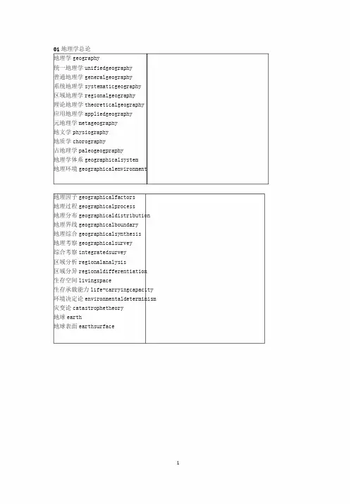
01地理学总论地理学geography统一地理学unifiedgeography普通地理学generalgeography系统地理学systematicgeography区域地理学regionalgeography理论地理学theoreticalgeography应用地理学appliedgeography元地理学metageography地文学physiography地质学chorography古地理学paleogeogpraphy地理学体系geographicalsystem地理环境geographicalenvironment地理因子geographicalfactors地理过程geographicalprocess地理分布geographicaldistribution 地理界线geographicalboundary地理综合geographicalsynthesis地理考察geographicalsurvey综合考察integratedsurvey区域分析regionalanalysis区域分异regionaldifferentiation生存空间livingspace生存承载能力life-carryingcapacity 环境决定论environmentaldeterminism 灾变论catastrophetheory地球earth地球表面earthsurface地球表层epigeosphere地理系统geosystem地理圈geographicalsphere景观圈landscapesphere岩石圈lithosphere水圈hydrosphere大气圈atmosphere土壤圈pedosphere生物圈biosphere地圈geosphere智能圈noonsphere技术圈technosphere北半球northernhemisphere南半球southernhemisphere地球体geoid地理纬度latitude地理经度longitude北极NorthPole南极SouthPole极圈ArcticCircle北回归线TropicofCancer南回归线TropicofCapricorn赤道equator时区timezone日界线dateline极昼polarday极夜polarnight洲continent大陆ocean洋sea内陆inland地理单元geographicalunit区划regionalization带belt地带zone区域region 地区area小区district02自然地理学自然地理学physicalgeography综合自然地理学integratedphysicalgeography普通自然地理学generalphysicalgeography自然综合体naturalcomplex地域自然综合体territorialnaturalcomplex自然地理过程physicalgeographicprocess自然生产潜力naturalpotentialproductivity进展因素progressivefactor残留因素relicfactor三维地带性threedimensionzonality水平地带horizontalzone垂直地带verticalzone地带性zonality非地带性azonality水平地带性horizontalzonality垂直地带性verticalzonality地方性locality坡向exposure阳坡adret,sunnyslope阴坡ubac,shadyslope山体效应Massenerhebungseffekt(德),综合自然区划integratedphysicogeographicalregionalization 雪带nivalbelt亚雪带subnivalbelt高山alpine亚高山subalpine山地mountains荒漠化desertification沙漠sandydesert岩漠rockydesert砾漠graveldesert泥漠argillaceousdesert盐漠saltdesert戈壁gobi绿洲oasis景观学landscapescience景观landscape相facies自然景观naturallandscape土地land土地系统landsystem土地分类landclassification土地类型landtype土地单元landunit土地要素landelement土地刻面landfacet刻面联合体facetcombination土地属性terraincharacteristics生态地理学ecogeography地生态学geoecology景观生态学landscapeecology生态系统ecosystem生态平衡ecologicalbalance生态区域ecoregion生态小区ecodistict生态地段ecosection生态区ecotope生态点ecosite自然资源naturalresources可再生资源renewableresources非可再生资源nonrenewableresources 灾害地理学hazardgeography自然灾害naturalhazard地貌学geomorphology地貌landform地貌年代学geomorphochronology地貌成因geomorphogenesis,landformgenesis 地貌形成作用landformformingprocess气候地貌学climaticgeomorphology动力地貌学dynamicgeomorphology地貌量计学geomorphometry人工地貌anthropogeniclandforms平原plain低地lowland高地highland丘陵hill山mountain山脉mountainrange,mountainchain岭range,ridge峰peak,mount山麓piedmont半岛peninsula岛屿island群岛archipelago海峡strait地峡isthmus海拔(高度)altitude,heightabovesealevel 相对高度relativeheight山嘴mountainspur盆地basin山间盆地intermountainbasin山间盆地intermountainbasin山峰mountainpeak崖cliff,scarp山麓平原piedmontplain高原plateau峡谷gorge,canyon谷valley沟谷ravine冲沟gully山形mountainforms山志orography阶地terrace台地tableland,platform洼地depression坡地slope坡度slope,gradient基岩bedrock地貌过程geomorphologicalprocess侵蚀[作用]erosion雨滴侵蚀raindroperosion剥蚀[作用]denudation刻蚀corrasion溶蚀corrosion冲刷wash,erosion片蚀sheeterosion溯源侵蚀headwarderosion下切侵蚀downcutting,incision,verticalerosion 侧[向侵]lateralerosion掏蚀undercutting侵蚀基[准]面baseleveloferosion总侵蚀基[准]面generalbaselevel 局部侵蚀基[准]面localbaselevel 裂点knickpoint沉积作用sedimentation,deposition堆积作用deposition,accumulation堆积物deposit加积作用aggradation沉积相sedimentaryfacies地貌世代generationoflandforms地貌序列landformsseries地形基面baselevel地貌组合landformassemblage正地貌positivelandform负地貌negativelandform正常地貌normallandform倒置地貌invertedlandform地貌倒置inversionoflandform刻蚀地貌erosionallandform夷平作用planationsurface夷平面peneplain准平面denudationsuface剥蚀面erosionsurface山麓[侵蚀]面pediment山麓侵蚀平面pediplain山顶面summitplane侵蚀循环erosioncycle回春作用rejuvenation相关沉积correlatedsediments地壳均衡isostasy新构造运动neotectonicmovement构造地貌学structuralgeomorphology,tectonicgeomorphology丹霞地貌“Danxia”landform构造高原structuralplateau构造阶地structuralterrace单面山cuesta(西)方山mesa猪背脊hogbackridge线形现象lineament断层崖faultscarp断层线崖fault-linescarp断层三角面triangularfacet断层谷triangularfacet断块山faultvalley火山blockmountain火山作用volcano风化[作用]weathering物理风化[作用]physicalweathering化学风化[作用]chemicalweathering生物风化[作用]biologicalweathering机械风化[作用]mechanicalweathering 差异风化[作用]differentialweathering 风化层regolith残积土residualsoil残积物eluvium残积层eluvium风化壳weatheredcrust8正残积风化壳orthoeluvialweatheredcrust碎屑型风化壳clasticweatheredcrust硅铝粘土型风化壳siallite-clayweatheredcrust硅铝碳酸盐型风化壳siallite-carbonateweatheredcrust硅铝-氧化物-硫酸盐风化壳siallite-chloride-sulphatewea-theredcrust 硅铝-铁质和富铝型风化壳siallite-ferriteandallitewea-theredcrustexfoliation,desquamation剥落exfoliation页状剥落crumbling块状崩落incrustation结壳作用crumbling块状崩落incrustation结壳作用talus盐屑堆taluscone盐屑锥山麓堆积talus坡积物slopedeposit坡水堆积物deluvium土体蠕动soilcreep滑塌collapse滑坡landslide,landslip泥石流debrisflow泥流mudflow岩崩rockfall流水地貌学fluvialgeomorphology流水地貌fluviallandform冲积物alluvium,alluvialdeposit冲积层alluvium冲积锥alluvialcone冲积扇alluvialfan洪积物proluvium,proluvialdeposit洪积层proluvium洪积扇proluvialfan河床riverbed河漫滩floodplain汇水区catchmentarea流域drainagearea,basin分水岭waterdivide,divide,watershed 辫状河braidedstream曲流meander天然堤naturallevee滨河床沙坝channelbar,sandbar凸岸坝pointbar牛轭湖ox-bowlake离堆山meandercore,meanderspur河流阶地riverterrace河流袭夺rivercapture河流错位riveroffset河流偏移riverdeflection风口windgap纵谷longitudinalvalley横谷transversevalley风蚀winderosion吹蚀deflation沙丘sanddune新月形沙丘crescentdune流动沙丘mobiledune,wanderingdune固定沙丘fixeddune半固定沙丘semifixieddune纵向沙丘longitudinaldune横向沙丘transversedune抛物线沙丘parabolicdune蜂窝状沙丘honeycombdunes沙垅sandridge风棱石wind-facetedstones,ventifact风蚀脊yardang沙暴sandstorm风蚀坑blowoutpit风蚀洼地deflationhollow干盐湖playa基岩扇rockfan岛山inselberg漠漆desertvarnish岩漆rockvarnish漠盖层desertpavement黄土loess黄土地貌loesslandform黄土塬“yuan,”loesstableland黄土梁“liang,”loessridge黄土峁“mao,”loesshill 劣地badland咯斯特karst咯斯特地貌学karstgeomorphology咯斯特地貌karstlandform咯斯特化karstification溶斗doline溶蚀谷polje溶蚀盆uvala落水洞sinkhole溶沟karren干谷dryvalley竖井shaft潜蚀作用undergrounderosion洞穴堆积cavedeposit咯斯特平原karstplain峰林peakforest石林stonepinacles洞穴学speleology假咯斯特pseudokarst类咯斯特parakarst泉华沉积sinterdeposition石灰华tufa海岸seacoast滨shore海岸地貌学coastalgeomorphology海蚀作用marineerosion海蚀龛wave-cutnotch海蚀洞seacave海蚀台abrasionplatform海蚀崖seacliff海蚀柱seastack岬角cape岩滩bench潮滩tidalflat潮汐通道tidalchannel,tidalinlet潮沟tidalcreek舄湖lagoon 三角洲delta河口湾estuary海滩coastalbeach滩脊beachridge滩脊[型]潮滩chenier滩脊[型]潮滩平原chenierplain 沙嘴sandspit障壁坝barrier滨外坝off-shorebar尖[形]滩cuspateforeland尖[形]坝tuspatebar 连岛坝tombolo陆连岛tomboloisland沿滨泥沙流longshoredrift海岸阶地coastalterrace,marineterrace全球性海面升降eustaticmovement珊瑚礁coralreef岸礁fringingreef堡礁barrierreef环礁atoll大陆架continentalshelf大陆坡continentalslope洋盆oceanicbasin海隆rise海岭oceanicridge平顶海山guyot海沟trench海渊abyssaldeep04气候学气候学climatology气候climate气候资源climateresources太阳辐射solarradiation反照射albedo积温accumulatedtemperature无霜期frost-freeperiod降水precipitation蒸发evaporation干燥度aridity热水平衡heat-waterbalance风向winddirection风速windspeed气候灾害climatedamage,climatichazard旱灾droughtdamage水灾flooddamage风灾winddamage雹灾haildamage湿害wetdamage热害heatdamage冻害freezingdamage冷害colddamage气候分类climaticclassification气候区划climaticregionalization气候带climaticzone气候区climaticregion气候型climatictype赤道带equatorialzone热带tropicalzone亚热带subtropicalzone温带temperatezone寒带coldzone湿润气候humidclimate干燥气候aridclimate热带雨林气候tropicalrainforestclimate 萨瓦纳气候savannaclimate森林气候forestclimate草原气候steppeclimate荒漠气候desertclimate苔原气候tundraclimate极地气候polarclimate高原气候plateauclimate山地气候mountainclimate大陆度continentality大陆性气候continentalclimate海洋性气候maritimeclimate地中海气候Mediterraneanclimate地形气候学topoclimatology区域气候regionalclimate地方气候localclimate小气候microclimate气候系统climaticsystem行星风系planetarywindsystem信风tradewind,trades季风monsoon梅雨Meiyu,,plumrain台风typhoon寒潮coldwave海陆风sea-landbreeze山谷风mountain-valleybreeze 干热风dry-hotwind焚风foehn雨影rainshadow气候变迁climaticchange古气候palaeoclimate历史气候historicalclimate 年轮气候学dendroclimatology 物候学phenology自然历naturalcalendar城市气候urbanclimate城市热岛urbanheatisland气候志climatography05水文地理学水文地理学hydrogeography水文学hydrology水体waterbody水团watermass河流学potamology水利学hydraulics水利经济学hydroeconomics水化学hydrochemistry森林水文学foresthydrology都市水文学urbanhydrology水文物理学hydrophysics古水文学palaeohydrology土壤水文学pedohydrology水文情势hydrologicalregime水文过程hydrologicalprocess水文测验hydrometry流域形态watershedmorphology流域分水线basindivide河道坡降channelgradient河道等级channelorder闭合盆地closedbasin 河网密度drainagedensity总蒸发evapotranspiration水平衡waterbudget,waterbalance陆面蒸发landevaporation水面蒸发watersurfaceevaporation分岔系数forkfactor河源headwaters水道网hydrographicnet支流tributary过程线hydrograph流量过程线分割separationofhydrograph瀑布waterfall水平降水horizontalprecipitation水循环watercycle水量交换waterexchange径流runoff径流系数runoffcoefficient年正常径流量annualnormalrunoff基流baseflow河床变形riverbeddeformation河流补给riverfeeding暴发洪水flashflood洪水flood流水过程fluvialprocesses层间流interaquiferflow壤中流interflow河流数目定律lawofstreamnumbers叠加定律lawofsuperposition流量discharge坡面流overlandflow洪峰流量peakdischarge产流runoffgeneration汇流flowconcentration产沙率rateofsedimentproduction 退水曲线recessioncurve径流模数runoffmodulus产水量wateryield悬移质suspendedload泥沙运动sedimentmovement产沙量sedimentyield水位waterstage洪水位floodlevel警戒水位warningstage水土流失waterandsoilloss水土保持waterandsoilconservation涝waterlogging暴雨径流stormflow输沙能力transportabilityofsediments 径流变率variabilityofrunoff地下水文学groundwaterhydrology承压地下水confinedgroundwater水力传导度hydraulicconductivity入渗infiltration土壤水soilwater含水层aquifer自流水盆地artesianbasin深层地下水deepphreaticwater裂隙水fissuredwater地下水位watertable矿泉mineralspring地下河undergroundriver饱和带saturationzone湖沼学limnology湖泊水文学lakehydrology湖流lakecurrent水质waterquality湖泊富营养化lakeeutrophication人工湖man-madelake盐湖saltlake咸水湖salt-waterlake淡水湖freshwaterlake构造湖tectoniclake,structurallake层结湖stratifiedlake季节性湖泊seasonallake火山湖volcaniclake高山湖alpinelake游移湖wanderinglake热湖warmlake微咸湖brackish-waterlake干涸湖extinctlake完全混和湖holomixedlake湖盆lakecirculation湖水环流lakecirculation湖泊蓄水量lakestorage冰川补给alimentationofglacier积雪水文学alimentationofglacier融雪水文学snowhydrology融雪径流snowrunoff有潮河口tidalestuary无潮海tidelesssea波浪侵蚀waveerosion地下水库groundwaterreservoir水资源waterresources供水Watersupply 水能hydropower06生物地理学生物地理学biogeography生物分布学chorology生物分布biochores分布区areal分布区中心areakcenter分布区间断arealdisjunction 分布区型arealtype扩散中心dispersalcenter残遗种区refugium种群population生物群biota生物地理群落biogeocoenosis 生境habitat小生境niche,microhabitat 群落生境biotope植物地理学phytogeography 植物区系flora生活型lifeform生活型谱lifeformspectrum 水生植物hydrophyte湿生植物hygrophyte中生植物mesophyte旱生植物xerophyte指示植物indicatorplant指示群落indicatorcommunity 植被vegetation植物群落plantcommunity群丛association群系formation植被型vegetationtype顶级群落climax演替succession针叶林coniferousforest泰加林taiga落叶林deciduousforest常绿阔叶林evergreenbroad-leavedforest硬叶林sclerophyllousforest照叶林laurelforest季[风]雨林monsoonforest 雨林rainforest红树林mangrove苔原tundra森林草原foreststeppe草原steppe高草草原prairie萨瓦纳savanna普那高原puna草甸meadow高山矮曲林alpinekrummholz森林上限upperforestlimit树线timberline动物地理学zoogeography动物区系fauna地理阻障geographicalbarriers动物传布synzoochory 华莱士线wallace’sline动物群落animalcommunity泛北极Holarctic古北界Palaearctic新北界Neoarctic旧热带界Palaeotropic新热带界Neotropic东洋界Oriental澳洲界Australasian土壤地理学pedogeography 土被soilmantle土链soilcatena土壤组合soilassociation 土壤复区soilcomplex土壤气候soilclimate土壤资源soilresources土壤退化soildegradation 土壤侵蚀soilerosion古土壤paleosoil森林土壤forestsoil草原土壤desertsoil荒漠土壤desertsoil高山土壤highmountainsoil 幼年土壤youngsoil成熟土壤maturesoil顶级土壤climaxsoil灰化土podzolicsoil棕壤brownearth褐土cinnamonsoil黄壤yellowearth红壤redearth砖红壤laterite黑钙土chernozem栗钙土chestnutsoil棕钙土brownsoil灰漠土graydesertsoil棕漠土browndesertsoil盐土solonchak碱土solonertz化学地理学chemicalgeography景观地球化学landscapegeochemistry地球化学景观geochemicallandscape自成景观autonomiclandscape从属景观auxiliarylandscape残积景观eluviallandscape水上景观superaquallandscape水下景观subaquallandscape水成景观aqueouslandscape,aquallandscapeelementarylandscape 单元景观biogeniclandscape生源景观abiogeniclandscape非生源景观aerialmigration大气迁移aqueousmigration水迁移biologicalmigration生物迁移mechanicalmigration机械迁移chemicalmigration,physico-chemical化学迁移migrationtypomorphicelement 标型元素typomorphiccompound标型化合物typomorphicion标型离子chemicaldenudation化学剥蚀环境地理学environmentalgeography环境地球化学environmentalgeochemistry 自然环境naturalenvironment社会环境socialenvironment区域环境regionalenvironment海洋环境marineenvironment环境系统environmentalsystem环境结构environmentalstructure环境要素environmentalelement环境演化environmentalevolution环境背景值environmentalbackgroundvalue 环境异常environmentalabnormality环境自净environmentalself-purification环境容量environmentalcapacity景观损害landscapedamage环境退化environmentaldegradation环境效应environmentaleffect环境污染environmentalpollution大气污染atmosphericpollution水污染waterpollution土壤污染soilpollution海洋污染marinepollution环境经济environmentaleconomy环境管理environmentalmanagement环境标准environmentalstandard环境质量environmentalquality环境质量参数environmentalqualityparameter环境质量指数environmentalqualityindex环境质量评价environmentalqualityevaluation环境影响评价environmentalimpactassessment环境质量综合评价environmentalqualitycomprehensiveevaluation 环境保护environmentalprotection环境规划environmentalplanning环境区划environmentalregionalization环境设计environmentaldesign自然保护conservationofnature自然保护区naturereserve自然资源保护conservationofnaturalresources生物资源保护livingresourcesconservation水资源保护protectionofwaterresources国家公园nationalpark地面沉降landsubsidence公害publicnuisance公害病publicnuisancedisease水悮病minamatadisease痛痛病itai-itaidisease11冰川学冰川学glaciology积雪snowcover粒雪firn粒雪化作用firnification粒雪盆firnbasin雪线snowline吹雪snowdrift雪崩avalanche雪蚀nivation陆冰landice冰山iceberg冰川glacier冰盖icesheet冰原icefield冰川化glacierization冰川作用glaciation冰川物质平衡glaciermass-balance 消融区ablationarea积累区accumulationarea冰川隙crevasse冰川地质学glacialgeology角峰horn冰斗cirqueU形谷U-shapevalley鼓丘drumlin羊背石rochemoutonnee冰擦痕glacialstria冰川河流glacialstream冰下河道subglacialchannel漂砾boulder纹泥varve海洋性冰川maritimeglacier大陆性冰川continentalglacier 极地冰川polarglacier山岳冰川mountainglacier冰斗冰川cirqueglacier悬冰川hangingglacier冰川变化glacialfluctuation 冰川退缩deglaciation冰期iceage小冰期littleiceage新冰期neoglaciation冰期后post-glacial间冰期interglacialperiod冷圈cryosphere冷圈学cryology12冻土学冻土学geocryology,cryopedology冻土frozenground融土meltedsoil季节冻土seasonalfrozenground多年冻土permafrost高山冻土alpinepermafrost冻土动力学permafrostdynamics冻土退化permafrostdegradation冻土进化permafrostaggradation富冰冻土icepermafrost冻结层中水interpermafrostwater冻土相分析permafrostphase-analyses冻融循环freeze-thawcycles冻结指数freezingindex融化指数thawingindex零点幕zerocurtain成冰作用iceformation冰胶结cementice冰分凝segregatedice地下水groundice冰透镜体icelens冰含量icecontent冻胀frostheaving冻胀力frostheavingforce冰缘periglacial寒冻风化cryogenicweathering,frostweathering 热喀斯特thermokarst热喀斯特湖thermokarstlake冰锲icewedge翻浆frostboilWORD格式13沼泽学沼泽学mirescience沼泽mire,swamp盐沼saltmarsh草甸沼泽meadowmarsh苔藓沼泽sedgemarsh,芦苇沼泽reedmarsh,phragmitesmarsh藓类沼泽massbog颤沼quakingmire,floatingmire林地沼泽forestmarsh红树林沼泽mangroveswamp海滨沼泽coastalmarsh滩地沼泽fluvialmarsh阶地沼泽terracemarsh平原沼泽plainmarsh高山沼泽plateaumarsh山地沼泽mountainmire,uplandmire沼泽形成过程mireformationprocess沼泽水文mirehydrology,peatlandhydrology沼泽植物mireplant低位沼泽fen中位沼泽transitionalmire高位沼泽raisedbog富营养沼泽eutrophicmire中营养化沼泽mesotrophicmire贫营养化沼泽oligotrophicbog沼泽化paludification沼泽生态系统mireecosystem沼泽率mirearea泥炭peat湿地wetland30专业资料整理。
地理环境:地理环境可分为自然环境、经济环境和社会文化环境三类。
三种地理环境在地域上和结构上互相重叠,相互联系,从而构成统一整体的地理环境。
自然环境自然环境由地球表层中的无机和有机的。
静态和动态的自然界各种物质和能量组成,具有地理结构特征并受自然规律控制。
根据其受人类社会干扰的程度不同,分为天然环境(或原生自然环境:只受人类间接或轻微影响,而原有自然面貌未发生明显变化的自然地理环境。
和人为环境(或次生自然环境:经受人类直接影响和长期作用之后,自然面貌发生重大变化的地区。
)。
经济环境:经济环境是指自然条件和自然资源经人类利用改造后形成的生产力地域综合体,包括工业、农业、交通、城镇居民点等各种生产力实体的地域配置条件和结构状态。
社会文化环境:社会文化环境,包括人口、社会、国家、民族、民俗、语言、文化等地域分布特征和组成结构,还涉及各种人群对周围事物的心理感应和相应的社会行为。
自然地理学(Physical Geography)自然地理学研究地球表面物质系统及其要素的组成、结构、功能、空间特征、时间特征以及各要素之间的相互作用的机理。
根据自然地理学的研究对象的复杂性和对其研究的领域分化,目前,自然地理学主要有以下分科:部门自然地理学(Sectional Physical Geography)分别研究组成地球表层物质系统的各种自然要素与过程本身,强调以某个要素为核心的分析与综合,包括的学科主要有地貌学、气候学、水文地理学、动(植)物地理学、土壤地理学等。
区域自然地理学(Regional Physical Geography)研究地球表层物质系统的某个地域组合的自然特征与过程,强调具体区域的个体性。
综合自然地理学(Integrated Physical Geography)主要研究地球表层物质系统的形成历史、现代过程、类型特征、地理分异和发展演变,它是自然地理学的理论研究部分,强调综合性。
自然地理环境:一个庞大的物质系统、组成包括:自然地理环境的各种物质、能量以及在能量支配下物质运动所构成的各种动态需同。
自然地理学气候学1、气象学气象属于自然地理吗1、气象学定义:研究大气及其物理现象的科学.随着研究领域的扩大,20世纪60年代气象学已发展为大气科学.所属学科:大气科学(一级学科);大气(二级学科);2、自然地理学定义:研究自然地理环境各种要素及其相互关系,阐明自然地理环境的结构、功能、物质迁移、能量转换、动态演变以及地域分异规律的学科.所属学科:地理学(一级学科);自然地理学(二级学科).3、地理学不限于研究地球表面的各个要素,更重要的是把它作为统一的整体,综合地研究其组成要素及它们的空间组合.它着重于研究各要素之间的相互作用、相互关系以及地表综合体的特征和时、空变化规律.地理学的综合性研究分为不同的层次,层次不同,综合的复杂程度也不同.高层次的综合研究,即人地相关性的研究,是地理学所特有的.4、气象学研究的是整层大气,即研究大气本身,相对较为单一;而地理学(自然地理部分)研究的是大气对流层,非整层大气,更注重各个要素(并非只有大气单一要素),并作为统一的整体来研究.5、气候学应是地理学与气象学的交叉学科,各有所长——气象学更注重气象要素多年变化的成因以及年际周期规律,相对单一细致;地理学更注重气候的空间分布,气候与其他地理要素之间的相互作用或响应关系,及其与人类的相互关系,相对更为综合.如果非要说气候属于哪一门学科,个人才疏学浅,个人认为单就“气候”而言,自然地理学研究的内容要比大气科学(气象学)稍多一些.2、自然地理学学什么自然地理学的研究对象是自然地理环境,包括只受到人类间接或轻微影响,而原有自然面貌未发生明显变化的天然环境,和长期受到人类直接影响而使原有自然面貌发生重大变化的人为环境。
自然地理环境是指地球表面,具有一定厚度的圈层,即岩石圈、水圈、大气圈、生物圈相互作用、相互渗透的区间内的一个特殊圈层。
它是在太阳辐射能、地球内能和生物能作用下形成的,比地球的其他圈层的特征要复杂得多。
在这里各种固体、液体、气体状态的物质同时稳定地存在并且相互渗透。