A crop phenology detection method using time-series MODIS data
Toshihiro Sakamoto *,Masayuki Yokozawa,Hitoshi Toritani,Michio Shibayama,
Naoki Ishitsuka,Hiroyuki Ohno
Department of Global Resources,National Institute for Agro-Environmental Sciences,3-1-3,Kannondai,Tsukuba,Ibaraki,305-8604,Japan
Received 12July 2004;received in revised form 2March 2005;accepted 5March 2005
Abstract
Information of crop phenology is essential for evaluating crop productivity and crop management.Therefore we developed a new method for remotely determining phenological stages of paddy rice.The method consists of three procedures:(i)prescription of multi-temporal MODIS/Terra data;(ii)filtering time-series Enhanced Vegetation Index (EVI)data by time-frequency analysis;and (iii)specifying the phenological stages by detecting the maximum point,minimal point and inflection point from the smoothed EVI time profile.Applying this method to MODIS data,we determined the planting date,heading date,harvesting date,and growing period in 2002.And we validated the performance of the method against statistical data in 30paddy fields.As for the filtering,we adopted wavelet and Fourier transforms.Three types of mother wavelet (Daubechies,Symlet and Coiflet)were used in Wavelet transform.As the results of validation,the wavelet transform performed better than the Fourier transform.Specifically,the case using Coiflet (order=4)gave remarkably good results in determining phenological stages and growing periods.The root mean square errors of the estimated phenological dates against the statistical data were:12.1days for planting date,9.0days for heading date,10.6days for harvesting date,and 11.0days for growing period.The method using wavelet transform with Coiflet (order=4)allows the determination of regional characteristics of rice phenology.We proposed this new method using the wavelet transform;Wavelet based Filter for determining Crop Phenology (WFCP).
D 2005Elsevier Inc.All rights reserved.
Keywords:Wavelet transform;MODIS;Phenological stage;Paddy field;Remote sensing
1.Introduction
Monitoring seasonal changes in vegetation activity and crop phenology over wide areas is essential for many applications,such as estimation of net primary production (Kimball et al.,2004),deciding time boundary conditions for crop yield modeling (Bauman et al.,2001)and supporting decisions about water supply (Digkuhn &Gal,1996).Identifying crop phenological stages from Moderate Resolution Imaging Spectroradiometer (MODIS)data may enable us to estimate crop growth under various regional weather conditions.For example,cool summers result in
delayed heading and thus decreased rice yields (Mahmood,1997;Wilson et al.,1995).
Remote sensing is often used for detecting seasonal vegetation changes.Various methods using daily Normal-ized Difference Vegetation Index (NDVI)data have been developed for monitoring crops and natural vegetation (Akiyama et al.,2002;Saito et al.,2002;Xiao et al.,2002).Jakubauskas et al.(2002)applied harmonic analysis to NDVI data from the US National Oceanographic and Atmospheric Administration’s Advanced Very High Reso-lution Radiometer (NOAA/A VHRR)and developed an innovative technique for identifying crop type from amplitude and phases of decomposed component.They stated that the application of harmonic analysis to time-series data is useful for detecting changes of land use and land cover,such as at planting and harvest.Several studies of forest phenology using MODIS data have also been
0034-4257/$-see front matter D 2005Elsevier Inc.All rights reserved.doi:10.1016/j.rse.2005.03.008
*Corresponding author.
E-mail address:sakamt@niaes.affrc.go.jp (T.Sakamoto).
Remote Sensing of Environment 96(2005)366–
374
https://www.doczj.com/doc/5b13144645.html,/locate/rse
made.Kang et al.(2003)used30-year mean air temper-ature and MODIS/leaf area index(LAI)data to detect the onset of vegetation greenness in Korea.Their results suggested that the phenological stages can be detected more precisely through a combination of climatic data and MODIS data.Zhang et al.(2003)identified phenological dates by finding points on the time profile curve of the Vegetation Index(VI)where the rate of curvature is maximum.
In general,time-series NDVI data obtained by satellite include various noise components such as aerosols and bidirectional reflectance distribution factors. Thus,noise reduction or fitting a model to observed data is necessary before phenological stages can be deter-mined.Tools for such preprocessing include smoothers such as polynomial and median filters(VanDijk et al., 1987),a moving window to select the local maximum VI(Viovy et al.,1992),Temporal Window Operation (TWO;Park et al.,1999),and logistic curve fitting (Zhang et al.,2003);for a review see Reed et al. (2003).
Several frequency analysis studies have used the Fourier transform for separating the high-frequency components of noise and the low-frequency components of seasonal changes of VI(Azzali&Menenti,2000;Roerink et al., 2000;Viovy et al.,1992).Sawada et al.(1999,2000) developed the Local Maximum Fitting method by applying the Fourier transform to10-day composite data of NOAA/ A VHRR NDVI to reconstruct a cloud-free seasonal profile of NDVI.Hara et al.(2003)modified that method and applied it to10-day composite data of SPOT-VEGETA-TION NDVI.
The wavelet transform also can be used to remove noise.Its strength is the feasibility of identifying the timing of events such as localized objective signals in the presence of noise.The wavelet transform has been used for estimating forest LAI and for canopy closure mapping from EO-1hyper-spectral data(Koger et al.,2003),and for detecting the interannual variability of NOAA/ A VHRR NDVI and its relationship with El Nin?o/Southern Oscillation Index(Li&Kafatos,2000).However few studies have used the wavelet transform for smoothing temporal VI data and for detecting crop phenological stages.The wavelet transform retains time components when transforming time-series data,and so can reproduce seasonal changes of vegetation without losing the temporal characteristics.In contrast,the trigonometric functions used in the Fourier transform are not localized in the time domain,and therefore the time component of the input data is averaged after the transforming process. Thus,we assumed that the wavelet transform could divide the noise components and reconstruct the seasonal VI time profile better than the Fourier transform.We used statistics of phenological stages of paddy rice to compare the performance of our method using the wavelet and Fourier transforms.2.Materials and methods
2.1.Wavelet and Fourier transforms
Time-series VI data filtered by methods using linear interpolation,such as the BISE(Viovy et al.,1992)and TWO methods(Park et al.,1999),have discontinuities with respect to first derivative,and the rates of increase and decrease of the interpolated data stay constant.Thus, it is hard to identify the crop growth stages by using inflection point or minimal point.Filtering methods using the Fourier or wavelet transform can reduce noise with reflecting the periodicity of seasonal vegetation change. The filtered VI data are continuous,and the inflection point and maximum point can be detected for delimiting growing seasons.We compared the Fourier and wavelet transforms as filtering methods in the identification of rice phenological stages from daily VI changes.
The wavelet transform is widely used; e.g.,in the analysis of long-term variability of air temperature(Khan et al.,2004),noise reduction in lidar signals(Fang& Huang,2004),and analysis of the variability of vegetation (Li&Kafatos,2000).
The function f(x)is transformed in the wavelet transform as follows:
W f a;b
eT?
ZtV
àV
f xeT
1
???a p w xàb a
dx;e1T
where a is a scaling parameter,b is a shifting parameter,and C implies a mother wavelet.In discrete form,parameters a and b are given as follows:
a;b
eT?2j;2j k
àá
;e2Twhere j and k are integers.
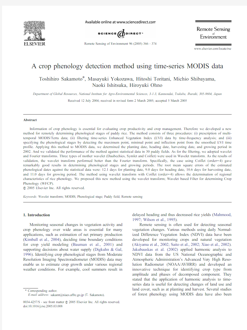
A wavelet is a small,localized wave in time or space and here satisfies the orthogonal condition.Since a wavelet has compact support,which means that its value becomes0 outside a certain interval of time(Fig.1),the time components of time-series data can be maintained during wavelet transformation.
The function f(x)is decomposed to linear combinations of wavelet functions in the multi-resolution approximation formula:
f xeT?f j xeTt
g j xeTt>tg1xeT;e3T
where the function f j(x)implies the approximate expression in level j,and g j(x)implies the high-frequency components in level j.
On the other hand,the Fourier transform decomposes a function f(x)to the frequency domain by a linear combi-nation of trigonometric functions as follows:
F x
eT?
ZtV
àV
f xeTeài x x dx;e4T
where x is frequency and F(x)is the Fourier coefficient with frequency x.
T.Sakamoto et al./Remote Sensing of Environment96(2005)366–374367
It is customary to use a discrete form as follows:
F k eT?
1N X N
à1n ?0
f i e à2p kni N Te;e5T
where k =0,1,2,...N à1,and N is the total number of input data.
We used wavelet transform and Fourier transform subroutines implemented in the Interactive Data Language (IDL:Research Systems Inc https://www.doczj.com/doc/5b13144645.html,A).2.2.Data description
2.2.1.Satellite data
The MODIS data (acquired in 2002)were provided by the EOS Data Gateway (EOS,2004).The product name is ‘‘MODIS/Terra surface reflectance 8-day Global 500m SIN GRID v004’’.The product was composed so as to have the lowest value of band 3over every 8days (Vermote &Vermeulen,1999).In addition,the product had already been systematically corrected for the effects of gaseous and aerosol scattering.Each pixel includes the ground reflec-tance ratio.Even with correction,the effects of the Bi-directional Reflectance Distribution Function (BRDF)on VI remained as noise.Time-series analysis is necessary in order to reduce the remaining noise.The observation date and sensor zenith angle of each pixel were accounted for in this study to cut out misleading data.
2.2.2.Statistical data and digital national land information Statistical data provided by the Ministry of Agriculture,Forestry and Fisheries (MAFF)of Japan were used as ground-truth data.The MAFF divides Japanese agricultural land into about 150cropping zones,each with an area of about 2600km 2.The planting,heading,and harvesting seasons in each cropping zone are recorded in the statistical
data.Each phenological season is defined by three dates:the beginning,peak,and end.We used these data to assess the performance of our new method for detecting phenological stages observed in 2002.
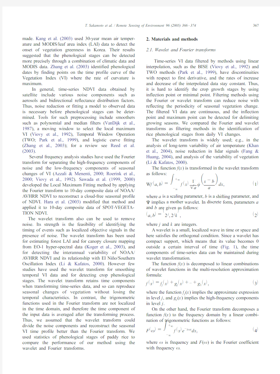
Digital national land information was published by the Ministry of Land,Infrastructure and Transportation of Japan (MLIT,1997)for national land planning,in which Japan is divided into a grid of 30s in latitude by 45s in longitude (ca.1?1km).Each grid includes areas of paddy fields,upland fields,forest,wasteland,buildings,roads and rail-roads,rivers and lakes,seaside,sea,golf courses,and other types.Referring to this information,we selected 30test sites from grids where the land coverage of paddy fields is more than 90%(Fig.2).
2.3.Prescription of multi-temporal satellite data
2.3.1.Vegetation index
The Enhanced Vegetation Index (EVI)can be linearly correlated with the leaf area index,and has a higher sensitivity than that of NDVI in high biomass areas (Huete et al.,2002).Since the biomass of paddy fields is low compared with forests,EVI retains linearity in paddy fields.Therefore EVI can be used to evaluate the process of paddy growth adequately with a wide dynamic range.Furthermore,EVI is more practical than NDVI when humidity is high.Since the rice growing stage falls in the rainy season when humidity is high,EVI is a more practical than NDVI for monitoring the paddy fields in Japan.Therefore,we used EVI in our method.
2.3.2.Removing data affected by thick clouds,and sensor zenith angle
Even though the available satellite data were corrected for the effects of aerosols,thick clouds veiling a pixel for 8days make it impossible to correct the surface reflectance of
0Time
F r e q u e n c y
246
Fig.1.Wavelet function (Coiflet 4)and sine function.
T.Sakamoto et al./Remote Sensing of Environment 96(2005)366–374
368
that pixel.To remove data affected by thick clouds,pixels whose band 3reflectance was more than 10%were removed as abnormal data.
The MODIS data used here had already been resampled systematically to a uniform spatial resolution (500m).However,in raw data before geometric conversion,the spatial resolution of a pixel depends on the sensor zenith angle.The larger the sensor zenith angle of a pixel,the lower the ground resolution of that pixel.For this reason,a VI with a broad sensor zenith angle includes a strong neighbor effect.It is essential to consider this effect of sensor zenith angle on the detection of phenological stage.We used the threshold of the sensor zenith angle to remove pixels with lower resolution,which give misleading results in time-series analysis.Because the grid resolution of the digital land-use map is about 1km,we defined the threshold of the sensor zenith angle as 32.25-(ca.750m).Pixels with a sensor zenith angle of more than 32.25-were removed.2.3.3.Data regulation
The number of elements in the input data array should be a power of 2for both wavelet and Fourier transforms.To make an input array with 2048elements,we used a year’s VI data continuously and recursively to fill the array in observational date order.Missing data were linearly interpolated.We used 365elements of the output array
from the 730th to the 1094th as the smoothed time profile of EVI.We used this processing to avoid the aliasing effect.2.4.Noise reduction and reconstructing the EVI profile with wavelet transform
The discrete wavelet transform can decompose time-series EVI data into scaled and shifted wavelets over a discrete set of scales.We assumed that the frequency of noise components in time-series EVI data is higher than that of the seasonal change of VI in paddy fields.Therefore,the smoothed time profile of EVI was reconstructed by using specific frequency components.According to the statistical data,the growing period of rice is generally 90to 160days in Japan.To reflect a seasonal change of VI,components with a frequency lower than 128(=27)should be taken.Furthermore,components with a frequency higher than scale 64(=26)should be reduced in order to avoid errors caused by abnormal data.These data were not removed in preprocessing and so prevented us from precisely determin-ing the date of peak VI around the heading season.In addition,components with a frequency lower than scale 32(=25)should be used for identifying the abrupt change in time-series VI data around the planting and harvesting seasons.We derived a smoothed time profile of EVI by averaging two time profiles,one reconstructed with
the
Fig.2.Locations of the 30test sites.
T.Sakamoto et al./Remote Sensing of Environment 96(2005)366–374369
lower-frequency components divided by scale64,the other with the lower-frequency components divided by scale32. Three types of mother wavelets were used:Daubechies (1988)(order=2–24),Coiflet(1–5),and Symlet(4–15).
2.5.Noise reduction and reconstructing the EVI profile with Fourier transform
In using the discrete Fourier transform,the input array of the time-series EVI data is divided into10discrete frequencies.The length of these frequencies is a power of 2.In the same way as with the discrete wavelet transform, the smoothed time profile of EVI was derived by averaging two time profiles of EVI,decomposed by wavelengths of64 and128,corresponding to scales32and64.
3.Threshold for detecting phenological stages
3.1.Heading date
According to time-series data of the spectral reflectance of paddy fields(Shibayama&Akiyama,1989),the maximum NDVI appears around the heading date.The reason for this is that the rice changes its growth phase from vegetative growth to reproductive growth on reaching the heading date,and leaves begin to wither and die.Therefore, we assumed that the smoothed time profile of EVI also shows a peak on the heading date.We defined the date of the maximum EVI in the time profile as the estimated heading date.
3.2.Planting date
In general,paddy fields are plowed and flooded before rice planting.The VI of paddy fields decreases during this period and then increases again after rice planting.Thus,for detecting the planting date from the smoothed time profile of EVI,we defined the following procedure for determining the planting date:(i)the minimal point(the first derivative equals0and changes from negative to positive at this point) or inflection point(the second derivative equals0and changes from negative to positive at this point)earlier than 60days from the estimated heading date was identified; then,(ii)the later one of these two points was automatically taken as the estimated planting date.The reason why two such discriminative points were used together for detecting the planting date is that the amount of biomass in the planting season is much less than that at the other phenological stages and it was difficult to detect subtle changes in EVI by only one discriminative point.
3.3.Harvesting date
After the heading season,VI in paddy fields begins to decrease as leaves wither and die.It then decreases abruptly because of harvesting.Therefore,the date of an inflection point(the second derivative equals0and changes from positive to negative)later than30days after the estimated heading date was defined as the estimated harvesting date.
4.Results and discussion
4.1.Validation with statistical data
Table1shows the performance of the method using the wavelet and Fourier transforms for detecting the pheno-logical stages and growing period.There was no significant difference between using the wavelet and Fourier transforms in the heading and harvesting dates.However,in determin-ing the planting date,the performance of the method using the wavelet transform was superior to that using the Fourier transform.The maximum difference of the root mean square error(RMSE)for estimating the planting date was5.1days between them.For estimating the growing period,the maximum difference was7.0days.This difference in estimating the growing period resulted mainly from the difference in estimating the planting date.Among the mother wavelets tested here,Coiflet4gave the best estimate.
The estimated phenological stages and the statistical data are compared in Figs.3and4.Table2indicated the number of cases that the estimated dates were within the period from beginning to end of each phenological season in statistical data.Fig.4shows the differences between the estimated phenological date and peak of phenological season in statistical data.The error of estimated planting date with the wavelet transform was smaller than that with the Fourier transform by5.1days in RMSE(Table.1).The number of cases in which the estimation error exceeded T16days when using the wavelet transform were:3(10%)in planting date, 2(7%)in heading date,1(3%)in harvesting date and6 (20%)in growing period.On the other hand,when using the Table1
Comparison of root mean square error(RMSE)of the estimated phenological date and growing period against the statistical data
Mother wavelet Growing
period
Planting
date
Heading
date
Harvesting
date Daubechies911.714.59.112.7 Daubechies1311.814.49.011.8 Daubechies1712.515.29.011.2 Symlet613.513.29.613.1 Symlet1213.913.79.611.1 Symlet1413.514.19.310.7 Coiflet314.012.59.412.4 Coiflet411.012.19.010.6 Coiflet511.013.79.010.1 Fourier18.017.28.811.5
The best three results of each mother wavelet are listed.
The number after the name of the mother wavelet indicates the order number.
T.Sakamoto et al./Remote Sensing of Environment96(2005)366–374 370
Fourier transform,those were:11(37%)in planting date,2(7%)in heading date,4(13%)in harvesting date and 8(27%)in growing period.Except for heading date,these numbers when using the wavelet transform were smaller than that using the Fourier transform.
The performances of these methods for estimating the growing period are compared in Fig.5.The maximum estimation error with the Fourier transform (51days)is much more than that with the wavelet transform (à25days),owing to the localized characteristics of the wavelet transform.The wavelet transform can detect localized changes separately in the time domain.In contrast,the trigonometric function of the Fourier transform is not localized in the time domain.Hence,the Fourier
transform
https://www.doczj.com/doc/5b13144645.html,parison between statistical data and the dates of phenological stages estimated by methods using the wavelet and Fourier transforms.
Day of year in Statistics
D O Y i n
E s t i m a t i c
Fig.4.One-to-one comparison between statistical data and phenological dates estimated by methods using the wavelet and Fourier transforms.DOY=day of
year.
T.Sakamoto et al./Remote Sensing of Environment 96(2005)366–374371
causes errors that occur in separate positions to interfere.Since the planting and harvesting dates estimated by using the wavelet transform did not include these errors,the growing period estimated by using the wavelet transform was also superior to that estimated by using the Fourier transform.
The method using the wavelet transform (Coiflet order =4)showed the best result.The RMSEs of the growing period and each phenological stage were around 12days.We believe that the good accuracy of our method is sufficient for discrimination of rice phenology in regions where dates are not available.However,for use in crop yield models,we consider that the RMSE of the estimated planting date (12.1days)was inadequate and has to be improved.
4.2.Smoothed time profile of EVI
The smoothed time profiles of EVI generated by both transforms are shown in Fig.6.These time profiles show the same seasonal tendency as the original EVI data.The changes around the planting season in the second derivative of time profiles of the EVI generated by wavelet transform
are larger than those by Fourier transform.The dates of the minimal and inflection points differed between profiles from wavelet and Fourier transforms (Fig.6).In addition,local changes in the time component around the planting season were blurred in the Fourier transform (Fig.6).The Fourier transform inadequately represents the appropriate position of the minimal and inflection points in the time domain.In the filtering process,the wavelet transform can hold the time component of temporal EVI data,but the Fourier transform cannot.We assumed that these character-istics of the time component in temporal EVI data led to the difference in accuracy.We believe that the filtering method using the wavelet transform is much more sensitive to vegetation seasonal changes than that using the Fourier transform.
4.3.Detecting the phenological stages on a regional scale The mixed pixel effect and topography may affect the spectral characteristics in satellite image.However,we focused on areas where most of each grid is used as paddy fields.Generally such areas are located on plains formed by alluviation.Therefore,there is little topographic and mixed pixel effect on the results.
The area of a parcel of paddy fields is less than about 5000m 2in Japan.The 500-m resolution of MODIS data is too coarse to show an individual parcel.Given that our objective in this study is to estimate the regional character-istics of rice phenology,it is appropriate to use MODIS data with a 500-m resolution for monitoring paddy fields on a regional scale.Additionally,compared with the
Growing period in Statistics
G r o w i n g p e r i o d i n E s t i m a t i c
1:1
Fig.5.One-to-one comparison between statistical data and growing periods estimated by methods using the wavelet and Fourier transforms.
Table 2
Number of cases that the estimated dates are within the period from beginning to end of each phenological seasons in statistical data
Wavelet analysis (Coiflet 4)
Fourier analysis Planting date 19(63%)14(47%)Heading date 26(87%)24(80%)Harvesting date
26(87%)
26(87%)
T.Sakamoto et al./Remote Sensing of Environment 96(2005)366–374
372
resolution of NOAA/A VHRR (ca.1.1?1.1km)and SPOT/VEGETATION (ca.1?1km),the resolution of the MODIS image is higher and offers an advantage in determining regional crop phenology.
5.Conclusions
We have developed a new systematic method for detecting the phenological stages of paddy rice from time-series MODIS data.The method consists of three proce-dures:(i)prescription of multi-temporal satellite data;(ii)filtering the time-series EVI data;and (iii)specifying the phenological stages from the smoothed EVI time profile.Our method can determine the planting,heading,and harvesting dates in paddy fields.The estimation was validated against statistical data from 30test sites.In filtering to reduce noise,the wavelet transform using Coiflet 4gave the best time profile of the EVI for detecting the phenological stages.Finally we proposed this new method using the wavelet transform:Wavelet based Filter for determining Crop Phenology (WFCP).
As crop calendars are not available in many regions,WFCP is particularly useful for determination of regional characteristics of rice phenology.We believe that WFCP has potential applicability to other crops and some natural vegetation,whose EVI profile has an obvious peak with a bell-shape (e.g.,wheat,deciduous forest,grassland).How-ever the mother wavelet used and the threshold for determination of phenological stages will depend on the species.
This study confirms that WFCP can be applied to MODIS data with 500-m resolution for determination of rice phenological stages over wide areas and can build a smoothed EVI profile in paddy fields.In the near future,we
will release a map of rice phenology in East Asia,revealing the relationship between seasonal changes in rice growth and regional characteristics of climatology.At the moment,various problems including the mix-pixel effect https://www.doczj.com/doc/5b13144645.html,ing MODIS/Aqua data (acquired after July 2002)together with MODIS/Terra data could improve the accu-racy of our method.
Acknowledgements
We would thank three anonymous reviewers for their valuable comments.Statistical data were provided by the Production,Marketing,and Consumption Statistics Division of the Statistics Department,Ministry of Agriculture,Forestry and Fisheries of Japan.This study was funded by MAFF.References
Akiyama,T.,Kawamura,K.,Fukuo,A.,&Chen,Z.Z.(2002).Sustainable
grassland management using GIS,GPS and remote sensing data in Inner Mongolia.In S.Uchida,C.Youqi,&G.Saito (Eds.),Application on remote sensing technology for the management of agricultural resources (pp.13–19).Beijing ’China Agricultural Scientech Press.Azzali,S.,&Menenti,M.(2000).Mapping vegetation–soil –climate
complexes in southern Africa using temporal Fourier transform of NOAA-A VHRR NDVI data.International Journal of Remote Sensing ,21,975–996.
Bauman,B.,Kropff,M.,Tuong,T.,Wopereis,M.,Berge,H.,&Laar,H.
(2001).ORYZA2000:Modeling lowland rice .Manila,Philippines ’IRRI.
Daubechies,I.(1988).Orthonormal bases of compactly supported wavelets.
Communications on Pure and Applied Mathematics ,41,909–996.Digkuhn,M.,&Gal,P.(1996).Effect of drainage date on yield and
dry matter partitioning in irrigated rice.Field Crops Research ,46,117–126.
-0.2
-0.100.10.20.3
0.40.50.60306090120150180210240270300330360
Day of year (in 2002)
E V I
using wavelet analysis
using fourier analysis
raw data which were not used in frequency analysis selected data by using threshold of the sensor angle
planting season heading season harvesting season
Planting date with fourier analysis
Planting date with wavelet analysis
Heading date with wavelet analysis
Heading date with fourier analysis
Harvesting date with fourier analysis
Harvesting date with wavelet
Fig.6.Original EVI data and time profile smoothed by the wavelet and Fourier transforms for data from Shiga-Kohoku (see Fig.1).
T.Sakamoto et al./Remote Sensing of Environment 96(2005)366–374
373
EOS(2004).NASA Earth Observing System data gateway Available at: https://www.doczj.com/doc/5b13144645.html,/pub/imswelcome/.
Fang,H.,&Huang,D.(2004).Noise reduction in lidar signal based on discrete wavelet transform.Optics Communications,233,67–76. Hara,M.,Okada,S.,Yagi,H.,Moriyama,T.,Shigehara,K.,&Sugimori,Y.
(2003).Developing and evaluation of the noise reduction filter for the time-series satellite image.Journal of the Japan Society of Photo-grammetry and Remote Sensing,5,48–59.
Huete,A.,Didan,K.,Miura,T.,Rodriguez,E.P.,Gao,X.,&Ferreira,L.
G.(2002).Overview of the radiometric and biophysical performance
of the MODIS vegetation indices.Remote Sensing of Environment,83, 195–213.
Jakubauskas,M.,Legates,D.,&Kastens,J.(2002).Crop identification using harmonic analysis of time-series A VHRR NDVI https://www.doczj.com/doc/5b13144645.html,puters and Electronics in Agriculture,37,127–139.
Kang,S.,Running,S.W.,Lim,J.,Zhao,M.,Park,C.,&Loehman,R.
(2003).A regional phenology model for detecting onset of greenness in temperate mixed forests,Korea:An application of MODIS leaf area index.Remote Sensing of Environment,86,232–242.
Khan,V.,Vilfand,R.M.,&Zavialov,P.O.(2004).Long-term variability of air temperature in the Aral Sea region.Journal of Marine Systems,47, 25–33.
Kimball,J.,McDonald,K.,Running,S.,&Frolking,S.(2004).Satellite radar remote sensing of seasonal growing seasons for boreal and subalpine evergreen forests.Remote Sensing of Environment,90, 243–258.
Koger,C.,Bruce,L.,Shaw,D.,&Reddy,K.(2003).Wavelet analysis of hyperspectral reflectance data for detecting pitted morning glory (Ipomoea lacunosa)in soybean(Glycine max).Remote Sensing of Environment,86,108–119.
Li,Z.,&Kafatos,M.(2000).Interannual variability of vegetation in the United States and its relation to El Nin?o/Southern Oscillation.Remote Sensing of Environment,71,239–247.
Mahmood,R.(1997).Impacts of air temperature variations on the boro rice phenology in Bangladesh:Implications for irrigation requirements.
Agricultural and Forest Meteorology,84,233–247.
MLIT(1997).Download site for distributing digital national information Available at:http://nlftp.mlit.go.jp/ksj/.
Park,J.,Tateishi,R.,&Matsuoka,M.(1999).A proposal of the Temporal Window Operation(TWO)method to remove high-frequency noises in
A VHRR NDVI time series data.Journal of the Japan Society of
Photogrammetry and Remote Sensing,38,36–47.
Reed,B.C.,White,B.,&Brown,J.F.(2003).Phenology:An integrative environmental science(pp.365–381).Dordrecht’Kluwer Academic Publishers.Research Systems Inc.https://www.doczj.com/doc/5b13144645.html,/.
Roerink,G.J.,Meneti,M.,&Verhoef,W.(2000).Reconstructing cloudfree NDVI composites using Fourier transform of time series.International Journal of Remote Sensing,21,1911–1917.
Saito,G.,Mino,N.,Li,Y.Q.,&Yasuda,Y.(2002).In S.Uchida,C.Youqi, &G.Saito(Eds.),Seasonal changes of vegetation index obtained from NOAA/AVHRR data in China and Japan(pp.107–114).Beijing’China Agricultural Scientech Press.
Sawada,Y.,Mitsuzuka,N.,&Sawada,H.(1999).Classification of vegetation types by time series data analysis of vegetation index.
Proceedings of the27th Conference of the Remote Sensing Society of Japan in November1999(pp.73–74).in Japanese,with English abstract.
Sawada,Y.,Sawada,H.,&Saito,H.(2000).Monitoring seasonal variations of vegetation by high-temporal-resolution spaceborne sensor.Proceed-ings of the Academic Conference of the Japan Society of Photo-grammetry and Remote Sensing in Tottori in16–17November2000 (pp.209–212).in Japanese.
Shibayama,M.,&Akiyama,T.(1989).Seasonal visible,near-infrared and mid-infrared spectra of rice canopies in relation to LAI and above-ground dry phytomass.Remote Sensing of Environment,27,119–127. VanDijk,A.,Callis,S.L.,Sakamoto,C.M.,&Decker,W.L.(1987).
Smoothing vegetation index profiles:An alternative method for reducing radiometric disturbance in NOAA/A VHRR data.Photogram-metric Engineering and Remote Sensing,53,1059–1067. Vermote,E.F.,&Vermeulen,A.(1999).MODIS Algorithm Technical Background Document,Atmospheric correction algorithm:Spectral reflectances(MOD09).NASA contract NAS5-96062.
Viovy,N.,Arino,O.,&Belward,A.S.(1992).The best index slope extraction(BISE):A method for reducing noise in NDVI time-series.
International Journal of Remote Sensing,13,1585–1590.
Wilson,D.R.,Muchow,R.C.,&Murgatroy,C.J.(1995).Model analysis of temperature and solar radiation limitations to maize potential productivity in a cool climate.Field Crops Research,43,1–18. Xiao,X.,Boles,S.,Frolking,S.,Salas,W.,Moore III,B.,He,L.,et al.
(2002).Observation of flooding and rice transplanting of paddy rice field at the site to landscape scales in China using VEGETATION sensor data.International Journal of Remote Sensing,23,3009–3022. Zhang,X.,Friedl,M.A.,Strahler,A.H.,Hodges,J.C.F.,Gao,F.,Reed,
B.C.,et al.(2003).Monitoring vegetation phenology using MODIS.
Remote Sensing of Environment,84,471–475.
T.Sakamoto et al./Remote Sensing of Environment96(2005)366–374 374
林业有害生物防治承包合同书 甲方: 乙方: 根据《中华人民共和国合同法》及相关规定,甲、乙双方本着平等、自愿的原则,经过友好协商,就乙方承包XX县XX镇面山及县境内高速公路沿线林业有害生物承包防治事宜,特订立本合同,以资信守。 一、承包内容 (一)工程名称:林业有害生物承包防治 (二)防治面积:每代X万亩 (三)承包内容:以政府购买社会化服务的形式,乙方负责春、秋两代松毛虫的防治工作。 (四)防治单价及金额:单价X元/亩,总金额:XX万(元)。防治药物由林业局代购20吨,6500元/吨,共13万元,其余及秋季所需药物由防治公司负责,防治工费为XX万元。 二、防治时间 2015年3月20日-4月25日;2015年8月-9月。 三、结算方式 (一)春代防治结束并验收达标后甲方向乙方支付合同防治工费的50%费用(8.35万元)。 (二)秋代防治结束验收达标后再次支付剩余合同防治工费的50%费用。 (三)乙方提供报账所需票据。甲方现金或转账至乙方指定账户。 四、承包防治服务标准
按合同签订附件《2015年松毛虫防治作业设计》(以下简称《作业设计》)中所提出的技术要求标准进行技术服务,并按《作业设计》标准进行施工验收。 五、甲方责任 (一)甲方负责提供技术指导,宣传施药过程中防止人畜中毒的注意事项和所要采取的技术措施,做好喷洒质量监督管理。 (二)在承包期内应配合乙方工作,提供必要的施工条件,施工结束后组织相关人员开展防治效果验收。 (三)对乙方服务质量不满意,应及时主动告知乙方,并提出合理建议双方共同协商,不断完善服务措施。 (四)按时支付工程款项,保证乙方正常施工。 六、乙方责任 (一)乙方在防治过程中及防治后,上岗防治施工作业人员必须严格遵守防治作业操作规程,保证防治质量和防治作业安全,不能使原有生态遭到破坏,严防机械起火引发森林火灾,否则一切法律后果由乙方自负。 (二)防治过程中乙方须遵循安全生产措施进行防治,做好安全施工培训,作业过程中严格遵守甲方的各项规章制度,工作人员在防治过程中发生的人畜中毒和伤病事故等一切意外事故由乙方自理,甲方概不负责。 (三)甲方如需调整防治地块及范围,乙方需配合调整防治。
单项选择题 1、作物产量中常说的经济系数是指 1.生物产量与经济产量之比 2.经济产量与生物产量之比 3.生物产量与经济产量的百分比 4.经济产量与生物产量的百分比 2、作物品质的评价指标中,下述属于形态指标的是 1.蛋白质 2.氨基酸 3.脂肪 4.颜色 3、作物生长的“营养三要素”是指 1. C、H、O 2. N、P、K 3. S、N、P 4. N、P、S 4、下列哪种根属于产品器官 1.气生根 2.须根 3.块根
4.不定根 5、下列属于喜钾作物的是 1.水稻 2.玉米 3.马铃薯 4.小麦 多项选择题 6、影响复种的条件包括 1.热量 2.水分 3.地力与肥料 4.劳畜力与机械化等 7、下列哪些作物需经过一定时期的低温诱导才能正常开花结实。 1.大麦 2.小麦 3.黑麦 4.油菜 8、作物的播种方式包括 1.插播
2.条播 3.点播 4.重播 9、下面哪些材料可用于繁殖下一代 1.颖果 2.块茎 3.块根 4.鳞茎 10、按照土壤质地进行分类,一般可以把土壤区分为下列几大类 1.砂土类 2.黑土类 3.壤土类 4.黏土类 11、根据作物对二氧化碳同化途径的特点,下列哪些作物属于C3作物 1.小麦 2.大豆 3.玉米 4.棉花 12、间作与套作不相同点在于 1.共生期长短不一样 2.熟制不一样 3.复种指数不一样
4.前者是成行种植,后者是成带种植 13、关于土壤质地下列表述正确的是 1.沙质土壤结构良好,保水保肥。 2.壤质土耐旱耐涝,适耕期长。 3.黏质土吸附作用强,保肥性好。 4.沙质土壤保水不保肥。 14、下列属于长日照作物的是 1.小麦 2.烟草 3.大麦 4.油菜 15、种子萌发必不可少的因素包括 1.光照 2.温度 3.水分 4.氧气 16、从引种角度看,短日照作物由北方向南方引种,下列表述正确的是 1.生育期缩短 2.生育期延长 3.生育期不变 4.营养生长期缩短 17、按照作物“S”生长进程,下列说法正确的是
投资建设珠海横琴岛现代商务科技综合体 项目建议书 香港诚丰集团 2013年3月31日
目录 第一章项目基本情况 (6) 项目简述 (6) 项目名称 (6) 项目性质 (6) 项目建设地点 (6) 项目的指导思想和原则 (6) 项目内容及规模 (7) 项目的战略定位 (10) 现实背景 (11) 政策依据 (12) 项目建设的可行性分析 (12) 区位及交通优势 (12) 环境优势 (13) 旅游资源优势 (13) 政策优势 (13) 项目建设的必要性分析 (14) 符合国务院关于横琴开发的有关政策规定 (14) 有利于优化产业结构,提高产业创新能力 (14) 有利于促进总部经济发展,带动周边商业和旅游业繁荣.. 15第二章项目申报单位的基本情况 (16) 申报单位概况 (16)
第三章市场分析 (18) 项目地位分析 (18) 项目生存的市场经济条件分析 (19) 高新技术产业发展分析 (19) 总部经济基础条件分析 (22) 高端现代服务业发展基础分析 (23) 创意文化产业的发展条件分析 (24) 城市发展对项目的驱动分析 (26) 生态优势 (26) 人才资源优势 (26) 产业集聚优势 (27) 开放型经济发展优势 (27) 本项目独特优势分析 (28) 聚集创新优势 (28) 整合优势 (28) 强强联手优势 (29) 第四章投资估算 (30) 投资概况 (30) 估算编制依据 (30) 估算范围 (30) 各分项投资估算 (31)
资金筹措 (32) 权益资金筹措 (32) 债务资金筹措 (32) 第五章投资回收期测算 (34) 项目收入与税金预测 (34) 收入预测 (34) 税金预测 (34) 项目投资效益分析 (34) 投资收益率 (34) 效益费用比 (35) 静态投资回收期 (35) 动态投资回收期 (35) 第六章项目的综合评价 (37) 项目经济评价 (37) 利税贡献 (37) 行业引领 (37) 技术引领 (38) 平台建设 (38) 项目社会评价 (39) 项目风险评估 (40) 市场风险 (40)
林业有害生物防治工作 技术办法 集团公司文件内部编码:(TTT-UUTT-MMYB-URTTY-ITTLTY-
张掖黑河湿地国家级自然保护区 省级财政林业有害生物防治补助资金项目 实 施 方 案 按照《森林病虫害防治条例》有关规定,认真贯彻“预防为主,科学防控,依法治理,促进健康”的林业有害生物防治方针,紧紧围绕我市林业有害生物发生危害及防治工作实际,以控制重点区域主要有害生物为目标,有效保护湿地资源,巩固湿地恢复与治理成果,促进林业生态体系和林业产业体系又好又快发展。 一、项目概况 近年来,我市按照“保护黑河湿地,建设生态张掖”的总体思路,强势推进黑河流域湿地保护工程、市区园林绿化建设工程,使全市的湿地资源得到了有效的保护,市区园林绿化水平及档次不断得到提升。但是长期以来,由于以黄斑星天牛为主的杨树蛀干害虫在湿地自然保护区和市区园林绿地中呈蔓延之势,导致蚜虫、槐木虱、红蜘蛛、蚧壳虫等病虫害危害不断加剧,给自然保护区的资源管理和市区园林绿化苗木造成较大的经济损失,严重危及我市生态环境安全。尽管我局采取了多项措施,组织技术人员开展了林业有害生物监测调查及防治工作,但由于病虫害发生面积大,防治资金严重短缺,使有害生物防治工作效果不明显。为加强自然保护区及市区园林绿地有害生物检疫监测、宣传培训及防治工作,防止林业有害生物扩散蔓延,确保黑河湿地资源生态系统安全和市区园林绿化建设成果, 二、指导思想
大力加强林业有害生物监测预警、检疫御灾、防治减灾、应急反应和防治法规体系建设,实现林业有害生物防治的标准化、规范化、科学化、法制化、信息化,大力加强重要有害生物重点治理,建立健全突发事件应急机制,大力推进无公害防治、预报实施专群结合、联防联治、标本兼治,确保危险性有害生物扩散蔓延趋势得到较大缓解,扭转林业有害生物严重发生的局面,使主要林业有害生物的发生范围和危害程序大幅度下降,促进森林健康成果。 项目实施内容 有害生物监测预警设,防治技术人员培训,检疫检验和除害处理 二、项目目标 林业有害生物成灾率控制在3.5‰以下,总体防治率达到85%以上,确保全市生态安全。 三、主要发生的林业有害生物 全市主要林业有害生物发生种类14种,其中虫害7种,即松毛虫、天牛、木蠹蛾、杨舟蛾、刺蛾、叶甲、蚜虫。 病害7种,即褐斑病、炭疽病、软腐病、烟煤病、锈病、黑斑病、赤枯病。 需监测的主要林业有害生物对象有线虫病、黄斑星天牛、介壳虫等。 四、主要林业有害生物防治方案 林业有害生物防治,严禁使用国家禁用的化学农药,突出营林技术、生物农药及其它无公害杀虫剂防治措施。食叶害虫的无公害防治率要达到100%,对其它林业公害生物,无公害防治率要达到80%以上。防治以生物防治、物理防治、穴状抚育或改变林相为主;天牛以诱捕器诱杀为主;其它病虫害以营林措施及修技抚育等为主。确保无公害防治率达标。 (一)松毛虫
《作物栽培学》复习题 一、单项选择题 1.瓦维络夫(1935年)将世界栽培植物的起源中心分为() A 8个 B 3个 C 13个 D 12个 2.以下为日照长度变长时开花的作物是() A 水稻 B 玉米 C 大麦 D 烟草 3.薯芋类作物的产品器官是() A 籽实 B 生殖器官 C 营养器官 D 种子 4.种子萌发过程中,无活力的死种子也能完成的过程是() A 萌动 B 萌发 C 出苗 D 吸胀 5.干燥环境下形成的绿豆种子,其休眠的原因是() A 胚的后熟 B 硬实 C 发芽的抑制物质 D 种子小 6.有利于提高作物的根冠比是() A 土壤水分充足 B 干旱 C 增施氮肥 D 剪根 7.玉米的需水临界期为() A 拔节至孕穗 B 孕穗至开花 C 开花至乳熟 D 乳熟至完熟 8.以下属喜氮作物的是() A 棉花 B 大豆 C 小麦 D 油菜 9.油菜的收获指数大致为() A、0.15 B、0.28 C、0.47 D、0.66 10.间套复种模式小麦/玉米/(甘薯+大豆)表示()。 A、一年四熟 B、四熟四作 C、三熟四作 D、二年三熟 11.四川等区域稻田的最主要轮作方式是() A 冬季作物年间轮换,夏季连作水稻 B 夏季水旱轮作 C 冬季作物和夏季作物均轮换 D 冬季和夏季均不轮换 12.作为播种材料的种子,一般发芽率不低于() A 60% B 70% C 90% D 100% 13.水稻群体叶面积系数在以下哪个生育时期最大() A 拔节期 B 抽穗期 C 成熟期 D 移栽期
14.属于自花授粉的作物有() A 水稻 B 玉米 C 棉花 D 高粱 15.以下器官是“库”的为() A 功能期内的叶 B 开花前作物的茎鞘 C 根系 D 开花后作物的茎鞘 16.作物群体内部,二氧化碳浓度较高的部位为() A 近地面层 B 中层 C 上层 D 顶层 17.以下属喜磷作物的是() A 水稻 B 高粱 C 花生 D 烟草 18.薯类作物的收获指数为() A、0.15 B、0.28 C、0.7-0.85 D、0.9 19.积温为3500-5000℃可() A 一年一熟 B 一年二熟 C 一年三熟 D 一年四熟 20.以下种植模式属于一年三熟的模式是() A小麦+蚕豆-玉米B油菜+马铃薯-水稻C小麦/玉米-水稻 D 小麦-玉米玉米 21.能均衡利用土壤营养元素的种植方式是() A 连作 B 复种连作 C 单作 D 轮作 22.甘蔗适宜收获期在() A 工艺成熟期 B 生理成熟期 C 叶片成熟期 D 开花期 23.大麦的花序属于() A 圆锥花序 B 穗状花序 C 总状花序 D 聚伞花序 24.小麦的需水临界期为() A 拔节至孕穗 B 孕穗至抽穗 C 开花至乳熟 D 乳孰至完熟 25.禾谷类作物稻、麦的收获指数大致为()左右。 A 0.1 B 0.5 C 0.9 D 0.8 26.千粒重25-30克的农作物为()。 A 玉米 B 小麦 C 水稻 D 油菜 27.二氧化碳补偿点较低的作物为()。 A 水稻 B 玉米 C 小麦 D 大麦 28.玉米起源于()起源中心。 A 印度 B 中亚 C 墨西哥南部和中美洲 D 南美 29.属于异花授粉的作物是()。 A 白菜型油菜 B 棉花 C 小麦 D 大豆 30.玉米的种植密度一般为()株/亩。 A 1千左右 B 2万左右 C 1万左右 D 4千左右
县林果病虫害防治技术方案 我县分布的主要病虫害有:糖槭蚧、大球蚧、吐伦球坚蚧、堆粉蚧、春尺蠖、沙枣跳甲、鼠害等,寄主有:枣、桃、杏、酸梅、苹果、梨、沙枣、柳、杨、榆、槐、葡萄等林木及其苗木。 森林病虫害防治的总体思路: 1、森林病虫害的防治要贯彻“预防为主,综合治理”的森保方针,严格执行《森林病虫害防治条例》,实行“谁经营、谁受益、谁防治“的责任制度。 2、加强检疫,严防病虫害的人为传播是预防森林病虫害发生危害的前提,要广泛开展森林植物的检疫工作。 3、采取实际步骤,大力推进以营林为主的治本措施。 (1)、培育良种壮苗,加强对抗病优良树种的引进工作。 (2)、根据分类经营的原则,针对不同的林种制定相应的营造混交林的标准。 (3)、加强低产林改造,有计划的将病虫害严重的纯林改造成混交林。 (4)、加强林木的栽培管理,及时灌水、施肥,增强树势,合理修剪,保持树木通风透光,为林木的生长创造良好的条件,可提高树体抗病虫能力,以而减轻病虫危害。 一、蚧类害虫防治技术方案(大球蚧、糖槭蚧、吐伦球坚蚧) (一)防治对策 根据“预防为主,综合治理”的方针和保护生态环境的原则,坚持以适地适树和选择抗性树种为主的原则,以生物制剂、仿生农
药和植物性杀虫剂为主导,协调运用人工、物理、化学的防治措施,降低虫口密度,压缩发生面积,切实控制其蔓延危害。 (二)防治措施 1、生物防治 果树落叶(11月中旬)后,用清园剂(融杀蚧螨)100倍液或石硫合剂5波美度喷雾,这是压低蚧类害虫虫口基数的关键措施。 2、人工防治 (1)结合修剪,剪除虫口密度大的枝条,带出果园集中烧毁; (2)冬季农闲时期,组织农民用毛刷刷除枝条上的蚧类害虫; (3)刮除老树皮,用涂白剂进行树干涂白。 3、化学防治 对防效差的果园,可采取春季补防和若虫期防治的办法。 (1)杏、桃、巴旦木等树在3月5日至3月20日前,红枣在4月5日至20日,核桃在3月25日至4月5日,葡萄、石榴在开墩时,用速扑杀、蚧虫毒、乐斯本1000-1500倍液喷雾防治。 (2)在5月中旬至6月上旬,初孵若虫期采用速扑杀、蚧虫毒、乐斯本1000-1500倍液喷雾。 二、春尺蠖防治技术方案 (一)防治对策 根据“预防为主,综合治理”的方针和保护生态环境的原则,坚持以适地适树和选择抗性树种为主的原则,以生物制剂、仿生农药和植物性杀虫剂为主导,协调运用人工、物理、化学的防治措施,降低虫口密度,压缩发生面积,切实控制其蔓延危害。 1、轻度发生区
作物栽培学试题及答案 一、名词解释(每小题2分,共计14分) 1、温度三基点 2、冻害 3、作物需水临界期 4、复种 5、间作 6、基本耕作 7、杂草 二、单项选择题(每小题1分,共计10分) 1、()是指作物一生中通过光合作用和吸收作物所生产和累积的各种有机物的总量。 A.生物产量 B.经济产量 C.光合产量 D.净生产量 2、()是指栽培目的所需要的产品的收获量。 A.生物产量 B.经济产量 C.光合产量 D.净生产量 3、生物产量转化为经济产量的效率称为()。 A.转化率 B.经济产量 C.经济系数 D.产量构成 4、()是谷类作物产量成分中的补偿能力最大的成分。 A.单位面积穗数 B.单穗粒数 C.种子千粒重 D.颖花数 5、经济系数最低的作物是()。 A.水稻 B.马铃薯 C.甜菜 D.大豆 6、谷类作物产量形成的主要特点是产量成分的()。 A.光合作用 B.补偿能力 C.相互抑制 D.相互促进 7、谷类作物小穗和小花的发育除受遗传影响外,最大影响因素是()。 A.种植密度 B.水肥供给 C.病虫危害 D.环境条件 8、作物干物质积累量最大的时期是()。 A. 缓慢增长期 B.指数增长期 C.直线增长期 D.减慢停止期 9、作物干物质积累速度最快的时期是()。 A. 缓慢增长期 B.指数增长期 C.直线增长期 D.减慢停止期 10、叶面积与植株干重之比称为()。 A.相对生长率 B.净同化率 C.叶面积比率 D.比叶面积 三、多项选择题(多选、少选、漏选、错选均不给分,每小题1.5分,共计15分) 1、农田生物的生态效应有()。 A.影响土壤肥力 B.影响农田小气候 C.改良土壤 D.固定流沙 E.保持水土 2、影响植物蒸腾速度的因素有()。 A.植物的形态结构 B.植物的生理类型 C.温度 D.气流 E.土壤水分的有效性 3、作物通过春化,其低温诱导的时期一般在作物感光前进行,可在()。 A.处于萌动状态的种子时期 B.苗期 C.花芽分化期 D.开花期 E.授粉期 4、冷害造成作物死亡的原因有()。 A.细胞间隙结冰 B.水分代谢失调 C.酶促反应平衡被破坏 D.原生质被撕裂 E.物质代谢平衡被打乱 5、土壤污染的类型有()。 A.固体废弃物污染 B.水污染 C.大气污染 D.生物污染 E.农业污染 6、节水灌溉技术主要有()。 A.喷灌技术 B.微灌技术 C.膜上灌技术 D.地下灌技术 E.作物调亏灌溉技术
深圳前海及珠海横琴 考察报告
目录 一、考察的基本情况 (1) (一)前海合作区 (1) 1.前海合作区区域范围 (1) 2.前海合作区战略定位 (2) 3.前海合作区主导产业 (2) 4.前海合作区发展目标 (4) 5.前海合作区管理机构设置 (4) (二)深圳市前海金融控股有限公司考察情况 (5) 1.公司基本情况介绍 (5) 2.公司赴港发行人民币债券 (5) (三)前海融资租赁考察情况 (6) 1.前海融资租赁介绍 (6) 2.前海融资租赁发展优势 (6) 3.前海融资租赁发展目标 (7) (四)珠海横琴考察情况 (7) 1.横琴定位 (7) 2.横琴产业发展 (9) 3.横琴制度创新 (10) 4.横琴发展目标 (10) 5.横琴七大产业 (11) 二、考察启示及工作建议 (11)
1.前海管理局政企合一 (11) 2.通过法制保障稳定的发展 (12) 3.土地出让,弹性年期 (13) 4.融资租赁因地制宜 (13) 5.横琴以产业促进招商 (14) 附件:前海及横琴优劣势分析精点 (15)
一、考察的基本情况 (一)前海合作区 1.前海合作区区域范围 2010年8月26日,国务院批复同意《前海深港现代服务业合作区总体发展规划》(以下简称《规划》),这是国务院批复的第十五个区域发展规划,是前海合作区成立的法律依据。 前海合作区是十五个区域(上海浦东新区、天津滨海新区、珠海横琴新区、福建海峡西岸经 济区等)中面积最小的,只有15平方 公里。在前海合作区范围内,还存在 一个保税港区,实行封闭管理,规划 控制面积3.71209平方公里,保税港 区2008年10月18日由国务院批准设 立。除去保税港区,前海合作区真正 的面积只有11平方公里多一点。 前海合作区位于深圳西部蛇口半岛的西侧、珠江口的东岸,依山面海,与伶仃洋相望,地处珠三角区域发展主轴和沿海功能拓展带的十字交汇处,由双界河、月亮湾大道、妈湾大道和前海湾海堤岸线合围而成。所有土地系由填海造地而来,土地及自然资源条件十分优越,是目前深圳特区内尚未开发的最大一块处女地。
林业有害生物防治工作 技术方案 Document number:WTWYT-WYWY-BTGTT-YTTYU-2018GT
张掖黑河湿地国家级自然保护区 省级财政林业有害生物防治补助资金项目 实 施 方 案 按照《森林病虫害防治条例》有关规定,认真贯彻“预防为主,科学防控,依法治理,促进健康”的林业有害生物防治方针,紧紧围绕我市林业有害生物发生危害及防治工作实际,以控制重点区域主要有害生物为目标,有效保护湿地资源,巩固湿地恢复与治理成果,促进林业生态体系和林业产业体系又好又快发展。 一、项目概况 近年来,我市按照“保护黑河湿地,建设生态张掖”的总体思路,强势推进黑河流域湿地保护工程、市区园林绿化建设工程,使全市的湿地资源得到了有效的保护,市区园林绿化水平及档次不断得到提升。但是长期以来,由于以黄斑星天牛为主的杨树蛀干害虫在湿地自然保护区和市区园林绿地中呈蔓延之势,导致蚜虫、槐木虱、红蜘蛛、蚧壳虫等病虫害危害不断加剧,给自然保护区的资源管理和市区园林绿化苗木造成较大的经济损失,
严重危及我市生态环境安全。尽管我局采取了多项措施,组织技术人员开展了林业有害生物监测调查及防治工作,但由于病虫害发生面积大,防治资金严重短缺,使有害生物防治工作效果不明显。为加强自然保护区及市区园林绿地有害生物检疫监测、宣传培训及防治工作,防止林业有害生物扩散蔓延,确保黑河湿地资源生态系统安全和市区园林绿化建设成果, 二、指导思想 大力加强林业有害生物监测预警、检疫御灾、防治减灾、应急反应和防治法规体系建设,实现林业有害生物防治的标准化、规范化、科学化、法制化、信息化,大力加强重要有害生物重点治理,建立健全突发事件应急机制,大力推进无公害防治、预报实施专群结合、联防联治、标本兼治,确保危险性有害生物扩散蔓延趋势得到较大缓解,扭转林业有害生物严重发生的局面,使主要林业有害生物的发生范围和危害程序大幅度下降,促进森林健康成果。 项目实施内容 有害生物监测预警设,防治技术人员培训,检疫检验和除害处理 二、项目目标 林业有害生物成灾率控制在‰以下,总体防治率达到85%以上,确保全市生态安全。 三、主要发生的林业有害生物 全市主要林业有害生物发生种类14种,其中虫害7种,即松毛虫、天牛、木蠹蛾、杨舟蛾、刺蛾、叶甲、蚜虫。
注:装订线内禁止答题,装订线外禁止有姓名和其他标记。 东北农业大学成人教育学院考试题签 作物栽培学(A) 一、名词解释(每小题4分,共计20分) 1.感光性: 2.离乳期: 3.晒田: 4.无效分蘖: 5.垩白度: 二、单项选择题(每小题2分,共计20分) 1.棉籽合点端的种皮结构,由于不具有()细胞,在种子萌发时成为水气的主要通道。 A.海绵 B.栅栏 C.砖形 D. 叶肉 2.小麦籽粒在植物学上叫颖果,由胚、()和胚乳三部分组成。 A.种皮 B.皮层 C.果皮 D.糊粉层 3.棉籽出苗温度比发芽高,温度在()时,有利于下胚轴的伸长而出苗。 A.12—14℃ B.14—16℃ C.16℃以上 D.5—10℃ 4.小麦籽粒体积在()达最大值。 A.乳熟期 B.乳熟未期 C.蜡熟期 D.蜡熟未期 5.适宜制作面包类食品的小麦籽粒胚乳一般为()。 A.粉质 B.角质 C.半粉质 D.半角质 6.马铃薯的收获期在()。 A. 蜡熟期 B. 膨大期 C. 生理成熟期 D.工艺成熟期 7.甘蔗的收获适期为()。 A.蔗茎伸长期 B. 蜡熟期 C. 生理成熟期 D. 工艺成熟期 8.玉米籽粒用的最适收获期为()。 A.蜡熟初期 B. 完熟期 C.灌浆期 D.过熟期 9.水稻种子安全贮藏水分为()。 A. 18% B. 15% C. 13% D. 5%
注:装订线内禁止答题,装订线外禁止有姓名和其他标记。 10.小麦种子安全贮藏水分为()。 A. 18% B. 15% C. 13% D. 5% 三、多项选择题(每小题2分,共计10分) 1.禾谷类作物产量构成因素包括哪些()。 A.穗数 B.分蘖数 C.每穗实粒数 D.有效颖花数 E.粒重。 2.豆类作物的产量构成因素有()。 A.株数 B.每株有效分枝数 C.每分枝荚数 D.每荚实粒数 E.粒重 3.薯类产量构成因素包括哪些()。 A.株数 B.每株薯块数 C.单薯重 D.分枝数 E.衣分 4.棉花产量构成因素包括哪些()。 A.株数 B.每株有效铃数 C.分枝数 D.每铃籽棉重 E.衣分 5.水稻产量构成因素包括哪些()。 A.穗数 B.分蘖数 C.每穗实粒数 D.有效颖花数 E.粒重 四、正误判断题(每小题1.5分,共计15分) ()1.玉米的最早播种期要求温度稳定通过℃。 ()2.豆科作物接种的根瘤菌属于微生物肥料。 ()3.种肥的作用是供给作物幼苗期作物生长的养分。 ()4.多数作物只有开花期是需水临界期。 ()5.甘蔗的适宜收获期为工艺成熟期。 ()6.马铃薯的适宜收获期为生理成熟期。 ()7.作物生育期间施用的肥料称之为追肥。 ()8.将速效化肥按一定浓度溶解于水中,通过机械喷洒于叶面,养分经叶面吸收施肥方法称谓根外追肥。 ()9.运用植物生长调节剂对植物生长发育进行促进或抑制称为作物化控。 ()10.红麻施肥方法应为:施足基肥,轻施苗肥,重施长杆肥。 五、简答题(每小题8分,共计24分) 1、叙述促花肥、保花肥各自的优缺点及施用技术? 2、水稻湿润育秧中,为什么强调培育壮秧?壮秧的形态与生理特征有哪些?
1、作物产量中常说的经济系数是指 .生物产量与经济产量之比 .经济产量与生物产量之比 .生物产量与经济产量的百分比 .经济产量与生物产量的百分比 2、作物品质的评价指标中,下述属于形态指标的是 .蛋白质 .氨基酸 .脂肪 .颜色 3、作物生长的“营养三要素”是指 .C、H、O .N、P、K .S、N、P .N、P、S 4、下列哪种根属于产品器官 .气生根 .须根 .块根 .不定根 5、下列属于喜钾作物的是 .水稻 .玉米 .马铃薯 .小麦 多项选择题 6、影响复种的条件包括 .热量 .水分 .地力与肥料 .劳畜力与机械化等 7、下列哪些作物需经过一定时期的低温诱导才能正常开花结实。.大麦 .小麦 .黑麦 .油菜
8、作物的播种方式包括 .插播 .条播 .点播 .重播 9、下面哪些材料可用于繁殖下一代 .颖果 .块茎 .块根 .鳞茎 10、按照土壤质地进行分类,一般可以把土壤区分为下列几大类 .砂土类 .黑土类 .壤土类 .黏土类 11、根据作物对二氧化碳同化途径的特点,下列哪些作物属于C3作物.小麦 .大豆 .玉米 .棉花 12、间作与套作不相同点在于 .共生期长短不一样 .熟制不一样 .复种指数不一样 .前者是成行种植,后者是成带种植 13、关于土壤质地下列表述正确的是 .沙质土壤结构良好,保水保肥。 .壤质土耐旱耐涝,适耕期长。 .黏质土吸附作用强,保肥性好。 .沙质土壤保水不保肥。 14、下列属于长日照作物的是 .小麦 .烟草 .大麦 .油菜 15、种子萌发必不可少的因素包括
.光照 .温度 .水分 .氧气 16、从引种角度看,短日照作物由北方向南方引种,下列表述正确的是 .生育期缩短 .生育期延长 .生育期不变 .营养生长期缩短 17、按照作物“S”生长进程,下列说法正确的是 .作物生长是不可逆的。 .各种促控措施,都应该在生长最快速到来之时应用。 .作物生长是可逆的。 .控制某器官应考虑对其他器官的影响。 判断题 18、马铃薯种薯贮藏的适宜温度为15~20℃。 . A.√ . B.× 19、一般说来,油料作物在低温和水分充足条件下,种子中积累脂肪相对较多。. A.√ . B.× 20、无霜期是指一年中没有霜冻的天数之和。 . A.√ . B.× 21、一般来说,玉米比小麦的光饱和点高。 . A.√ . B.× 22、间作与套作涉及两种作物的共生期是一样的。 . A.√ . B.× 23、块根块茎都可以作为繁殖下一代的种子。 . A.√ . B.× 24、冬小麦必须经历一定的低温才能正常开花结实。
横琴概况 \ 横琴简介 2009年8月14日,国务院正式批复《横琴总体发展规划》,横琴成为探索粤港澳紧密合作新模式的新载体。 2009年12月16日,横琴新区正式成立,实行比经济特区更加特殊的政策,横琴开发全面启动。目前岛内设一镇、三个社区居委会,下辖11条自然村,新区成立之初,岛内居住人口7000多人,其中常住人口4203人。 横琴新区以合作、创新和服务为主题,充分发挥横琴地处粤港澳结合部的优势,推进与港澳紧密合作、融合发展,逐步把横琴建设成为带动珠三角、服务港澳、率先发展的粤港澳紧密合作示范区。 横琴概况 \ 横琴优势 ?最独特的区位 ?最开放的口岸 ?最宽松的体制 ?最优惠的政策 ?最宜居的环境 中国内地惟一与香港、澳门陆桥相连的地方。 依托当前世界上发展最平稳快速的第二大经济体中国大陆。 背靠中国经济最发达的珠三角,面向南海。 是“一国两制”的交汇点,是中国走向世界、世界进入中国的门户。 横琴概况 \ 历史沿革 1992年横琴岛被广东定为扩大开放四个重点开发区之一。 2004年时任广东省委书记张德江同志提出将横琴岛创建为“泛珠三角横琴经济合作区”。 2008年12月,国务院通过《珠江三角洲地区改革发展规划纲要》,明确要“规划建设珠海横琴新区等合作区域,作为加强与港澳服务业、高新技术产业等方面合作的载体”。
2009年1月10日,时任中共中央政治局常委、国家副主席习近平在考察澳门期间宣布:中央政府已决定同意开发横琴岛,并将在开发过程中充分考虑澳门实现经济适度多元发展的需要。 2009年6月24日,国务院常务会议通过《横琴总体发展规划》,决定将横琴岛纳入珠海经济特区范围。 2009年8月14日,国务院正式批复了《横琴总体发展规划》,将横琴岛纳入珠海经济特区范围,实行更加开放的产业和信息化政策,立足促进粤港澳三地的紧密合作发展,促进港澳繁荣稳定。 2009年12月16日,继天津滨海新区和上海浦东新区之后,中国第三个国家级新区在珠海市横琴挂牌成立,同时该区投资总额逾726亿元人民币的首批四大工程也宣布启动,中共中央政治局委员、广东省委书记汪洋,中共广东省委副书记、广东省省长黄华华,为珠海市横琴新区的党政机构揭了牌。 2010年3月5日,国务院总理温家宝在十一届全国人大三次会议《政府工作报告》中指出,要积极推进港珠澳大桥等大型跨境基础设施建设和横琴岛开发,深化粤港澳合作,密切内地与港澳经济的联系。 2010年3月6日,广东省人民政府和澳门特别行政区政府在北京人民大会堂签署了《粤澳合作框架协议》,确立了合作开发横琴、产业协同发展等合作重点,提出了共建粤澳合作产业园区等一系列合作举措。 2011年3月11日,横琴开发纳入国家“十二五”规划。 2012年3月5日,国务院总理温家宝在《政府工作报告》明确提出:“支持澳门建设世界休闲旅游中心,推进横琴新区建设,促进经济适度多元发展”。 2012年10月30日,中共中央党史研究室编写的《党的十七大以来大事记》由新华社播发,横琴发展被列入2009年记事。 横琴概况 \ 大事记 2005年9月10日,中共中央政治局常委、国务院总理温家宝视察广东时第一站就踏上了与澳门最近处仅200米的横琴岛,并由衷赞道:“横琴岛真是一块宝地!”。 对于横琴岛开发问题,温总理做了最新要求和最高指示:横琴规划要和珠海整理规划相衔接,要谋而后动。
2020年春西南大学[1119]《作物栽培学》作业答案单项选择题 1、作物产量中常说的经济系数是指 1. 生物产量与经济产量之比 2.经济产量与生物产量之比 3.生物产量与经济产量的百分比 4.经济产量与生物产量的百分比 2、作物品质的评价指标中,下述属于形态指标的是 1.蛋白质 2.氨基酸 3.脂肪 4.颜色 3、作物生长的“营养三要素”是指 1.C、H、O 2.N、P、K 3.S、N、P 4.N、P、S 4、下列哪种根属于产品器官 1.气生根 2.须根 3.块根
4. 不定根 5、下列属于喜钾作物的是 1.水稻 2.玉米 3.马铃薯 4.小麦 多项选择题 6、影响复种的条件包括 1.热量 2.水分 3.地力与肥料 4.劳畜力与机械化等 7、下列哪些作物需经过一定时期的低温诱导才能正常开花结实。 1.大麦 2.小麦 3.黑麦 4.油菜 8、作物的播种方式包括 1.插播 2.条播
3. 点播 4.重播 9、下面哪些材料可用于繁殖下一代 1.颖果 2.块茎 3.块根 4.鳞茎 10、按照土壤质地进行分类,一般可以把土壤区分为下列几大类 1.砂土类 2.黑土类 3.壤土类 4.黏土类 11、根据作物对二氧化碳同化途径的特点,下列哪些作物属于C3作物 1.小麦 2.大豆 3.玉米 4.棉花 12、间作与套作不相同点在于 1.共生期长短不一样 2.熟制不一样 3.复种指数不一样
4. 前者是成行种植,后者是成带种植 13、关于土壤质地下列表述正确的是 1.沙质土壤结构良好,保水保肥。 2.壤质土耐旱耐涝,适耕期长。 3.黏质土吸附作用强,保肥性好。 4.沙质土壤保水不保肥。 14、下列属于长日照作物的是 1.小麦 2.烟草 3.大麦 4.油菜 15、种子萌发必不可少的因素包括 1.光照 2.温度 3.水分 4.氧气 16、从引种角度看,短日照作物由北方向南方引种,下列表述正确的是 1.生育期缩短 2.生育期延长 3.生育期不变 4.营养生长期缩短
《横琴总体发展规划》全文 目录 前言 1 第一章横琴开发的重要意义 2 第二章总体要求和发展目标 4 第一节指导思想 4 第二节发展定位 4 第三节目标和任务 5 第三章空间布局7 第一节功能分区7 第二节开发强度9 第四章产业发展12 第一节产业发展目标12 第二节产业发展重点12 第三节产业发展策略17 第五章基础设施19 第一节交通19 第二节能源20 第三节供排水21 第四节信息21 第五节综合防灾22 第六节基础设施发展策略22 第六章公共服务设施24 第一节公共服务设施体系24 第二节公共服务设施发展策略25 第七章生态环境26 第一节生态空间结构26 第二节环境功能区划30
第三节生态环境建设策略28 第八章开发管理模式29 第一节开发模式29 第二节管理模式29 第九章保障措施31 第一节政策支持31 第二节组织实施33 第十章近期建设行动计划35 第一节近期建设规模35 第二节近期建设重点35 前言 市横琴岛地处珠江口西岸,与澳门隔河相望,是珠江口一个环境优美、生态良好的海岛。经过多年建设,基本实现了“六通”(桥通、路通、水通、电通、邮通、口岸通),建成了横琴大桥、莲花大桥,设立了国家一类口岸,修建了贯通全岛的环岛公路,接通了供水管道,建成了11万伏变电站,为下一步发展奠定了良好的基础。 充分发挥横琴毗邻港澳的区位优势,抓住《珠江三角洲地区改革发展规划纲要(2008—2020)》赋予珠三角“科学发展、先行先试”的重大机遇,推进与港澳紧密合作发展,对于促进珠江口西岸地区经济发展形成新的增长极,促进澳门经济适度多元发展和港澳地区长期繁荣稳定都具有重要的战略意义。 为加快横琴开发建设,发挥带动珠三角、服务港澳、率先发展的作用,特制定本规划。规划围为横琴岛,土地总面积106.46平方公里,规划期至2020年。 第一章横琴开发的重要意义
111883--四川农业大学作物栽培学(本科)期末备考题库111883奥鹏期末考试题库合集 单选题: (1)38. 通常年平均气温在12-16℃的复种制度为()。 A.一年一熟 B.一年二熟 C.一年三熟 D.二年三熟 正确答案:B (2)13.下列各对种植方式中,都是由两种播栽期相近的作物在田间构成复合群体的是() A.间作与套作 B.间作与混作 C.混作与连作 D.间作与轮作 正确答案:B (3)29.短日照作物的水稻北种南移,生育期将() A.变长 B.变短 C.不变 D.不定 正确答案:B (4)16. 在下列化学物质中,能促进农产品成熟的是( )
A.吲哚乙酸 B.激动素 C.2,4—D D.乙烯 正确答案:D (5)46. 根据油菜麦的温光反应特性,油菜属于()。 A.高温长日作物 B.高温短日作物 C.低温长日作物 D.低温短日作物 正确答案:C (6)43. 当水稻第n叶抽出时,其主茎哪个节位长出分蘖?() A.n B.n-1 C.n-2 D.n-3 正确答案:D (7)15. 根据水稻对温、光条件的反应,水稻是( ) A.高温、长日作物 B.高温、短日作 C.低温、长日作物 D.低温、短日作
正确答案:B (8)32.下列属于单子叶植物的是() A.豆类 B.棉花 C.油菜 D.高粱 正确答案:D (9)33.茎是空心的作物是() A.小麦 B.玉米 C.高粱 D.甘蔗 正确答案:A (10)48. 在前季作物生长后期,在其行间播种或移栽后季作物的种植方式称为() A.间作 B.套种 C.复种 D.连作 正确答案:B (11)28.在田间一般有多少植株达标时为某生育时期的始期?() A.10%
横琴新区控制性详细规划(内容简介) 一、规划依据——法律法规: 1.《中华人民共和国城乡规划法》 2.《中华人民共和国土地管理法》 3.《中华人民共和国环境保护法》 4.《城市规划编制办法》 5.《城市用地分类与规划建设用地标准(GBJ 137-90)》6.《广东省城市控制性详细规划管理条例》 7.《广东省城市控制性详细规划指引》 8.《珠海市城市规划条例》 9.《珠海市土地管理条例》 10.《珠海市环境保护条例》 11.《珠海市城市规划技术标准与准则》 12.其它相关的法律法规、规范和技术管理规定——上层次规划: 1.《珠江三角洲城镇群协调发展规划(2004-2020)》2.《珠江三角洲地区改革发展规划纲要(2008-2020)》3.《珠海市城市总体规划(2001-2020)》 4.《珠海城市空间发展战略研究(珠海2030)》 5.《珠海市重大交通基础设施集疏运网络规划》 6.《横琴总体发展规划》 7.《横琴新区城市总体规划(2009-2020)》
二、规划范围 东隔十字门水道与澳门相邻,南濒南海,西临磨刀门水道,北与珠海南湾城区隔马骝洲水道相望,规划总面积106.46平方公里。 三、发展定位与发展目标 1.发展定位:“一国两制”下探索粤港澳合作新模式的示范区。深化改革开放和科技创新的先行区。促进珠江口西岸地区产业升级发展的新平台。 2.发展目标:经过10到15年的努力,把横琴建设成为连通港澳、区域共建的“开放岛”,经济繁荣、宜居宜业的“活力岛”,知识密集、信息发达的“智能岛”,资源节约、环境友好的“生态岛”。 四、发展规模与空间结构 1.发展规模:规划2015年人口规模为12万人左右,建设用地规模控制在12平方公里;2020年人口规模为28万人左右,建设用地规模控制在28平方公里,人均建设用地100平方米。2.空间结构:规划形成各具特色、紧凑发展、紧密关联的“三片、十区”的功能布局。“三片”为商务服务片、科教研发片、休闲旅游片。“十区”为商务服务片中的口岸服务区、中心商务区和国际居住社区;科教研发片中的教学区、综合服务
林业有害生物防治能力提升项目防控体系建设现状及发展方向 摘要:介绍徐州市林业有害生物防控体系建设现状,分析其存在的问题,并探讨新时期防控体系建设的发展方向,以期为林业有害生物防控体系建设提供参考。 关键词:林业有害生物防控体系;建设;问题;发展方向;江苏徐州林业有害生物是制约林业发展的瓶颈之一,直接影响社会的经济效益尧生态 效益和社会效益。加强林业有害生物防控体系建设,将林业有害生物发生造成的损失降到最低程度,对促进林业健康发展尧确保森林资源生态安全具有重大意义。徐州市位于江苏省西北部,苏尧鲁尧豫尧皖四省交界处。地理位置为东经116 毅22忆~118毅40忆尧北纬33毅43忆~34毅58忆。境内地形以平原为主,平原面积约占全市面积的90%,平原总地势由西北向东南降低。现辖3个县5个区2 个市157 个镇(办事处),人口945 万人,土地总面积达11258km2,有林地面积达294866.66hm2,森林覆盖率达31.3%,活立木蓄积达1120万m3。该市属暖温带季风气候区,四季分明,光照充足,雨量适中,雨热同期,符合林业有害生物发生危害的基本条件。 1林业有害生物发生概况 近几年,徐州市随着荒山绿化尧城市园林建设等的加快,森林覆盖面积逐年增加,为各类林业有害生物发生提供大量寄主植物。根据2015要2016年林业有害生物普查结果,全市已初步鉴定林业有害生物677 种,其中病害49种,虫害有12 目126 科618 种,有害植物10 种。除了常发性林业有害生物美国白蛾 ( HyphantriacuneaDrury ) 尧舟蛾类 ( Not-odontidae ) 尧草履蚧 ( Drosichacontrahens ) 尧桑天牛 ( AprionagermariHope ) 外,柿绒蚧 ( AcanthococcuskakiKuwana )尧重阳木锦斑蛾 (HistiarhodopeCramer )尧杨白潜蛾 ( Leucopterasu-sinellaHerrich-Sch 覿ffer ) 尧黄翅缀叶野螟 ( BotyodesdiniasalisWalker )尧缀叶丛螟 (Locastramuscosalis )尧仁扇舟蛾 ( ClosterarestituraWalker ) 和杨扁角叶爪叶蜂 ( Stauronematuscompre-ssicornis )等呈上升趋势,如果环境条件适宜,这些害虫有可能转变成本地的主要林木害虫。徐州市林业有害生物种类多,发生面积大,危害严重。据统计,各类林业有害生物年均发生面积为30766.67hm2,重点发生在全市111 个镇(办事处)尧1524村(街道尧小
《作物栽培学》试题 一、填空(每空1分,共20分): 1.作物生长发育离不开的外界环境条件包括()、()、()、()和()。2.起源于我国的作物有()、()和()等 3.按作物对温度条件的要求,作物可分为()和()。 4.籼稻谷粒,粳稻谷粒。 5.水稻促花肥施用的时期是期,保花追肥施用的时期是期。 6.米由、、、胚乳和胚组成。 7.生产上常见的三种玉米类型是、和。 二、名词解释(每题2分,共20分): 作物生育期 种子的寿命 经济系数 光合势 水分临界期 水稻叶蘖同伸现象 够苗晒田 垩白率 见展叶差 大喇叭口期 三、简答题(每题5分,共30分): 1.简述作物营养生长与生殖生长的关系 2.简述确定作物播种期的主要依据。 3.简述地膜覆盖的主要作用 4.简述水稻湿润秧田水分管理要点。 5.水稻前促、中控、后补施肥法。 6.水稻品质指标。 四、论述题(共30分): 1.试述作物产量构成因素间的关系和调控措施。(15分) 2.论述水稻本田水分调控技术。(8分) 3.试述玉米对氮肥的需求规律及穗肥的施用技术。(7分)
《作物栽培学》参考答案 一.填空题(每空1分,共20分) 1.光、温、水、气、肥 2.大麦、大豆、粟 3.喜温作物、耐寒作物 4.细长、短圆 5.第一苞分化至第一次枝梗原基分化期、雌雄蕊形成至减数分裂期 6.果皮、种皮、糊粉层 7.硬粒型、马齿型、半马齿型 二.名词解释(每小题2分,共20分) 1.作物生育期:作物从出苗到成熟之间的总天数,即作物的一生,称为作物的全生育 时间。 2.种子的寿命:种子的寿命是指种子从采收到失去发芽力的时间。 3.经济系数:经济产量与生物产量的比值,即生物产量转化为经济产量的效率。 4.光合势:叶面积与光合时间的乘积为光合势。 5.水分临界期:作物对水分需要最敏感的时期,此时如果缺水将造成难以弥补的损失。 6.稻叶蘖同伸现象:指水稻、小麦等作物的母茎叶片发育与分蘖芽的分化保持着一定的关系。这种关系遵循N=n-3的规律。 7.够苗晒田:当田间总茎蘖数达到预定的穗数时,便开始晒田。 8.垩白率:一般指米粒中有白垩米粒的比率。 9.见展叶差:可见叶片数与展开叶片数之差。 10.大喇叭口期:指玉米抽雄前10-15天,穗位上部叶片出生快而大,叶片密集呈大喇叭状。此时为大喇叭口期。 三.简答题(每小题5分,共30分) 1.述作物营养生长与生殖生长的关系。 答:①营养生长期是生殖生长期的基础;②营养生长和生殖生长并进阶段两者矛盾大,要促使其协调发展;③在生殖生长期,作物营养生长还在进行。 2.述确定作物播种期的主要依据。 答:确定作物播种期的主要依据有:①气候条件;②栽培制度;③品种特性;④病虫害。 3.述地膜覆盖栽培的主要作用。 答:(1)地膜覆盖的土壤热效应 (2)地膜覆盖的保墒作用。 (3)地膜覆盖的其它作用,包括加速土壤营养的转化和吸收,改善土壤理化状况,防止雨水冲击造成土壤板结等。 4.简述水稻湿润秧田水分管理要点。 答:芽期:水不上厢,保持厢面湿润(2分)。幼苗期:湿润与浅灌相结合(2分)。成苗期:保持浅水层(1分)。 5.水稻前促、中控、后补施肥法。 答:在施足底肥的基础上,早施分蘖肥以确保一定穗数(1分),当分蘖达到一定数量时,通过晒田控制稻株对氮素的吸收,从而控制无效分蘖,避免田间过早封行,提高分蘖成穗率,促进壮秆大穗(2分),晒田复水后,酌情施用穗肥和粒肥,达到多穗多粒的目的(2分)。 6.水稻品质指标