城市交通规划外文翻译
- 格式:doc
- 大小:109.50 KB
- 文档页数:21
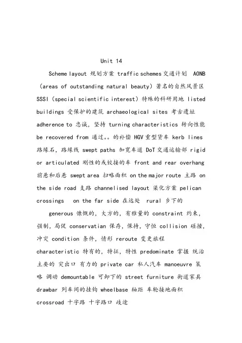
Unit 14Scheme layout 规划方案traffic schemes交通计划AONB(areas of outstanding natural beauty)著名的自然风景区SSSI(special scientific interest)特殊的科研用地listed buildings 受保护的建筑archaeological sites 考古遗址adherence to 忠诚,坚持turning characteristics 转向性能be recovered from 通过。
的补偿HGV重型货车kerb lines路缘石,路缘线swept paths 加宽车道DoT交通运输部rigid or articulated 刚性的或铰接的车front and rear overhang 前悬和后悬swept area 扫略面积on the major route 主路on the side road 支路channelised layout 渠化方案pelican crossings on the far side 在远处rural 乡下的generous 慷慨的,大方的,有雅量的constraint 约束,强制,局促conservatian 保存,保持,守恒collision 碰撞,冲突condition 条件,情形reroute 变更旅程characteristic 特有的,特征,特性predominate 掌握统治主要的突出口有力的private car 私人汽车manoeuvre 策略调动demountable 可卸下的street furniture 街道家具drawbar 列车间的挂钩wheelbase 轴距车轮接地面积crossroad 十字路十字路口歧途Traffic Planning Steps交通规划步骤(Data collection数据收集Forecasts预测Goal specification明确目标Preparation of alternative plans可选择计划的准备Testing检验Evaluation 评价Implementation实施)Levels(Policy planning政策规划Systems planning系统规划Preliminary engineering初步设施建造Engineering design 建造设计Planning for operations of existing systems or services现存系统运营的设计)Cost estimation 成本估算traffic flow simulation交通流模拟an action plan实施性规划quantitative data数据资料in the light of 按照,根据,当作stratification 层化成层阶层的形成assign 分配指派赋值quantitative 数量的量的transportation improvement 交通运输改善feedback 回授反馈反应deliberate 深思熟虑的故意的null 无效力的,无效的benchmark 基准legislature 立法机关takeover 接收接管transit system 运输系统Conrail 联合铁路公司corridor study 路廊环境研究,高速通道研究deregulation 违反规定Unit 16Four-step planning procedure四阶段规划法:trip generation 出行生成,trip distribution, 出行分布modal split,方式划分traffic assignment交通分配urban transportation planning 城市运输规划transportation facility 运输设施gap 间隙差距Trip rate出行率the target planning years目标规划年trip end 出行端点traffic zone交通小区car trips and public transport trips小汽车和公共交通出行gravity model重力模型centroids traffic zones交通小区形心all-or-nothing assignment 全有全无分配法capacity restrained assignment容量限制分配法multipath proportional assignment多路径概率分配法a measure ofLink impedance路径阻抗interlocking 联锁的favorable 赞成的Unit 17longitudinal spacing纵向间距level terrain 平原地形Rolling terrain丘陵区Mountainous terrain山岭区Crawl speed is the maximum sustained speed that heavy vehicles can maintain on an extended upgrade of a given percent 爬坡速度是重型车辆在一定比例的延长的爬坡段上的最大行驶速度signalization conditions信号控制条件signal phasing信号相位timing配时type of control 控制类型an evaluation of signal progression for each lane group每车道组的信号联动评价的全部规定saturation flow饱和流量saturation flow rate 饱和流率topography 地形学curb 路边account for 说明解决得分estimation 估计,预算,评价Unit 18fatalities.恶性事故motorcycle occupant摩托车成员vehicle-miles traveled车公里poorly timed signals配时不当House of Representatives' Subcommittee众议院Federal aid Highways hearings联邦政府助建公路Unit 19Biographical descriptors个人经历Chronic medical conditions长期医学状况Hearing听力Loss of limb 肢体残疾Vision视力face validity表面效度raw 擦伤处inadvertent 不注意的疏忽的illumination 照明阐明启发Unit 20One-way street单向交通industrial parks工业园区transition areas转向区域circuitous route迂回区域the one-way pair成对的单向街道central business districts 中心商业区residential lot 居民区Unit 21Junction types交叉口类型uncontrolled nonpriority junctions; 不受控制的非优先次序交叉口priority junctions; 优先次序交叉口roundabouts;环形交叉口traffic signals; 交通标志grade separations立体交叉)Traffic sign 交通标志Warning sign 警告标志Regulatory sign 禁止标志Directional informatory sign 方向指示标志other informatory sign 其他指示标志Carriageway narrowing车道狭窄limit capacity限制容量congestion charging拥挤收费innovation solutions革新方案pedestrian crossing人行横道traffic capacity of road道路交通通行能力highway networks 公路网Traffic Management 交通管理innovation solutions 革新方案signal-controlled 信号控制的traffic capacity of road 道路通行能力pedestrian crossing 人行横道Unit 22Traffic Surveillance交通监管field observations 实地观察Electronic surveillance.电子监管Closed-circuit television.闭路电视Aerial surveillance .无线电监管Emergency motorist call systems .驾驶员紧急呼救系统Citizen-band radio .城市广播Police and service patrols巡逻警察服务aerial surveillance 空中监测空中监视predetermined value 预先确定的值,事先规定的值Unit 23Be subject to受制于Parking surveys停车调查(Parking supply survey停车位供应调查Parking usage survey停车场使用情况调查Concentration survey)停车饱和度调查Durationsurvey持续时间调查Parker interview survey停车访问调查)On-and-off-street路边和路外停车trip destination出行终点the trip-maker出行生成者a closed circuit闭循环Unit 24Date to源于,追溯trade-offs交换,平衡positive guidance 正确引导root-mean-square 均方根Saturn 土星Pascal 帕斯卡filter 滤波器man-machine systems 人机系统交通工程专业英语翻译Unit 21 (文拿董德忠戚建国)Traffic Management交通管理Objectives目标Traffic management arose from the need to maximize the capacity of existing highway networks within finite budget and, therefore, with a minimum of new construction. Methods, which were often seen as a quick fix, required innovation solutions and new technical developments. Many of the techniques devised affected traditional highway engineering and launched imaginative and cost effective junction designs Introduction of signal-controlled pedestriancrossings not only improved the safety of pedestrians on busy roads but improved the traffic capacity of roads by not allowing pedestrians to dominate the crossing point.交通管理起源于这样一种需要,那就是在预算有限的情况下,以最少的新建工程项目,最大限度的提高现有道路网的通行能力。
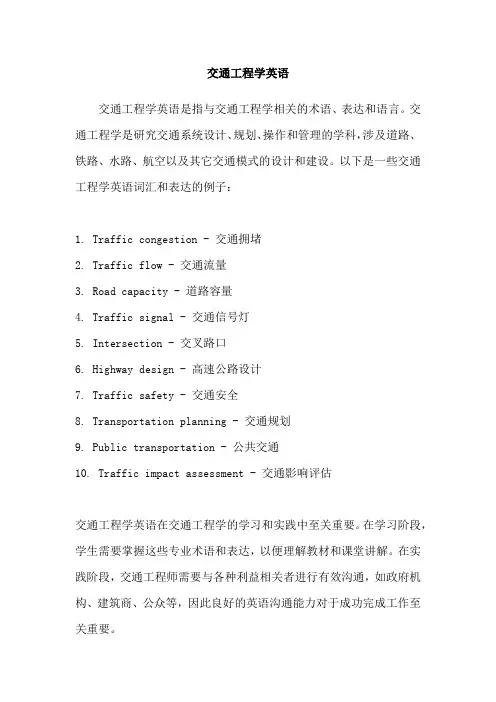
交通工程学英语
交通工程学英语是指与交通工程学相关的术语、表达和语言。
交通工程学是研究交通系统设计、规划、操作和管理的学科,涉及道路、铁路、水路、航空以及其它交通模式的设计和建设。
以下是一些交通工程学英语词汇和表达的例子:
1. Traffic congestion - 交通拥堵
2. Traffic flow - 交通流量
3. Road capacity - 道路容量
4. Traffic signal - 交通信号灯
5. Intersection - 交叉路口
6. Highway design - 高速公路设计
7. Traffic safety - 交通安全
8. Transportation planning - 交通规划
9. Public transportation - 公共交通
10. Traffic impact assessment - 交通影响评估
交通工程学英语在交通工程学的学习和实践中至关重要。
在学习阶段,学生需要掌握这些专业术语和表达,以便理解教材和课堂讲解。
在实践阶段,交通工程师需要与各种利益相关者进行有效沟通,如政府机构、建筑商、公众等,因此良好的英语沟通能力对于成功完成工作至关重要。
此外,交通工程学英语还与国际交流和合作密切相关。
随着全球化的加深,交通工程师需要参与国际项目或与国际同行合作。
良好的英语能力将有助于交流和合作,促进技术交流和经验分享。
总之,交通工程学英语是交通工程学中不可或缺的一部分。
掌握这些专业术语和表达将有助于学生在学习和实践中取得成功,并促进国际交流与合作。
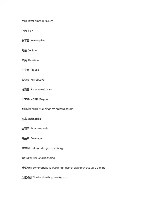
草图Draft drawing/sketch平面Plan总平面master plan剖面Section立面Elevation正立面Façade透视图Perspective轴测图Axonometric view示意图/分析图Diagram地图分析/制图mapping/ mapping diagram图表chart/table容积率floor area ratio覆盖率Coverage城市设计Urban design; civic design区域规划Regional planning总体规划comprehensive planning/ master planning/ overall planning 分区规划District planning/ zoning act控制性详细规划Regulatory Plan修建性详细规划Site planning (constructive-detailed planning)场地规划Site planning近期建设规划Immediate planning步行轴Walking axis概念设计conceptual design方案设计schematic design扩初设计design development详细设计、细部设计Detail Design城市化Urbanization城市生态Urban ecology城市农业urban farming/ urban agriculture经济能量来源Economy energy sources可持续发展Sustainable development历史性城市的保护规划Preservation Plan of historic cities旧城更新、改造-Urban Regeneration/Urban Revitalization/Retrofitting Plan 城市再开发-Urban Redevelopment开发区Development area城市化水平Urbanization level城市群Urban Agglomeration/ Metropolitan Area/ Metropolitan Coordinating Region/mega region城市系统Urban system卫星城市(城镇)Satellite town/ affiliate township城市基础设施Urban infrastructure市政基础设施Municipal Infrastructure绿色基础设施Green Infrastructure生态基础设施Ecological Infrastructure居民点Settlement城市City市Municipality; city城镇Town城市管理区域Administrative region of a city商业区Commercial district民政区域Civil district居住区规划Residential area planning护林区Ranger district绿地Percentage of greenery coverage绿化覆盖率Ratio of green space绿地率Landscaping within factory工厂绿化Landscaping of square广场绿化Landscaping of residential area居住区绿化Improved vegetation & wildlife谷底植栽场Landscaping around public building公共建筑绿化Indoor garden室外绿化Urban green 城市绿化Urban green space system城市绿化系统Public green space公共绿地Park公园Green belt 绿地Specified green space专用绿地Green buffer防护绿地空间(建筑)Parlor客厅Washroom; toilet卫生间、洗手间Balcony阳台、包厢Bathroom浴室Cabinet橱柜Courtyard building庭院建筑Dining-room ; dining hall餐厅Entrance入口Kitchen厨房Roof屋顶Kid room儿童房Dollhouse儿童游乐室Living room起居室Pavilion亭、阁Private garden私家花园Resident住宅Shared zone共享空间Toilet洗手间Servants hall用人房Scale比例Element要素、自然环境conference center会议中心Retail shop零售商店Theatre剧院园林景观Arbor乔木Shrub灌木Band stone铺石Car park below地下车库Carved paving bands曲线形铺地Cartilage Garth 庭园Courtyard identification sign标志牌Courtyard 庭院Fall瀑布Feature景色Footpath步道Garden bridge园桥Garden and park园林Herbage草本植物Liana藤本植物Natural cut stone砌石Pave铺地Pavilion 亭、阁Pavilion on terrace榭Planting植被Planting beds 花坛Plaza大广场Platform台Deck promenade栈道Pole lights灯柱Pool小水池Sculpture雕塑常用的景观英文参考1.主入口大门/岗亭(车行& 人行)MAIN ENTRANCE GATE/GUARD HOUSE main entrance gate/guard house (FOR VEHICLE& PEDESTRIAN ) for vehicle& pedestrian2.次入口/岗亭(车行& 人行)2ND ENTRANCE GATE/GUARD HOUSE 2nd entrance gate/guard house (FOR VEHICLE& PEDESTRIAN )3.商业中心入口ENTRANCE TO SHOPPING CTR. Entrance to shopping ctr.4.水景WATER FEATURE water feature5.小型露天剧场MINI AMPHI-THEATRE mini amphitheatre6.迎宾景观-1WELCOMING FEATURE-1 welcoming feature-17.观景木台TIMBER DECK (VIEWING) timber deck (viewing)8.竹园BAMBOO GARDEN bamboo garden9.漫步广场WALKWAY PLAZA walkway plaza10.露天咖啡廊OUT DOOR CAFE out door cafe11.巨大迎宾水景-2GRAND WELCOMING FEATURE-2 grand welcoming feature-2 12.木桥TIMBER BRIDGE timber bridge13.石景、水瀑、洞穴、观景台ROCK'SCAPE WATERFALL'S rock's cape waterfall's GROTTO/ VIEWING TERRACE grotto/ viewing terrace14.吊桥HANGING BRIDGE hanging bridge15.休憩台地(低处)LOUNGING TERRACE (LOWER ) lounging terrace (lower ) 16.休憩台地(高处)LOUNGING TERRACE (UPPER ) Lounging terrace (upper )17.特色踏步FEATURE STEPPING STONE feature stepping stone18.野趣小溪RIVER WILD river wild19.儿童乐园CHILDREN'S PLAYGROUND children's playground20.旱冰道SLIDE Slide21.羽毛球场BADMINTON COURT badminton court 网球场Tennis court 22.旱景DRY LANDSCAPE dry landscape23.日艺园JAPANESE GARDEN Japanese garden24.旱喷泉DRY FOUNTAIN dry fountain25.观景台VIEWING DECK viewing deck26.游泳池SWIMMING POOL swimming pool27.极可意JACUZZI JacuzziWADING POOL wading pool29.儿童泳池CHILDREN'S POOL children's pool30.蜿蜒水墙WINDING WALL winding wall31.石景雕塑ROCK SCULPTURE rock sculpture32.中心广场CENTRAL PLAZA central plaza33.健身广场EXERCISE PLAZA exercise plaza34.桥BRIDGE bridge35.交流广场MEDITATING PLAZA meditating plaza36.趣味树阵TREE BATTLE FORMATION tree battle formation 37.停车场PARING AREA paring area38.特色花架TRELLIS trellisSCULPTURE TRAIL sculpture trail40.(高尔夫)轻击区PUTTING GREEN putting green41.高尔夫球会所GOLF CLUBHOUSE golf clubhouse42.每栋建筑入口ENTRANCE PAVING TO UNIT entrance paving to unit43.篮球场BASKETBALL COURT basketball court44.网球场TENNIS COURT tennis court45.阶梯坐台/种植槽TERRACING SEATWALL/PLANTER terracing seat wall / planter 46.广场MAIN PLAZA main plaza47.森林、瀑布FOREST GARDEN WATERFALL forest garden waterfall48.石景园ROCKERY GARD。
Unit Three Transportation PlanningText A Definition of transportation planningThere are many kinds of planning such as urban planning, economic planning, financial planning, industrial planning, and environmental planning. In the field of transportation, planning can be further divided into highway planning, urban transportation planning, airport planning and so on. It is obvious that planning plays an important role in modern society and that it is concentrated in particular areas, subjects, or systems no matter what this function is.(社会中)存在各种各样的规划,如城市规划、经济计划、金融计划、工业规划以及环境规划。
而在交通运输领域,交通规划又可以进一步细分为公路规划,城市交通规划以及机场规划等等。
明显地在现代社会中(各种)规划扮演者重要角色,不管最终(这些规划)的作用是什么,它都被用于某些特殊领域、学科和系统中。
We defined planning as the activity or process that examines the potential of future actions guide a system toward desired direction, for example, toward the attainment of positive goals, the avoidance of problems, or both. Being he conceptual, premeditative process, planning is a fundamental characteristic of all human beings.我们将规划定义为:规划是检验评估未来某项行动对于引导整个系统朝着预期方向(例如,实现积极的目标,避免出现问题等)发展可能性的一个过程。
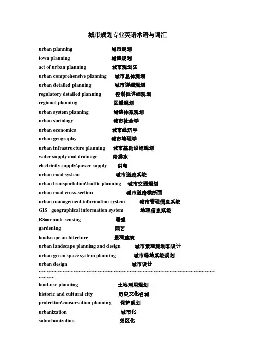
城市规划专业英语术语与词汇urban planning 城市规划town planning 城镇规划act of urban planning 城市规划法urban comprehensive planning 城市总体规划urban detailed planning 城市详细规划regulatory detailed planning 控制性详细规划regional planning 区域规划urban system planning 城镇体系规划urban sociology 城市社会学urban economics 城市经济学urban geography 城市地理学urban infrastructure planning 城市基础设施规划water supply and drainage 给排水electricity supply\power supply 供电urban road system 城市道路系统urban transportation\traffic planning 城市交通规划urban road cross-section 城市道路横断面urban management information system 城市管理信息系统GIS =geographical information system 地理信息系统RS=remote sensing 遥感gardening 园艺landscape architecture 景观建筑urban landscape planning and design 城市景观规划和设计urban green space system planning 城市绿地系统规划urban design 城市设计~~~~~~~~~~~~~~~~~~~~~~~~~~~~~~~~~~~~~~~~~~~~~~~~~~~~~~~~~~~~~~~~~~ ~~~~~~land-use planning 土地利用规划historic and cultural city 历史文化名城protection\conservation planning 保护规划urbanization 城市化suburbanization 郊区化public participation 公众参与sustainable development 可持续性发展over-all urban layout 城市整体布局pedestrian crossing 人行横道human scale 人类尺度street furniture 街道小品sculpture and fountain 雕塑和喷泉traffic and parking 交通与停车landscape node 景观节点-----------------------------------------------------------------------archaeological 考古学的habitat 住处aesthetics 美学geometrical 几何学的moat 护城河vehicles 车辆,交通工具mechanization 机械化merchant class 商人阶级urban element 城市要素plaza 广场avenue 林荫道---------------------------------------------- adaptable 适应性强的organism 有机体department stores 百货商店opera 歌剧(院)symphony 交响乐cathedral 教堂density 密度circulation 循环treatment measures 处理措施three dimensional form 三维condemn 谴责rural area 农村地区regional planning agencies 区域规划机构reference standard 参考标准water area 水域alteration 变更inhabitant\resident 居民motorway 高速公路abstract 摘要key words 关键词reference 参考资料----------------------------------------dimension 大小employment 就业recreation 消遣transportation 交通urban fringes 城市边缘sewage treatment plant 污水处理厂brain drain 人才流失drainage area 汇水面积traffic flow 交通流(量)traffic concentration\density 交通密度traffic control 交通管制traffic bottleneck 交通瓶颈地段traffic island 交通岛(转盘)traffic point city 交通枢纽城市urban redevelopment 旧城改造urban revitalization 城市复苏------------------------------------------urban fabric 城市结构(肌理)urban form 城市形态warehouse 仓库material processing center 原料加工中心religious building 宗教建筑correctional institution 教养院transportation interface 交通分界面CBD=central business district 中心商业区public agencies of parking 停车公共管理机构energy conservation 节能individual building 单体建筑mega-structures 大型建筑megalopolis 特大城市green space 绿地corporation 公司accessibility 可达性service radius 服务半径=------------------------------------------------urban landscape 城市景观topography 地形visual landscape 视觉景观visual environment 视觉环境visual landscape capacity 视觉景观容量tourist industry 旅游业service industry 服务业relief road 辅助道路rural population 乡村人口roofline 屋顶轮廓线-----------------------------------------------urban design 城市设计nature reserve 自然保护区civic enterprise 市政企业artery 动脉,干道,大道land developer 土地开发商broad thorough-fare 主干道---------------------------------------------------urban water supply system 城市给水系统storage reservoir 蓄水库distribution reservoir 配水库distribution pipes 配水管water distribution system 配水系统catchment area 汇水面积open channel 明渠sewerage system 污水系统separate system 分流制combined system 合流制rainfall 降水domestic waste 生活垃圾industrial sewage 工业污水stream flow 河流流量runoff 径流treatment plant 处理厂-------------------------------------------------- spatial structure 空间结构labor force 劳动力biosphere 生物圈biodiversity 生物多样性blueprint 蓝图monument 纪念物high-rise building 高层建筑物lawn 草地pavement 人行道sidewalk 人行道winding path 曲径---------------------------------------- metropolis 大都市construction work 基建工程slums 贫民区alleys 大街小巷gothic 哥特式renaissance 文艺复兴。
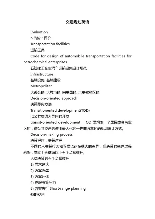
交通规划英语Evaluationn.估价;评价Transportation facilities运输工具Code for design of automobile transportation facilities for petrochemical enterprises石油化工企业汽车运输设施设计规范Infrastructure基础设施; 基础建设Metropolitan大都会的; 大城市的; 宗主国的; 大主教教区的Decision-oriented approach决策导向方法Transit oriented development(TOD)以公共交通为导向的开发transit-oriented development,TOD是规划一个居民或者商业区时,使公共交通的使用最大化的一种非汽车化的规划设计方式。
Decision-making process决策程序,决策过程不同的人决策行为和习惯也存在很大的差异,但决策的整体过程来看,基本上会遵循以下五个步骤循环。
人类决策的五个步骤循环1) 需求确认2) 方案收集3) 方案评估4) 克服决策压力5) 方案执行Short-range planning短期规划Long range planning长期规划Demand for transport is derived交通需求是衍生性的Activityn.活动; 活跃,敏捷; 活动力; 教育活动;Aggregate model集计模型在传统的交通规划或交通需求预测中,通常首先将对象地区或群体划分为若干个小区或群体等特定的集合体,然后以这些小区或群体为基本单位,展开问题的讨论。
因此,在建立模型或将样本放大时,需要以这一类的集合体为单位对数据进行集计处理。
通过上述集计处理得到的数据称为集计数据,而用集计数据所建立的模型称为集计模型。
Disaggregate model交通需求预测的集计模型通常是将每个人的交通活动按交通小区进行统计处理、分析,从而得到以交通小区为单位的分析模型。

交通工程专业词汇中英术语对照中英术语对照公路highway道路road公路工程highway engineering公路网highway network公路网密度highway density公路等级highway classification公路自然区划climatic zoning for highway公路用地highway right-of-way高速公路freeway; expressway等级公路classified highway辅道relief road干线公路arterial highway支线公路feeder highway专用公路accommodation highway国家干线公路(国道)national trunk highway省级干线公路(国道)provincial trunk highway 县公路(县道)county road乡公路(乡道)township road辐射式公路radial highway环形公路ring highway绕行公路bypass交通结构traffic structure交通组成traffic composition混合交通mixed traffic交通流traffic flow交通流理论traffic flow theory车流vehicle stream交通密度traffic density车头间距space headway车头时距time headway车间净距vehicular gap延误delay地点速度spot speed行驶速度running speed运行速度operating speed临界速度critical speed平均速度average speed计算行车速度(设计车速)design speed交通量traffic volume年平均日交通量annual average daily traffic 月平均日交通量monthly average daily traffic 年第30位最大小时交通量thirtieth highest annualhourly volume年最大小时交通量maximum annual hourly 设计小时交通量design hourly volume通行能力traffic capacity基本通行能力basic traffic capacity可能通行能力possible traffic capacity设计通行能力design traffic capacity道路服务水平level of service公路交通规划traffic planning交通调查traffic survey交通量调查traffic volume survey交通量观测站traffic volume observation station起迄点调查(OD调查)origin-destination study 出行trip境内交通local traffic过境交通through traffic交通发生traffic generation交通分布traffic distribution交通分配traffic assignment交通预测traffic prognosis行车道carriageway分离式行车道divided carriageway 车道lane变速车道speed-change lane加速车道acceleration lane减速车道deceleration lane爬坡车道climbing lane停车道parking lane错车道turn-out lane自行车道cycle path路侧人行道sidewalk分隔带lane separator中央分隔带median divider中间带central strip路肩shoulder;verge路缘带marginal strip路缘石kerb;curb侧向余宽lateral clearance路拱camber;crown路拱横坡crown slope公路建筑限界clearance of highway 公路路线highway route公路线形highway alignment平面线形horizontal alignment纵面线形vertical alignment线形要素alignment elements平曲线horizontal curve极限最小平曲线半径limited minimum radius of horizontal curve复曲线compound curve反向曲线reverse curve断背曲线broken-back curve回头曲线switch-back curve缓和曲线transition curve竖曲线vertical curve弯道加宽curve widening加宽缓和段transition zone of curve超高superelevation超高缓和段superelevation runoff纵坡longitudinal gradient最大纵坡maximum longitudinal gradient最小纵坡minimum longitudinal gradient变坡点grade change point平均纵坡average gradiant坡长限制grade length limitation高原纵坡拆减highland grade compensation缓和坡段transition grading zone合成坡度resultant gradient视距sight distance停车视距non-passing sight distance, stopping sight distance 超车视距passing sight distance道路交叉road intersection;道口railroad grade crossing平面交叉at-grade intersection;grade crossing正交叉right-angle intersection斜交叉skew intersection环形交叉rotary intersection十字形交叉"+"T形交叉T intersection错位交叉offset intersection; staggered junctionY形交叉Y intersection立体交叉grade separation分离式立体交叉simple grade separation, separate grade crossing互通式立体交叉interchange苜蓿叶形立体交叉full cloverleaf interchange 部分苜蓿叶形立体交叉cloverleaf interchange 菱形立体交叉diamond interchange 定向式立体交叉directional interchange喇叭形立体交叉three-Leg interchange环形立体交叉rotary interchange匝道ramp 交叉口road crossing;intersection交叉口进口intersection entrance交叉口出口intersection exit加铺转角式交叉口intersection with widened corners拓宽路口式交叉口flared intersection分道转弯式交叉口channelized intersection渠化交通channelization交织weaving交织路段weaving section合流converging分流diverging冲突点conflict point交通岛traffic island导流岛channelization island中心岛central island安全岛refuge island沿线设施roadside facilities交通安全设施traffic safety device人行横道crosswalk人行地道pedestrian underpass人行天桥pedestrian overcrossing护栏guard fence防护栅guard fence,safety barrier遮光栅anti-dizzling screen应急电话emergency telephone反光标志reflective sign反光路钮reflective button弯道反光镜traffic mirror道路交通标志road traffic sign警告标志warning sign禁令标志regulatory sign指示标志guide sign指路标志information sign辅助标志auxiliary sign可变信息标志changeable message sign 路面标线pavement marking防雪设施snow protection facilities防沙设施sands protection facilities隔音墙acoustic barrier停车场parking area踏勘reconnaissance可行性研究feasibility study线形设计highway alignment design公路景观设计highway landscape design选线route selection路线控制点control point定线location比较线alternative line展线line development初测preliminary survey定测location survey地貌topographic feature地物culture地形topography台地terrace垭口pass;saddle back平原区plain terrain微丘区rolling terrain重丘区hilly terrain山岭区mountainous terrain沿溪线valley line山脊线ridge line山坡线hill-side line越岭线ridge crossing line土方调配cut-fill transition土方调配图cut-fill transition program土方调配经济运距economical hauling distance 导线traverse 导线测量traverse survey中线center line中线测量center line survey施工测量construction survey竣工测量final survey(路线)平面图plan交点intersection point虚交点imaginary intersection point转点turning point转角intersection angle方位角azimuth angle象限角bearing方向角direction angle切线长tangent length曲线长curve length外(矢)距external secant测站instrument station测点observation point中桩center stake加桩additional stake护桩reference stake断链broken chainage水准测量leveling survey水准点bench mark绝对基面absolute datum高程elevation 地面高程ground elevation设计高程designed elevation(路线)纵断面图profile中桩填挖高度cut and fill at center stake 地形测量topographic survey基线base line地形图topographic map等高线contour line横断面测量cross-sectional survey横断面图cross-section坑探pit test钻探boring摄影测量photogrammetry航空摄影测量aerial photogrammetry地面立体摄影测量ground stereophoto grammetry地面控制点测量ground control-point survey 航摄基线aerophoto base影像地图photographic map像片索引图(镶辑复照图)photo index航摄像片判读aerophoto interpretation综合法测图planimatric photo全能法测图universal photo微分法测图differential photo像片镶嵌图photo mosaic路基subgrade路堤embankment路堑cutting半填半挖式路基part cut-part fill subgrade 台口式路基benched subgrade路基宽度width of subgrade路基设计高程design elevation of subgrade (路基)最小填土高度minimum height of fill 边坡side slope边坡坡度grade of side slope(边)坡顶top of slope(边)坡脚toe of slope护坡道berm边坡平台plain stage of slope碎落台berm at the foot of cutting slope护坡slope protection挡土墙retaining wall重力式挡土墙gravity retaining wall衡重式挡土墙balance weight retaining wall 悬臂式挡土墙cantilever retaining wall扶壁式挡土墙counterfort retaining wall柱板式挡土墙column-plate retaining wall锚杆式挡土墙anchored retaining wall by tierods锚碇板式挡土墙anchored bulkhead retaining wall石笼rock filled gabion抛石riprap路基排水subgrade drainage边沟side ditch截水沟intercepting ditch排水沟drainage ditch急流槽chute跌水drop water蒸发池evaporation pond盲沟blind drain渗水井seepage well透水路堤permeable embankment过水路面ford填方fill挖方cut借土borrow earth弃土waste取土坑borrow pit弃土堆waste bank回填土back-filling黄土loess软土soft soil淤泥mud泥沼moor泥炭peat盐渍土salty soil膨胀土expansive soil冻土frozen soil多年冻土permafrost流砂quicksand软弱地基soft ground强夯法dynamic consolidation预压法preloading method反压护道loading berm砂井sand drain路基砂垫层sand mat of subgrade压实compaction压实度degree of compaction(标准)最大干容重maximum dry unit weight相对密实度relative density毛细水capillary water土石方爆破blasting procedure抛掷爆破blasting for throwing rock爆破漏斗blasting crater松动爆破blasting for loosening rock 爆破作用圈acting circles of blasting路面pavement弹性层状体系理论elastic multilayer theory (回弹)弯沉deflection加州承载比(CBR)California bearing ratio,(CBR)路面宽度width of pavement路槽road trough刚性路面rigid pavement柔性路面flexible pavement路面结构层pavement structure layer面层surface course磨耗层wearing course联结层binder course基层base course垫层bed course隔水层aquitard隔温层thermal insulating course封层seal coat透层prime coat保护层protection course补强层strengthening layer高级路面high type pavement次高级路面sub-high type pavement中级路面intermediate type pavement低级路面low type pavement水泥混凝土路面cement concrete pavement沥青路面bituminous pavement沥青混凝土路面bituminous concrete pavement 沥青碎石路面bituminous macadam pavement沥青贯入碎(砾)石路面bituminous penetration pavement沥青表面处治bituminous surface treatment 块料路面block pavement石块路面stone block pavement泥结碎石路面clay-bound macadam pavement水结碎石路面water-bound macadam pavement 级配路面graded aggregate pavement稳定土基层stabilized soil base course工业废渣基层industrial waste base course 块石基层Telford base层铺法spreading in layers拌和法mixing method厂拌法plant mixing method路拌法road mixing method热拌法hot mixing method冷拌法cold mixing method热铺法hot laid method冷铺法cold laid method贯入法penetration method铺砌法pitching method缩缝contraction joint胀缝expansion joint真缝true joint假缝dummy joint横缝transverse joint纵缝longitudinal joint施工缝construction joint传力杆dowel bar拉杆tie bar路面平整度surface evenness路面粗糙度surface roughness路面摩擦系数friction coefficient of pavement附着力adhesive force水滑现象hydroplaning phenomenon桥梁bridge公路桥highway bridge公铁两用桥highway and rail transit bridge 人行桥pedestrian bridge跨线桥overpass bridge高架桥viaduct永久性桥permanent bridge半永久性桥semi-permanent bridge临时性桥temporary bridge钢筋混凝土桥reinforced concrete bridge预应力混凝土桥prestressed concrete bridge 钢桥steel bridge 圬工桥masonry bridge木桥timber bridge正交桥right bridge斜交桥skew bridge弯桥curved bridge坡桥bridge on slope斜桥skew bridge正桥right bridge上承式桥deck bridge中承式桥half-through bridge下承式桥through bridge梁桥beam bridge简支梁桥simple supported beam bridge连续梁桥continuous beam bridge悬臂梁桥cantilever beam bridge联合梁桥composite beam bridge板桥slab bridge拱桥arch bridge 双曲拱桥two-way curved arch bridge空腹拱桥open spandrel arch bridge实腹拱桥filled spandrel arch bridge系杆拱桥bowstring arch bridge桁架桥truss bridge刚构桥rigid frame bridgeT形刚构桥T-shaped rigid frame bridge连续刚构桥continuous rigid frame bridge斜腿刚构桥rigid frame bridge with inclined legs 斜拉桥(斜张桥)cable stayed bridge悬索桥suspension bridge漫水桥submersible bridge浮桥pontoon bridge开启桥movable bridge装配式桥fabricated bridge装拆式钢桥fabricated steel bridge涵洞culvert管涵pipe culvert拱涵arch culvert箱涵box culvert盖板涵slab culvert无压力式涵洞non-pressure culvert压力式涵洞pressure culvert半压力式涵洞partial pressure culvert倒虹吸涵siphon culvert上部结构superstructure主梁main beam横梁floor beam纵梁longitudinal beam, stringer挂梁suspended beam拱圈archring拱上结构spandrel structure腹拱spandrel arch拱上侧墙spandrel wall桥面系floor system, bridge decking桥面铺装bridge deck pavement伸缩缝expansion and contraction joint桥面伸缩装置bridge floor expansion and contraction installation安全带safety belt桥头搭板transition slab at bridge head下部结构substructure桥墩pier墩身pier body墩帽coping盖梁bent cap破冰体ice apron重力式桥墩gravity pier实体桥墩solid pier空心桥墩hollow pier柱式桥墩column pier排架桩墩pile bent pier柔性墩flexible pier制动墩braking pier单向推力墩single direction thrusted pier 桥台abutment台身abutment body前墙front wall翼墙wing walls台帽coping锥坡conical slope耳墙wing wallsU形桥台U-shaped abutment八字形桥台flare wing wall abutment一字形桥台head wall abutment, straight abutment重力式桥台gravity abutment埋置式桥台buried abutment扶壁式桥台counterforted abutment锚锭板式桥台anchored bulkhead abutment支撑式桥台supported type abutment地基subsoil加固地基consolidated subsoil天然地基natural subsoil基础foundation扩大基础spread foundation沉井基础open caisson foundation管柱基础cylindrical shaft foundation桩基础pile foundation桩pile预制桩precast pile就地灌注桩cast-in-place concrete pile摩擦桩friction pile支承桩bearing pile承台bearing platform支座bearing固定支座fixed bearing活动支座expansion bearing索塔cable bent tower索鞍cable saddle调治构造物regulating structure丁坝spur dike顺坝longitudinal dam桥位bridge site桥梁全长total length of bridge 主桥main bridge 引桥approach span跨径span桥涵计算跨径computed span桥涵净跨径clear span矢跨比rise span ratio计算矢高calculated rise of arch桥下净空clearance of span桥面净空clearance above bridge floor桥梁建筑高度construction height of bridge 荷载load 永久荷载permanent load可变荷载variable load偶然荷载accidental load荷载组合loading combinations车辆荷载标准loading standard for design vehicle设计荷载design load施工荷载construction load梁beam简支梁simple-supported beam连续梁continuous beam悬臂梁cantilever beam板slab拱arch桁架truss刚构rigid frame柱column强度strength刚度stiffness rigidity抗裂度crack resistance稳定性stability位移displacement变形deformation挠度deflection预拱度camber流域catchment basin集水面积runoff area径流runoff水文测验hydrological survey河床river bed河槽river channel主槽main channel边滩side shoal河滩flood land河床宽度bed width河槽宽度channel width过水断面discharge section水位water level最高(或最低)水位maximum (minimum)water level 通航水位navigable water level设计水位design water lever水面比降water surface slope河床比降gradient of river bed湿周wetted perimeter糙率coefficient of roughness水力半径hydraulic radius水文计算hydrological computation设计流量designed discharge设计流速designed flow velocity行近流速approach velocity洪水调查flood survey洪水频率flood frequency设计洪水频率designed flood frequency潮汐河流tidal river悬移质suspended load推移质bed material load水力计算hydraulic computation水头water head冲刷scour桥下一般冲刷general scour under bridge桥墩(或台)局部冲刷local scour near pier自然演变冲刷natural scour冲刷系数coefficient of scouring淤积silting壅水back water流冰ice drift先张法pretensioning method后张法post-tensioning method缆索吊装法erection with cableway悬臂拼装法erection by protrusion悬臂浇筑法cast-in-place cantilever method 移动支架逐跨施工法span by span method纵向拖拉法erection by longitudinal pulling method顶推法incremental launching method转体架桥法construction by swing浮运架桥法erecting by floating顶入法jack-in method围堰cofferdam护筒pile casing隧道tunnel洞门tunnel portal衬砌tunnel lining明洞open cut tunnel 围岩surrounding rock隧道建筑限界structural approach limit of tunnels明挖法open cut method矿山法mine tunnelling method盾构法shield tunnelling method沉埋法(沉管法)immersed tunnel导坑heading隧道支撑tunnel support构件支撑element support喷锚支护lock bolt support with shotcrete 隧道通风tunnel ventilation隧道照明tunnel lighting养护maintenance定期养护periodical maintenance巡回养护patrol maintenance大中修周期maintenance period小修保养routine maintenance中修intermediate maintenance大修heavy maintenance改善工程road improvement抢修emergency repair of road加固strengthening of structure回砂sand sweeping罩面overlay of pavement路面翻修pavement recapping路面补强pavement strengthening车辙rutting路面搓板surface corrugation路面网裂net-shaped cracking路面龟裂alligator cracking路面碎裂pavement spalling反射裂缝reflection crack路面坑槽pot holes路面冻胀surface frost heave路面沉陷pavement depression路面滑溜surface slipperiness露骨surface angularity啃边edge failure泛油bleeding拥包upheaval拱胀blow up错台faulting of slab ends错法slab staggering滑坡slide坍方land slide崩塌collapse碎落debris avalanche沉降settlement沉陷subsidence泥石流mud avalanche(振动)液化liquefaction翻浆frost boiling岩溶karst沙害sand hazard雪害snow hazard水毁washout好路率rate of good roads养护质量综合值general rating of maintenance quality 路容road appearance路况road condition路况调查road condition survey路政管理road administration民工建勤civilian labourers working on public project养路费toll of road maintenance养路道班maintenance gang粒料granular material集料(骨料)aggregate矿料mineral aggregate矿粉mineral powder砂sand砾石gravel砂砾sand gravel卵石cobble stone碎石broken stone, crushed stone片石rubble块石block stone料石dressed stone石屑chip工业废渣industrial solid waste结合料binder有机结合料organic binding agent沥青bitumen地沥青asphalt天然沥青natural asphalt石油沥青petroleum asphalt煤沥青coal tar乳化沥青emulsified bitumen氧化沥青oxidized asphalt路用沥青road bitumen有机结合料inorganic binding agent粉煤灰fly ash混合料mixture沥青混合料bituminous mixture 沥青混凝土混合料bituminousconcrete mixture 沥青碎石混合料bituminous macadam mixture 沥青砂asphalt sand沥青膏asphalt mastic水泥砂浆cement mortar石灰砂浆lime mortar水泥混凝土混合料cement concrete mixture水泥混凝土cement concrete钢筋混凝土reinforced concrete预应力(钢筋)混凝土prestressed concrete早强混凝土early strength concrete干硬性混凝土dry concrete贫混凝土lean concrete轻质混凝土light-weight concrete纤维混凝土fibrous concrete外掺剂admixture减水剂water reducing agent加气剂air entraining agent早强剂early strength agent缓凝剂retarder钢筋steel bar预应力钢材prestressing steel高强钢丝high tensile steel wire钢铰线stranded steel wire冷拉钢筋cold-stretched steel bar冷拔钢丝cold-drawn steel wire高强螺栓high strength bolt空隙率porosity孔隙比void ratio粒径grain size颗粒组成grain composition细度fineness筛分sieve analysis级配gradation级配曲线grading curve最佳级配optimum gradation含水量water content最佳含水量optimum water content稠度界限consistency limit液限liquid limit塑限plastic limit缩限shrinkage limit塑性指数plasticity index水泥标号cement mark水泥混凝土标号cement concrete mark水泥混凝土配合比proportioning of cement concrete 水灰比water cement ratio和易性workability坍落度slump硬化hardening水硬性hydraulicity气硬性air hardening离析segregation徐变creep老化ageing(沥青)稠度consistency(of bitumen)针入度penetration粘(滞)度viscosity软化点softening point延度ductility闪点flash point溶解度dissolubility热稳性hot stability水稳性water stability油石化asphalt-aggregate ratio含油率bitumen content压碎率rate of crushing磨耗度abrasiveness弹性模量modulus of elasticity回弹模量modulus of resilience劲度(模量)stiffness modulus模量比modulus ratio泊松比Poisson's ratio疲劳试验fatigue test劈裂试验splitting test三轴试验triaxial test击实试验compaction test触探试验cone penetration test弯沉试验deflection test环道试验circular track test承载板试验loading plate test透水性试验perviousness test车辙试验wheel tracking test马歇尔试验Marshall stability test压实度试验compactness test铺砂法sand patch method硬练胶砂强度试验earth-dry mortar strengthtest软练胶砂强度试验plastic mortar strengthtest (水泥)安定性试验soundness test(of cement) 击实仪compaction test equipment 长杆贯入仪penetration test equipment承载板loading plate杠杆弯沉仪beam lever deflectometer路面曲率半径测定仪surface-curvature apparatus路面平整度测定仪viameter路面透水度测定仪surface permeameter五轮仪fifth-wheel tester制动仪skiddometer速度检测器speed detector万能试验机universal testing machine三轴(剪切)仪triaxial shear equipment加州承载比(CBR)测定仪California bearing ratiotester标准筛standard sieves(沥青)针入度仪penetrometer(沥青)粘度仪viscosimeter(沥青)延度仪ductilometer(沥青)软化点仪(环-球法)softening point tester(ring-ball method)闪点仪(开口杯式)flash point tester (open cup method)马歇尔稳定度仪Marshall stability apparatus (沥青混合料)抽提仪bitumen extractor砂浆稠度仪mortar penetration tester坍落度圆锥筒slump cone标准工业粘度计standard concrete consistometer饱和面干吸水率试模saturated-surface-dried moisture retention tester撞击韧度试验机impact toughness machine圆盘耐磨硬度试验机wear hardness machine狄法尔磨耗试验机Deval abrasion testing machine洛杉矶磨耗试验机Los Angeles abrasion testing machine压碎率试模crushing strength tester单斗挖掘机single-bucket excavator推土机bulldozer除根机rootdozer铲运机scraper平地机grader挖沟机trencher耕耘机cultivator松土机ripper松土搅拌机pulvi-mixer稳定土拌和机stabilizer凿岩机rock breaker碎石机stone crusher碎石撒布机stone spreader装载机loader羊足压路机sheep-foot roller手扶式单轮压路机walk behind single drum蛙式打夯机frog rammer内燃夯实机internal combustion compactor铁夯(铁撞柱)tamping iron压路机roller振动压路机vibratory roller沥青加热器asphalt heater沥青泵asphalt pump沥青洒布机asphalt sprayer沥青洒布车asphalt distributor沥青混合料拌和设备asphalt mixing plant沥青混合料摊铺机asphalt paver散装水泥运输车cement deliver truck水泥混凝土混合料拌和设备concrete mixing plant (水泥混凝土混合料)搅拌concrete deliver truck 运输车水泥混凝土混合料摊铺机concrete paver振捣器concrete vibrator水泥混凝土混合料整面机concrete finisher真空泵vacuum pump水泥混凝土路面切缝机concrete joint cutter 水泥混凝土路面锯缝机concrete saw水泥混凝土路面清缝机concrete joint cleaner 水泥混凝土路面填缝机concrete joint sealer 水泵pump泥浆泵mud pump张拉钢筋油泵prestressed steel bar drawing oil pump砂浆泵mortar pump水泥混凝土混合料泵concrete pump钢筋切断机bar shear钢筋冷轧机cold-rolling mill钢筋冷拉机steel stretcher钢筋冷拔机steel bar cold-extruding machine 钢筋冷镦机steel bar heading press machine 钢筋拉伸机steel extension machine 钢筋弯曲机steel bar bender钢筋调直机steel straighten machine对焊机butt welder钻孔机boring machine打桩机pile driver拔桩机pile extractor千斤顶jack张拉预应力钢筋千斤顶prestressed steel bar drawing jack手拉葫芦chain block 起重葫芦hoisting block卷扬机hoister缆索吊装设备cableway erecting equipment起重机crane架桥机bridge erection equipment砂筒sand cylinder盾构shield全气压盾构compressed air shield半盾构roof shield隧道掘进机tunnel boring machine全断面隧道掘进机tunnel boring machine for full section 喷枪shotcrete equipment装碴机mucker盾构千斤顶main jack拉合千斤顶pull-in jacks复拌沥青混合料摊铺机asphalt remixer路面铣削机pavemill回砂车sand sweeping equipment除雪机snow plough装雪机snow Loader洗净剂喷布车detergent spray truck清扫车sweeper洒水车water truck划标线机Line maker振动筛vibrating screen撒布机spreader输送机conveyer提升机elevator翻斗车dump-body car自卸汽车dumping wagon牵引车tow truck拖车头tractor truck挂车trailer平板车flat truck工程车shop truck万能杆件fabricated universal steel members 交通规则traffic rules交通事故traffic accident交通事故率traffic accident rate人口事故率population accident rate车辆事故率vehicle accident rate运行事故率operating accident rate交通控制traffic control中央控制台central control unit点控制spot control线控制line control面控制area control交通信号traffic signal交通信号灯traffic signal lamp信号周期signal cycle绿信比split ratio信号相位signal phase相位差phase difference绿波green wave交通监视系统traffic surveillance 交通公害vehicular pollution 英汉术语对照索引abrasiveness磨耗度absolute datum绝对基面abutment桥台abutment pier制动墩acceleration lane加速车道accidental load偶然荷载accommodation lane专用车道acoustic barrier隔音墙acting circles of blasting爆破作用圈 additional stake加桩adjacent curve in one direction同向曲线 admixture外加剂adverse grade for safety反坡安全线aerial photogrammetry航空摄影测量 aerophoto base航摄基线aerophoto interpretation航摄像片判读 ageing老化aggregate集料(骨料)air hardening气硬性alignment design(城市道路)平面设计,线形设计alignment element线形要素alligator cracking路面龟裂allowable rebound deflection容许(回弹)弯沉alternative line 比较线anchored bulkhead abutment锚锭板式桥台anchored bulkhead retaining wall锚锭板式挡土墙anchored retaining wall by tie rods锚杆式挡土墙anionic emulsified bitumen阴离子乳化沥青annual average daily traffic年平均日交通量 anti-creep heap(厂矿道路)挡车堆anti-dizzling screen防炫屏(遮光栅)antiskid heap(厂矿道路)防滑堆approach span引桥aquitard隔水层arch bridge拱桥arch culvert拱涵arch ring拱圈arterial highway干线公路arterial road(厂内)主干道,(城市)主干路 asphalt distributor沥青洒布车asphalt mixing plant沥青混合料拌和设备 asphalt paver沥青混合料摊铺机asphalt remixer复拌沥青混合料摊铺机 asphalt sand沥青砂asphalt sprayer沥青洒布机asphaltic bitumen地沥青at-grade intersection平面交叉auxiliary lane附加车道average consistency(of soil)(土的)平均稠度average gradient 平均纵坡azimuth angle方位角balance weight retaining wall衡重式挡土墙 base course基层base line基线basic traffic capacity基本通行能力beam bridge梁桥beam level deflectometer杠杆弯沉仪bearing支座bearing angle象限角bearing pile支承桩bearing platform承台bed course垫层bench mark水准点benched subgrade台口式路基bending strength抗弯强度Benkelman beam杠杆弯沉仪(贝克曼弯沉仪) bent cap盖梁berm护坡道binder结合料binder course联结层bitumell沥青bitumen extractor(沥青混合料)抽提仪bitumen-aggregate ratio油石比bituminous concrete mixture沥青混凝土混合料bituminous concrete pavement沥青混凝土路面 bituminous macadam mixture 沥青碎石混合料bituminous macadam pavement沥青碎石路面bituminous mixture沥青混合料bituminous pavement沥青路面bituminous penetration pavement沥青贯入式路面bituminous surface treatment(沥青)表面处治blasting crater 爆破漏斗blasting for loosening rock松动爆破blasting for throwing rock抛掷爆破blasting procedure土石方爆破bleeding泛油blind ditch盲沟blind drain盲沟block pavement块为路面block stone块石blow up拱胀boring钻探boring log(道路)地质柱状图boring machine钻孔机borrow earth借土borrow pit取土坑boundary frame on crossing道口限界架 boundary frame on road道路限界架boundary line of road construction道路建筑限界bowstring arch bridge系杆拱桥box culvert箱涵branch pipe of inlet雨水口支管branch road(城市)支路,(厂内)支道bridge桥梁bridge decking桥面系bridge deck pavement桥面铺装bridge floor expantion and contraction installation桥面伸缩装置bridge girder erection equipment架桥机 bridge on slope坡桥bridge site桥位bridge road驮道broken chainage断链broken stone碎石broken back curve断背曲线buried abutment埋置式桥台bus bay公交(车辆)停靠站bypass公交绕行公路cable bent tower索塔cable saddle索鞍cable stayed bridge斜拉桥(斜张桥) cableway erecting equipment缆索吊装设备california bearing ratio(CBR)加州承载比(CBR)california bearing ratio tester加州承载比(CBR)测定仪camber curve路拱曲线cantilever beam bridge悬臂梁桥cantilever retaining wall悬臂式挡土墙 capacity of intersection 交叉口通行能力 capacity of network路网通行能力capillary water毛细水carriage way车行道(行车道)cast-in-place cantilever method悬臂浇筑法cationic emulsified bitumen阳离子乳化沥青 cattle-pass畜力车道cement concrete水泥混凝土cement concrete mixture水泥混凝土混合料 cement concrete pavement水泥混凝土路面center-island中心岛center lane中间车道center line of road道路中线center line survey中线测量center stake中桩central reserve分隔带channelization渠化交通channelization island导流岛channelized intersection分道转弯式交叉口 chip石屑chute急流槽circular curve圆曲线circular road环路circular test环道试验city road城市道路civil engineering fabric土工织物classified highway等级公路classified road等级道路clay-bound macadam泥结碎石路面clearance净空clearance above bridge floor桥面净空 clearance of span桥下净空climatic zoning for highway公路自然区划 climbing lane爬坡车道cloverleaf interchange苜蓿叶形立体交叉 coal tar煤沥青cobble stone卵石coefficient of scouring冲刷系数cohesive soil粘性土cold laid method冷铺法cold mixing method冷拌法cold-stretched steel bar冷拉钢筋column pier柱式墩combination-type road system混合式道路系统 compaction压实compaction test击实试验compaction test apparatus击实仪 compactness test压实度试验composite beam bridge联合梁桥composite pipe line综合管道(综合管廊) compound curve复曲线concave vertical curve凹形竖曲线concrete joint cleaner(水泥混凝土)路面清缝机concrete joint sealer(水泥混凝土)路面填缝机 concrete mixing plant水泥混凝土(混合料)拌和设备concrete paver水泥混凝土(混合料)摊铺机 concrete pump水泥混凝土(混合料)泵concrete saw(水泥混凝土)路面锯缝机cone penetration test触探试验conflict point冲突点conical slope锥坡consistency limit(of soil)(土的)稠度界限consolidated subsoil 加固地基consolidation固结construction by swing转体架桥法construction height of bridge桥梁建筑高度 construction joint施工缝construction load施工荷载construction survey施工测量continuous beam bridge连续梁桥contour line等高线contraction joint缩缝control point路线控制点converging合流convex vertical curve凸形竖曲线corduroy road木排道counterfort retaining wall扶壁式挡土墙counterfort abutment扶壁式桥台country road乡村道路county road县公路(县道),乡道creep徐变critical speed临界速度cross roads十字形交叉cross slope横坡cross walk人行横道cross-sectional profile横断面图cross-sectional survey横断面测量crown路拱crushed stone碎石crushing strength压碎值culture地物culvert涵洞curb路缘石curb side strip路侧带curve length曲线长curve widening平曲线加宽curved bridge弯桥cut挖方 cut corner for sight line(路口)截角cut-fill transition土方调配cut-fill transition program土方调配图 cutting路堑cycle path自行车道cycle track自行车道deceleration lane减速车道deck bridge上承式桥。
Urban transportation PlanningAn urban transportation system is basic component of an urban area's social,economic,and physical structure. Not only does the design and performance of a transportation system provide opportunities for mobility,but over the long term,it influences patterns of growth and the level of economic activity through the accessibility it provides to land. Planning for the development or maintenance of the urban transportation system is thus an important activity,both for promoting the efficient movement of people and goods in an urban area and for maintaining the strong supportive role that transportation can play in attaining other community objectives.There are several basic concepts about an urban transportation system that should be kept in mind. Most important,a transportation system in an urban area is defined as consisting of the facilities and services that allow travel throughout the region,providing opportunities for:(I)mobility to residents of an urban area and movement of goods and (2) accessibility to land .Given this definition,an urban transportation system can be further characterized by three major components: the spatial configuration that permits travel from one location to another; the transportation technologies that provide the means of moving over these distances; and the institutional framework that provides for the planning, construction, operation, and maintenance of system facilities.The Spatial Configuration of a Transportation SystemOne way to describe the spatial dimension of an urban transportation system is to consider the characteristics of individual trips from an origin to a destination. For example, a trip can consist of several types of movement undertaken to achieve different objectives. Travelers leaving home might use a local bus system to reach a suburban subway station(a trip collection process),proceed through the station to the subway platform (a transfer process),ride the subway to a downtown station (a line-haul process),and walk to a place of employment (a distribution process). Similarly,one can view a home-to-work trip by car as consisting of similar segments,with the local street system providing the trip collectionprocess, a freeway providing the line-haul capability,a parking lot in the central business district serving as a transfer point,and walking,as before,serving the distribution function.The facilities and services that provide these opportunities for travel,when interconnected to permit movement from one location to another,form a network. Thus,another way of representing the spatial dimension of an urban transportation system is as a set of road and transit networks. Even in the smallest urban areas,where mass transit is not available,the local street network provides the basic spatial characteristic of the transportation system.The transportation system of a city can influence the way in which the city's social and economic structure, often called the urban activity system,develops. At the same time,changes in this structure can affect the ability of the transportation system to provide mobility and accessibility. Thus , the transportation system is closely related to the urban activity system and; historically, has been an important determinant of urban form.Because of the relation between transportation and urban activities,many of the methods used by transportation planners depend on estimates of trips generated by specific land uses. The relation also suggests that the options available to public officials dealing with transportation problems should include not only those related directly to the transportation system, but also actions such as zoning that affect the distribution of land use, and thus influence the performance of the transportation system.The foregoing considerations point to two important principles for transportation planning: The transportation system should beConsidered as an integral part of the social and economic system in an urban area.Viewed as a set of interconnected facilities and services designed to provide opportunities for travel from one location to another.The Technology of Urban TransportationThe technology of urban transportation is closely related to the spatial configuration of the transportation system in that the design transportation networks reflects the speed, operating , and cost characteristics of the vehicle or mode of transportation being used. Technology includes the means of propulsion, type of support,means of guidance,and control technique.The development and widespread use of electric streetcars in urban areas during the late nineteenth century was a technological innovation that initiated the transformation of most North American cities. The advent of the electric streetcar permitted urban areas to expand beyond the boundaries that had been dictated by previous transportation technologies (e. g.,walking,horse,horsecar),spawning `streetcar suburbs' with dramatically lower residential densities along streetcar lines radiating from the central city. Whereas many industries had decentralized along railroad lines leading from the central city,and workers initially had to live near these factories, the introduction of streetcars now permitted more distant living.The success of the streetcar in providing access from selected suburban areas to central business districts was followed by public acceptance of a second major technological innovation-the automobile,powered by the internal combustion engine. Increasing consumer preferences for lower-density living and for an ability to travel beyond established urban boundaries sparked a phenomenal growth in automobile ownership and usage,beginning in the 1920s . ④The automobile continues and accelerated the evolution of urban structure started by the electric streetcar. Its availability permitted further expansion of urban areas and, more important, provided access to land between the radial streetcar and railroad lines leading into the central city.The technology of the internal-combustion engine,however, also led to the decline of other transportation modes used in urban areas by providing a less expensive and more flexible replacement for rail-based modes. While the automobile provided new opportunities for personal mobility and urban growth, motor buses rapidly replaced electric streetcars, to the extent that only five North American cities today still operate large-scale streetcar systems-Boston, Philadelphia, Pittsburgh, Toronto, and San Francisco (although this trend has reversed somewhat in recent years with new `light rail' systems in operation in Edmonton, Calgary, San Diego, and Buffalo). At the same time, the growth of private automobile use has dramatically reduced the use of public transportation in general, particularly since the end of World War II. According to the latest census figures, in 1980, 62. 3 million Americans normally drove alone to work each day, another 19 million car-pooled, and 6 million used public transportation.The technologies and the resulting modes available today for urban transportation are common to most cities but are often applied in different ways to serve different purposes. Itshould be noted that certain types of modes are appropriate than others in serving different types of urban trips.The technological dimension of the urban transportation system suggests a third principle for urban transportation planning:Transportation planners must consider the transportation system as consisting of different modes , each having different operational and cost characteristics.From; Michael D. Meyer and Eric J. Miller "Urban Transportation Planning", 1984Traffic signalsIn the United States alone ,some 250,000 intersections have traffic signals , which are defined as all power-operated traffic-control devices except flashers,signs,and markings for directing or warning motorists, cyclists,or pedestrians.Signals for vehicular,bicycle,and pedestrian control are …pretimed‟where specific times intervals are allocated to the various traffic movements and as 'traffic actuated' where time intervals are controlled in whole or in part by traffic demand.Pretimed Traffic Signals'Pretimed' traffic signals are set to repeat regularly a given sequence of signal indications for stipulated time intervals through the 24-hr day. They have the advantages of having controllors of lower first cost and that they can be interconnected and coordinated to vehicles to move through a series of intersections with a minimum of stops and other delays. Also, their operation is unaffected by conditions brought on by unusual vehicle behavior such as forced stops,which,with some traffic-actuated signal installations may bring a traffic jam. Their disadvantage is that they cannot adjust to short-time variations in traffic flow and often hold vehicles from one direction when there is no traffic in the other. This results in inconvenience, and sometimes a decrease in capacity.‘Cycle length’the time required for a complete sequence of indications, ordinarily falls between 30 and 120s. Short cycle lengths are to be preferred, as the delay to standing vehicles is reduced. With short cycles, however a relatively high percentage of the total time is consumed in clearing the intersection and starting each succeeding movement. As cycle length increases, the percentage of time lost from these causes decreases. With high volumesof traffic, it may be necessary to increase the cycle length to gain added capacity.Each traffic lane of a normal signalized intersection can pass roughly one vehicle each 2.1s of green light. The yellow (caution) interval following each green period is usually between 3 and 6s,depending on street width,the needs of pedestrians, and vehicle approach speed. To determine an approximate cycle division, it is common practice to make short traffic counts during the peak period. Simple computations give the number of vehicles to be accommodated during each signal indication and the minimum green time required to pass them. With modern control equipment, it is possible to change the cycle length and division several times a day, or go to flashing indications to fit the traffic pattern better.At many intersections,signals must be timed to accommodate pedestrian movements. The Manual recommends that the minimum total time allowed be an initial interval of 4 to 7s for pedestrians to start plus walking time computed at 4 ft/s (1. 2m/s). With separate pedestrian indicators,the WALK indication(lunar white) covers the first of these intervals, and flashing DON'T WALK (Portland orange ) the remainder. The WALK signal flashes when there are possible conflicts with vehicles and is steady when there are none. Steady DON'T WALK tells the pedestrian not to proceed.If pedestrian control is solely by the vehicle signals,problems develop if the intersection is wide, since the yellow clearance interval will have to be considerably longer than the 3 to 5s needed by vehicles. This will reduce intersection capacity and may call for a longer cycle time. On wide streets having a median at least 6 ft (1. 8m)wide,pedestrians may be stopped there. A separate pedestrian signal activator must be placed on this median if pedestrian push buttons are incorporated into the overall control system.Coordinated MovementFixed-time traffic signals along a street or within an area usually are coordinated to permit compact groups of vehicles called `platoons’to move along together without stopping. Under normal traffic volumes,properly coordinated signals at intervals variously estimated from 2500 ft (0. 76km)to more than a mile (1. 6km) are very effective in producing a smooth flow of traffic. On the other hand,when a street is loaded to capacity,coordination of signals is generally ineffective in producing smooth traffic flow.Four systems of coordination-simultaneous, alternate,limited progressive, and flexibleprogressive-have developed over time. The simultaneous system made all color indications on a given street alike at the same time .It produced high vehicle speeds between stops but low overall speed. Because of this and other faults,it is seldom used today.The alternate system has all signals change their indication at the same time,but adjacent signals or adjacent groups of signals on a given street show opposite colors. The alternate system works fairly well on a single street that has approximately equal block spacing. It also has been effective for controlling traffic in business districts several blocks on a said, but only when block lengths are approximately equal in both directions. With an areawide alternate system,green and red indications must be of approximately equal length. This cycle division is satisfactory where two major streets intersect but gives too much green time to minor streets crossing major arteries. Other criticisms are that at heavy traffic volumes the later section of the platoon of vehicles is forced to make additional stops,and that adjustments to changing traffic conditions are difficult.The simple progressive system retains a common cycle length but provides 'go' indications separately at each intersection to match traffic progression. This permits continuous or nearly continuous flow of vehicle groups at a planned speed in at least one direction and discourages speeding between signals. Flashing lights may be substituted for normal signal indications when traffic becomes light.The flexible progressive system has a master controller mechanism that directs the controllers for the individual signals. This arrangement not only gives positive coordination between signals,but also makes predetermined changes in cycle length,cycle split,and offsets at intervals during the day. For example,the cycle length of the entire system can be lengthened at peak hours to increase capacity and shortened at other times to decrease delays.Flashing indications can be substituted when normal signal control is not needed. Also the offsets in the timing of successive signals can be adjusted to favor heavy traffic movements, such as inbound in the morning and outbound in the evening. Again,changes in cycle division at particular intersections can be made. The traffic responsive system is an advanced flexible progressive system with the capacity to adjust signal settings to measured traffic volumes.Where traffic on heavy-volume or high-speed arteries must be interrupted for relatively light cross traffic,semi-traffic-actuated signals are sometimes used. For them,detectors areplaced only on the minor street. The signal indication normally is green on the main road and red on the cross street. On actuation, the indications are reversed for an appropriate interval after which they return to the original colors.Highway Capacity And Levels of ServiceCapacity DefinedA generalized definition of capacity is: The capacity of any element of the highway system is the maximum number of vehicles which has a reasonable expectation of passing over that section (in either one or both directions) during a given time period under prevailing roadway and traffic conditions. A sampling of capacities for modern highway elements is as follows:Facility Capacity in Passenger Cars Freeways and expressways away from ramps and weaving2000 sections, per lane per hourTwo-Lane highways, total in both directions, per hour 2000Three-lane highways, total in each direction, per hour 2000Twelve-foot lane at signalized intersection, per hour of green1800signal time(no interference and ideal progression)In treating capacity,TRB Circular 212 divides freeways into components: basic freeway segments and those in the zone of influence of weaving areas and ramp junctions. Capacities of expressways,multilane highways,and two- and three-lane facilities also have the two components: basic and those in the zone of influence of intersections. Each of these is treated separately below.Speed-Volume-Capacity Relationships for BasicFreeway and Multilane Highway SegmentsA knowledge of the relationships among speed,volume,and capacity is basic to understanding the place of capacity in highway design and operation. Figurel3.1,which gives such a relationship for a single freeway or expressway lane, is used for illustrative purposes.If a lone vehicle travels along a traffic lane,the driver is free to proceed at the design speed. This situation is represented at the beginning of the appropriate curve at the upper left of Fig. 13.1. But as the number of vehicles in the lane increases, the driver's freedom to select speed is restricted. This restriction brings a progressive reduction in speed. For example,many observations have shown that,for a highway designed for 70 mph (113km/h),when volume reaches 1900 passenger cars per hour,traffic is slowed to about 43 mph (69km/h). If volume increases further, the relatively stable normal-flow condition usually found at lower volumes is subject to breakdown. This zone of instability is shown by the shaded area on the right side of Fig. 13. 1. One possible consequence is that traffic flow will stabilize at about 2000 vehicles per hour at a velocity of 30 to 40 mph (48 to 64km/h) as shown by the curved solid line on Fig. 13. 1. Often,however , the quality of flow deteriorates and a substantial drop in velocity occurs; in extreme cases vehicles may come to a full stop. In this case the volume of flow quickly decreases as traffic proceeds under a condition known as …forced flow.‟ V olumes under forced flow are shown by the dashed curve at the bottom of Fig.13. 1. Reading from that curve,it can be seen that if the speed falls to 20 mph (32km/h),the rate of flow will drop to 1700 vehicles per hour; at 10 mph (16km/h) the flow rate is only 1000;and,of course,if vehicles stop,the rate of flow is 0. The result of this reduction in flow rate is that following vehicles all must slow or stop,and the rate of flow falls to the levels shown. Even in those cases where the congestion lasts but a few seconds, additional vehicles are affected after the congestion at the original location has disappeared. A …shock wave’develops which moves along the traffic lane in the direction opposite to that of vehicle travel. Such waves have been observed several miles from the scene of the original point of congestion,with vehicles slowing or stopping and then resuming speed for no apparent reason whatsoever.Effects of the imposition of speed limits of 60, 50, and 40 mph are suggested by the dotted lines on Fig. 13. 1. A 55-mph (88km/h) curve could also be drawn midway between the 60 and 50 mph dotted curves to reflect the effects of the federally imposed 55-mph limit, but this is conjectural since the level of enforcement varies so widely.Vehicle spacing,or its reciprocal, traffic density, probably have the greatest effect on capacity since it generates the driver's feeling of freedom or constraint more than any other factor. Studies of drivers as they follow other vehicles indicate that the time required to reacha potential collision point,rather than vehicle separation,seems to control behavior. However,this time varies widely among drivers and situations. Field observations have recorded headways (time between vehicles) ranging from 0. 5 to 2 sec, with an average of about 1. 5s.Thus,the calculated capacity of a traffic lane based on this 1. 5 s average, regardless of speed,will be 2400 vehicles per hour. But even under the best of conditions, occasional gaps in the traffic stream can be expected,so that such high flows are not common. Rather, as noted,they are nearer to 2000 passenger cars per hour.The ‘Level of Service’ ConceptAs indicated in the discussion of the relationships of speed, volume or density, and vehicle spacing, operating speed goes down and driver restrictions become greater as traffic volume increase. …Level of service‟ is commonly accepted as a measure of the restrictive effects of increased volume. Each segment of roadway can be rated at an appropriate level,A to F inclusive,to reflect its condition at the given demand or service volume. Level A represents almost ideal conditions; Level E is at capacity; Level F indicates forced flow.The two best measures for level of service for uninterrupted flow conditions are operating or travel speed and the radio of volume to capacity达到最大限度的广播,called the v/c ratio. For two- and three-lane roads sight distance is also important.Abbreviated descriptions of operating conditions for the various levels of service are as follows:Level A—Free flow; speed controlled by driver's desire,speed limits, or physical roadway conditions.Level B—Stable flow; operating speeds beginning to be restricted; little or no restrictions on maneuverability from other vehicles.Level C—Stable flow; speeds and maneuverability more closely restricted.Level D—Approaches unstable flow; tolerable speeds can be maintained but temporary restrictions to flow cause substantial drops in speed. Little freedom to maneuver,comfort and convenience low.Level E—V olumes near capacity; speed typically in neighborhood of 30 mph (48km/h); flow unstable; stoppages of momentary duration. Ability to maneuver severely limited.Level F—Forced flow,low-operating speeds,volumes below capacity; queues formed.A third measure of level of service suggested in TRB Circular 212 is traffic density. This is,for a traffic lane,the average number of vehicles occupying a mile (1. 6km) of lane at a given instant. To illustrate,if the average speed is 50 mph,a vehicle is in a given mile for 72 s. If the lane carrying 800 vehicles per hour,average density is then 16 vehicles per mile ;spacing is 330 ft (100m),center to center. The advantage of the density approach is that the various levels of service can be measured or portrayed in photographs.From: Clarkson H. Oglesby and R. Gary Hicks “Highway engineering”, 1982城市交通规划城市交通系统是市区的社会、经济、和物质结构的一个基本组成部分。

A KNOWLEDGE-BASED CONCEPTUAL VISION OF THE SMART CITYElsa NEGRE Camille ROSENTHAL-SABROUX Mila GASCóLAMSADE LAMSADE Center for Innovation in CitiesParis-Dauphine University Paris-Dauphine University Institute for Innovation SIGECAD Team SIGECAD Team and Knowledge ManagementFrance France ESADE-Ramon Llull Universityelsa.negre@dauphine.frcamille.rosenthal-sabroux@dauphine.frmila.gasco@AbstractThe term smart city is a fuzzy concept, not well defined in theoretical researches nor in empirical projects. Several definitions, different from each other, have been proposed. However, all agree on the fact that a Smart City is an urban space that tends to improve the daily life (work, school,...) of its citizens(broadly defined). This is an improvement fromdifferent points of view: social, political, economic, governmental. This paper goes beyond this definition and proposes a knowledge-based conceptual vision of the smart city, centered on people’s information and knowledge of people, in order to improve decision-making processes and enhance the value-added of business processes of the modern city.1. IntroductionOver the past few decades, the challenges faced by municipal ,such as urban growth or migration, have become increasingly complex and interrelated. In addition to the traditional land-use regulation, urban maintenance, production, and management of services, governments are required to meet new demands from different actors regarding water supply, natural resources sustainability, education, safety, or transportation (Gascóet al,2014). Innovation, and technological innovation in particular, can help city governments to meet the challenges of urban governance, to improve urban environments, to become more competitive and to address sustainability concerns. Since the early 90s, the development of Internet and communication technologies has facilitated the generation of initiatives to create opportunities for communication and information sharing by local authorities. This phenomenon appeared in the United States then moved to Europe and Asia. Indeed, in oureveryday life, we are more and more invaded by data and information. This flow of data and information is often the result of Information and Communication Technologies (ICT). Moreover, potentialities of ICT, that have almost exponentially increased have given rise to a huge mass of data to treat (Batty, 2013). The world is becoming increasingly digital and people are affected by these changes. Also, the digital infrastructure infers an information environment that is “as imperceptible to us as water is to a fish”(McLuhan & Gordon, 2011).There exists a kind of parallelism between technologies and humans. On one hand, people use technologies more and more and are hyperconnected, and, on the other hand, (numeric) systems are more and more user-centered (Viitanen &Kingston, 2014). Thus, within cities, systems have to adaptto hyper-connected citizens, in a very particular environment, the one of cities in constant evolution where systems and humans are nested. The advent of new technologies also confronts the city to a large influx of data (Big Data) from heterogeneous sources, including social networks. Itis also important to note that much information and /or knowledge flow between different people (with different uses and backgrounds) and between different stakeholders (Kennedy, 2012). In this respect, the city sees that numerous data circulate via the internet, wireless communication, mobile phones,…Finally, smart cities are exposed to technological issues tied to the huge mass of data which pass within them. These data can carry knowledge and, by the way, the smart city, and de facto, the smart city,aware of the existence and of the potential of this knowledge, can exploit and use them.Note that, for a city, all citizens become knowledgecitizens, especially those whose knowledge is the crucial factor enabling them to improve theirdecision-making processes. In this respect,knowledge is fundamentally valuable to make better decisions and to act accordingly.Given this context, this paper focuses on knowledge in the smart city. The paper discusses both explicit knowledge (knowledge extracted from data which flows within the city) and tacit knowledge(that is, citizen’s knowledge). Our argument is twofold:on one hand, we believe that, due to the importance for the city management of tacit knowledge, the city should be closer to its citizens(Bettencourt, 2013). On the other, a city can become smarter by improving its decision-making process and, therefore, by making better decisions. ICT can help in this respect: more data and better-managed data result in, not only more information, but also more knowledge. More knowledge gives rise to better decisions (Grundstein et al, 2003; Simon,1969).The remainder of this paper is organized as follows. Next, we present some literature on smart cities and knowledge. Subsequently, we describe the opportunities and challenges smart cities offer for cities development and growth. The City’s Information and Knowledge System is then introduced. Finally, we bring to a close, drawing some conclusions on what a knowledge-based smart city is.2. Related Work2.1. On smart citiesThe origins of the smart city concept are related to the European Union’s energetic efficiency programs that aimed at making cities sustainable(AMETIC, 2013). However, important conceptual trends have also contributed to the emergence of this term. In particular, the influence of openinnovation has been key. Chesbrough (2006 & 2003) defines open innovation as a strategy by which firms commercialize external (as well as internal) ideas by deploying outside (as well as in-house) pathways to the market. In addition, “ideas can also originate outside the firm’s own labs and be brought inside for commercialization. In other words, the boundary between a firm and its surrounding environment is more porous, enabling innovation to move easily between the two”(Chesbrough, 2003: 37).Despite open innovation was born in relation to the industry and the business world, several authors think this theory can be easily implemented in different fields. In this respect, while historically the public sector has lagged on the innovation curve,today information technology is opening up new opportunities to transform governance and redefine government-citizen interactions, particularly within cities (Chan, 2013; Pyrozhenko, 2011; Almirall &Wareham, 2008). In this context, a smart city can be understood as an environment of open and userdriven innovation for experimenting and validating ICT-enabled services (Schaffers et al., 2011).A second relevant stream of theory that has contributed to the development of smart cities is urban planning and urban development (Trivellato etal., 2013). Ferro et al. (2013) state that the term smart city probably finds its roots in the late nineties with the smart growth movement calling for smart policies in urban planning. According to Anthopoulos & Vakali (2011), urban planning controls the development and the organization of a city by determining, among other, the urbanization zones and the land uses, the location of various public networks and communal spaces, the anticipation of the residential areas, and the rules for buildings constructions. Traditionally, urban planners have been concerned with designing the physical infrastructure of communities, such as transportation systems, business districts, parks and, housing development (Fernback, 2010). Currently, in doing so, urban planners find in technology an enormous opportunity to shape the future of a city (Townsend,2013), particularly for urban planning is a complextask requiring multidimensional urbaninformation, which needs to be shared and integrated(Wangetal.2007).Regardless of its origins, various attempts have been made to academically define and conceptually describe a smart city. AlAwadhi & Scholl (2013) state that, actually, these definitions depend on different types and groups of practitioners think about what a smart city is. In this respect, although no generally accepted academic definition has emerged so far, several works have identified certain urban attributes that maycharacterize what a smart city is.To start with, Giffinger et al. (2007) rank 70 European cities using six dimensions: smart economy (competitiveness), smart people (human and social capital), smart governance (participation), smart mobility (transport and ICT), smart environment(natural resources), and smart living (quality of life).As a result, they define a smart city as “a city well performing in a forward-looking way in these six characteristics, built on the ‘smart combination of endowments and activities of self-decisive,independent and aware citizens”(p. 11). Moreover, Nam & Pardo (2011) suggest three conceptual dimensions of a smart city: technology, people, and community. For them, technology is key because of the use of ICT to transform life and work within a city in significant and fundamental ways.However, a smart city cannot be built simp ly through the use of technology. That is why the role of human infrastructure, human capital and education, on one hand, and the support of government and policy, on the other, also become important factors. These three variables considered, the authors conclude that “a city is smart when investments in human/social capital and IT infrastructure fuel sustainable growth and enhance a quality of life, through participatory governance”(p. 286).In turn, Leydesdorff & Deakin (2011) introduce a triple helix model of smart cities. They argue that can be considered as densities in networks among three relevant dynamics: the intellectual capital of universities, the wealth creation of industries, and the democratic government of civil society. Lombardi et al. (2011) build on this model and refer to the involvement of the civil society as one of the key actors, alongside the university, theindustry and the government. In Lombardi’s words(2011)“this advanced model presupposes that the four helices operate in a complex urban environment, where civic involvement, along with cultural and social capital endowments, shape the relationships between the traditional helices of university, industry and government. The interplay between these actors and forces determines the success of a city in moving on a smart development path”(p. 8).Yet, so far, one of the most comprehensive and integrative framework for analyzing smart city projects has been presented by Chourabi et al. (2012).The authors present a set of eight dimensions, both internal and external, that affect the design,implementation, and use of smart cities initiatives:1) Management and organization: Organizational and managerial factors such as project size, leadership or change management.2)Technology: Technological challenges such as lack of IT skills.3) Governance: Factors related to the implementation of processes with constituents who exchange information according to rules and standards in order to achieve goals and objectives.4) Policy context: Political and institutional components that represent various political elements and external pressures.5) People and communities: Factors related to the individuals and communities, which are part of the so-called smart city, such as the digital divide or the level of education.6) Economy: Factors around economic variables such as competitiveness,innovation,entrepreneurship, productivity or flexibility.7)Built infrastructure: Availability and quality of the ICT infrastructure.8) Natural environment: Factors related to sustainability and better management of natural resources. Finally, according to Dameri (2013), within the European Union, the concept of smart city is based on four basic elements that composed the city:1) Land: The territorial dimension is not limited to the administrative boundaries of the city but may extend to the region. Sometimes, cities group together and form a network to share knowledge and best practices to tackle urban problems. The city is subjected to influences and regulations of the nation, which itself is affected by more global prerogatives.2)Infrastructures: Buildings, streets, traffic and public transports impact the quality of urban life and urban environment.3) People: All the stakeholders who are linked to the city (students, workers, neighbors, friends, tourists, …).4) Government: Urban policies are defined at the local level, and also at the central level, or even at a more global level, such as the European level, depending on the topic, the action, the project, However, a definition of a smart city is indispensable to define its perimeter and to understand which initiatives can be considered smart and which cannot. Moreover, a standard definition is also the first step for each city to specify its own vision of a smart city strategy. The definition and the comprehensive smart city framework(threats,opportunities,…) are the necessary basis on which to build the smart city goals system. That is why, in this paper, we agree with the Chourabi, et al’s framework(2012) and the Caragliu, etal.’s definition (2009) and consider that cities are smart when investments inhuman and social capital and traditional (transport) and modern (ICT) communication infrastructure fuelsustainable economic growth and a high quality oflife, with a wise management of natural resources,through participatory governance.2.2. On knowledgeAs mentioned in the introduction, the smart city must be able to exploit knowledge that result from data management. This knowledge will result in better decisions in order for the 21st century city to address its main challenges (Negre & Rosenthal-Sabroux, 2014).We suggest an approach to digital information systems centered on people’s information and knowledge of people, in order to improve decisionmaking processes and enhance the value-added of business processes of the city.ICT allow people located outside a city to communicate with other people and to exchange knowledge. These observations concerning knowledge in the city context highlight the importance of tacit knowledge. It points out the interest of creating a favorable climate for both the exchange and sharing of tacit knowledge and its transformation into explicit knowledge and therefore extending the field of knowledge which will come under the rules and regulations governing industrial property (Negre & Rosenthal-Sabroux, 2014).Moreover, we should emphasize the fact that capitalizing on city’s knowledge is an ongoing issue, omnipresent in everyone’s activities, which specifically should have an increasing impact on management functions of the city. Polanyi (1967) classifies the human knowledge into two categories: tacit knowledge and explicit knowledge. He says: “tacit knowledge is personal,context-specific, and therefore hard to formalize andcommunicate. Explicit or 'codified' knowledge, on the other hand, refers to knowledge that is transmittable in formal, systematic language" (p.301). Our point of view can be found in the work of Nonaka & Takeuchi (1995), with reference to Polanyi (1967), considering that “tacit knowledge and explicit knowledge are not totally separated but mutually complementary entities”(Nonaka &Takeuchi, 1995: 61). For Nonaka & Takeuchi (1995), explicit knowledge can be easily expressed in written documents but is less likely to result in major decisions than tacit knowledge, which is to say that the decision process stems from knowledge acquired through experience, albeit difficult to express in words.Tangible elements are “explicit knowledge”. Heterogeneous, incomplete or redundant, they are often marked by the circumstances under which knowledge was created. They do not express the unwritten rules of those who formalized knowledge, the “unspoken words”. They arestored and disseminated in archives, cabinets, and databases, ...(Polanyi, 1967).Intangible elements are “tacit knowledge”.Acquired through practice, they are adaptable to the situations. Explicitly or non-explicitly, they are often transmitted by implicit collective apprenticeship or by a master-apprentice relationship. They are located in people's minds (Polanyi, 1967).By analogy with the works of Polanyi (1967),Nelson and Winter (1982), Davenport & Prusak(1998) and Grundstein et al. (2003), the city’s knowledge consists of tangible elements (databases, procedures, drawings, models, documents used for analyzing and synthesizing data, …) and intangible elements (people's needs, unwritten rules of individual and collective behavior patterns, knowledge of the city’s history and decision-making contexts, knowledge of the city environment(citizens, tourists, companies, technologies,influential socio-economic factors, …). All these elements characterize the city’s capability to innovate, produce, sell, and support its services. They are representative of the city’s experience and culture. They constitute and produce the added-valueof the city.These observations concerning knowledge in the city context highlight the importance of tacit knowledge. They point out the interest in taking into account tacit knowledge in decision processes. As a reminder, we believe that the decision in the context of smart cities, where data and knowledge flow, is permanent and important.3. Opportunities and challenges of the smart citiesCities are confronted to a continuous improvement process and have to become smarter and smarter (Negre & Rosenthal-Sabroux, 2014). In doing so, they are confronted with threats and opportunities.Opportunities in cities are given by innovation,education, culture, companies, public organizations and public spaces where people can exchange, make sport, share experiences, meet each other, …On the other side, difficulties related to urbanization, environment protection, pollution,inefficient public transports, traffic, lack of green spaces, social differences, …are threats to city.To deal with these threats and opportunities,questions regarding knowledge in the city arise: How should we link knowledge management to the smart city strategy? What activities should be developed and promoted? What organizational structures should be put in place? How should we go about creating them? How can we implement enabling conditions for knowledge management initiatives?What impact and benefit evaluation methods should be installed?How can we go about provoking cultural change towards a more knowledge-sharing attitude? Within this perspective, we must keep in mind that cities need to evolve through their own efforts, by intensifying diversity and creating new foundations for thought and behavior.A knowledge-based city requires that each citizen takes responsibility for objectives, contributions to the city and, indeed, for behavior as well. This implies that all citizens are stakeholders of the city.This vision places strong emphasis on the ultimate goal of the digital information system which is providing knowledge-citizens, engaged in a daily related decision process, with all the information needed to understand situations they will encounter to make choices - which is to say, to make decisions –to carry out their activities, capitalizing the knowledge produced in the course of performing these tasks.The use of high technology help to improve a better way of life in the city because citizens are more informed, connected and linked. Moreover,using Information and Communication Technology(ICT) is essential to create social inclusion, social communication, civil participation, higher education and information quality.Finally, it is important to note that if smart cities are too connected/linked, they can become ICTaddicts(Viitanen & Kingston, 2014). In that case, it is possible that, one day, some smart cities will be confronted to problems of cyber-security and/or resilience, such as in the new video game “Watch Dogs”(Ubisoft) in which the player is at the heart of a smart and hyper-connected city in which his smartphone gives him/her control of all infrastructures of the CTOs (Central Operating System - high performance system that connects infrastructures and facilities of public security of the city to a centralized exchange pole). The player can handle the traffic lights to create a huge pile or stop a train to board and escape the forces ... Everything that is connected to the network can become a weapon.Opportunities and challenges should be more related to knowledge in the smart city. Therefore, in the next section, we propose to adapt the concept of Enterprise’s Information and Knowledge System(EIKS) introduced by Grundstein & Rosenthal- Sabroux (2009) to smart cities to address challenges related to knowledge in the smart city.4. The Smart City’s Information and Knowledge SystemIn general, an information system “is a set ofelements interconnected which collect (orrecover),process, store and disseminate information in order tosupport decision and process control” (Laudon &Laudon 2006). Grundstein & Rosenthal-Sabroux(2009) introduced the notion of knowledge into the information system and proposed the concept of Enterprise’s Information and Knowledge System(EIKS). In this section, by analogy, we propose our Smart City’s Information and Knowledge System(CIKS) where data and knowledge flow within.Under the influence of globalization and the impact of Information and Communication Technologies (ICT) that modify radically our relationship with space and time, the city increasingly develops its activities in a planetary space with three dimensions:•A global space covering the set of cities (the nation).• A local space corresponding to the city located in a given geographic area.•An area of influence that covers the field of interaction of the city with the other cities.The city locked up on its local borders is transformed into an extended city, without borders,opened and adaptable. The land is the territorial dimension of a city, with different levels. These levels range from the local dimension, to regional, network, national and finally the global dimension.Furthermore, this city is placed under the ascendancy of the unforeseeable environment that leads towards uncertainty and doubt.The city meets fundamental problems of information exchange and knowledge sharing among,on the one hand, its formal entities distributed in the world and on the other hand, the city's people(nomadic or sedentary), bearers of diversified values and cultures according to the origin. Two networks of information overlap:• A formal information network between the internal or external entities, in which data and explicit knowledge circulate. This network is implemented by means of intranet and extranet technologies.•An informal information network between nomadic or sedentary peoples. This network favors information exchange and tacit knowledge sharing. It is implemented through converging Information and Communication Technologies (for example the new IPOD with Web 2.0).The problems occur when nomadic people(tourists or students for example) placed in new,unknown or unexpected situations, need to get“active information”, that is, informationand knowledge they need immediately to understand the situation, solve a problem, take a decision, and act.That means that ICT provide the information needed by people who are the heart of the city. By extension, our reflection is: ICT bear potentialities,they bring new uses, they induce a new organization,and they induce a new vision of city, what we call a “smart city”. And, ICT are the heart of the smart city.Building on this, a city can be seen as an information system and because of its hyperconnected nature, smart city can be seen as more than an information system: an information and knowledge system. In fact, the City’s Information and Knowledge System (CIKS) consists mainly in a set of individuals (people) and digital information systems. CIKS rests on a socio technical context,which consists of individuals (people) in interaction among them, with machines, and with the very CIKS. It includes:•Digital Information Systems (DIS), which are artificial systems, the artefacts designed by ICT.•An information system constituted by individuals who, in a given context, are processors of data to which they give a sense under the shape of information. This information, depending of the case, is passed on, remembered, treated, and diffused by them or by the DIS.• A knowledge system, consisting of tacit knowledge embodied by the individuals, and of explicit knowledge formalized and codified on any shape of supports(documents, video, photo, digitized or not).Under certain conditions, digitized knowledge is susceptible to be memorized, processed and spread with the DIS.We must identify information and knowledge to a city’s activities and for individual and collective decision-making processes. The objective could be to design a Digital Information System (DIS) which would allow the city’s stakeholders to receive, to gain access to, and to share the greatest variety of information and knowledge they deem necessary, as rapidly as possible, in order to accelerate decisionmaking processes and to make them as reliable as possible.5. ConclusionThe city has evolved over time: it started with scattered houses, then these houses were grouped into cities, which were industrialized and mechanically connected to other cities and, now, we have hyper connected cities (with citizens who are connected,who need access to different information, and with cities that are connected to the rest of the world)(Kennedy, 2012).In this paper, we propose a conceptual vision of the smart city, based on knowledge. Knowledge can be: explicit knowledge (knowledge extracted from data which flows within the city) and/or tacit knowledge (that is, citizen’s knowledge). According to the previous works on the area of smart cities and knowledge management and the study of threats and opportunities of cities, one specific challenge appears(among some): knowledge must be integrated into the city. Thus, we introduce our Smart City’s Information and Knowledge System (CIKS) where data and knowledge flow within.The smart city is more than Information and Communication Technologies (ICT), and more thanpeople. It also has to do with knowledge (Kennedy,2012; Negre & Rosenthal-Sabroux, 2014).Our vision is an approach that takes into account people, information, knowledge and ICT. From our point of view, knowledge is a factor of competence in order to improve the “smartness”of the city and to handle the complexity of the cities (du, in part, to ICT).6. ReferencesAlAwadhi, S. & Scholl, H. J. (2013). “Aspirations and realizations: the smart city of Seattle”. Paper presented at the 46th Hawaii International Conference on System Sciences. Maui, HI, January 7-10. Almirall, E. & Wareham, J. (2008). “Living labs and openinnovation: Roles and applicability”. The ElectronicJournal for Virtual Organizations and Networks, 10(special issue): 21-46.AMETIC (2013). Smart cities. Barcelona: AMETIC.Anthopoulos, L. & Vakali, A. (2012). “Urban planning andsmart cities: Interrelations and reciprocities”. In F. Alvarezet al. (eds.). Future Internet Assembly 2012. From promisesto reality. New York: Springer (pp. 178-189). Batty, M. (2013). “Big data, smart cities and city planning”.Dialogues in Human Geography, November 2013 vol. 3no. 3 274-279Bettencourt, L. (2013). “Four simple principles to plan thebest city possible”. New Scientist, 18 (December):30-31.Caragliu, A., Del Bo, C. & Nijkamp, P. (2009). Smart citiesin Europe. Technical report.Chan, C. (2013): “From open data to open innovationstrategies: Creating e-services using open governmentdata”. Paper presented at the 46th Hawaii International Conference on System Sciences. Big Island (HI), January7-10.Chesbrough, H. (2006).。
Urban transportation PlanningAn urban transportation system is basic component of an urban area's social,economic,and physical structure. Not only does the design and performance of a transportation system provide opportunities for mobility,but over the long term,it influences patterns of growth and the level of economic activity through the accessibility it provides to land. Planning for the development or maintenance of the urban transportation system is thus an important activity,both for promoting the efficient movement of people and goods in an urban area and for maintaining the strong supportive role that transportation can play in attaining other community objectives.There are several basic concepts about an urban transportation system that should be kept in mind. Most important,a transportation system in an urban area is defined as consisting of the facilities and services that allow travel throughout the region,providing opportunities for:(I)mobility to residents of an urban area and movement of goods and (2) accessibility to land .Given this definition,an urban transportation system can be further characterized by three major components: the spatial configuration that permits travel from one location to another; the transportation technologies that provide the means of moving over these distances; and the institutional framework that provides for the planning, construction, operation, and maintenance of system facilities.The Spatial Configuration of a Transportation SystemOne way to describe the spatial dimension of an urban transportation system is to consider the characteristics of individual trips from an origin to a destination. For example, a trip can consist of several types of movement undertaken to achieve different objectives. Travelers leaving home might use a local bus system to reach a suburban subway station(a trip collection process),proceed through the station to the subway platform (a transfer process),ride the subway to a downtown station (a line-haul process),and walk to a place of employment (a distribution process). Similarly,one can view a home-to-work trip by car as consisting of similar segments,with the local street system providing the trip collection process, a freeway providing the line-haul capability,a parking lot in the central business district serving as a transfer point,and walking,as before,serving the distribution function.The facilities and services that provide these opportunities for travel,when interconnected to permit movement from one location to another,form a network. Thus,another way of representing the spatial dimension of an urban transportation system is as a set of road and transit networks. Even in the smallest urban areas,where mass transit is not available,the local street network provides the basic spatial characteristic of the transportation system.The transportation system of a city can influence the way in which the city's social and economic structure, often called the urban activity system,develops. At the same time,changes in this structure can affect the ability of the transportation system to provide mobility and accessibility. Thus , the transportation system is closely related to the urban activity system and; historically, has been an important determinant of urban form.Because of the relation between transportation and urban activities,many of the methods used by transportation planners depend on estimates of trips generated by specific land uses. The relation also suggests that the options available to public officials dealing with transportation problems should include not only those related directly to the transportation system, but also actions such as zoning that affect the distribution of land use, and thus influence the performance of the transportation system.The foregoing considerations point to two important principles for transportation planning: The transportation system should beConsidered as an integral part of the social and economic system in an urban area.Viewed as a set of interconnected facilities and services designed to provide opportunities for travel from one location to another.The Technology of Urban TransportationThe technology of urban transportation is closely related to the spatial configuration of the transportation system in that the design transportation networks reflects the speed, operating , and cost characteristics of the vehicle or mode of transportation being used. Technology includes the means of propulsion, type of support,means of guidance,and control technique.The development and widespread use of electric streetcars in urban areas during the late nineteenth century was a technological innovation that initiated the transformation of mostNorth American cities. The advent of the electric streetcar permitted urban areas to expand beyond the boundaries that had been dictated by previous transportation technologies (e. g.,walking,horse,horsecar),spawning `streetcar suburbs' with dramatically lower residential densities along streetcar lines radiating from the central city. Whereas many industries had decentralized along railroad lines leading from the central city,and workers initially had to live near these factories, the introduction of streetcars now permitted more distant living.The success of the streetcar in providing access from selected suburban areas to central business districts was followed by public acceptance of a second major technological innovation-the automobile,powered by the internal combustion engine. Increasing consumer preferences for lower-density living and for an ability to travel beyond established urban boundaries sparked a phenomenal growth in automobile ownership and usage,beginning in the 1920s . ④The automobile continues and accelerated the evolution of urban structure started by the electric streetcar. Its availability permitted further expansion of urban areas and, more important, provided access to land between the radial streetcar and railroad lines leading into the central city.The technology of the internal-combustion engine,however, also led to the decline of other transportation modes used in urban areas by providing a less expensive and more flexible replacement for rail-based modes. While the automobile provided new opportunities for personal mobility and urban growth, motor buses rapidly replaced electric streetcars, to the extent that only five North American cities today still operate large-scale streetcar systems-Boston, Philadelphia, Pittsburgh, Toronto, and San Francisco (although this trend has reversed somewhat in recent years with new `light rail' systems in operation in Edmonton, Calgary, San Diego, and Buffalo). At the same time, the growth of private automobile use has dramatically reduced the use of public transportation in general, particularly since the end of World War II. According to the latest census figures, in 1980, 62. 3 million Americans normally drove alone to work each day, another 19 million car-pooled, and 6 million used public transportation.The technologies and the resulting modes available today for urban transportation are common to most cities but are often applied in different ways to serve different purposes. It should be noted that certain types of modes are appropriate than others in serving different types of urban trips.The technological dimension of the urban transportation system suggests a third principle for urban transportation planning:Transportation planners must consider the transportation system as consisting of different modes , each having different operational and cost characteristics.From; Michael D. Meyer and Eric J. Miller "Urban Transportation Planning", 1984Traffic signalsIn the United States alone ,some 250,000 intersections have traffic signals , which are defined as all power-operated traffic-control devices except flashers,signs,and markings for directing or warning motorists, cyclists,or pedestrians.Signals for vehicular,bicycle,and pedestrian control are ‘pretimed’where specific times intervals are allocated to the various traffic movements and as 'traffic actuated' where time intervals are controlled in whole or in part by traffic demand.Pretimed Traffic Signals'Pretimed' traffic signals are set to repeat regularly a given sequence of signal indications for stipulated time intervals through the 24-hr day. They have the advantages of having controllors of lower first cost and that they can be interconnected and coordinated to vehicles to move through a series of intersections with a minimum of stops and other delays. Also, their operation is unaffected by conditions brought on by unusual vehicle behavior such as forced stops,which,with some traffic-actuated signal installations may bring a traffic jam. Their disadvantage is that they cannot adjust to short-time variations in traffic flow and often hold vehicles from one direction when there is no traffic in the other. This results in inconvenience, and sometimes a decrease in capacity.‘Cycle length’the time required for a complete sequence of indications, ordinarily falls between 30 and 120s. Short cycle lengths are to be preferred, as the delay to standing vehicles is reduced. With short cycles, however a relatively high percentage of the total time is consumed in clearing the intersection and starting each succeeding movement. As cycle length increases, the percentage of time lost from these causes decreases. With high volumes of traffic, it may be necessary to increase the cycle length to gain added capacity.Each traffic lane of a normal signalized intersection can pass roughly one vehicle each2.1s of green light. The yellow (caution) interval following each green period is usually between 3 and 6s,depending on street width,the needs of pedestrians, and vehicle approach speed. To determine an approximate cycle division, it is common practice to make short traffic counts during the peak period. Simple computations give the number of vehicles to be accommodated during each signal indication and the minimum green time required to pass them. With modern control equipment, it is possible to change the cycle length and division several times a day, or go to flashing indications to fit the traffic pattern better.At many intersections,signals must be timed to accommodate pedestrian movements. The Manual recommends that the minimum total time allowed be an initial interval of 4 to 7s for pedestrians to start plus walking time computed at 4 ft/s (1. 2m/s). With separate pedestrian indicators,the WALK indication(lunar white) covers the first of these intervals, and flashing DON'T WALK (Portland orange ) the remainder. The WALK signal flashes when there are possible conflicts with vehicles and is steady when there are none. Steady DON'T WALK tells the pedestrian not to proceed.If pedestrian control is solely by the vehicle signals,problems develop if the intersection is wide, since the yellow clearance interval will have to be considerably longer than the 3 to 5s needed by vehicles. This will reduce intersection capacity and may call for a longer cycle time. On wide streets having a median at least 6 ft (1. 8m)wide,pedestrians may be stopped there. A separate pedestrian signal activator must be placed on this median if pedestrian push buttons are incorporated into the overall control system.Coordinated MovementFixed-time traffic signals along a street or within an area usually are coordinated to permit compact groups of vehicles called `platoons’to move along together without stopping. Under normal traffic volumes,properly coordinated signals at intervals variously estimated from 2500 ft (0. 76km)to more than a mile (1. 6km) are very effective in producing a smooth flow of traffic. On the other hand,when a street is loaded to capacity,coordination of signals is generally ineffective in producing smooth traffic flow.Four systems of coordination-simultaneous, alternate,limited progressive, and flexible progressive-have developed over time. The simultaneous system made all color indications on a given street alike at the same time .It produced high vehicle speeds between stops but lowoverall speed. Because of this and other faults,it is seldom used today.The alternate system has all signals change their indication at the same time,but adjacent signals or adjacent groups of signals on a given street show opposite colors. The alternate system works fairly well on a single street that has approximately equal block spacing. It also has been effective for controlling traffic in business districts several blocks on a said, but only when block lengths are approximately equal in both directions. With an areawide alternate system,green and red indications must be of approximately equal length. This cycle division is satisfactory where two major streets intersect but gives too much green time to minor streets crossing major arteries. Other criticisms are that at heavy traffic volumes the later section of the platoon of vehicles is forced to make additional stops,and that adjustments to changing traffic conditions are difficult.The simple progressive system retains a common cycle length but provides 'go' indications separately at each intersection to match traffic progression. This permits continuous or nearly continuous flow of vehicle groups at a planned speed in at least one direction and discourages speeding between signals. Flashing lights may be substituted for normal signal indications when traffic becomes light.The flexible progressive system has a master controller mechanism that directs the controllers for the individual signals. This arrangement not only gives positive coordination between signals,but also makes predetermined changes in cycle length,cycle split,and offsets at intervals during the day. For example,the cycle length of the entire system can be lengthened at peak hours to increase capacity and shortened at other times to decrease delays.Flashing indications can be substituted when normal signal control is not needed. Also the offsets in the timing of successive signals can be adjusted to favor heavy traffic movements, such as inbound in the morning and outbound in the evening. Again,changes in cycle division at particular intersections can be made. The traffic responsive system is an advanced flexible progressive system with the capacity to adjust signal settings to measured traffic volumes.Where traffic on heavy-volume or high-speed arteries must be interrupted for relatively light cross traffic,semi-traffic-actuated signals are sometimes used. For them,detectors are placed only on the minor street. The signal indication normally is green on the main road and red on the cross street. On actuation, the indications are reversed for an appropriate intervalafter which they return to the original colors.Highway Capacity And Levels of ServiceCapacity DefinedA generalized definition of capacity is: The capacity of any element of the highway system is the maximum number of vehicles which has a reasonable expectation of passing over that section (in either one or both directions) during a given time period under prevailing roadway and traffic conditions. A sampling of capacities for modern highway elements is as follows:In treating capacity,TRB Circular 212 divides freeways into components: basic freeway segments and those in the zone of influence of weaving areas and ramp junctions. Capacities of expressways,multilane highways,and two- and three-lane facilities also have the two components: basic and those in the zone of influence of intersections. Each of these is treated separately below.Speed-Volume-Capacity Relationships for BasicFreeway and Multilane Highway SegmentsA knowledge of the relationships among speed,volume,and capacity is basic to understanding the place of capacity in highway design and operation. Figurel3.1,which gives such a relationship for a single freeway or expressway lane, is used for illustrative purposes.If a lone vehicle travels along a traffic lane,the driver is free to proceed at the design speed. This situation is represented at the beginning of the appropriate curve at the upperleft of Fig. 13.1. But as the number of vehicles in the lane increases, the driver's freedom to select speed is restricted. This restriction brings a progressive reduction in speed. For example,many observations have shown that,for a highway designed for 70 mph (113km/h),when volume reaches 1900 passenger cars per hour,traffic is slowed to about 43 mph (69km/h). If volume increases further, the relatively stable normal-flow condition usually found at lower volumes is subject to breakdown. This zone of instability is shown by the shaded area on the right side of Fig. 13. 1. One possible consequence is that traffic flow will stabilize at about 2000 vehicles per hour at a velocity of 30 to 40 mph (48 to 64km/h) as shown by the curved solid line on Fig. 13. 1. Often,however , the quality of flow deteriorates and a substantial drop in velocity occurs; in extreme cases vehicles may come to a full stop. In this case the volume of flow quickly decreases as traffic proceeds under a condition known as ‘forced flow.’ V olumes under forced flow are shown by the dashed curve at the bottom of Fig.13. 1. Reading from that curve,it can be seen that if the speed falls to 20 mph (32km/h),the rate of flow will drop to 1700 vehicles per hour; at 10 mph (16km/h) the flow rate is only 1000;and,of course,if vehicles stop,the rate of flow is 0. The result of this reduction in flow rate is that following vehicles all must slow or stop,and the rate of flow falls to the levels shown. Even in those cases where the congestion lasts but a few seconds, additional vehicles are affected after the congestion at the original location has disappeared. A ‘shock wave’develops which moves along the traffic lane in the direction opposite to that of vehicle travel. Such waves have been observed several miles from the scene of the original point of congestion,with vehicles slowing or stopping and then resuming speed for no apparent reason whatsoever.Effects of the imposition of speed limits of 60, 50, and 40 mph are suggested by the dotted lines on Fig. 13. 1. A 55-mph (88km/h) curve could also be drawn midway between the 60 and 50 mph dotted curves to reflect the effects of the federally imposed 55-mph limit, but this is conjectural since the level of enforcement varies so widely.Vehicle spacing,or its reciprocal, traffic density, probably have the greatest effect on capacity since it generates the driver's feeling of freedom or constraint more than any other factor. Studies of drivers as they follow other vehicles indicate that the time required to reach a potential collision point,rather than vehicle separation,seems to control behavior. However,this time varies widely among drivers and situations. Field observations haverecorded headways (time between vehicles) ranging from 0. 5 to 2 sec, with an average of about 1. 5s.Thus,the calculated capacity of a traffic lane based on this 1. 5 s average, regardless of speed,will be 2400 vehicles per hour. But even under the best of conditions, occasional gaps in the traffic stream can be expected,so that such high flows are not common. Rather, as noted,they are nearer to 2000 passenger cars per hour.The ‘Level of Service’ ConceptAs indicated in the discussion of the relationships of speed, volume or density, and vehicle spacing, operating speed goes down and driver restrictions become greater as traffic volume increase. ‘Level of service’ is commonly accepted as a measure of the restrictive effects of increased volume. Each segment of roadway can be rated at an appropriate level,A to F inclusive,to reflect its condition at the given demand or service volume. Level A represents almost ideal conditions; Level E is at capacity; Level F indicates forced flow.The two best measures for level of service for uninterrupted flow conditions are operating or travel speed and the radio of volume to capacity达到最大限度的广播,called the v/c ratio. For two- and three-lane roads sight distance is also important.Abbreviated descriptions of operating conditions for the various levels of service are as follows:Level A—Free flow; speed controlled by driver's desire,speed limits, or physical roadway conditions.Level B—Stable flow; operating speeds beginning to be restricted; little or no restrictions on maneuverability from other vehicles.Level C—Stable flow; speeds and maneuverability more closely restricted.Level D—Approaches unstable flow; tolerable speeds can be maintained but temporary restrictions to flow cause substantial drops in speed. Little freedom to maneuver,comfort and convenience low.Level E—V olumes near capacity; speed typically in neighborhood of 30 mph (48km/h); flow unstable; stoppages of momentary duration. Ability to maneuver severely limited.Level F—Forced flow,low-operating speeds,volumes below capacity; queues formed.A third measure of level of service suggested in TRB Circular 212 is traffic density. This is,for a traffic lane,the average number of vehicles occupying a mile (1. 6km) of lane at a given instant. To illustrate,if the average speed is 50 mph,a vehicle is in a given mile for 72 s. If the lane carrying 800 vehicles per hour,average density is then 16 vehicles per mile ;spacing is 330 ft (100m),center to center. The advantage of the density approach is that the various levels of service can be measured or portrayed in photographs.From: Clarkson H. Oglesby and R. Gary Hicks “Highway engineering”, 1982城市交通规划城市交通系统是市区的社会、经济、和物质结构的一个基本组成部分。
高中生英语作文城市规划与交通Urban Planning and TrafficUrban planning and traffic are inextricably linked.The way a city is planned directly affects the flow of traffic, and poor planning can lead to traffic congestion, pollution, and a decrease in quality of life for its residents.Therefore, it is essential for urban planners to consider traffic management when designing cities.One of the main reasons for traffic congestion is the lack of efficient public transportation systems.City planners should focus on developing efficient, affordable, and accessible public transportation options such as buses, subways, and light rail systems.This would encourage people to use public transportation instead of private cars, reducing the number of vehicles on the road and easing traffic congestion.Another aspect of urban planning that can impact traffic is the design of roads and intersections.City planners should design roadways that accommodate different modes of transportation, including cars, bicycles, and pedestrians.This can be achieved by creating dedicated lanes for buses and bikes, building sidewalks, and implementing traffic-calming measures such as speed bumps and traffic lights.Furthermore, urban planners should consider the location and design of residential, commercial, and industrial areas when planning cities.By clustering similar land uses together, planners can reduce thedistance people need to travel to get to work, school, or shopping, thereby reducing traffic congestion.In addition, city planners should prioritize the development of green spaces and parks in urban areas.This not only provides residents with a place to relax and enjoy nature but also helps to improve air quality, which is essential for public health.In conclusion, urban planning plays a crucial role in managing traffic and improving the overall quality of life in cities.By focusing on developing efficient public transportation systems, designing roads and intersections that accommodate different modes of transportation, clustering similar land uses together, and prioritizing the development of green spaces, city planners can create vibrant, sustainable, and traffic-free cities.。
城市交通规划与出行行为研究(英文中文双语版优质文档)With the acceleration of the urbanization process, urban traffic problems have increasingly become the focus of attention. How to scientifically plan urban traffic, improve travel efficiency, and reduce traffic congestion and safety accidents has become an important topic in urban traffic planning and travel behavior research. This article will discuss the relevant content of urban transportation planning and travel behavior research.1. Significance of Urban Transportation PlanningUrban traffic planning refers to the long-term planning formulated for urban traffic problems. In urban transportation planning, it is necessary to comprehensively consider the development trends and demands of various transportation modes, analyze the bottlenecks and contradictions of urban transportation, and formulate reasonable transportation routes and plans, so as to provide effective guarantees for the sustainable development of cities.The significance of urban transportation planning lies in:1. Promote the coordinated development of urban transportation systems. Through scientific planning, the urban traffic structure and layout can be optimized, the efficiency and convenience of the traffic system can be improved, and a strong support can be provided for the sustainable development of the city.2. Optimize the urban travel environment. Through traffic planning, traffic routes and facilities can be reasonably planned, traffic congestion and traffic accidents can be reduced, the urban travel environment can be improved, and the travel quality and happiness of residents can be improved.3. Improve the city's economic competitiveness. Through transportation planning, it can promote the adjustment, transformation and upgrading of urban industrial structure, improve the competitiveness and attractiveness of urban economy, and provide strong support for the sustainable development of the city.2. Elements of urban transportation planningUrban transportation planning mainly includes the following elements:1. Goals and tasks of transportation planning. Clarify the goals and tasks of traffic planning, such as optimizing traffic structure, improving traffic efficiency, and reducing traffic accident rate.2. Traffic analysis and assessment. Analyze the status quo and problems of urban traffic through traffic flow analysis and traffic environment assessment, and provide scientific basis for traffic planning.3. Traffic facilities and road network planning. Through the scientific planning of traffic facilities and road network, optimize traffic structure and layout, improve traffic efficiency and convenience.4. Traffic mode and travel mode planning. According to different travel needs and traffic conditions, formulate reasonable traffic mode and travel mode planning to improve the quality and happiness of urban travel.5. Environmental protection and resource utilization. Environmental protection and resource utilization should be considered in transportation planning, and sustainable development transportation planning should be formulated to realize the coordinated development of transportation and environment.6. Economic and social benefits. Traffic planning should take economic and social benefits into consideration, and realize the coordinated development of traffic development and urban economy and society.3. Factors Influencing Travel BehaviorUrban transportation planning not only needs to consider the planning of transportation facilities and road network, but also needs to consider people's travel behavior. Travel behavior refers to the behavior of people choosing travel methods and routes at a specific time and place. People's travel behavior is influenced by the following factors:1. Individual factors. People's individual factors include age, gender, education level, income level, etc. These factors will affect people's travel preferences and travel mode choices.2. Social factors. People's social factors include family status, work environment, cultural background, etc. These factors will also affect people's travel preferences and travel mode choices.3. Traffic factors. Traffic factors include the degree of perfection of traffic facilities, traffic congestion, travel distance and time, etc. These factors will affect people's travel methods and route choices.4. Environmental factors. Environmental factors include weather, climate, road conditions, etc., which also affect people's travel patterns and route choices.5. Psychological factors. Psychological factors include people's needs for travel safety and comfort, habits and preferences for travel methods, etc. These factors will affect people's travel methods and route choices.4. The development trend of urban transportation planning and travel behavior researchThe development trend of urban transportation planning and travel behavior research mainly includes the following aspects:1. Traveler-centric transportation planning. Traditional transportation planning often focuses on transportation facilities and road networks, ignoring the needs and preferences of travelers. Future traffic planning will focus more on travelers as the center, and formulate traffic planning from the perspective of travelers.2. Refined traffic management and regulation. In the future, traffic management and regulation will be more refined. Through technical means such as big data and artificial intelligence, intelligent regulation of traffic congestion will be realized, and traffic efficiency and safety will be improved.3. Green travel and low-carbon transportation. Future urban transportation planning will pay more attention to green travel and low-carbon transportation. By developing public transportation and encouraging walking and cycling, the use of private cars will be reduced and the impact of transportation on the environment will be reduced.4. Multimodal mobility and smart mobility. The way of travel in the future will be more diversified and intelligent. People will travel through various modes of transportation, and can realize the convenience and intelligence of travel through smart devices.5. Social transportation and sharing economy. Future urban transportation planning will pay more attention to socialized transportation and sharing economy, and reduce transportation costs and improve travel efficiency through the development of shared cars and shared bicycles.In short, the future urban transportation planning will pay more attention to the development of people-oriented, green and low-carbon, diversified intelligence and sharing economy, so as to realize the sustainable development of urban transportation.随着城市化进程的加速,城市交通问题越来越成为人们关注的焦点。
高中生英语作文《城市规划与交通拥堵》Task: Write an essay on urban planning and traffic congestion.Title: Urban Planning and Traffic Congestion: A Complex Relationship Urbanization is an inevitable phenomenon in the contemporary world, as more and more people migrate to cities in search of better opportunities and a higher quality of life.However, this rapid urban growth brings with it a host of challenges, one of which is traffic congestion.This essay aims to explore the intricate relationship between urban planning and traffic congestion, and suggests possible solutions to mitigate the issue.Traffic congestion arises when the demand for transportation exceeds the supply of road space, leading to delays, pollution, and increased frustration for commuters.Poor urban planning is a significant contributor to this problem.In many cities, urban sprawl has led to the development of suburbs far from the city center, resulting in long commuting distances and a higher reliance on private vehicles.Additionally, inadequate public transportation systems and lack of bicycle-friendly infrastructure exacerbate the issue.To address traffic congestion, urban planners must adopt a multi-faceted approach.One solution is to promote compact city design, which encourages mixed-use development and reduces the need for long-distance commuting.This can be achieved by creating walkableneighborhoods with easy access to public transportation and essential services.Furthermore, investing in public transportation, such as buses, trains, and light rail systems, can help reduce the dependency on private vehicles and alleviate congestion.Another strategy is to implement smart traffic management systems, which use technology to optimize traffic flow and reduce delays.This can be achieved through the use of traffic signals, intelligent transportation systems, and real-time traffic monitoring.Additionally, encouraging the use of carpooling and ridesharing services can help reduce the number of vehicles on the road.Moreover, urban planners should prioritize the development of green infrastructure, such as parks and green spaces, to improve air quality and provide relief from the heat island effect.This, in turn, can help reduce air pollution and improve public health.In conclusion, the relationship between urban planning and traffic congestion is complex and requires a holistic approach.By promoting compact city design, investing in public transportation, implementing smart traffic management systems, and prioritizing green infrastructure, urban planners can mitigate traffic congestion and create more sustainable and livable cities.It is essential that policymakers and planners work together to address this pressing issue and ensure a better future for our cities.。
城市交通英语作文In the bustling city, traffic plays a pivotal role in connecting people to various destinations. The city's transportation system is a symphony of movement, with its own rhythm and pace. Here's an essay on urban transportation:Urban Transportation: The Pulse of the CityThe city, a hub of human activity, thrives on the efficiency of its transportation network. It is the lifeline that fuels the city's growth and development, ensuring that its inhabitants can move from one place to another with ease and convenience.Public Transit: The BackboneAt the heart of urban transportation lies the public transit system. Buses and trains weave through the city, providing a cost-effective and environmentally friendly means of transportation for many. The subway, in particular, is a marvel of modern engineering, allowing for quick andefficient travel beneath the bustling streets.Cycling: The Eco-Friendly OptionWith the rise of environmental consciousness, cycling hasgained popularity as a sustainable mode of transport. Cities are now investing in bike lanes and bike-sharing programs to encourage this greener alternative. It not only reduces carbon emissions but also promotes a healthier lifestyle.Private Vehicles: The Personal TouchDespite the convenience of public transit, many city dwellers still rely on private vehicles for their commute. Cars, motorcycles, and scooters offer the flexibility to travel at one's own pace and schedule. However, the downside is the increased traffic congestion and pollution.Taxis and Ride-Sharing: The Flexible ChoiceFor those who prefer not to own a vehicle, taxis and ride-sharing services offer a convenient alternative. With a few taps on a smartphone, a ride can be summoned to one's location, providing a door-to-door service that is both comfortable and time-saving.The Future of Urban TransportationAs cities continue to grow, so does the need for innovative transportation solutions. Autonomous vehicles, electric scooters, and even flying taxis are on the horizon, promising to revolutionize how we navigate urban landscapes.ConclusionUrban transportation is a complex system that requirescareful planning and management. It is not just about moving people from point A to point B; it's about creating a seamless experience that enhances the quality of life forcity dwellers. As technology advances, the city's transportation network will continue to evolve, offering more choices and better connectivity for all.This essay provides an overview of the various modes of transportation available in a city, highlighting their benefits and challenges, and looking towards the future of urban mobility.。
本科毕业设计(论文)外文翻译专业名称:土木工程年级班级:学生姓名:指导教师:二○年月日Urban transportation PlanningAn urban transportation system is basic component of an urban area's social,economic,and physical structure. Not only does the design and performance of a transportation system provide opportunities for mobility,but over the long term,it influences patterns of growth and the level of economic activity through the accessibility it provides to land. Planning for the development or maintenance of the urban transportation system is thus an important activity,both for promoting the efficient movement of people and goods in an urban area and for maintaining the strong supportive role that transportation can play in attaining other community objectives.There are several basic concepts about an urban transportation system that should be kept in mind. Most important,a transportation system in an urban area is defined as consisting of the facilities and services that allow travel throughout the region,providing opportunities for:(I)mobility to residents of an urban area and movement of goods and (2) accessibility to land .Given this definition,an urban transportation system can be further characterized by three major components: the spatial configuration that permits travel from one location to another; the transportation technologies that provide the means of moving over these distances; and the institutional framework that provides for the planning, construction, operation, and maintenance of system facilities.The Spatial Configuration of a Transportation SystemOne way to describe the spatial dimension of an urban transportation system is to consider the characteristics of individual trips from an origin to a destination. For example, a trip can consist of several types of movement undertaken to achieve different objectives. Travelers leaving home might use a local bus system to reach a suburban subway station(a trip collection process),proceed through the station to the subway platform (a transfer process),ride the subway to a downtown station (a line-haul process),and walk to a place of employment (a distribution process). Similarly,one can view a home-to-work trip by car as consisting of similar segments,with the local street system providing the trip collection process, a freeway providing the line-haul capability,a parking lot in the central business district serving as a transfer point,and walking,as before,serving the distribution function.The facilities and services that provide these opportunities for travel,wheninterconnected to permit movement from one location to another,form a network. Thus,another way of representing the spatial dimension of an urban transportation system is as a set of road and transit networks. Even in the smallest urban areas,where mass transit is not available,the local street network provides the basic spatial characteristic of the transportation system.The transportation system of a city can influence the way in which the city's social and economic structure, often called the urban activity system,develops. At the same time,changes in this structure can affect the ability of the transportation system to provide mobility and accessibility. Thus , the transportation system is closely related to the urban activity system and; historically, has been an important determinant of urban form.Because of the relation between transportation and urban activities,many of the methods used by transportation planners depend on estimates of trips generated by specific land uses. The relation also suggests that the options available to public officials dealing with transportation problems should include not only those related directly to the transportation system, but also actions such as zoning that affect the distribution of land use, and thus influence the performance of the transportation system.The foregoing considerations point to two important principles for transportation planning: The transportation system should beConsidered as an integral part of the social and economic system in an urban area.Viewed as a set of interconnected facilities and services designed to provide opportunities for travel from one location to another.The Technology of Urban TransportationThe technology of urban transportation is closely related to the spatial configuration of the transportation system in that the design transportation networks reflects the speed, operating , and cost characteristics of the vehicle or mode of transportation being used. Technology includes the means of propulsion, type of support,means of guidance,and control technique.The development and widespread use of electric streetcars in urban areas during the late nineteenth century was a technological innovation that initiated the transformation of most North American cities. The advent of the electric streetcar permitted urban areas to expandbeyond the boundaries that had been dictated by previous transportation technologies (e. g.,walking,horse,horsecar),spawning `streetcar suburbs' with dramatically lower residential densities along streetcar lines radiating from the central city. Whereas many industries had decentralized along railroad lines leading from the central city,and workers initially had to live near these factories, the introduction of streetcars now permitted more distant living.The success of the streetcar in providing access from selected suburban areas to central business districts was followed by public acceptance of a second major technological innovation-the automobile,powered by the internal combustion engine. Increasing consumer preferences for lower-density living and for an ability to travel beyond established urban boundaries sparked a phenomenal growth in automobile ownership and usage,beginning in the 1920s . ④The automobile continues and accelerated the evolution of urban structure started by the electric streetcar. Its availability permitted further expansion of urban areas and, more important, provided access to land between the radial streetcar and railroad lines leading into the central city.The technology of the internal-combustion engine,however, also led to the decline of other transportation modes used in urban areas by providing a less expensive and more flexible replacement for rail-based modes. While the automobile provided new opportunities for personal mobility and urban growth, motor buses rapidly replaced electric streetcars, to the extent that only five North American cities today still operate large-scale streetcar systems-Boston, Philadelphia, Pittsburgh, Toronto, and San Francisco (although this trend has reversed somewhat in recent years with new `light rail' systems in operation in Edmonton, Calgary, San Diego, and Buffalo). At the same time, the growth of private automobile use has dramatically reduced the use of public transportation in general, particularly since the end of World War II. According to the latest census figures, in 1980, 62. 3 million Americans normally drove alone to work each day, another 19 million car-pooled, and 6 million used public transportation.The technologies and the resulting modes available today for urban transportation are common to most cities but are often applied in different ways to serve different purposes. It should be noted that certain types of modes are appropriate than others in serving different types of urban trips.The technological dimension of the urban transportation system suggests a thirdprinciple for urban transportation planning:Transportation planners must consider the transportation system as consisting of different modes , each having different operational and cost characteristics.From; Michael D. Meyer and Eric J. Miller "Urban Transportation Planning", 1984城市交通规划城市交通系统是市区的社会、经济、和物质结构的一个基本组成部分。