Robust Node Localization for Wireless Sensor Networks ABSTRACT
- 格式:pdf
- 大小:130.72 KB
- 文档页数:5


“科技信息检索与论文写作课程”专业课题检索报告课题名称:无线传感器网络三维节点定位算法的研究姓名:于彦波学号: 1142201439 专业:电子与通信工程导师签字:完成时间: 2015 年01月01日检索报告要求一、本报告用计算机或钢笔认真如实完成。
二、本报告包括两个部分,第一部分包括课题名称、关键词、中英文检索式、检索结果(中英文文献不少于30篇,并按标准格式列出,涉及中英文数据库不少于8个);第二部分要求完成一份综述报告,包括本课题的国内外发展现状及趋势、主要的研究机构与专家等。
三、课题名称自选,范围是与所学专业相关的题目,由导师直接命题,于第一次课后至第二次课前选定。
从第二次开始,利用每个讲座安排的上机时间,结合自己的课题完成与本讲内容相应的中英文文献检索,包括相关的期刊、学位论文、专利、成果等文献的检索。
四、课余时间完成综述报告,并由导师签字后上交。
五、无论在教室还是在机房,请务必在最后一次课前完成并上交。
一、课题分析二、检索过程明细1. 检索策略中文检索式(如:主题=(关键词1)or(关键词2))英文检索式2. 检索结果列表(同一数据库使用多种检索式时,记录不同结果可拆分表格)三、综述报告(两个课题分别写)1.本课题主要研究内容本课题首先对无线传感器网络进行了阐述,并对其有关的概念进行了分析,然后对本课题重点即定位技术作了详细的分析,对已有的节点定位算法进行了详细的分析和研究,归纳和总结一些经典的定位算法,并在此基础上重点研究了测距质心定位算法,分析了该算法存在的不足之处和局限性,提出了不同的改进策略。
计划设计完成算法方案之后,利用仿真工具MATLAB对提出的改进和设计算法进行仿真、分析和对比。
实验仿真结果主要从锚节点密度和节点通信半径等几个方面进行比较。
比较观察到的结果表明,提出的新算法在定位精度和定位率上都有一定的程度上提高。
2.国内外研究现状无线传感器网络最初起源于美国的一个先进国防科研项目,但由于当时某些条件的限制,使得无线传感器网络的应用只能局限在军方领域,但近几年来,数字电子技术、无线通信和微电子技术等技术的进步,大力地推动了低功耗多功能无线传感器网络在各个领域的快速应用和发展。

基于RSS-IWLS的认知无线电系统主用户定位算法李洪兵;陈斌斌;廖玉祥;冯文江【摘要】In this paper, it proposes a novel primary user positioning algorithm RSS-IWLS-based to estimate the position and transmission power of the primary user at the same time in cognitive radio systems. The proposed algorithm considers the practical factors not only path loss but also shadowing effect and channel noise that affect the estimation accuracy. The simulation results show that the proposed algorithm is better than RSS-LS algorithm in estimation accuracy.%在认知无线电系统中,主用户定位是执行无线传输场景分析,进而共享主用户频谱资源,提供基于位置辅助业务的前提条件。
针对主用户发射信号功率未知情况,提出一种基于接收信号强度的改进加权最小二乘(RSS-IWLS)算法实现在对主用户定位的同时估计其发送功率。
该算法综合考虑路径损耗、阴影效应和信道噪声对定位精度的影响。
仿真结果表明,执行RSS-IWLS算法获得的主用户位置估计精度比基于接收信号强度的最小二乘算法更高。
【期刊名称】《计算机工程与应用》【年(卷),期】2016(000)002【总页数】5页(P146-150)【关键词】认知无线电系统;主用户定位;接收信号强度;加权最小二乘算法【作者】李洪兵;陈斌斌;廖玉祥;冯文江【作者单位】国网重庆市电力公司江北供电分公司,重庆 401120;重庆大学通信工程学院,重庆 400044;国网重庆市电力公司江北供电分公司,重庆 401120;重庆大学通信工程学院,重庆 400044【正文语种】中文【中图分类】TN92LI Hongbing,CHEN Binbin,LIAO Yuxiang,et al.Computer Engineering and Applications,2016,52(2):146-150.认知无线电[1]通过择机占用主用户空闲频谱,与主用户共享资源,能缓解频谱资源短缺与宽带业务需求之间的矛盾。
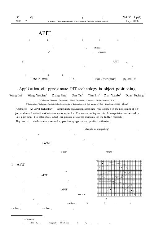
第36卷增刊(I)2006年7月 东南大学学报(自然科学版)JOURN AL OF SO UTHEAST UNI VERSITY (Natural S cience Edition ) Vol 136S up (I)July 2006 APIT 技术在目标定位中的应用王 磊1 王月清1 张 萍1 孙 涛1 田 斌1 柴远波2 段富强1(1海军工程大学电子工程学院,武汉430033)(2解放军信息工程学院信息技术研究所,郑州450002)摘要:提出了在无线传感器网络中目标定位与节点定位采用同一种技术———APIT 技术,即以三角形内的点近似定位算法来对未知节点和目标进行定位,这种算法仅需要少量通信和简单计算,同时还具有良好的扩展性,从而为进一步的研究提供了一个可行的思路.关键词:无线传感器网络;定位方法;位置估计中图分类号:T N915;TP301 文献标识码:A 文章编号:1001-0505(2006)增刊(I)20201203Application of a ppr oximate PIT technology in object positioningWang Lei 1 W ang Yueqing 1 Zhang Ping 1 S un T ao 1 Tian Bin 1 Chai Y uanb o 2 Duan Fuqiang1(1C ollege of Electroni c Engineering ,Naval Engi neering Univers i ty ,W uhan 430033,C hi na)(2Inform ati on T echnique G raduate School ,Uni vers ity of Inform ation and Engi neering of P LA ,Z hengzhou 450002,C hina )Abstract : An APIT technology —appr oximate localization algorithm —was adopted in the positioning of ob 2ject and node localization of wireless sensor netw orks.Fe w corresponding and sim ple c omputation are needed in this alg orithm.I t is extensible ,which can pr ovide a feasible mentality for the fur t her research.K ey w or ds : w ireless sens or netw orks ;positioni ng approaches;position estimation 收稿日期622 作者简介王磊(—),男,硕士生,@63;王月清(联系人),女,副教授,硕士生导师随着计算机技术和无线电通信技术的发展,普适计算(ubiquitous c omputing)将被应用在各种领域,融入到人们的日常生活中,提高人们的生活质量和水平.普适计算的一个前提条件是必须获取普适计算对象的位置信息[1],这个位置信息依据普适计算的不同具体应用,可以是基于区域范围的,也可以是基于精确坐标的.在无线传感器网络(W SN )中也同样面临着普适计算的需求.有很多定位技术都可以对物体进行定位,但适合普适计算要求的、对多个移动物体精确定位的、系统电子复杂性[2]低的技术却并不多.基于API T 定位技术是一种可行的、适合WS N 普适计算要求的定位技术.图1 目标定位区域示意图(○—节点;●—目标物体)1 APIT 算法分析无线传感器网络中存在两类定位技术,一是节点自定位技术,二是目标定位技术.APIT 作为在节点定位技术中应用比较成熟的技术,我们把它引入到目标定位技术中,这样在网络优化、减少系统电子复杂性、降低成本上将有很大的期望.在讨论这个问题之前,首先归纳出算法运行的环境.APIT 使用一个新的基于区域的方法来执行定位估测,这个方法将环境分离成anchor 节点间的三角形区域,用一个网格算法计算某个目标可能所在的最大区域.基本思想是,目标从所有听得见的anchors 中选择3个anchors ,然后连接这三个anchors ,构成一个三角形,判断目标是否:2000420.: .在三角形中.然后APIT 对不同的anchors 组合重复测试,直到测试完所有的组合或者得到要求的精确度为止.最后,计算所有包含目标的三角形的交集的质心,以此决定目标的大致位置.由于APIT 要求anchors 的密集度高,因此只适合anchors 节点密集的传感器网络.首先要考虑的是需要传感器网络是自组织的[3],假定节点都是已知的.为了简化和易于表示,限定在二维空间.假定所有的节点都位于区域内,如图1所示.在这种算法中如何确定目标物体在最近的3个节点所构成的三角形中.可以用到达时间及时间差测距法.到达时间(TO D )技术通过测量信号传播时间来测量距离.在TO A 方法中,若电波从节点到目标物体的传播时间为t ,电波传播速度为c ,则节点到目标物体的距离为t ×c .比较到各个节点的时间从而选出最短距离的节点构成三角形区域,如图2所示.图2 三角区域测试距离示意图(A:目标物体N :节点d :距离)在确定三角形区域后,测试目标物体在这三个节点所组成的三角形内部还是外部;然后再选择另外三个节点进行同样的测试,直到达到所需的精度.如果目标物体在三角形内部则这个三角形区域的质心作为估计位置[4].APIT 算法最关键的步骤是测试目标物体在三个节点所组成的三角形内部还是外部,这一测试的理论基础是三角形内的点(PI T )测试.PIT 测试用来测试目标物体是在三个节点所组成的三角形内部还是外部,其原理如图3所示.假如存在一个方向,沿着这个方向M 点会同时远离或者同时接近A 、B 、C 三个点,那么M 位于ΔA BC 外;否则M 位于ΔA BC 内.这就是PIT 测试的原理,其证明可以在文献[5]中找图3 PIT 测试示意图到.在静态目标物体,M 点固定,不能朝着不同的方向移动,此时无法执行PIT 测试,为此定义APIT 测试,如图4所示.假如目标物体M 的邻居节点中没有同时远离或同时靠近三个节点A ,B ,C 的节点,那么M 就在ΔA BC 之内;否则M 就在ΔA BC 之外.如图4中,目标物体M 通过与邻居节点1交换信息,得知自身运动至节点1,将远离节点B图4 APIT 示意图和C ,但会接近节点A ,与邻居节点2,3,4的判断过程类似,确定自身位于ΔA BC 内,而在图4的右图中,目标物体M 可知假定自身运动至邻居节点2处,将同时远离节点A ,B ,C ,故判断自身不在ΔABC 中.当目标物体M 比较靠近ΔA BC 的一条边,或者M周围的邻居节点分布不均匀时,APIT 的判断可能会发生错误,当节点密度越大,则APIT 判断发生错误的概率越小.2 结 语用APIT 技术对目标进行定位需要进一步解决的问题是:①降低距离相关的算法产生的距离误差.②距离无关的算法中有较稀疏节点时,目标可能不被多个已知节点包围下一步的工作是研究距离测量错误及稀疏对定位性能的影响,并针对现有定位算法的不足,提出三阶段的定位算法,包括距离测量、目标定位和迭代精确三个阶段202东南大学学报(自然科学版)第36卷anch ors .an ch or .参考文献(References)[1]付维权,孙志仁,曹奇英.普适计算中的定位感知系统[J ].单片机与嵌入式系统应用,2004(2):15218.Fu W eiquan ,Sun Z hiren ,Cao Qiying.Orientation apperceive sys tem in general suitab le account [J ].M icro controller &Embedd ed Sy stem ,2004(2):15218.(in Chinese )[2]雷鸣雳,周功道,冯祖仁.基于伪码相关技术的超生波2无线电定位系统[J ].微电子学与计算机,2004,24(3);1022106.Lei M ing li ,Z h ou G ongd ao ,Fen g Zuren.U ltras on ic 2radio wav e location s ystem based on pseud o 2rand om correlation techn ology[J ]Mi 2croelectronics &C omputer ,2004,24(3):102-106.(in Chinese )[3]周正.无线传感器网络节点自定位技术[J ].中兴通讯技术,2005,11(4):51256.Z h ou Zh eng.Self 2l ocalizati on techn olog ies for w ireless sens or n etw ork nodes[J ].Zh ongxing Teleco m T echnology ,2005,11(4);51-56.(in Ch inese)[4]李国华,刘宝铃,沈树群.基于超声波技术的3D 定位系统研制[J ].计算机测量与控制,2005,13(9):9262928.Li G u ohua ,Liu Baoling ,Shen Shuqun.Research and dev elopment o f 32D P ositioning s ystem based on the ultras ound techn olog y[J ].Compu ter Au to mated M easurement &Con tro l ,2005,13(9):926-928.(in Ch inese)[5]He T ian ,Huang Chengdu ,Blum B M ,et al.Range 2free l ocalizati on schemes in large scale sens or netw orks [C]//Proceeding s o f th e9th Annual International Con feren ce on Mo bile Co mputing and Network ing ,M OBIC OM ’2003.N ewY ork :A CM Press ,2003:81295.302增刊(I )王磊,等:APIT 技术在目标定位中的应用。

抵御虫洞攻击的无线传感器网安全定位算法陈立建;金洪波;毛科技;苗春雨;邬锦彬;陈庆章【摘要】Localization is a pivotal technology in wireless sensor networks and location information of sensor nodes is essential to location-based applications. Wireless sensor network is a dynamic network,which is re-localized for a time. However,attackers are invaded easily and influence the re-localization. In this paper,we analyze the influence of wormhole attack on DV-Hop firstly. Then,a Trust-Model-based DV-Hop localization against wormhole attack is proposed. The simulation results shows that the proposed TMDV-Hop can efficiently reduce the effects of the worm?hole attack on the DV-Hop re-localization without extra-hardware,which validates the effectiveness of the proposed algorithm.%节点定位技术是无线传感器网络的支撑技术之一,节点位置信息是很多基于无线传感器网络的应用的基础.无线传感器网络是一个动态的网络,每隔一段时间需要进行重新定位,并且在重定位过程中易受到攻击节点攻击.针对无线传感器网络中无需测距的定位技术,分析虫洞攻击对DV-Hop定位的影响,提出了一种基于信誉模型的抵御虫洞攻击的分布式轻量级DV-Hop安全定位算法TMDV-Hop(Trust-Model-based DV-Hop Localization Against Wormhole Attack).仿真表明,在无需额外硬件辅助下,TMDV-Hop算法能有效降低虫洞攻击对定位过程的影响,验证了该算法的有效性.【期刊名称】《传感技术学报》【年(卷),期】2016(029)012【总页数】6页(P1882-1887)【关键词】无线传感器网络;安全定位;DV-Hop;虫洞攻击;信誉模型【作者】陈立建;金洪波;毛科技;苗春雨;邬锦彬;陈庆章【作者单位】浙江广播电视大学萧山学院,杭州311201;浙江工业大学计算机科学与技术学院,杭州310023;浙江工业大学计算机科学与技术学院,杭州310023;浙江工业大学计算机科学与技术学院,杭州310023;浙江工业大学计算机科学与技术学院,杭州310023;浙江工业大学计算机科学与技术学院,杭州310023;浙江工业大学计算机科学与技术学院,杭州310023【正文语种】中文【中图分类】TP393无线传感器网络 WSNs(Wireless Sensor Networks)由大量传感器节点组成,已经广泛的应用在军事和生产生活中,例如战场监视、环境监测和卫生医疗方面[1]。

基于Schmidt正交单位化的稀疏化定位算法赵春晖;许云龙;黄辉;崔冰【摘要】To improve the localization accuracy of a node in the wireless sensor network with a mobile beacon node, a sparse localization algorithm using Schmidt orthonormalization ( SLSO) was proposed. With the SLSO, the node localization problem was converted to a reconstruction problemof the sparse signal by gridding the sensing area, and a new observation matrix which is able to effectively satisfy the restricted isometry property ( RIP ) was obtained by Schmidt orthonormalization. To solve the problem of the sparse signal being approximately sparse in the model, a centroid algorithm was adopted to improve the localization accuracy. The experiment results show that, compared with MAP algorithms, SLSO has better localization accuracy, and requires less broadcasting times.%为了提高在一个移动信标节点下的无线传感器网络节点定位的精度,提出了一种稀疏化的无线传感器网络节点定位算法。
一种基于迭代聚类的无线传感器网络定位算法(英文)罗海勇;李慧;赵方;彭金华【期刊名称】《中国通信:英文版》【年(卷),期】2011(8)1【摘要】In wireless sensor networks,node localization is a fundamental middleware service.In this paper,a robust and accurate localization algorithm is proposed,which uses a novel iterative clustering model to obtain the most representative intersection points between every two circles and use them to estimate the position of unknownnodes.Simulation results demonstrate that the proposed algorithm outperforms other localization schemes (such as Min-Max,etc.) in accuracy,scalability and gross error tolerance.【总页数】7页(P58-64)【关键词】无线传感器网络;定位算法;网络节点;聚类模型;迭代;中间件服务;仿真结果;极大极小【作者】罗海勇;李慧;赵方;彭金华【作者单位】Institute of Computing Technology,Chinese Academy of Sciences;Beijing University of Posts and Telecommunications【正文语种】中文【中图分类】TP212;P228【相关文献】1.一种基于模糊聚类的无线传感器网络定位算法 [J], 邱萌;乔秀全;徐惠民2.一种基于多维标度的分簇迭代无线传感器网络定位算法 [J], 林吉;李晖3.无线传感器网络中一种基于多维定标的迭代定位算法 [J], 陈万明;梅涛;孟庆虎;梁华为;刘玉枚4.一种基于迭代投票的无线传感器网络安全定位算法 [J], 张品;毛文敏;徐静5.一种基于多维标度的分簇迭代无线传感器网络定位算法 [J], 林吉;李晖因版权原因,仅展示原文概要,查看原文内容请购买。
Table of ContentsA Comparative Diagnosis Approach on Transformer’s Insulating OilMing-Jong Lin 1 Research and application based on MOOC courses certification platformBing Xu, Yizhi Zhang 6 The Research on Image Extraction and Segmentation Algorithm inLicense Plate RecognitionWeijian Fang, Xin Zhou 12 Analysis and Applications of Campus Network Flow ControlZhonghua Hu, Weijian Fang 17 A Survey of Computer Network Management TechnologyLi Tan 21 Application of the Cellular Automata Method to Simulation of MultiplePit Similar DefectsRusyn Bohdan, Tors`ka Roxana, Kosarevych Rostyslav 25 Integrated approach to the detection of distributed network attacksGulmira Shangytbayeva, Roza Beysembekova 29 The Study of Enterprise Technical Alliance Comprehensive Profit Allocation Based on Orthogonal ProjectionBo Wang 33 The Spatial Analysis of Monastery on the Qinghai-Tibet PlateauZhuoma CaiJi, Guo Luo, Dayuan Xue, Yuhuan Du 37 Comprehensive Brand Effect: A Data of Automobile BrandsYiweng Yang, Yan Xv, Jianbo Tu, Xuehong Ji 42 Application On the Accidental Vehicle Technology Expertise and Software DevelopmentHaihua Xu, Guangfu Li 49 Airworthiness Management and Engineering Curriculum and its ImplementationJianbo Hu 54 Using MFC and Managed C++ to Realize Configuration UtilityLaiping Wu, Tao Lin, Libin Chen 58 Research on the Relationship between User-to-User Interaction and UserCo-created ValueJianbo Tu, Yan Xu 63Design and implementation of timing tasks based on Avtivti5 Workflow TechnologyJieping Hu, Shulin Yang 68 The Measurement of Corporate Brand: Based on a Stakeholder PerspectiveYiweng Yang, Xinrui Zhang, Zelin Tong, Xuehong Ji 72 Seam the Real with the Virtual:a Review of Augmented RealityRui Zheng, Dan Zhang, Guosheng Yang 77 Reliability Optimization of Electrical Power Systems Subject to Severe Environmental LoadsChunyang Li, Shouhua Chen, Lingwei Li 81 Analysis of photovoltaic Cell Arrangement in the Independent solarPower generating System Installed above Farm LandGezhi Wu, Yu Zhou 87 Fuzzy PID Control System In Industrial EnvironmentHong He, Yu Li, Zhihong Zhang, Xiaojun Xu 91 Research on Data Transmission Method Based 4G in PlatformNingxia Yang, Yongfeng Chen, Min Qin 96 Sports 3D Simulation Technology and Its Application in Minority Sports PopularizationQi Huang, Xiaowei Zou, Haidong Yang 101 Design and Implementation of the Coastal Zone Ecological High Precision Monitoring and Assessment SystemWeiquan Wang, Xueping Zhang, Junkuo Cao 106 Analysis Of Inertial Stability Dynamical For Robot Based On LieAlgebraXinxing Lai, Jin Zhong 111 Design about Simple Tester of Low Capacitance Based on MAX038Liping Zheng 115 Development and Design of General Data Mining SystemBaowen Chen 120 Research on Intelligent Irrigation and Fertilization System In Greenhouse Based on Cloud ComputingLingyun Zhu 124 Analysis and Application of Data Mining Based on Clustering AlgorithmHonghui Lai, Xiaotao Lai 129 Research on Chinese segmentation algorithm based on Hadoop cloudplatformHong Chen 134 The research of land resources e-government system of Henan provincebased on GISXiaoxu Cheng 139 Node Localization Technology of Wireless Sensor Network (WSN) Basedon Harmony Search (HS) AlgorithmYiliang Guo, Bin Mu 145 Research on moving object tracking based on Markov modelCanrong Yao, Shaotao Liu 149 Research on the model design and simulation for training platform basedon network controlFanfan Wang, Lusi Liu, Xiaoli Wang 153 Research on image and video transmission mechanism of the Androidplatform based on 4GJuanjuan Liu, Zhengguang Liu, Zhigang Zhao 159 Research on the Control System of Greenhouse Based on Particle Swarmand Neural NetworkJun Wang, Haiye Yu 164 Efficiency Analysis Of Ground Source Heat Pump In Energy-SavingBuilding Based on Multi Target & Multi ConstraintBing Bai, Chongen Wang 169 Masonry Arch Technology Mortar Joint Control Method and StressAnalysisWeiya Yan 174 REIT Performance and Dynamic Portfolio ConsiderationsKeyu Feng, Yan Yan, Quanbao Li 178 Research on greenhouse intelligent remote control systemJun Wang, Hai Yu 183 24-hour greenhouse temperature prediction model based on the weatherforecastJun Wang, Hai Yu 188 Emergency evacuation simulation in public facilities based on CTMHecheng Zhou, XiaoFang Zhao 196 The Cusp Catastrophe Model of Major Accidents Based on Ideas ofBlack Swan and Its Application in Port Road ProjectsYanfeng Bai, Ling Zhang, Xuejun Wen 201 The Technique and Management of Investment Control in Metro EngineeringShunmao Mao, Tingting Zhu 207 Contrastive Analysis about the Case of Public Bicycle System AmongThree Cities in ShandongChuanzeng Song, Zheng Fa, Xinlei Li, Haiyang Song 212 Single Vehicle Traffic Accidents in Shanghai River-crossing TunnelsYingying Xing, Jian Lu, Chen Wang 219 Eco-Driving --- Current Strategies and issues, A Preliminary SurveyChunxiao Li, Aiping Ni, Jie Ding 226 The Application Research of Operating Vehicle GPS Big Data MiningYao Yu, Ding Chen 235 Research advance of the model of activated sludge process to wastewater treatmentJia Zhou, Limin Ma, Houran Song 240 Applications and platform of Technology-driven financial innovation and integration patterns for LED industrial chain of integrated businessGuoqing Qu, Feng Xiong, Junshi Li 245 Study on All-Phrase FFT Spectrum Analysis Technology in 25Hz SeriesTrack Circuit ReceiverTuo Shen, Lexiang Wei, Xiaoqing Zeng 251 Double T Filter Based New Cable Insulation Detection Approach AndDesign for the Subway TrainPeng Tian, Decun Dong, Hongliang Pan 256 The research on intelligent monitoring system of key tire parameters for automotive driving safety based on vehicular networking264 Huaguang Yang, Lin Xi, Qingquan He, Fengfeng Liu, Ming Yang, Hua Yan,Weimin YangReal time monitoring method for the longitudinal settlement of shieldtunnel using wireless inclinometerJianguo Yin, Hongwei Huang 274 A Potential Based Many-Particle Model for Pedestrian FlowXiaoyang Li, Peng Zhang, Dianliang Qiao, Wong S.C., Choi Keechoo 281 Research on Multidisciplinary Design Modeling of LED Lighting ProductsFeng Xiong, Renfei Ma, Jianjian Mei, Liu Lilan, Yu Tao 287。
2008年6月Journal on CommunicationsJune 2008第29卷第6期 通 信 学 报 V ol.29 No.6分布式无线传感器网络定位算法MDS-MAP(D)马震,刘云,沈波(北京交通大学 通信与信息系统北京市重点实验室,北京 100044)摘 要:针对无线传感器网络的定位问题,提出了一种分布式的算法MDS-MAP(D),明确给出了节点相对坐标计算和局部网络融合的过程,并对算法进行了计算复杂性分析和仿真。
MDS-MAP(D)以分布式节点分簇为基础,利用网络的连接关系,在不需要高精度测距技术支持的条件下对节点坐标进行估计,减小了节点定位的计算复杂度和能量消耗。
分析与仿真结果表明,算法的计算复杂度由3()O N 下降到2(),O Nm m N <,并且定位精度提高了1%~3%。
关键词:无线传感器网络;定位;多维标度;分布式中图分类号:TP393 文献标识码:A 文章编号:1000-436X(2008)06-0057-06Distributed locating algorithm for wireless sensornetworks- MDS-MAP(D)MA Zhen, LIU Yun, SHEN Bo(Key Laboratory of Communication & Information Systems, Beijing Jiaotong University,Beijing Municipal Commission of Education, Beijing 100044, China)Abstract: A new distributed locating algorithm MDS-MAP(D) was proposed, which attempted to improve the perform-ance of node localization in wireless sensor networks. The process of the computation about node relative coordinates and the aggregation from local network to global network are introduced explicitly. Further, the analyses to computational complexity and the simulations of the algorithm are also present. MDS-MAP(D), which is based on node clustering mechanism and uses connectivity of nodes to estimate the coordinates of nodes, reduces the complexity and energy con-sumption of node localization on the absence of distance measurement with high precision. The simulation and analysis results indicate that the complexity of node localization algorithm falls to 2(),O Nm m N < from 3()O N and the accu-racy is improved 1%~3%.Key words: wireless networks; location; multidimensional scaling; distribution1 引言无线传感器网络(WSN, wireless sensor network)技术在最近几年得到了迅速发展,正逐渐被广泛用于军事、交通、环境和工业生产等领域,完成对温度、湿度、压力和速度等许多物理量的测量[1]。
矿产资源开发利用方案编写内容要求及审查大纲
矿产资源开发利用方案编写内容要求及《矿产资源开发利用方案》审查大纲一、概述
㈠矿区位置、隶属关系和企业性质。
如为改扩建矿山, 应说明矿山现状、
特点及存在的主要问题。
㈡编制依据
(1简述项目前期工作进展情况及与有关方面对项目的意向性协议情况。
(2 列出开发利用方案编制所依据的主要基础性资料的名称。
如经储量管理部门认定的矿区地质勘探报告、选矿试验报告、加工利用试验报告、工程地质初评资料、矿区水文资料和供水资料等。
对改、扩建矿山应有生产实际资料, 如矿山总平面现状图、矿床开拓系统图、采场现状图和主要采选设备清单等。
二、矿产品需求现状和预测
㈠该矿产在国内需求情况和市场供应情况
1、矿产品现状及加工利用趋向。
2、国内近、远期的需求量及主要销向预测。
㈡产品价格分析
1、国内矿产品价格现状。
2、矿产品价格稳定性及变化趋势。
三、矿产资源概况
㈠矿区总体概况
1、矿区总体规划情况。
2、矿区矿产资源概况。
3、该设计与矿区总体开发的关系。
㈡该设计项目的资源概况
1、矿床地质及构造特征。
2、矿床开采技术条件及水文地质条件。