测绘专业英语考试试题
- 格式:doc
- 大小:68.50 KB
- 文档页数:4
测绘英语面试题及答案1. What is the difference between GPS and GIS?Answer: GPS stands for Global Positioning System, which is a satellite-based navigation system used for determining the precise location of a receiver on Earth. GIS, on the other hand, stands for Geographic Information System, which is a framework for gathering, managing, and analyzing data related to positions on Earth's surface.2. Explain the concept of triangulation in surveying.Answer: Triangulation is a surveying method that involves measuring the angles of a triangle formed by three known points. By knowing the length of one side and the angles opposite to the other two sides, the distances to the unknown points can be calculated using trigonometry.3. What is the role of a datum in geospatial data?Answer: A datum is a reference system used to define the shape of the Earth and the location of points on its surface. It is essential for ensuring that measurements are consistent and accurate across different datasets and geographic locations.4. How do you perform a topographic survey?Answer: A topographic survey involves measuring and mapping the physical and man-made features of an area. It typically includes the use of leveling instruments to determine elevations, and the collection of data on thelocation, shape, and elevation of features such as buildings, roads, and natural landforms.5. What is remote sensing and how is it used in mapping?Answer: Remote sensing is the acquisition of information about an object or phenomenon without making physical contact with the object. In mapping, it is used to collect data about the Earth's surface using satellite or aerial imagery, which can then be processed and analyzed to create detailed maps and 3D models.6. Describe the process of aerial photography for mapping.Answer: Aerial photography involves capturing images of the Earth's surface from an aircraft or drone. These images are then used to create maps and 3D models by identifying and measuring features on the ground. The process includes planning the flight path, taking high-resolution photographs, and processing the images to create accurate and detailed maps.7. What is the significance of LiDAR technology in modern surveying?Answer: LiDAR, which stands for Light Detection and Ranging, is a remote sensing technology that uses laser light to measure distances. It is significant in modern surveying because it allows for the rapid and accurate collection of highly detailed topographic data, even in challenging environments such as dense forests or urban areas.8. How do you ensure the accuracy of surveying measurements? Answer: Ensuring accuracy in surveying measurementsinvolves using high-quality instruments, following standardized procedures, and applying appropriate corrections for factors such as temperature, atmospheric conditions, and instrument errors. Additionally, thorough field checks and data validation are essential to confirm the reliability of the measurements.9. Explain the term 'geodetic control network'.Answer: A geodetic control network is a system of points on the Earth's surface that have been precisely measured and defined in terms of their coordinates. These points serve as a reference framework for other surveying and mapping activities, ensuring consistency and accuracy acrossdifferent projects and regions.10. What are the different types of map projections?Answer: Map projections are methods used to represent the Earth's surface on a flat plane. Different types include cylindrical projections (e.g., Mercator), conic projections (e.g., Lambert Conformal Conic), and azimuthal projections (e.g., Azimuthal Equidistant). Each type has its own strengths and weaknesses in terms of preserving distances, areas, shapes, or directions.。
测绘工程专业英语全文翻译(Unit20~30)Unit 20 Understan ding the GPS(认识GPS)What Is GPS?(什么是GPS)The global Positioning System (GPS) operated by the U .S. Department OF Defense (DOD)is a satellite-based system that can be used to locate positions anywhere on the earth(.全球定位系统(GPS),由美国国防部管理,是一个基于人造卫星的系统,可以用来在全球任何地方定位)GPS provides continuous (24 hours/day), real-time, 3-dimensional positioning, navigation and timing worldwide.(GPS 提供全世界范围内的全天候,实时,三维坐标,导航和授时的功能。
)Any person with a GPS receiver can access the system, and it can be used for anyapplication that requires location coordinates.(任何拥有一台GPS 接收机的人都可以使用这套系统,可以应用于任何需要位置坐标的工作中)The GPS system consists of three segments: ⑴the space segment: the GPS satellitesthemselves, ⑵the control segment, operated by the U .S. military, and ⑶the user segment,which includes both military and civilian users and their GPS equipments(.GPS 由三个部分组成:⑴太空部分:GPS 卫星自己,⑵地面控制部分,由美国军方控制,⑶用户部分,包括军方和民用用户和他们的装备。
一、词汇或短语翻译(英译汉)1. 沉陷观测2. 挠度观测3. 建筑红线放样4. 横断面测量5. 大地水准面差距或大地水准面高6. 正高7. 甚长基线干涉测量8. 最小二乘平差9. 方差-协方差矩阵10. 正态分布11. 竖盘指标差12. 光学对中器13. 附合导线14. 坐标方位角15. 天顶距16. 水道测量17. 1980 1980大地测量参考系统二、词汇或短语翻译(汉译英)1. 工程测量2. 施工放样3. 竣工测量4. 大地高5. 参考椭球参考椭球6. 卫星激光测距 ()7. 重力场8. 测量平差9. 多余观测10. 点位中误差 a11. 粗差检验12. 自动目标识别 ()13. 几何水准测量14. 水准尺15. 平面控制网16. 控制测量17. 地籍测量三、句子翻译(英译汉)1. , , .测量是测定地面上各点的相对位置,以便根据它们之间正确的水平或竖直关系,按比例展示出天然地物和人工地物的一种技术。
2. , , , .在进行高程测量的一般程序中,比如水准测量中保持前后视距相等,自动考虑和补偿了地球曲率和大气折光的影响,基于曲面得到的高程仍然是可靠的,不需要测量员对数据进行进一步的处理。
3. . . ,, .这种类型的测量考虑到地球曲率的影响,被称为大地测量。
这种类型的测量的特点是区域广、基线长,用来测定控制点的精确位置。
在大地测量中,测站之间距离长,需要使用比平面测量中更精密的仪器和测量方法。
4. , , .两点之间距离可以是水平的,倾斜的或垂直的。
. 水平距离和倾斜距离测量有多种方法,取决于测量的精度要求。
5. , a . , , .电子测距仪的问世给测量程序带来一场深刻的革命,导致了重点与技术的改变。
不管地形情况如何,距离测量现在都变得简单、迅速,而且有很高的精度。
5. . .更集成的电子测距仪除测量斜距外,同时还具备测量水平角、竖直角和天顶距的功能。
这类仪器一般称之为全站仪。
6. , .控制网的类型从小区域的、简单的、便宜的到大范围的、复杂的、价格昂贵的不等。
测绘工程专业英语考试重点Geomatic测绘学Geosciences地球科学Geodesy大地测量学Cadastral surveying地籍测量Geodetic surveying 大地测量Marine survey 海洋测量Geological survey 地质测量Control survey 控制测量Horizontal survey 水平测量Vertical survey 高程测量Topographic survey 地形测量Tacheometry 视距测量Contour等高线Chart图表Fieldwork外业Officework内业Elevation高程Basic point 基准点Benchmark 水准基点Stations 测站Geoid 水准面Vertical垂直Theodolite经纬仪Monumentation埋石Latitude纬度Longitude经度Prime meridian 本初子午线Gravity field 重力场Curvature 曲率Fixed error 固定误差Proportionnal error 比例误差Multiplication constant 乘常数Angle 角度Zenith distance 天顶距Circle 度盘Azimuth方位角Triangulation 三角测量Traversing 导线测量Triangulateration 边角测量Control network 控制网Forward intersection 前方交会Resection 后方交会Side intersection 侧方交会Traverse angle 导线折角Open traverse 支导线Close traverse 闭合导线Close loop traverse闭合环导线Connecting traverse 符合导线Coordinate increment坐标增量Trigonometric leveling 三高程测量Horizontal 水平距Rod plate 尺垫Coordinates 坐标系Geodetic 大地基准Origin 原点Parameter 参数Map projection 地图投影Equidistant projection等距投影Equivalent projection 等积投影Orthographic projection 正射投影Differential correction 差分改正Real time kinematicRTK实动定位Cartograph制图学Raster 栅格光栅Embed 嵌入Resolution 分辨率Data classification 数据分类Topological relationship 拓扑关系aerial photogrammetry 航空摄测量Remote sensing 遥感InSAR干涉合成孔径雷达Prism 棱镜Blunder/gross error 粗差Index error 指标差Standard deviation 标准差Mean square error中误差Calibrate 校准Normal equation 法方程Space segment 空间部分--------------------------settlement observation 沉陷观测deflection observation 挠度观测property line survey 建筑红线放样cross-section survey 横断面测量geoid undulation 大地水准面差距orthometric height 正高very long baseline interferometry甚长基线干涉测量connecting traverse 附合导线zenith distance 天顶距hydrographic survey 水道测量工程测量engineering survey施工放样construction layout orsetting-out survey竣工测量as-built survey参考椭球reference ellipsoid 参考卫星激光测距satellite laserranging(SLR)重力场gravity field测量平差adjustment ofobservation or survey adjustment多余观测redundant observation点位中误差mean square error ofa point粗差检验gross error detection自动目标识别automatic targetrecognition(ATR水准尺level lod平面控制网horizontal controlnetwork地籍测量cadastral surveying orproperty survey1. Surveying is the art of making such measurements of the relative positions of points on the surface of the earth that, on drawing them to scale, natural and artificial features may be exhibited in their correct horizontal or vertical relationships.测量是测定地面上各点的相对位置,以便根据它们之间正确的水平或竖直关系,按比例展示出天然地物和人工地物的一种技术。
一、名词解释:1、Surveying (测量学)is the art of making such measurements of the relative positions of points on the surface of Earth that,on drawing them to scale natural and artificial features may be exhibited in their correct horizontal or vertical relationships.2、Plane surveying (平面测量)is of wide scope and utility,and its methods are e mployed in the vast majorit y of surveys undertaken for various purposes,such as en gineering ,architectural,legal,c ommercial,scientific,geograph ical,exploratory,military,and n avigational.3、Geodetic surveys(大地测量)are usually of a nati onal character,occasionally w orks of international coopera tion,and they are undertaken as basis for the production of accurate maps of wide areas.4、Leveling(水准测量) is t he general term applied to a ny of the various processes by which elevations of point s or differences in elevation are determined.5、The theodolite (经纬仪)is an instrument designed for the measurement of hori zontal and vertical angles.It is the most precise instrume nt available for such observ ations,and is of wide applica bility in surveying.6、A traverse(导线)is a series of consecutive lines whose lengths and directions have been determined from field measurements7、Traversing(导线测量),the act of establishing traverse stations and making the ne cessary measurements,is one of the most basic and wid ely practiced means of deter mining the relative locations of points.8、Azimuths(方位角)are measured clockwise from th e north end of the meridian through the angle points. 9、Topographic surveys(地形测量)are made to deter mine the configuration (relie f) of the earth’s surface and to locate natural and cultur al features on it.10、A topographic map(地形图)is a large scale repres entation of a portion of theEarth’s showing culture, relief, hydrography, and perhaps vegetation.11、Systematic-Error(系统误差):These-errors conformto mathematical and physical laws.Their magnitude maybe constant or variable depending on conditions.12、Radom error(偶然误差):These are errors that remain after mistakes and systematic errors have been eliminated.13、Precision(精度)refers to the degree of refinementor consistency of a group of measurements.14、Accuracy(准确度)which denotes the absolute nearness of measured quantities to their true values.二、填空1、The metal case is attached to some part of the instrument in such a way as topermit some (adjustment) of the position.2、Transits,are instrumentswhich ..... Along the verticalplane (altitude) as well asthe horizontal plane (azimuth).3、These instruments are (tripods),plane tables,(level rods),chains,and (tapes).4、As can be observed ,EDM systems are made up ofthree components-(a transmitter),(a reflector),and (a receiver).5、....the telescope must becapable of rotation about a(horizontal axis),for measurement of horizonal angles,the instrument must be rotatedabout a (vertical axis).6、There must be an (indexmark) on the rotating part,placed so that readings canbe taken against it on the(graduated circle).7、.....the observer operatesa setting device to obtain a(mean reading) free from(eccentricity error).8、If the (plumb bob) is not over the point,the (centering screw) can be loosenedand the.......9、These notes include directions.....stations with (fourdifferent positions).Two readings were taken on each position (one with the telescope normal or direct and onewith the instrument (reversed or plunged)).10、The line is determinedby a telescope with the usual components consisting of(object glass),(focusing arrangement),(diaphragm withcross-lines), and (eye-piece).11、A level fitted with (horizontal circle) and (stadia lines) can be used to make acomplete (three-dimensional) survey of a limited area round the instrument.12、Levels are used to obtain the direct measurement of (height differences)between two points.13、Which transmit either (modulated laser) or (infrared light) having wavelengths within or slightly beyondthe ......14、Which transmits (microwaves) with (frequencies) in the range of 3 to 35GHZcorresponding to wavelength of about 1.0 to 8.6 mm.15、The methods used in measuring angles or directionsof traverse lines vary,and include (compass bearings),(interior angles),(deflection angles),(angles to the right),(azimuths).16、The instrument is oriented at each station by (backsighting) on the previous point with (the back bearingset) on the plates.17、(Electronic devices) and (taping) are used most often and provide the highestorder of accuracy.18、On construction work,(allowable limits of closure)depend on the use and extent of the traverse and typeof project.Bright location, for example ,demands a highdegree of precision.19、Vertical control is provided by bench marks in or near the tract to be surveyed.It becomes the foundation for correctly portraying reliefon a map,A (vertical control net)is established by (lines of levels)starting fromand closing on bench marks.三、翻译:1、It is convenient to considerthat a bubble tube has anaxis,which may be taken as astraight line parallel to the freesurface of the liquid when thebubble is in the centralposition determined by thegraduation marks.当气泡处于分划线所确定的中心位置时,我们可以很容易想像水准管有一个轴,这个轴可以看作是一条与液体的自由表面平行的直线。
高二英语地质勘探单选题40题1.Geologists use _____ to study the structure of the earth.A.telescopesB.microscopesC.satellitesD.seismographs答案:D。
本题考查地质学家使用的工具名称。
选项A“telescopes”是望远镜,用于观测天体等;选项B“microscopes”是显微镜,用于观察微小物体;选项C“satellites”是卫星,主要用于通讯、气象等领域;选项D“seismographs”是地震仪,地质学家使用地震仪来研究地球结构。
2.During geological exploration, they often _____ rocks to analyze their composition.A.collectB.holdC.touchD.throw答案:A。
本题考查在地质勘探中对岩石的动作。
选项B“hold”是拿着;选项C“touch”是触摸;选项D“throw”是扔;选项A“collect”是收集,在地质勘探中,地质学家经常收集岩石来分析其成分。
3.The _____ is an important tool for measuring the thickness of rock layers.A.rulerB.tape measureC.sonarD.sediment core答案:B。
本题考查测量岩石层厚度的工具。
选项A“ruler”是尺子,一般用于测量较小物体的长度;选项C“sonar”是声纳,主要用于水下探测;选项D“sediment core”是沉积物岩心;选项B“tape measure”是卷尺,可以用来测量岩石层的厚度。
4.Geologists _____ different methods to determine the age of rocks.eB.makeC.doD.have答案:A。
Geomatics is a relatively new scientific term created by Pollock and Wright in 1969, with the intention of combining the terms geodesy and geoinformatics.It includes the tools and techniques used inSurveying and Mapping,Remote Sensing (RS),Cartography,Geographic Information Systems(GIS), Global Navigation Satellite Systems(GNSS, i.e.,GPS, Glonass,Galileo,Compass),Photogrammetry, Geography, Geosciences, Computer Sciences, Information Science and various spatial observation technologies, land development and environmental sciences, etc.测绘学是一种相对较新的科学术语由波洛克和赖特在1969年提出,目的是将大地测量学与地理信息学结合起来。
它包括的工具和技术应用于测绘、遥感(RS)、地图学、地理信息系统(GIS)、全球导航卫星系统(GNSS,即。
、GPS、Glonass、伽利略、北斗),摄影测量、地理学、地球科学、计算机科学、信息科学和各种空间观测技术、土地开发、环境科学等。
Surveying may be defined as the technology and scie nce of the study of earth’s shape and size, as well as making measurements of the relative positions of natural and man-made features on, above or below the earth’s surface, and representing these information in analog forms as contoured maps or sections, paper plan or chart, or as figures in report tables, or in digital form as a three dimensional mathematical model stored in the computer.测量的技术和科学可以定义为研究地球的形状和大小,以及测量位于地球表面上或者低于或者高于地球表面的自然的或人造的物体的相对位置,并将这些信息以模拟形式的波状外形的地图、剖面图、论文计划、图表、数据报告表中呈现或以数字形式存储在计算机三维数学模型中。
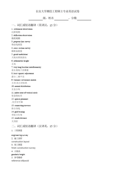
长安大学测绘工程硕士专业英语试卷级,姓名,分数一、词汇或短语翻译(英译汉,15分)1.settlement observation沉降观测2.deflection observation挠度观测3.property line survey物业线测量4.cross-section survey横断面测量5.geoid undulation`大地水准面波动6.orthometric height正高7.very long baseline interferometry甚长基线干涉测量8.least-squares adjustment最小二乘平差9.variance-covariance matrix方差-协方差矩阵10.normal distribution正态分布11.index error of vertical circle竖盘指标差12.optical plummet.光学对中器13.connecting traverse附合导线14.grid bearing坐标方位角15.zenith distance天顶距二、词汇或短语翻译(汉译英,15分)1.工程测量engineering survey2.施工放样construction layout3.竣工测量finish construction survey4.大地高geodetic height5.参考椭球reference ellipsoid6.卫星激光测距)satellite laser ranging7.重力场gravitational field8.测量平差measurement adjustment9.多余观测redundant observation10.点位中误差mean square error of a point11.粗差检验Gross error test12.自动目标识别automatic target recognition ATR13.几何水准测量geometrical levelling14.水准尺leveling rod15.平面控制网horizontal control network三、句子翻译(英译汉,32分)1.Surveying is the art of making such measurements of the relative positions of points on the surface of the earth that,on drawing them to scale,natural and artificial features may be exhibited in their correct horizontal or vertical relationships.2.The ordinary procedure in determining elevations,such as balancing backsight and foresight distance in differential leveling,automatically takes into account the curvature of the earth and compensates for earth curvature and refraction,and elevations referred to the curved surface of reference are secured without extra effort by the surveyor.3.The type of surveying that takes that takes into account the true shape of the earth is called geodetic surveying.This type of survey of survey is suited for large areas and long lines and is used to find the precise location of basic points needed for establishing control for other surveys.In geodetic surveying,the stations are normally long distances apart,and more precise instruments and surveying methods are required for this type of surveying than for plane surveying.4.Distance between two points can be horizontal,slope,or vertical.Horizontal and slope distances can be measured with lots of techniques of measurement depending on the desired quality of the result.5.The advent of EDM instrument has completely revolutionized all surveying procedures,resulting in a change of emphasis and techniques.Distance can now be measured easily,quickly and with great accuracy,regardless of terrain conditions.5.More complete EDM instruments also have the capacity of measuring horizontal and vertical or zenith angles as well as the slope distance.These instruments referred to as total station instruments.6.Control networks range from small,simple and inexpensive to large and complex and very expensive to establish.7.The method of surveying called triangulation is based on the trigonometric proposition that if one side and three angles of a triangle are known,the remaining sides can be computed by the law of sines.Furthermore,if the direction of one side is known,the direction of the remaining sides can be determined.And the coordinates of unknown points can be computed by application of trigonometry.8.Since the advent of EDM equipment,traversing has emerged as the most popular method to establish control networks such as basic area control,mapping,control of hydrographic surveys and construction projects.9.In engineering surveying,it is ideal way to surveys and dimensional control of route-type projects such as highway,railroad,and pipeline construction.10.An indirect measurement requires calculation and can be determined from its mathematical relationships to direct measurements when it is not possible or practical to make direct measurements.For example,station coordinates can be mathematically computed by measuring angles and lengths of lines between points directly. 11.Whenever the surveyor conducts a field survey,no matter how simple or complex,he invariably makes more measurements than are absolutely necessary to locate the points in the survey.12.In a least-squares adjustment,the following condition of mathematical probability is enforced:The sum of the square of the errors times their respective weights are minimized.In surveying,errors in measurements conform to the laws of probability,and they follow the normal distribution theory.13.Students are tempted to scribble notes on scrap sheets of paper for later transfer in neater form to the regular field book.14.This demonstration should make the student conscious of the need for care of these screws,which can become bound or even stripped if too pressure is applied.15.It can be seen that for short distances up to several hundred feet EDM equipment may not provide measurements as precise as those obtained by taping.16.Due to factors such as changes of ground water level,tidal phenomena,tectonic phenomena,etc,engineering structures(such as dams,bridges,high rise buildings,etc.)are subject to deformation.四、段落翻译(英译汉,38分)1.A total station is the most commonly used instrument now in geomatics engineering,which is fully integrated instrument that captures all the spatial data necessary for a3-dimensional positional information.A total station integrates the functions of an electronic theodolite for measuring angles,an EDM for measuring distances,digital data and a data recorder.All total stations have similar constructional features regardless of their age or level of technology,and all perform basically the same function.After the instrument has been set up on a control station,centered,leveled and properly oriented,and the prismtarget has been set up over another point whose position is to be measured,the surveyor may focus the target and depress a button.Then output from the horizontal and vertical circular encoders and from the EDM can be displayed at the instrument and stored in a data collector and enters into a built-in microprocessor.The microprocessor can convert the measured slope distance to the horizontal distance using the measured vertical or zenith angle.The microprocessor also computes the difference in elevation between the instrument center and the prism target.If the elevation of the instrument center(the HI)and the height of the reflector target(the HT)above the ground are entered,the microprocessor computes the elevation of the target station taking into account the effect of curvature and refraction.2.In the last decade,there has been dramatic development and growth in the use of hardware and software solutions to both measure and process geo-spatial data.This has created and will continue to create new areas of application,with associated job opportunities for suitably qualified graduates.As a result,the role of the “surveyor”is expanding beyond traditional areas of practice,as described above,into new areas of opportunity.In addition,recent advances in the technology of data collection and processing have blurred the boundaries of practice and activity between what were previously regarded as related but separate areas.Such developments are forecast to continue and will create new career paths for graduates whose education and training is broadly based and of a high academic standard.As we know,surveying is divided into two major categories:geodetic surveying and plane surveying.Geodetic surveying takes into account the true shape of the earth whereas plane surveying treats the earth as a flat surface. The subject of this text aims at the study of the size and shape of the earth which refers to Geodesy.The expression“the size and shape of the earth”has various meanings in geodesy according to the way it is used and the precision with which the earth’s size and shape is to be defined.The actual topographic surface is most apparent with its variety of landforms and water areas.This is,in fact,the surface on which actual earth measurements are made.It is not suitable,however,for exact mathematical computations because the formulas which would be required to take the irregularities into account would necessitate a prohibitive amount of computations.。
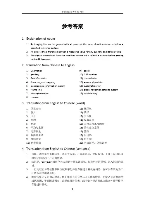
参考答案1.Explanation of nouns1)Animaging line on the ground with all points at the same elevation above or below aspecified reference surface.2)An error is the difference between a measured value for any quantity and its true value.3)The signals transmitted from the satellites bounce off a reflective surface before gettingto the GPS receiver.2.translation from Chinese to English1)Geomatics2)geodesy3)Geoinformatics4)Surveying and mapping5)Geographical information system6)Plumb line7)photogrammetry8)contour 9)geoid10)GPS receiver11)constellation12)accuracy/precision13)systematicerror14)global navigation satellite system15)spatial entity3.Translation from English to Chinese (word)1)卫星定位2)航片3)卫片4)高程5)精度6)平均海水面7)地形测量8)视距测量法9)海洋测量10)精密量剧11)视距丝12)放样13)全站仪14)仪器误差15)三角高程水准测量16)惯性定位系统17)伪距18)民用码19)拓扑学20)随机误差,偶然误差4.Translation from English to Chinese (sentence)1)这样,测绘学在地球科学,各种工程学,计算机科学,空间规划,土地开发和环境科学之间架起了广泛的桥梁。
最新测绘工程专业英语复习资料及答案第一章1.geoscience:地球科学rmation:信息学;情报学3.monitor:监控;监测;监视;控制;追踪;监控器4.appreciate:增值;涨价;鉴赏;赏识5.dwindle:缩小6.国际标准化组织:International Standardization Organization:7.explicit:清楚的;外在的;直率的8.hydrographic:与水道测量有关的;与水文地理有关的9.海道测量:hydrographic survey:10.p ractitioner:从业者11.e xpertise:专门技术;专家的意见12.f lexibility:适应性;机动性13.i ncorporation:结合;合并;形成法人组织;形成公司14.c oherent:一致的;连贯的15.d emise:死亡;让位;让渡;馈赠16.b lur;弄得模糊不清;涂污;污损17.v isualization:可视化;清楚呈现18.p ertaining:与...有关,附属...的19.i magery:肖像;雕刻影像20.p lotting:标图;测绘21.i llustrative:说明性的;例证性的22.e ntity:实体23.d igitize:将资料数字化24.r egistration:注册;报到;登记25.f orestry:林产;森林地;林学26.地质学;地质概况:geology27.地理学的;地理的:geographical28.i nfrastructure:基础下部组织;下部组织29.导航;航海;航空;领航;navigation30.q uarterly:一年四季的;每季的31.e volve:(使)发展;(使)进展;(使)进化32.c adastre:地籍;地籍簿;地籍图33.地籍测量:cadastral surveying34.s ensor:传感器35.m anipulate:(熟练地)操作;使(机器等);利用36.s tate-of-the-art:先进的;一流的37.地球物理学:geophysics38.o ceanography:海洋学39.r etrieval:检索;恢复;修补;重获40.e mbrace:拥抱;互相拥抱;包含;收买;拥抱41.测绘学:geomatics42.大地测量学:geodesy43.测绘:surveying and mapping44.摄影测量学:photogrammetry45.遥感(RS):remote sensing46.全球定位系统(GPS):global positioning system47.卫星定位:satellite positioning48.地理信息系统(GIS):geographic information system49.土地管理:land management50.c omputer graphics:计算机图形学第二章1.Artificial (ABC)A、人造的B、假的C、非原产地的D、艺术作品2.Analog(BC)A、相同的B、类似物C、相似体D、一样的3.Category(ABC)A、种类B、类别C、范畴D、种族4.Permanent(AB)A、永久的B、持久的C、永别的D、怀孕5.Spheroid(ABC)A、球状体B、椭球体C、旋转椭球体D、圆球体6.Allowance(ABC)A、容许误差B、容差C、容许量D、误差7.Meridian(ABCD)A、子午线B、正午C、子午线的D、正午的7.Northing(AD)A、北距(向北航行的距离)B、北方C、北边D、北进8.Sophisticate(BCD)A、改变B、弄复杂C、篡改D、使变得世故9.Trench(ABCD)A、沟壕B、堑壕C、管沟D、电缆沟10.Tangent(ABD)A、相切的B、切线的C、切开D、切线8.图表;海图:chart9.Dimensional:空间的10.Monument:纪念碑11.永久标石:permanent monument12.Monumentation:埋石13.外业工作;实地调查;野外作业: fieldwork14.经纬仪:theodolite15.Prerequisite:先决条件16.直径:diameter17.赤道;赤道线:equator18.纬度;范围;地区(复数):latitude19.经度;经线经度:longitude20.本初子午线:prime meridian21.东西距;朝东方;东行航程:easting22.重力;地心引力:gravity23.gravity field:重力场24.曲率;弯曲:curvature25.铅锤;垂直的;使垂直:plumb26.plumb line:铅垂线27.Trigonometry:三角法28.plane trigonometry:平面三角29.Algebra:代数学30.Analytical:解析的;分析的31.analytical geometry:解析几何32.弦长:chord33.三角形;三角关系:triangle34.Spherical:球形的;球的35.大地水准面:geoid36.Atlantic Ocean:大西洋37.Pacific Ocean:太平洋38.后视:backsight39.前视:foresight40.折光;折射:refraction41.大地测量;大地测量学:geodetic surveying42.平面测量;平面测量学:plane surveying43.控制测量:control survey44.水平测量;平面测量:horizontal surveying45.高程测量;垂直测量:vertical surveying46.地形测量:topographic survey47.碎部测量:detail survey48.土地测量;地籍测量: land survey49.路线测量:route survey50.管道测量:pipe survey51.城市测量:city survey52.hydrographic survey:水道测量53.marine survey:海洋测量54.mine survey:矿山测量55.geological survey:地质测量第三章56.Fundamental(BD)A、基本方法B、基本原则C、基本政策D、基本原理33.Odometer(AD)A、里程表B、计程车C、油耗表D、自动计程仪57.Vehicle(ABCD)A、交通工具B、车辆C、媒介物D、传达手段43.Circumference(BD)A、周长B、周围C、周遭D、圆周41.Stadia(AB)A、视距B、视距仪C、视距测量D、视距尺42.Intercept(BD)A、截断B、截取C、截获D、中途阻止43.Multiply(ABD)A、乘B、增加C、增援D、繁殖44.Nominal(ABCD)A、名义的B、有名无实的C、名字的D、名词性的45.Consequence(ABCE)A、结果推理B、推论C、因果关系D、推开E、重要的地位67.Visibility(ACDE)A、可见度B、可见光C、可见性D、显著E、面向度69.Airborne(BCD)A、空中的B、空气传播的C、空降的D、空运的58.Modulated(ABC)A、已调整的B、已调制的C、被调的D、调制调节器59.Particle(ABCDE)A、粒子B、点C、极小量D、微粒E、质点1.Euclidean space:欧几里德空间2.旋转,革命:revolution3.invar正确答案:第一空:铟瓦第二空:不胀钢4.alloy正确答案:第一空:合金5.coefficient正确答案:第一空:系数6.thermal正确答案:第一空:热的第二空:热量的7.tacheometry正确答案:第一空:视距测量8.望远镜正确答案:第一空: telescope9.manufacturer正确答案:第一空:制造业者第二空:厂商10.topographic正确答案:第一空:地势的第二空:地形学上的11.作为结果而发生的;合成的正确答案:第一空: resultant12.地形正确答案:第一空: terrain13.electromagnetic正确答案:第一空:电磁的14.infrared正确答案:第一空:红外线的第二空:红外线15.distance measurement正确答案:第一空:距离测量16.precise ranging正确答案:第一空:精密测距17.步测,定步正确答案:第一空: pacing18.distance measurement instrument正确答案:第一空:测距仪19.rangefinder正确答案:第一空:测距仪20.electronic distance measurement正确答案:第一空:电子测距仪21.光速测距仪,光电测距仪正确答案:第一空: geodimeter22.electromagnetic distance measureing instrument正确答案:第一空:电磁波测距仪23.elctro-optical distance measuring instrument 正确答案:第一空:光电测距仪24.long-range EDM instrument正确答案:第一空:远程电子测距仪25.infrared EDM instrument正确答案:第一空:红外测距仪ser distance measuring instrument正确答案:第一空:激光测距仪ser ranger正确答案:第一空:激光测距仪28.microwave distance measuring instrument正确答案:第一空:微波测距仪29.satellite laser ranger正确答案:第一空:卫星激光测距仪30.two-color laser ranger正确答案:第一空:双色激光测距仪批语31.测距误差正确答案:第一空: distance-measuring error 32.固定误差正确答案:第一空: fixed error33.比例误差正确答案:第一空: proportional error34.视距正确答案:第一空: sighting distance35.multiplication constant正确答案:第一空:乘常数36.加常数正确答案:第一空: addition constant37.stadia multiplication constant正确答案:第一空:视距乘常数38.视距加常数正确答案:第一空: stadia addition constant 39.standard field of length正确答案:第一空:长度标准检定场40.标称精度正确答案:第一空: nominal accuracy41.视距丝正确答案:第一空: stadia hair42.视距间隔正确答案:第一空: stadia interval一、第四章1.perpendicular A、相交的B、垂直的C、相连的D、正交的正确答案:BD2.projectionA、投影,投影图,地图投影B、投射C、规划D、项目正确答案:ABC3.radiusA、半径B、范围C、辐射光线D、有效航程E、界限正确答案:ABCDE menceA、开始B、开展C、开发D、着手正确答案:AD 5.clampA、夹子B、夹具C、夹钳D、夹住正确答案:ABC6.spindleA、锭子B、纺锤C、纺织D、轴/杆/芯轴正确答案:ABD二.填空题(共39题,86.8分)1.(直线)相交,交叉正确答案:第一空:intersect 2.天顶,顶点,顶峰,最高点正确答案:第一空:zenith3.celestial正确答案:第一空:天上的stial sphere正确答案:第一空:天球5.测角器,倾斜仪正确答案:第一空:clinometer 6.sextant正确答案:第一空:六分仪7.罗盘,指南针,圆规正确答案:第一空:compass8.protractor正确答案:第一空:量角器9.顺时针方向的正确答案:第一空:clockwise10.反时针方向的正确答案:第一空:counterclockwise11.sexagesimal正确答案:第一空:六十的第二空:六十进位的12.sexagesimal system正确答案:第一空:六十分制13.切成两份,对开正确答案:第一空:bisect14.编码器,译码器正确答案:第一空:encoder15.结晶状的,水晶正确答案:第一空:crystal16.liquid crystal displays正确答案:第一空:液晶显示17.diode正确答案:第一空:二极管ht-emitting diode displays正确答案:第一空:发光二极管显示19.钟摆,摇摆正确答案:第一空:pendulum20.补偿器正确答案:第一空:compensator21.供应正确答案:第一空:provision22.indexing正确答案:第一空:标定指数23.初始化正确答案:第一空:initialize24.方位,方位角正确答案:第一空:azimuth25.方向,方位正确答案:第一空:bearing26.象限正确答案:第一空:quadrant27.水平角正确答案:第一空:horizontal angle28.垂直角正确答案:第一空:vertical angle29.俯角正确答案:第一空:depression angle 30天顶距正.确答案:第一空:zenith distance批语31.高度角正确答案:第一空:elevation angle32.水平刻度盘正确答案:第一空:horizontal circle33.竖直度盘正确答案:第一空:vertical circle34.真北正确答案:第一空:true north35.大地方位角正确答案:第一空:geodetic azimuth36.坐标方位角正确答案:第一空:grid azimuth37.磁方位角正确答案:第一空:magnetic azimuth38.方向观测法正确答案:第一空:method by series 第二空:method of direction observation39.method in all combination正确答案:第一空:全组合测角法1.A vertical line at any point on the earth’s surface is the line that follows the direction of gravity at that point.正确答案:地球表面任一点的垂线是指这点上沿着重力的方向的线。
专业英语练习一Exercise One1.Explain the meaning of each of the following technical terms in English and write the corresponding technical term in Chinese.2.解释下列术语中的每一个技术术语的含义,并在中文书写相应的技术术语。
1) Geomatics 测绘学;2) geoinformatics地理信息技术;地理信息学2. Answer the following questions in English.用英语回答下面的问题。
1) What does the term Geomatics mean?2) What are the sources of spatial data comes from? 空间数据的来源是什么?3) What kind of disciplines can Geomatics find its application? 什么样的学科地理信息学能找到它的应用吗?3. Write the corresponding English terms of the Chinese terms写相应的英语术语的术语1) 测绘学2) 大地测量学3) 测绘4) 摄影测量学5) 遥感6) 全球定位系统7) 卫星定位8) 地理信息系统10) 土地管理11) 计算机图形学4. Translate the following sentences into Chinese. 把下列句子译成中文。
1) Geomatics is a field of activities which, using a systemic approach, integrates all the means used to acquire and manage spatial data required as part of scientific, administrative, legal and technical operations involved in the process of the production and management of spatial information.课本p7 Notes③2) The term geomatics emerged first in Canada and as an academic discipline; it has been introduced worldwide in a number of institutes of higher education during the past few years, mostly by renaming what was previously called “geodesy”or “surveying”, and by adding a number of computer science-and/or GIS-oriented courses. 课本p7 Notes①3) Geomatics is the modern scientific term referring to the integrated approach of measurement, analysis, management, storage and display of the descriptions and location of Earth based data, often termed spatial data. These data come from many sources, including earth orbiting satellites, air and sea-borne sensors and ground based instruments. It is processed and manipulated withstate-of-the-art information technology using computer software and hardware. It has applications in all disciplines which depend on spatial data, including environmental studies, planning, engineering, navigation, geology and geophysics, oceanography, land development and land ownership and tourism. It is thus fundamental to all the geoscience disciplines which use spatially related data. [from the School of Geomatic Engineering, Univ. of New South Wales] 测绘学是现代科学术语,指的是地球基础数据(通常被称为空间数据)的描述和位置的测量,分析,处理,存储和显示的综合办法。
测绘工程专业英语pdf测绘工程专业英语涉及了该领域的专业词汇和表达方式。
以下是一些常见的测绘工程专业英语词汇和短语:1. surveying engineering:测绘工程2. mapping:测绘3. surveying instrument:测绘仪器4. surveying chain:测链5. leveling instrument:水准仪6. theodolite:经纬仪7. global positioning system (GPS):全球定位系统8. digital elevation model (DEM):数字高程模型9. digital terrain model (DTM):数字地形模型10. remote sensing:遥感11. image processing:图像处理12. geographic information system (GIS):地理信息系统13. map projection:地图投影14. coordinate system:坐标系15. triangulation:三角测量16. traverse surveying:导线测量17. leveling:水准测量18. GPS positioning:GPS定位19. map compilation:地图编制20. photogrammetry:摄影测量21. structure from motion (SfM):运动结构法22. close-range surveying:近景测量23. LiDAR (Light Detection and Ranging):激光雷达测量24. bathymetry:水深测量25. grading and layout:土方量计算与施工布置26. map updating:地图更新。
GIS专业英语复习题〔一〕I.Directions: The following is a list of terms about Geographic Information Systems. After reading it, you are required to find the items equivalent to those given in Chinese in the table below. 〔5*2=10 marks〕A-data conversion K-longitudeB-coordinate system L-projection and registrationC-map projectionsM-correlation analysisD-latitude N-spatial dataE-thematic mapO-hypermediaF-vector data P-geographical information systems(GIS)G-spatial analysis Q-raster dataH-multimedia R-digital elevation models(DEM)I-geo-referenced data S- Overlay AnalysisJ-information retrieval T-database management system(DBMS)1.( ) 叠加分析( ) 地理参照数据2.( ) 信息检索( )经度,经线3.( ) 栅格数据( )专题地图4.( ) 投影与匹配()空间数据5.( )数字高程模型()坐标系统II. Directions: There are 5 incomplete statements here. You should fill in each blank with the proper word according to the knowledge of Geographic Information Systems. (10*1=10marks)1. The Pioneering stage of development history of GIS began to appear in the_______.2.There are two major methods to input, store and visualize mapped data in GIS: ______ GIS and ______ GIS.3. In the vector based model, geospatial data is represented in the form of __________. In vector data, the basic units of spatial information are _____, _______ and polygons.4. I n a GIS, locations on the earth’s surface described by a series of x,y coordinates. Coordinate systems can be self-described or in units that relate to the real world. The units of geodetic coordinate system are decimal degrees; degrees, ______,_______.5. The forms of data in GIS are ______data, _____ data and temporal data.III. Directions:Choosing the best answer from the given four choices to fill in the blank.〔10*2=20 marks〕1. The abbreviation of Geographic Information System (GIS) is_______.A .GPS B.MPS C.GIS D.MIS2. The full name of GIS is______ .A. Geographic Information SystemB. Word Processing SystemC. Global Positioning SystemD. Earth Satellite System3. The core function of GIS is_____.A. queryB. retrievalC. statistical calculationD. spatial analysis function4. GIS was germinated (formed) in the early_______.A.1950sB. 1960sC.1970sD. 1980s5. _______ was considered as the father of GIS.A. GoodchildB. ColwellC. Roger TomlinsonD. Terry Coppok6. The first system in the modern era to be generally acknowledged as a GIS was ________.A. Canada Geographic Information System (or CGIS)B. GIS-based researchC. Loess Plateau Information SystemD.WebGIS7. I n a GIS, locations on the earth’s surface described by a series of x,y coordinates. Coordinate systems can be self-described or in units that relate to the real world. The units of planar coordinate system are __________.A.Decimal degrees;B. degrees, minutes, secondsC. hours, minutes, secondsD. meters; and feet8.All Data within a GIS are stored within databases. A database is a collection of information about things and their relationships to each other.Geographic information systems rely on two interrelated types of databases: the _________ database and the ________ database.A.spatial, non-spatialB.spatial,attributeC. vector; rasterD. vector-based; raster-based9. Developing the boundaries of the region within the specified distance from the airport is called a proximity or ______ operation, and is a common tool in spatial analysis.A. overlayB. networkC. bufferD. spatial statistics10. One of the significant signs that GIS distinguishes from other information systems is__________.A. spatialanalysisB. attribute analysisC. statistical analysisD. correlation analysisIV.Directions:Translating the following Specialized English wordsinto Chinese or English. (16*2=32marks)1. spatial data2. geographicanalysis3. database management and update4. thematic map5. latitude and longitude6. geodetic coordinate system7.aerial photographs8. multimedia/hypermedia GIS9. 硬件和软件10. 数据转换11. 信息技术12. 地图投影13. 矢量和栅格数据14. 输入和输出系统15. 虚拟现实16. 环境管理与保护V. Directions:Translating the following sentences into Chinese. (3*4=12 marks)1.GIS is a system of hardware, software and procedures to facilitate the management, manipulation, analysis, modeling, representation and display of geo-referenced data to solve complex problems regarding planning and management of resources.2. With the availability of real-time global positioning systems and cost-effective mobile telecommunications, it has become possible to develop real-time GIS that monitor, transmits, records and analyses the movement of mobile agents such as vehicles, people or animals.3. The so-called geo-spatial information science depends on computer technology and communication technology as the main technical support including global positioning system (GPS), geographic information systems (GIS), remote sensing (RS) and other spatial information technology. Its functions contain acquisition, measurement, analysis, storage, management, display, transmission and application of the data of the earth and spatial distribution. Geo-spatial information science is an important part of earth information science.VI.Directions: Answering the following questions.(4*4=16 marks)1.What are the major components of GISystem? And what are the functions of GIS?2. What are the advantages and disadvantages of raster data?3.What kind of functions does GIS spatial analysis have? Can you give some relative examples for different functions respectively?4.GIS can be widely in many realm, and please give several examples of GIS applications.GIS专业英语复习题〔二〕I.Directions: The following is a list of terms about Geographic Information Systems. After reading it, you are required to find the items equivalent to those given in Chinese in the table below. 〔5*2=10 marks〕A- informationextraction H-quantitative remote sensingB- spatial resolution I-electromagnetic spectrumC- geometric correction J-Light Detection and Ranging(LIDAR)D-microwave remote sensing K-lossy compressionE-image fusion/integrationL-spatial resolutionF- lossless compression M- analog imageG-radio detection and ranging (RADAR)N- radiometric correction1. ( ) 空间分辨率( ) 模拟图像2. ( ) 信息提取( ) 图像融合3. ( )无损压缩( ) 光探测和测距(激光雷达)4. ( ) 几何校正( ) 电磁波谱5. ( )雷达〔无线电测距与定位〕( ) 定量遥感II. Directions: There are 5 incomplete statements here. You should fill in each blank with the proper word according to the knowledge of Geographic Information Systems. (16*1=16marks)1. Remote sensing of the environment by geographers is usually done with the help of mechanical devices known as ____________.2.In respect to the type of energy resources, the types of remote sensing can be divided into ________ remote sensing and ________ remote sensing.3. Remote sensing is the science of __________ informa tion about the earth’s surface without actually being in contact with it. This is done by _______ and ________ reflected or emitted energy and processing, analyzing, and applying that information.4. Different image captured by different remote sensing instruments have different characters. Characters of satellite sensor consist of satellite ______ and swath and the _______, ______, radiometric and ________ resolutions of remote sensing data.5. Features Used in Image Interpretation and Recognitioninclude shape, size, _________or color, __________, shadow and _________.6. The simplest form of remote sensing uses photographic cameras to record information from visible or near _______ wavelengths.During World War I, _______photography played an important role. The development of ______ photography following World War II gave a more natural depiction(n.描绘,描写) of surface objects.III. Directions:Choosing the best answer from the given four choices to fill in the blank.〔10*2=20 marks〕1.Geographers use the techniques of _________ to monitor or measure phenomena found in the Earth’s lithosphere, biosphere, hydrosphere, and atmosphere.A. eyesB. remote sensingC. the sense of smellD. the sense of hearing2. In respect to wavelength regions, remote sensing can be classified into three types. They are visible and reflective infrared remote sensing, ________ infrared remotesensing and _________ remote sensing.A.thermal;microwaveB.thermal; radarC. microwave; radioD.radar;radio3. Recent advances in remote sensing and geographic information have led the way for the development of _______ Remote Sensing, which is an instrument called an “active sensor〞.A. spatialB. spectralC. radarD. laser4. The full name of RS is______ .A. Random Access MemoryB.Recording of energy by the sensorC. Remotely sensed dataD.Remote Sensing5.In the________, a revolution in remote sensing technology began with the deployment of space satellites.A. 1950sB.1960sC.1970sD. 1980s6. The first meteorological satellite, ______, was launched by the United States using an Atlas rocket on April 1, 1960.A.TIROS-1B. LandsatC.SPOTD. Radarsat-17._______, which was launched in 2002, has a maximum ground resolution of 2.5 x2.5 meters in both panchromatic mode and multispectral operation.A. Landsat 7B. SPOTC. Radarsat-1D. SPOT-58.Radar is an acronym for _________.A. Radar Remote SensingB. Radio DetectionC. Radio Detection and RangingD. Radio Signals9.As a microwave remote sensing technique, ________ system has all-day andall-weather imaging capability and provides unique images and has become an important technique of data acquisition for change detection, especially in some regions where it is difficult for optical sensors to acquire high-quality image.A.RadarB.SARC. LIDARD.InSAR10. ________technology has evolved in the last four decades to become a prominent remote sensing tool for geo-spatial researches, which is an active optical remote sensing technology that measures properties of scattered light to find range andother information of a distant target.A.SARB.RadarC.InSARD. LIDARIV.Directions:Translating the following Specialized English words into Chinese or English. (12*2=24 marks)1.electromagnetic radiation2. multi-spectral Scanner(MSS)3. spectral resolution4. radiometric correction5. digital elevation or digital terrain models(DEMs/DTMs)6.Thematic Mapper7.遥感8.雷达系统9.波段10.数字图像11. 被动式/主动式传感12. 图象分析V. Directions:Translating the following sentences into Chinese. (3*5=15 marks)1. Remote sensing is a technology for sampling electromagnetic radiation to acquire and interpret non-contiguous geospatial data from which to extract information about features, objects, and classes on the earth’s land surface, oceans, and atmosphere.2.Radiation and the Atmosphere(B) – as the energy travels from its source to the target, it will come in contact with and interact with the atmosphere it passes through. This interaction may take place a second time as the energy travels from the target to the sensors.3. Interaction with the Target (C) –once the energy makes its way to the target through the atmosphere, it interacts with the target depending on the properties of both the target and the radiation.VI.Directions: Answering the following questions. (3*5=15 marks)1.What is the process of remote sensing?Can you describe the process of remote sensing in a simple way?2.What are characteristics of satellite remote sensing image?3.In the resources management and environmental monitoring,could you please give us some examples to explain the application area that can benefit from the integration of a GIS, RS and GPS?GIS专业英语复习题〔三〕I. Directions: The following is a list of terms about Geographic Information Systems. After reading it, you are required to find the items equivalent to those given in Chinese in the table below. 〔5*2=10 marks〕A-smart phones G-master control stationB-Personal Digital Assistant (PDA) H-Wireless Local Area Network〔WLAN〕C-atmospheric delay I- Emergency ResponseD-Location Based Service(LBS) J- Precise Positioning Service(PPS)E-orbital planes K- Standard Positioning Service(SPS)F-Global System for Mobile Communication M- handheld PCs1. ( ) 主控制站( ) 精准定位效劳2. ( ) 大气延迟( ) 个人数字助理/掌上电脑3. ( ) 智能( ) 轨道平面4. ( ) 基于位置的效劳( ) 无线局域网络5. ( ) 应急响应( ) 全球通信系统II. Directions: There are 5 incomplete statements here. You should fill in each blank with the proper word according to the knowledge of Geographic Information Systems. (16*1=16marks)1. GPS system consists of three major segments: the ______ segment, the ______ segment and the ________ segment.2. Besides GPS, now there are three kinds of satellite position navigation system in the world. They are: global navigation satellite system (________) of former Soviet Union, Galileo system of European Union(UN) and _____ System of China.3. The ________ constellation is composed of 24 satellites in six orbital planes. The satellites operate in ch satellite transmits on two L_______ frequencies, L1 (1575.42 MHz) and L2 (1227.6 MHz).4. In general, a wireless communication system consists of three main components: the Mobile Switching Centres (MSC) or __________ equipment, the ________ and the user _______.5. The integration of remote sensing, GPS, and GIS can be conceptualized and summarized by four models:_______, ________, hierarchical and ________.6.The applications of integration of GIS, RS and GPS include resources management and environmental ________, emergency________, and __________ mapping.III. Directions:Choosing the best answer from the given four choices to fill in the blank.〔10*2=20 marks〕1. The ________ system, operated by the U.S. Department of Defense, is the first GPS system widely available to civilian users.A. GNSSB. NAVSTARC. GLONASSD. Beidou2.The __________, sometimes called the Standard Positioning Service (SPS), is a pseudorandom noise code that is modulated onto the L1 carrier.A. Coarse-Acquisition (C/A) codeB. Precision (P) codeC.Y codeD.PRN code3. _______System is thought as the most accurate observe method now.A. GPSB. OCSC. GNSSD. RTK4. "3S" technology refers to______.A.GIS RS GPSB. GIS DSS GPSC.GIS GPS OSD.GIS DSS RS5. Pseudo-random noise code has P code, Y code and ______.6. In order to connect mobile devices to a fixed network in which the cartographic server will be set, we can use two kinds of wireless networks. ________s have a limited coverage, from few meters to some kilometers. Their main characteristics are that they provide high transmission rates and usually are privately owned.A. WWANB.WAPC. WLAND. WML7. The mobile handsets may be cell phones or small handheld computing devices known as _____________.A. PDAB. LBSC. OSD. PVT8._________ is a must for the widespread adoption of location-based services. Moreover, it ensures network security and privacy and helps to facilitate billing and revenue sharing.A. Diverse mobile mapping standardsB. Market capacityC. InteroperabilityD. User privacy9.GPS determines location by computing the difference between the time a signal isse nt and the time is received. GPS satellites carry ______ that provide extremely accurate time. The time information is placed in the codes broadcast by the satellite so that a receiver can continuously determine the time the signal was broadcast.A.atomic clocksB. electronic clocksC.GIS receiverD. sensors10. SA refers to _______________.A. Precise Positioning ServiceB. Selective AvailabilityC. Standard Positioning ServiceD. anti-spoofingIV.Directions:Translating the following Specialized English words into Chinese or English. (12*2=24 marks)1.constellation2. pseudo-range3. spatial visualization4.phase5.coarse/acquisition (C/A)code6. carrier frequencies7. 实时8. 民用码9. 精确码(p码)10. GIS接收机11.全球导航卫星系统12.笔记本电脑V.Directions:Translating the following sentences into Chinese. (3+3*4=15 marks)1.Global Positioning System (GPS) is a space-based radio-navigation system, consisting of 24 satellites and ground support. GPS provides users with accurate informationabout their position and velocity, as well as the time, anywhere in the world and in all weather conditions.2. GPS is a public information service used by both the public and private sections of our global economy to improve productivity, increase safety, protect the environment and so on. GPS technology has matured into a resource that goes far beyond its original design goals.These days, people from many other walks of life are using GPS in ways that make their work more productive, safer, and sometimes ever easier.3.The integration of remote sensing, GPS, and GIS coupled with powerful computer modeling tools enables resources managers to better adapt to the dynamic, multi-use management complexities of natural resources. Integration empowers them to quantitatively model the resources and objectively analyze their multiple demands in nearly real time.4. GPS has become a widely used aid to navigation worldwide, and a useful tool for mapmaking, land surveying, commerce, scientific uses, tracking and surveillance, and hobbies such as geocaching and waymarking. Also, the precise time reference is used in many applications including the scientific study of earthquakes and as a time synchronization source for cellular network protocols. In addition, GPS has become a mainstay of transportation systems worldwide, providing navigation for aviation, ground, and maritime operations.VI.Directions: Answering the following questions. (4*4=16 marks)1.What are the components of GPS and what are functions of each component?2. Please talk about the characteristics of GPS and the real-world application of GPS in a brief way.3.What is the relationship between GIS, RS and GPS in the system integration? Please give some examples about integration of GIS, RS and GPS.4.What is LBS? Which aspects should be considered in constructing and developing LBS?。
一:Electronic Distance Measurement(EDM) (电子测距仪)The Electronic Distance Measurement(EDM) was first introduced in 1950s by the founders of Geodimeter Inc.(电子测距仪的概念是由Geodimeter【―光电测距仪‖――商标名】公司的创始人在20世纪50年代引入的。
)The advent of EDM instrument has completely revolutionized all surveying procedures, resulting in a change of emphasis and techniques.(EDM测量手段的出现【advent】是对所有测量手段的完全的革命,导致了侧重点和技术的改变。
)Distance can now be measured easily, quickly and with great accuracy, regardless of terrain conditions.(现在距离可以被很容易、快速和精确的测量,而又不受地形【terrain】影响。
)EDM instruments refer to the distance measurement equipments using light and radio waves.EDM 是利用光波和无线电波测距的设备Both light waves and radio waves are electromagnetic.(光波和无线电波都是电磁波【electromagnetic电磁的】)They have identical velocities in a vacuum (or space) to 299,792.458±0.001km/sec. (它们在真空中都有一样的速度299,792.458±0.001km/sec)These velocities, which are affected by the air‘s density, are reduced and need to be recalculated in the atmosphere.(由于会受到空气密度的影响而降低,它们的速度,在大气中需要重新计算)The basic principle of EDM instruments is that distance equals time multiplied by velocity. (EDM的基本原理是距离等于时间乘速度)Thus if the velocity of a radio or light wave and time required for it to go from one point to another are known, the distance between the two points can be calculated.(这样,如果无线电波或光波的速度和其从一点到另一点所需的时间已知了,两点之间的距离就可以计算出来)The EDM instruments may be classified according to the type and wavelength of the electromagnetic energy generated or according to their operational range.(可以依照电磁波产生【generate】的类型和波长或根据它们的运作范围给EDM分类。
测绘专业英语考试题A卷答案一、1、绘图法 2、测地学 3、陆地测量 4、曲线图 5、导线测量 6、航空相片 7、数据融合 8、绘图员 9、基准站 10、三角测量 11、信号多路径效应 12、水准管 13、纠正 14、近景摄影测量学二、1、lay out 2、horizontal distance 3、spheroid 4、inaccuracy 5、engineer’stransit 6、digital information 7、projection conversion 8、perspective view9、navigation 10、leveling 11、Remote Sensing 12、basic data 13、photography14、detailed survey三、1、测量作业的目的有两个,第一个目的是绘制地图、曲线图和断面图,并因而精确确定地面物体的相对位置和高程;第二个目的是布置放样或者把待建物体的设计位置和高程在实地标示出来。
2、建立起控制之后,测量员把地面上的碎部点符合到控制点所提供的控制网。
测量计算要考虑测量和控制的不同精度和方法。
3、GIS如何应用地图中的信息呢?如果所用的数据还不是数字形式,也就是说,还不是计算机能识别的形式,那么我们可以运用多种技术来捕获此信息。
我们可以数字化地图,或者利用鼠标手工追踪数据去收集特征点的坐标。
4、投影是绘图法的一个基本内容。
它是一个把信息从三维地球曲面转换到平面纸张或计算机显示屏上的数学工具。
5、GPS 卫星在一条非常精确的轨道上每天绕地球运行两圈并把信号信息传送给地球。
GPS 接收机接收这种信息并用三角法来计算用户的确切位置。
本质上, GPS 接收机比较卫星发射信号时的时间和它接收到此信号时的时间,我们通过时间差可以知道GPS 接收机和卫星之间的距离。
6、摄影测量和遥感是关于从相片上获得信息的科学。
摄影测量的重点在于几何信息,而遥感中主题信息则比较重要。
滁州学院2010 /2011学年度第2学期期末考试试卷测绘工程专业(本科) 2008 级《测绘专业英语》试卷(时间90分钟)一、 词汇或短语翻译(英译汉)(每小题1分,共20分) 1. settlement observation 沉陷观测2. deflection observation 挠度观测3. property line survey 建筑红线放样4. cross-section survey 横断面测量5. geoid undulation 大地水准面差距 或 大地水准面高6. orthometric height 正高7. very long baseline interferometry 甚长基线干涉测量 8. least-squares adjustment 最小二乘平差9. variance-covariance matrix 方差-协方差矩阵 10. normal distribution 正态分布11. index error of vertical circle 竖盘指标差 12. optical plummet 光学对中器 13. connecting traverse 附合导线 14. grid bearing 坐标方位角 15. zenith distance 天顶距16. hydrographic survey 水道测量17. Geodetic Reference System 1980 1980大地测量参考系统二、词汇或短语翻译(汉译英)(每小题1分,共20分)1. 工程测量 engineering survey2. 施工放样 construction layout or setting-out survey3. 竣工测量 as-built survey4. 大地高 geodetic survey5. 参考椭球 reference ellipsoid 参考椭球6. 卫星激光测距 satellite laser ranging(SLR)7. 重力场 gravity field8. 测量平差 adjustment of observation or survey adjustment 9. 多余观测 redundant observation10. 点位中误差 mean square error of a point11. 粗差检验 gross error detection12. 自动目标识别 automatic target recognition(ATR) 13. 几何水准测量 direct leveling or spirit leveling 14. 水准尺 level rod15. 平面控制网 horizontal control network 16. 控制测量 control survey17. 地籍测量 cadastral surveying or property survey三、句子翻译(每小题×分,共×分)1. Surveying is the art of making such measurements of the relative positions of points on the surface of the earth that, on drawing them to scale, natural and artificial features may be exhibited in their correct horizontal or vertical relationships.测量是测定地面上各点的相对位置,以便根据它们之间正确的水平或竖直关系,按比例展示出天然地物和人工地物的一种技术。
2. The ordinary procedure in determining elevations, such as balancing backsight and foresight distance in differential leveling, automatically takes into account the curvature of the earth and compensates for earth curvature and refraction, and elevations referred to the curved surface of reference are secured without extra effort by the surveyor.在进行高程测量的一般程序中,比如水准测量中保持前后视距相等,自动考虑和补偿了地球曲率和大气折光的影响,基于曲面得到的高程仍然是可靠的,不需要测量员对数据进行进一步的处理。
3. The type of surveying that takes that takes into account the true shape of the earth is called geodetic surveying. This type of survey of survey is suited for large areas and long lines and is used to find the precise location of basic points needed for establishing control for other surveys. In geodetic surveying ,the stations are normally long distances apart, and more precise instruments and surveying methods are required for this type of surveying than for plane surveying.这种类型的测量考虑到地球曲率的影响,被称为大地测量。
这种类型的测量的特点是区域广、基线长,用来测定控制点的精确位置。
在大地测量中,测站之间距离长,需要使用比平面测量中更精密的仪器和测量方法。
4. Distance between two points can be horizontal, slope, or vertical. 两点之间距离可以是水平的,倾斜的或垂直的。
Horizontal and slope distances can be measured with lots of techniques of measurement depending on the desired quality of the result. 水平距离和倾斜距离测量有多种方法,取决于测量的精度要求。
5. The advent of EDM instrument has completely revolutionized all surveying procedures, resulting in a change of emphasis and techniques. Distance can now be measured easily, quickly and with great accuracy, regardless of terrain conditions.电子测距仪的问世给测量程序带来一场深刻的革命,导致了重点与技术的改变。
不管地专业: 年级/班级: 姓名: 学号:装 订 线 内 不 要 答 题形情况如何,距离测量现在都变得简单、迅速,而且有很高的精度。
5. More complete EDM instruments also have the capacity of measuring horizontal and vertical or zenith angles as well as the slope distance. These instruments referred to as total station instruments.更集成的电子测距仪除测量斜距外,同时还具备测量水平角、竖直角和天顶距的功能。
这类仪器一般称之为全站仪。
6. Control networks range from small, simple and inexpensive to large and complex and very expensive to establish.控制网的类型从小区域的、简单的、便宜的到大范围的、复杂的、价格昂贵的不等。
7. The method of surveying called triangulation is based on the trigonometric proposition that if one side and three angles of a triangle are known, the remaining sides can be computed by the law of sines.这种测量方法称为三角测量,是基于如下三角形定理:如果三角形的一条边长和三个内角已知,那么其余的边长可以根据正弦定理计算得到。
Furthermore, if the direction of one side is known, the direction of the remaining sides can be determined. And the coordinates of unknown points can be computed by application of trigonometry.此外,如果其中一条边的方向已知,其余边的方向就可以确定。
故未知点的坐标可以由三角公式计算得到。
8. Since the advent of EDM equipment, traversing has emerged as the most popular method to establish control networks such as basic area control, mapping, control of hydrographic surveys and construction projects.自从电子测距仪问世,导线测量已成为建立控制网最常用的方法,比如基本的区域控制,制图,水文测量和建筑工程的控制等。
9. In engineering surveying, it is ideal way to surveys and dimensional control of route-type projects such as highway, railroad, and pipeline construction.在工程测量中,导线测量是线状工程的测量和尺寸控制的理想方法,比如公路、铁路、管线施工等。