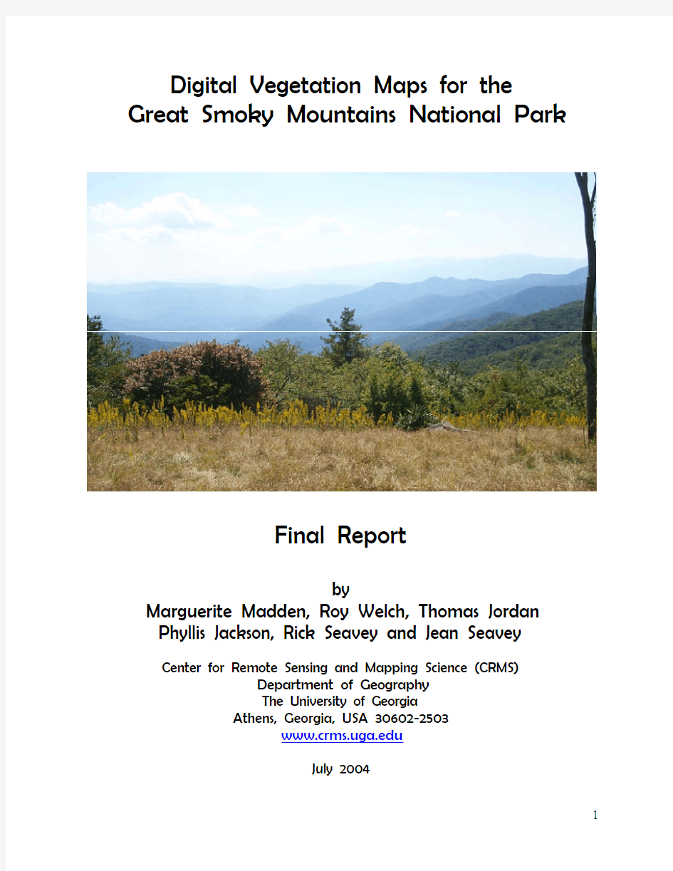

Digital Vegetation Maps for the Great Smoky Mountains National Park
Final Report
by
Marguerite Madden, Roy Welch, Thomas Jordan
Phyllis Jackson, Rick Seavey and Jean Seavey
Center for Remote Sensing and Mapping Science (CRMS)
Department of Geography
The University of Georgia
Athens, Georgia, USA 30602-2503
https://www.doczj.com/doc/b114302969.html,
July 2004
Digital Vegetation Maps for the
Great Smoky Mountains National Park
Final Report
by
Marguerite Madden, Roy Welch, Thomas Jordan,
Phyllis Jackson, Rick Seavey and Jean Seavey
Center for Remote Sensing and Mapping Science (CRMS)
Department of Geography
The University of Georgia
Athens, Georgia, USA 30602-2503
mmadden@https://www.doczj.com/doc/b114302969.html,
Submitted to:
U.S. Department of Interior
National Park Service
Great Smoky Mountains National Park
Gatlinburg, Tennessee
Cooperative Agreement No.
1443-CA-5460-98-019
July 15, 2004
Table of Contents
Page List of Figures 4 List of Tables 6 List of Attachments 7 Summary 8 Introduction 8 Study Area 10 Methodology 12 Photogrammetric Operations 15 Photointerpretation Operations 17 Overstory and Understory Vegetation Database and Map Products 22 Modeling Applications 29 Fire Fuel Modeling 29 Percent Canopy Data Layers 34 Understory Density 37 Conclusion 38 Acknowledgements 40 References 41 Attachments 45
List of Figures
Figure Description Page Figure 1. Location of (a) Appalachian Mountains and (b) Great Smoky 9 Mountains National Park in eastern United States.
Figure 2. 3D perspective view of GRSM constructed from a mosaic of SPOT 11 multispectral images draped over a digital elevation model. Elevations
range from approximately 200 to over 2000 m above sea level.
Figure 3. An example of a large-scale color infrared aerial photograph recorded 12 in October 1997 and used for photo interpretation of vegetation detail.
Figure 4. Diagram showing photogrammetric, photointerpretation and GIS 14 operations used to map the vegetation of GRSM.
Figure 5. Tree tops were used as pass points in overlapping images in the 16 heavily forested GRSM.
Figure 6. The elevations of ground control points (GCPs) were determined from 16 the 30-m digital elevation model (DEM) using bilinear interpolation.
Figure 7. A mosaic of orthorectified 1:12,000-scale photographs was created 17 for quality assurance and checking.
Figure 8. Ground digital image of overstory and understory vegetation recorded 18 with a Kodak FIS 265 digital camera interfaced to a Garmin III Plus GPS. Figure 9. (a) Original photo overlay depicting vegetation polygons and a 1-cm grid 21 before corrections for relief displacement. (b) Overlay and grid after
orthorectification showing the extreme corrections required to accommodate the large range of relief in the area.
Figure 10. Individual vector files from four adjacent photos that have been edited 22 and edge matched.
Figure 11. Hardcopy vegetation maps plotted at 1:15,000 scale correspond to the area 23 covered by 25 individual USGS 7.5-minute topographic quadrangles in
GRSM as outlined on this generalized overview map of GRSM overstory
vegetation.
List of Figures (Continued)
Figure Description Page Figure 12. Generalized overview map of GRSM understory vegetation. 24 Figure 13. Total area (hectares) of generalized overstory vegetation classes in GRSM. 27 Figure 14. Total area (hectares) of generalized understory vegetation classes in GRSM. 28 Figure 15. National Park Service resource/fire managers Mike Jenkins and Leon Konz, 30
along with CRMS research assistant, Robin (Dukes) Puppa, determine the Anderson Fuel Model associated with a particular vegetation community in
GRSM.
Figure 16. Examples of GRSM vegetation communities associated with Anderson Fuel 31, 32 Models.
Figure 17. A sample of the fire fuel model data set with fuel model values based on 35
unique combinations of overstory/understory vegetation and understory
density (decimals).
Figure 18. CRMS photo interpreter Phyllis Jackson and NatureServe botanists Alan 35
Weakly and Rickie White assess the vegetation community and percent
canopy in the field.
Figure 19. Percent canopy within the Gatlinburg quadrangle in leaf-on (a) and 36
leaf-off (b) conditions color-coded according to canopy classes based on percent of canopy closure (c).
Figure 20. A portion of the GRSM understory density data set depicting light, medium 38
and heavy densities of Rhododendron (R), Kalmia(K) and mixed
Rhododendron/Kalmia (RK).
List of Tables
Table Description Page Table 1. Specifications of data sources available for map/database development 13 of GRSM.
Table 2. Sample hierarchy of alpine forest classes within the overstory vegetation 19 classification system for GRSM cross referenced to association descriptions
by CEGL numbers in the National Vegetation Classification System.
Table 3. Sample classes within the understory vegetation classification system 20 for GRSM.
Table 4. Generalized overstory vegetation and area statistics for GRSM. 26 Table 5. Generalized understory vegetation and area statistics for GRSM. 28 Table 6. Level I rules for assigning fuel classes in GRSM. 33 Table 7. Example of Level II rules for assigning decimal values to fuel classes. 33 Table 8. Percent canopy classes. 34
List of Attachments
Attachment Description
Attachment A Reprint of Jordan (2004), Control extension and orthorectification
procedures for compiling vegetations databases of National Parks
in the Southeastern United States, In, M.O. Altan, Ed., International
Archives of Photogrammetry and Remote Sensing, Vol. 35,
Part 4B: 422-428.
Attachment B CRMS-NatureServe Overstory Vegetation Classification System
for mapping Great Smoky Mountains National Park, by Phyllis Jackson,
Rickie White and Marguerite Madden.
Attachment C Details on the CRMS-NatureServe Overstory GRSM Vegetation
Classification System, by Phyllis Jackson.
Attachment D CRMS Understory Vegetation Classification System for mapping
Great Smoky Mountains National Park, by Rick Seavey and Jean Seavey. Attachment E Details on the CRMS GRSM Understory Vegetation Classification
System, by Rick Seavey and Jean Seavey.
Attachment F Summary of Park-wide statistics for overstory classes.
Attachment G Summary of Park-wide statistics for understory classes.
Attachment H Reprint of Madden (2004) Vegetation modeling, analysis and visualization in U.S. National Parks, In, M.O. Altan, Ed., International Archives of Photogrammetry and Remote Sensing, Vol. 35, Part 4B: 1287-1292.
Digital Vegetation Maps for the
Great Smoky Mountains National Park
Summary
Detailed overstory and understory vegetation, forest fire fuels, percent canopy and understory density databases and associated maps of the 2000 km2 Great Smoky Mountains National Park were developed by the Center for Remote Sensing and Mapping Science at The University of Georgia in support of resource management activities of the U.S. National Park Service. Overstory vegetation was identified to the association level and crosswalked to the finest division of the National Vegetation Classification System (NVCS) protocol for the U.S. Geological Survey (USGS) – National Park Service (NPS) Vegetation Mapping Program. Understory vegetation was identified using an association-level classification system developed in this project that included density estimates when possible. With terrain relief exceeding 1700 m and continuous forest cover over 95 percent of the Park, the requirement to use 1:12,000 and 1:40,000-scale color infrared aerial photographs as the primary data source for vegetation interpretation created a photogrammetric challenge. Challenges included lack of suitable ground control, excessive relief displacements and over 1000 photographs needed to cover the study area. In addition, Great Smoky Mountains National Park contains the world’s most botanically diverse temperature zone forest and required the creation of a detailed, hierarchical classification system. For these reasons, a combination of analog photointerpretation, digital softcopy photogrammetry, geographic information system (GIS) and Global Positioning System (GPS)-assisted field data collection procedures were employed in the construction of the vegetation databases. Once complete, the overstory and understory vegetation databases were input to rule-based GIS models for analysis of forest fire fuels, percent canopy and understory density. All together, the overstory and understory vegetation data sets total 513 mb of digital data, while fire products of fuel model classes, leaf-on percent canopy, leaf-off percent canopy and understory density total 605 Mb. Hardcopy maps tiled by U.S. Geological Survey (USGS) 7.5-minute topographic quadrangle (all or portions of 25 quads are contained in GRSM) were plotted at
1:15,000 scale for overstory and understory vegetation. These maps depict the full detail of the 170 and 196 unique, association-level classes in the overstory and understory, respectively. The overstory database contains nearly 50,000 polygons (513 Mb of data) and the understory database contains nearly 25,500 polygons (605 Mb). Generalized overstory and understory vegetation data sets with approximately 24 classes each were created using GIS reclassification commands and used to produce 1:80,000-scale overview maps of the entire park. Fire fuel model, percent canopy (leaf-on and leaf-off) and understory density data sets also were used to produce park-wide maps.
Introduction
Great Smoky Mountains National Park (GRSM) encompasses approximately 2,000 km2 of continuous forest cover in the southern Appalachian Mountains in southeastern United States (Figure 1). Located along the North Carolina-Tennessee border, this national park receives as many as 10 million visitors each year, yet contains one of the most diverse collections of plants
and animals in the world. It has been designated as both an International Biosphere Reserve and a World Heritage Site (Walker, 1991).
a.
b.
Figure 1. Location of (a) Appalachian Mountains and (b) Great Smoky Mountains National Park in eastern United States.
Although the GRSM was mapped at 1:24,000 scale by the U.S. Geological Survey (USGS) in the 1960s and 1970s, these topographic maps, while essential, do not provide the detailed information and flexibility required to manage the Park, protect it from threats due to fire and
population pressure, or to monitor changes caused by air pollution and invasive exotic plants and animals. These problems at GRSM and other parks have led the USGS and the National Park Service (NPS) to sponsor the development of detailed vegetation databases in digital format from remotely sensed data that can be used in a geographic information system (GIS) environment to create large-scale map products, conduct analyses of change and support the preservation of our national resources (USGS, 2002). The USGS-NPS National Vegetation Mapping Program aims to map all of the National Park System units using a consistent vegetation classification system and mapping protocol (Grossman et al. 1994, 1998; Maybury 1999).
The Center for Remote Sensing and Mapping Science (CRMS), Department of Geography at The University of Georgia, (https://www.doczj.com/doc/b114302969.html,) has been involved in vegetation mapping and database development in national parks of the southeastern U.S. for the past 10 years (Welch et al. 1995, 1999, 2002a, 2002b; Welch and Remillard 1996). As a remote sensing and mapping facility, the CRMS is unique in is combination of expertise in both technical and biological aspects of vegetation mapping projects. Scientists at the CRMS specialize in image processing, photogrammetry, GIS, air photo interpretation and field surveying, as well as botany, biology and ecology. This allows a close link between the two major components of a vegetation mapping/database project: 1) photogrammetric rectification and GIS database construction; and 2) vegetation interpretation, classification and field verification.
In addition to in-house cross training of technical and biological skills, the CRMS has developed a strong working relationship with NatureServe, a non-profit conservation organization that developed the U.S. National Vegetation Classification System and is a primary partner in the USGS-NPS Vegetation Mapping Program (https://www.doczj.com/doc/b114302969.html,). Collaboration between the CRMS and the NatureServe-Durham, North Carolina Office has resulted in the development of a detailed classification system for GRSM that maximizes the information on vegetation communities that can be gleaned from large-scale color infrared aerial photographs, while remaining compatible with the U.S. National Vegetation Classification System (Anderson et al. 1998, Jackson et al. 2002).
The objectives of this report are to: 1) demonstrate how digital photogrammetry, photointerpretation, GIS and Global Positioning Systems (GPS)-assisted field techniques were refined, adapted and integrated to permit the construction of geocoded vegetation databases from more than 1,000 large-scale aerial photographs of the rugged, high-relief GRSM; 2) discuss the CRMS-NatureServe GRSM Vegetation Classification System; and 3) present GIS analyses of the overstory and understory vegetation databases for the development of fuel models, percent cover and understory density for the management and control of forest fires. Because GRSM is considered one of the most difficult terrain areas to map in the United States, it is envisioned that the techniques discussed below can be modified as necessary and applied to rugged and remote, forested lands in other U.S. National Parks.
Study Area
Great Smoky Mountains National Park was established in 1934 in an attempt to halt the damage to forests caused by erosion and fires associated with logging activities of the 1800s and early 1900s. By the 1920s, nearly two-thirds of the lands that would become GRSM had been
logged or burned (Walker, 1991). The Park now protects 2000 km2 of forestland within the southern Appalachian Mountains – among the oldest mountain ranges on earth. Elevations in GRSM range from approximately 250 m along the outside boundary of the Park to 2,025 m at Clingman’s Dome (Figure 2). Rock formations in the region are sedimentary, the result of silt, sand and gravel deposits into a shallow sea that covered the area between 900 and 600 million years ago (Moore, 1988). More than 900 km of streams and rivers that flow within the Park are replenished by over 200 cm of rain per year. As of 2004, 1,637 species (1,293 native and 344 exotic) of flowering plants, 10 percent of which are considered rare, and over 4,000 species of non-flowering plants are found in GRSM (Walker, 1991). The forestlands include over 100 different species of trees and contain the most extensive virgin hardwood forest in the eastern United States (Whittaker, 1956; Kemp, 1993; Houk, 2000).
Figure 2. 3D perspective view of GRSM constructed from a mosaic of SPOT multispectral images draped over a digital elevation model. Elevations range from approximately 200 to over 2000 m above sea level.
Scientists estimate that the flora and fauna currently identified in the Park represent only 10 percent of the total species that are likely present (Kaiser, 1999). In order to discover the full range of life in GRSM, an ambitious project is underway known as the All Taxa Biodiversity Inventory (ATBI) that aims to identify every life form in the Park (possibly over 100,000 species) over the next ten to fifteen years (White and Morse, 2000). The efforts of ATBI participants rely heavily on map information in order to locate various habitats, conduct fieldwork and establish sample plots.
Natural resource managers at GRSM realized early-on the value of producing a detailed vegetation database that could be used to map habitats and aid researchers in their quest for identifying new mountain species. They also required a vegetation database for providing baseline information for future monitoring and management tasks. Facing threats by air pollution, invasive exotic plants and animals such as the hemlock woolly adelgid (Adelges
tsugae), large numbers of Park visitors, arson/accidental forest fires and exotic diseases (e.g., chestnut blight, dogwood anthracnose, beech bark disease, butternut canker and, potentially, sudden oak death), Park managers needed analysis tools to assist them in the preservation of valuable resources. Consequently, in 1999, the Center for Remote Sensing and Mapping Science at The University of Georgia entered into a Cooperative Agreement with the NPS to create a detailed digital database for GRSM that includes both overstory and understory vegetation and an analysis of fuels that can cause forest fires in the Park.
Methodology
The main requirement for the project was to produce a vegetation database and associated maps in vector format that contained polygons for over 150 overstory and understory plant communities plotted to within approximately + 5 to + 10 m of their true ground locations. Overstory vegetation was mapped using more than 1000 color infrared aerial photographs of 1:12,000 scale in film transparency format recorded with a Wild RC20 photogrammetric camera, f = 15 cm) in late October by the U. S. Forest Service. The fall photos were acquired when the leaves were still on the trees (leaf-on) and displayed a color diversity that allowed the vegetation communities/species to be identified (Table 1, Figure 3). Relief displacements were a major problem, in some cases reaching more than 40 mm on the 23 x 23 cm format photographs (Jordan, 2004; Attachment A).
Figure 3. An example of a large-scale color infrared aerial photograph recorded in October 1997 and used for photo interpretation of vegetation detail.
The understory vegetation was mapped from 1:40,000-scale color infrared photographs recorded (with a Wild RC30 camera, f = 15 cm) in the winter months as part of the USGS National Aerial Photography Program (NAPP). At that time of year, deciduous trees have lost their leaves (leaf-off) and it is possible to delineate the understory evergreen shrubs and trees that are both combustible and sufficiently dense to restrict crews combating forest fires or conducting search and rescue missions. With the dense forest cover, steep slopes, absence of ground control and relief exceeding 30 percent of the flying height for the large-scale photographic coverage, the construction of a vegetation database accurate in both the spatial and thematic context necessitated a combination of softcopy photogrammetry, photointerpretation and GIS procedures organized in parallel as shown in Figure 4. These are discussed below.
Table 1. Specifications of data sources available for map/database development of GRSM.
Data Source Format and
Type of
Data
Flying
Height (FH)
and/or Scale
Resoluti
on
No.
Required
to Cover
the Park
Comments and/or
Problems
Color infrared (CIR) Air Photos October 1997-
1998
23 x 23 cm
Analog film
transparencies
FH =1800 m
1:12,000 ~ 0.4 m ~ 1,000
Terrain relief in excess of
30% of flying height. A
smaller scale could
alleviate this problem. Fall
leaf-on conditions are ideal
for mapping overstory
forest communities.
USGS NAPP Air
Photos March/April 1997-
1998
23 x 23 cm
Analog film
transparencies
FH ≈ 6,000 m
1:40,000 ~ 1m ~ 130
Scale is too small for
mapping overstory
vegetation. Leaf-off
conditions are ideal for
mapping understory
vegetation.
USGS
Topographic Maps
Paper maps 1:24,000 - 25 Last updated 1960-1970’s.
USGS DOQQs Pan and CIR Digital - 1 m 80 USGS DOQQs have a
planimetric accuracy of
approximately ± 3 m RMS.
USGS Level 2
DEMs Digital 1:24,000 30 m post
spacing
25 USGS Level 2 DEMs have
a vertical accuracy of
approximately ± 3-5 m
RMS.
Photogrammetric Operations Photointerpretation Operations
Figure 4. Diagram showing photogrammetric, photointerpretation and GIS operations used to map the vegetation of GRSM.
Photogrammetric Operations
The main objective of the photogrammetric procedure was to densify the sparse ground control in the Park by means of aerotriangulation, a photogrammetric operation whereby a relatively small number of ground control points (GCPs) are used to mathematically compute the ground coordinates of a much larger number of identified pass points (Jordan, 2002). In this way, the control network is adequately densified for the orthorectification process. At the outset, the 1:12,000-scale film transparencies were scanned at 600 dots per inch (dpi) using an Epson Expression 836xl desktop scanner to create black-and-white digital photos of 42-μm pixel resolution, providing a file of 35 Mbytes for each photo. These digital photos were then displayed on the computer monitor and with the aid of the R-WEL, Inc. Desktop Mapping System (DMS) software package, the image (x,y) coordinates of pass points and GCPs were measured in the softcopy environment. This was a painstaking and time-consuming task. In the absence of cultural features and the near continuous tree canopy cover, the passpoints, in the majority of instances, were individual tree-tops that had to be identified uniquely on overlapping photographs – not an easy job in terrain of high relief recorded on large-scale photographs (Figure 5).
Ground control points were, for the most part, natural features (e.g., rock outcrops and forks in stream channels) identified on both the 1:12,000-scale color infrared transparencies and USGS Digital Orthophoto Quarter Quads (DOQQs) produced from 1:40,000-scale panchromatic aerial photographs recorded in 1993. The Universal Transverse Mercator (UTM) grid coordinates (X,Y tied to the North American Datum of 1927 or NAD 27) of these GCPs were measured directly from the DOQQs (accurate to within + 3 m). Elevations for the GCPs were derived using CRMS custom software to interpolate the Z-coordinates to within + 3 to + 5 m from USGS Level 2 Digital Elevation Models (DEMs) with 30-m post spacing (Figure 6). Thus, in this project, no ground survey work was required to obtain the GCPs needed as a framework for the aerotriangulation process.
Analytical aerotriangulation was undertaken for blocks of up to 90 photos, where each block corresponded to the area covered by one of the 25 USGS 1:24,000-scale map sheets covering the Park. The PC Giant software package, in conjunction with the DMS software, was employed for the aerotriangulation process. Output from the aerotriangulation was a set of X, Y and Z coordinates in the UTM coordinate system for the nine or more pass points identified by CRMS personnel on each photo. Typical root-mean-square error (RMSE) values for these coordinates averaged + 7 m for the XY vectors and + 10 m for elevations (Z).
The pass points with their X, Y and Z coordinates derived from the aerotriangulation process provided the ground control required to generate orthophotos and mosaics from the scanned air photos (Figure 7). These orthophotos and mosaics, in turn, were employed in the editing and attributing operations required to build the vector database. Most importantly, however, the control provided by the aerotriangulation process was essential for rectifying vector overlays generated as part of the photointerpretation procedure described below.
Figure 5. Tree tops were used as pass points in overlapping images in the heavily forested GRSM.
Figure 6. The elevations of ground control points (GCPs) were determined from the 30-m digital elevation model (DEM) using a bilinear interpolation algorithm.
Figure 7. A mosaic of orthorectified 1:12,000-scale photographs was created for quality assurance and checking. Terrain features that are well aligned between individual photographs indicate a good overall solution. This is necessary for the rectified vegetation linework of individual photographs to edgematch correctly.
Photointerpretation Operations
The steps of the photointerpretation process listed in Figure 4 proceeded in parallel with the photogrammetric operations. Overstory vegetation was interpreted from the 1:12,000-scale leaf-on color infrared aerial photographs. On the other hand, the understory vegetation was interpreted from the 1:40,000-scale (leaf-off) transparencies.
Although it might appear desirable to scan the color infrared transparencies at high resolution and undertake the vegetation classification as an on-screen interpretation and digitizing procedure, this has proved to be exceedingly time consuming, cumbersome and expensive compared to more traditional approaches (Welch et al. 1995 and 1999; Rutchey and Vilchek 1999). Moreover, photointerpreters must view the vegetation in stereo and in color within the context of a relatively large area of terrain in order to identify the vegetation communities. This is most easily done using a stereoscope to view the analog air photos so that the vegetation
patterns can be assessed in relation to the terrain. Recognizing the need to augment manual procedures with automated techniques, the steps described below integrate conventional photointerpretation procedures with digital processing technology in an attempt to streamline the database and map compilation process.
At the beginning of the GRSM mapping project, the photointerpreters, in conjunction with NPS plant specialists, conducted field investigations to collect data on the forest communities and correlate signatures evident on the aerial photographs with ground observations. Consequently, UTM coordinates and field data were collected at over 2000 locations with the aid of a Garmin III Plus hand-held GPS receiver and a Kodak Digital Field Imaging System (FIS) 265 digital camera system. The hand-held Kodak digital camera was connected to the Garmin GPS that “stamped” the location, date and time on each image (Figure 8). These images were input to ArcView to provide a pictorial record of field observations.
Figure 8. Ground digital image of overstory and understory vegetation recorded with a Kodak FIS 265 digital camera interfaced to a Garmin III Plus GPS.
A compilation of all field information was used by Center for Remote Sensing and Mapping Science (CRMS) ecologists to organize the GRSM overstory and understory vegetation into a classification system with 170 unique association-level classes suitable for use with the large and medium-scale (1:12,000 and 1:40,000, respectively) color infrared aerial photographs (Jackson et al. 2002; Table 2). The term, association, is defined by Grossman et al. (1998) as a “plant community type of definite floristic composition, uniform habitat conditions and uniform physiognomy”. Terrestrial communities in GRSM have one to several strata of vegetation: tree canopy, sub-canopy, tall shrub, short shrub, herbaceous, non-vascular, vine/liana and epiphyte. The combination of vegetation in all of these strata present determines the community type.
The term “overstory vegetation” refers to the entire vegetation community. Communities are named and referenced by vegetation in their tallest stratum, plus abundant and/or indicator species in lower strata. Photointerpreters can see the tallest strata on color infrared photos, and may or may not be able to see through this layer to shorter layers. Sometimes a community can be determined solely by seeing its location and seeing the uppermost stratum, for example, a Hardwood Cove. In other cases, a lower stratum (or strata) must be seen because this stratum determines the community type. For example, three kinds of Montane Red Oak communities have the same canopy, but their differences are determined by an evergreen tall shrub stratum, a deciduous tall shrub stratum, or an orchard-like herbaceous stratum.
The overstory classification system was based on the USGS-NPS Vegetation Classification of GRSM for the area corresponding to the Cades Cove and Mount Le Conte USGS topographic quadrangles developed by The Nature Conservancy (TNC) as part of the USGS-NPS Vegetation Mapping Program (TNC, 1999). The full overstory CRMS/NatureServe GRSM Vegetation Classification system is provided in Attachment B with a crosswalk to NVCS Community Element Global (CEGL) code numbers for association divisions. Further details on the development and use of the CRMS/NatureServe GRSM Vegetation Classification system are provided in Attachment C.
Table 2. Sample hierarchy of alpine forest classes within the overstory vegetation classification system for GRSM cross referenced to association descriptions by CEGL numbers in the National Vegetation Classification System.
_________________________________________________________________________ FOREST
GRSM Veg Code [CEGL Code]
A.Sub Alpine Mesic Forest
1.Fraser Fir (above 6000 ft.) F [6049, 6308]
a. Formerly Fraser Fir (F) [6049, 6308]
b. Fraser Fir/Deciduous Shrub-Herbaceous F/Sb [6049]
c. Fraser Fir/Rhododendron F/R [6308]
2.Red Spruce – Fraser Fir S-F*, S/F, F/S [7130, 7131]
a. Red Spruce – Fraser Fir/Rhododendron S-F/R [7130]
b. Red Spruce – Fraser Fir/Low Shrub-Herb S-F/Sb [7131]
3.Red Spruce S [7130,7131]
a. Red Spruce/Rhododendron (5000-6000 ft.) S/R [7130]
b. Red Spruce/Southern Mountain Cranberry- S/Sb [7131]
Low Shrub/Herbaceous (5400-6200 ft.)
4.Red Spruce – Yellow Birch – Northern Hardwood S/NHxB [6256]
5.Exposed Northern Hardwood/Red Spruce NHxE/S [3893]
6.Beech Gap NHxBe [6246, 6130]
a.North Slope Tall Herb Type NHxBe/Hb [6246]
b.South Slope Sedge Type NHxBe/G [6130]
* Symbols: (-) designates a equal mix and (/) designates the first class listed is dominate (> 50 percent) over the second class listed.
_______________________________________________________________________
In order to accommodate the complex vegetation patterns found in GRSM and generally maintain a minimum mapping unit of 0.5 ha, a three-tiered scheme was developed for attributing vegetation polygons, similar to that developed for an earlier project in the Everglades of south Florida (Madden et al. 1999). The three-tiered scheme allowed photointerpreters to annotate each polygon in the database with a primary or dominant vegetation class accounting for more than 50 percent of the vegetation in the polygon. Where appropriate, secondary and tertiary vegetation classes are added to describe mixed-plant communities within the polygon. Secondary and tertiary classes were especially useful for describing ecotones, and for polygons with a patchwork of communities below the minimum mapping unit size. See Attachment C for further explanation of the three-tiered polygon attribution procedure.
A separate classification system containing over 196 unique association-level classes was developed by CRMS photointerpreters in consultation with NPS resource managers to map the understory vegetation (Table 3).
Table 3. Sample classes within the understory vegetation classification system for GRSM.
_______________________________________________________________________ Pine overstory with Kalmia understory
a. Pine dominant over high density Kalmia (PI/Kh)
b. Pine dominant over medium density Kalmia (PI/Km)
c. Pine dominant over low density Kalmia (PI/Kl)
d. Pine dominant over possible Kalmia (PI/Kp)
e. Pine dominant over implied Kalmia (PI/Ki)
* Symbols: (/) designates the first class listed is dominate (> 50 percent) over the second class listed.
The term “understory” denotes woody vegetation of medium height (3 to 5 m) that does not reach the forest canopy level. Understory classes of particular interest to fire managers included two evergreen, broad-leaf shrubs: rhododendron (Rhododendron spp.) and mountain laurel (Kalmia latifolia). Information on the location and density of these understory shrubs is important for modeling fire fuels, assessing fire behavior and determining accessibility for research, resource management and search and rescue activities. Interpretation of these understory vegetation strata from the air photos, therefore, included further classification according to the density of the shrub as light (l), medium (m) or heavy (h). Additional subclasses were added for these shrub areas of interest to qualify uncertainty in their interpretation and identification when the understory was obscured by overstory vegetation. In these cases, the evergreen forest community (e.g., “T” for hemlock) and the probable understory shrub (e.g., “R” for rhododendron) are combined in a single label of T/R with an indicator of “i” to denote “implied” or “p” to denote “possible” rhododendron, in place of a density symbol (i.e., T/Ri). Implied is defined to mean the conditions are right for the presence of the species and it is believed to be found there. On the other hand, possible is defined as the conditions are only marginally right for the presence of the species. The full understory classification system is